July 3
(4.1; 250.5 total, 1923.5 to go; -10.9 from pace, -124.5 overall)
After a full breakfast of pancakes and an omelette at the store (it’s a diner as well as a general store), I get back on the trail, but not before being told that there’s a nice storm coming through in the afternoon and that it might be wise to consider my schedule once I’ve reached the first shelter.
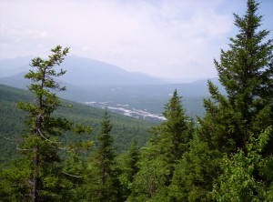
The first big trail feature of the day is Moody Mountain; by Maine standards it’s not especially big (2440 feet), and it’s a reasonably nice hike up the side. By the time I arrive at Hall Mountain Lean-to on the other side it’s early afternoon and the rain hasn’t come; since it’s ten miles to the next lean-to, I decide to stop early and avoid getting wet.
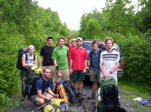
Given the time, it’s not surprising that it takes a few hours for anyone else to show up. By the end of the day I share the shelter with three other people: Laserchuck (apparently it’s a sailing term, not associated with speediness) doing a northbound thru-hike, Sunday going southbound (I apparently just crossed his path back in Monson when he was laid up for a week due to injury), and a guy on his second day out doing a section hike north. Since it’s so early and I’ve got a little extra food due to the Andover layover, I cook and eat two dinners tonight.
Just as I’m heading to sleep, Sunday asks if he can have a match to light a cigar, and he and the guy whose name I don’t remember each smoke a cigar before going to sleep. It’s strange, but I’ve seen a fair number of hikers smoking on the trail; I wouldn’t have expected it given that smoking’s not particularly good for your lungs. There’s certainly much talk on the trail of stops at pubs and breweries in towns along the way; I recall once seeing wine juice boxes that look like they’d be awesome at the end of a day, perhaps in a short stretch between towns (water’s heavy and all). The big difference there is that alcohol, in moderation, is good for you and not actively harmful, but smoking, in any quantity, isn’t. Even weirder, I’ve seen a hiker or two rolling weed joints at the end of the day, which makes even less sense than a cigar, so I suppose it could be worse. (This was just after Monson, for what it’s worth; apparently he “resupplied” in Greenville, although how in the world you’d know where to find a resupply spot in a city you don’t know is beyond me. I really should have asked him when I had the chance — not to use said knowledge but rather just to know it for the pedagogical value, in the same way that when I enter a store with signs mentioning closed-circuit cameras I feel obligated to look and find them as if to scout out the best way to rob it. It’s all shades of this xkcd comic, really.)
I end the day, as I’ve nearly always (sans a night or two in hostels, to the best of my memory) done so far, reading a bit of the Bible I’ve carried with me. Typically I’ll read a few chapters before going to sleep; I started at the beginning of Romans and have been working my way forward from there (as of July 22 I’m in 2 Timothy, for what it’s worth). Sometimes, however, I’ll get sidetracked with something like Saul’s reign or something else; tonight it was the book of Ecclesiastes. (Yes, I did say “book” — it’s only eight or ten pages, not too long.) Having read it, I have to say it’s by far the weirdest passage in the Bible I’ve ever read. Anyone out there done any studying of it? I can’t imagine it’s possible to get too much out of it without having some sort of “guidebook” to help you through it and its content, to be honest.
July 4
(14.0; 264.5 total, 1909.5 to go; -1.0 from pace, -125.5 overall)
Whee! Fourth of July! Happy Independence Day!
I need to start writing these entries while I’m on the trail; it’s now (the 22nd) nearly three weeks since I actually finished this day, and things are starting to get hazy.
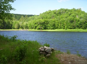
I get a relatively early and quick start out of the lean-to and head over to the next one, Frye Notch Lean-to, just over ten miles away. Along the way next to Wyman Pond I meet a sectionwise thru-hiker, Ol’ Graceful. He says he’s on his seventeenth year of section hiking and will complete the full thru-hike with this section. To be honest, I find this achievement in many ways more impressive than a one-shot thru-hike like I’m doing; consistently committing time every year for that long to doing sections is something I can’t imagine I’d be willing to do, to be honest. There are too many other things I’d want to do (cross-country bike trip, I’m looking at you!) for me to be likely to continue doing it year after year like that. There’s also the conditioning: getting in shape again every time you start has to make the hike far less fun than it would otherwise be.
I stop for lunch at Frye Notch as a couple is sitting there doing the same, heading north on a day hike. They say the climb ahead up Baldpate Mountain is fairly intense; at this point, as a thru-hiker, I’m not sure whether to believe them or not. Unfortunately, all my sources of information are suspect at this point. Northbounders are in far better shape than me, so their analysis doesn’t apply. Day hikers are an entirely different breed from backpackers. Section hikers are closest, but there aren’t that many of them out on the trail. I leave a nice 4th of July note in the register and encourage other hikers to read the Federalist Papers as I’ve slowly been doing along the trail. (I also mentioned that I’d be dropping my copy off somewhere along the trail when I finished it, but as it turns out I only just finished them before my thru-hike experience ended, so nobody else got to read my copy.)
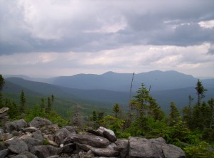
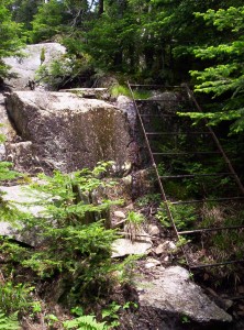
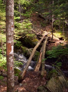
As it turns out, the 3.5 miles to the next lean-to over the mountain are initially easy going, temporarily very difficult (right up a sheer rocky slope), a reasonable stroll down and over to the second of the mountain’s peaks, and another steep descent to the lean-to. Since it’s the 4th I consider making the shelter, packing up a few things, and heading back to the top of the second peak (1.6 miles round trip) to try to catch fireworks, but unfortunately the peak is wooded, and three miles to get to the top of the first, clear summit and back (in the dark!) is too far, so I stop.
Tonight’s shelter is where I finally meet Spanky, he of the long shelter register entries accompanied with Bible verses (Sunday referred to him as “preacher-man” once), website, and a fairly relaxed pace. Spanky did a southbound trek in ’02 as well (his home is near Springer, hence the direction), and he says he’s doing the hike and then living out the rest of his life with his wife. He’d get along with my mom well, because he talks quite a bit. (I’m not much of a conversationalist, but I’ll talk when there are other people around or they try to draw me into discussion, generally.) We see a snowshoe hare run across the clearing in front of the lean-to; I lust for a gun, a license, and hunting season. It appears it’ll just be the two of us for awhile, but eventually four or five northbounders walk in from Carlo Col, 16.5 miles south and just before the NH-ME border, and we share the shelter with them. One’s British and mentions having made an entry in the next shelter’s register noting “Happy Insurgency Day”, which I find moderately amusing.
July 5
(11.5; 276.0 total, 1898.0 to go; -3.5 from pace, -129.0 overall)
Today is the day that I finally meet that most vaunted adversary along the Appalachian Trail, Mahoosuc Notch. Some thru-hikers describe it as the most difficult mile on the entire trail; I have customarily reserved judgment and set no expectations regarding it.
Today is the first day of the trail where I’m not in Maine ATC land any more. Once I pass Maine 26, I enter AMC land. The Appalachian Mountain Club is old — older than the Appalachian Trail itself — and is probably most closely associated with the White Mountains. Today also marks the start of an abomination upon the trail: fee sites. The AMC is a non-profit organization, but frankly, from the way they operate, it’s not obvious. Most sites in the area of the trail they maintain have an overnight use fee of $8; even worse, camping is prohibited within a quarter mile of all such sites (to preserve the land, which is probably accurate but is a stunningly convenient excuse), and they require non-site camping to be off the trail by 200 feet, so you can’t just hike until you find a nice place to stop, generally.
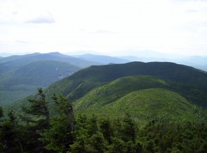
The hike up to Speck Pond Shelter goes over a mountain to Speck Pond, the highest body of water in Maine. I pass two thru-hikers named Pickle and Garlic while doing so, one of whom has apparently just completed a Triple Crown due to having sectioned in Maine previously. The Triple Crown of hiking is the Appalachian Trail, the Pacific Crest Trail, and the Continental Divide Trail; if you think just the AT is insane, well, there are gradations of insanity. 🙂
I arrive in Speck Pond to catch up to Spanky, who says he’s stopping for the day. I’m still aiming to finish the Notch and get to the shelter on the other side of it, so I continue on. I’m starting to run low on trail snacks now, which isn’t good; I have plenty for meals, but a hiker can’t survive on just meals unless he’s willing to make very long breaks to cook meals on the trail — not good for hiking pace. Spanky gives me some of the food he’s carrying; it’s not trail food, but it’ll help, and oatmeal can be trail food in a pinch.
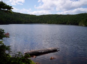
First, however, I have to hike down from Speck Pond to the bottom of the Notch; that hike goes slowly, as all descents do, and I finally decide that when I reach Gorham I’m going to get a set of hiking poles (really could have used them through Maine, but a bit late for that now). Finally, I reach the Notch.
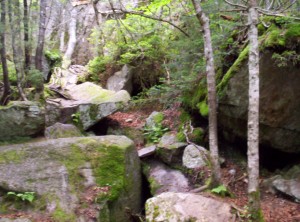
Mahoosuc Notch is about a mile of ravine traveling over, under, and around house-sized boulders. It’s sheltered from the elements and contains scattered patches of ice/snow year-round, and the temperature’s easily twenty degrees lower than elsewhere. My pace slows quite a bit, and I have to plan my footing and route much, much more carefully than I usually do. I can see why they call it the most difficult mile, but frankly, after going through it, I don’t understand that sentiment. The only proper way to approach this is to budget a few hours and to look at it as rock-hopping through a giant’s playground; it’s absolutely a blast if you don’t care how little progress you’re actually making. Of all the miles of trail I’ve hiked, both on and off the Appalachian Trail (which at this point are of comparable magnitude, although probably not equal), this mile is by far the best mile of trail I’ve ever hiked. If you’re ever up in this area, give yourself a day to do it and hike through Mahoosuc Notch; you’ll be glad you did.
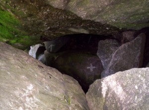
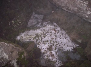
The Notch progresses slowly. Spanky apparently decided to move on, and he catches up to me perhaps halfway through the Notch. We pass by a dead moose carcass, which the AMC has chosen to leave there to let it decay naturally. It’s a very powerful odor, and between that and my route-finding skills taking me a bit away from it I end up not taking a picture of it.
Eventually, after many false finishes, we exit the Notch. It’s pretty late at this point — at least 7 or so — and there’s still a mile and a half to Full Goose Shelter. Spanky’s headlight broke in the 100-Mile Wilderness, and it’s only dusky, so I let him borrow mine as I carefully and slowly step up Fulling Mill Mountain.
We reach the top just as it gets dark, and as we only have one working light (and an underpowered one at that for night-hiking) between us, we stop atop the mountain for the night. I pull out a meal and eat; the stars are awesome tonight. Spanky raves about how he wanted to sleep atop a mountain in Maine and finally got the chance on his last night in Maine. We’re 5.4 miles from the border now, and I can’t wait to see the back side of Maine!
July 6
(15.0; 291.0 total, 1883.0 to go; 0.0 from pace, -129.0 overall)
I wake up around 6:30 or so to sunlight and dew; conveniently I’d put my sleeping bag inside my tent, used bivy-style on the rocks atop the mountain, so it’s not very wet. Sunlight dries things pretty well atop the rocks on the mountain, and I eat oatmeal for breakfast. A few northbounders — Topo, Cookie, and Kirby are the names I remember — pass us pretty early. Topo asks how many packets I eat a day; I’m currently at around two, and she says she and her companions are up to five now.
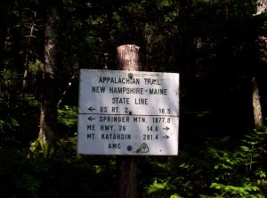
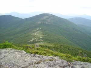
The morning progresses at about an average pace over a couple mountains. The trail to the top of one is pretty amusing, because, standing atop the highest point, I can clearly see the trail making a 30-degree bend to reach it — no taking the shortest path between two points around here! Trail snacks are now almost entirely depleted, and after passing the state line (NEW HAMPSHIRE!) I have to stop and cook a dinner for energy.
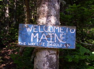
Another five miles down and I reach Gentian Pond Campsite, closely followed by a southbounder named Moose. He’s hiking with a girl named Duckie who apparently also attends or attended MIT (or maybe just lived in Boston? memory hazy), but she doesn’t catch up by the time I get there, and given my snack situation I want as short a trip into Gorham the next day as possible, so I continue on another 4.9 miles to Trident Col Tentsite after being given an energy bar by a hiker in the shelter. It’s a good thing, too — at this point I’m down to eating powdered hot chocolate dry for the energy. I leave Gentian at 19:30 or so, and it takes me until 22:30 to get to Trident, the last two hours of it in darkness save for my flashlight at a snail’s pace. Thankfully the blazes are pretty thick, so it’s not too hard to follow the path (although I do stumble about twenty feet down the trail to the tentsite without noticing until I look up to see a blue blaze rather than a white one). I make and eat dinner and fall asleep quickly, hoping to wake up and get into Gorham early.
July 7
(6.9; 297.9 total, 1876.1 to go; -8.1 from pace, -137.1 overall)
My plan to wake up early fails miserably, but at least I’m not sleepy. I eat a breakfast and a dinner as preparation for the walk in, still mostly snackless save for some hot chocolate packets, and hit the trail at 10:30.
I make reasonable progress down the trail and don’t hurt too much until the last few miles, when I’ve depleted my energy from breakfast and hot chocolate. The last miles really drag, and it’s a relief to finally hit US 2. My target for the day is White Birches Campground a mile and a half towards Gorham, which has a hiker bunkroom and some ability to shuttle into Gorham. I start walking, thinking to look for a reasonable place to sit and put out the thumb, when a white van stops and picks me up. Turns out the guy lives at the campground and drives hikers around a bit in his spare time. I get to the campground, drop my backpack inside, say hi to yet another hiking couple named Dan and Leah (from Texas or thereabouts, married since December, recent college graduates, were going to go as the Honeymooners but the name was taken and so just go by their real names), whose entries I’ve seen as I’ve hiked the trail, and get a shower. Once that’s completed, I get a ride in to a Shaw’s grocery store between Gorham and Berlin, where I pick up 1.75 quarts of mint chocolate chip ice cream. Ice cream containers have had horrible size deflation recently; I wanted a half gallon, but the only option for half gallons was Shaw’s ice cream, and they didn’t have mint chocolate chip, sadly. After eating that and reading several of the Federalist Papers, I order a pizza from Mr. Pizza in town, eat that, and head to sleep. The plan in the morning is to head into town, eat a breakfast at Welsh’s, hit up the library to write some updates, get hiking poles and fuel, and get groceries for the next leg of travel.
The biggest change going forward, now, is that unless I bivouac in non-site sites, I’m going to be paying camping fees when I stay at campsites. There are good reasons for the fees: they sometimes support a site caretaker, help defray the costs of dealing with human waste (privies aren’t all that cheap to operate in the middle of nowhere and often involve chartering a helicopter periodically), and advance other AMC goals. That said, nearly all the rest of the trail is free, so it comes as a bit of a slap in the face. Many thru-hikers are fairly antagonistic towards the AMC, and (speaking from outside AMC-land now) I can understand why, although I’ll probably talk more about that in the next update. Right now I’m in Hanover, NH (Dartmouth College land) heading into Vermont; I’m guessing my next stop with Internet access will be Rutland, but we’ll have to see, since I might not have time to take advantage of it.
On the topic of pictures, they’re still coming, but it’s a slow process. The problem is I have to upload them in bulk, usually, because individual pictures just takes too long. I’d prefer to self-host them as well, so no Flickr. Last, WordPress doesn’t seem to have a good way to use a picture already on the server within a post unless it’s previously been used by WordPress; I’d like to say “use this URL”, but I need the thumbnailing to save people some bandwidth (kinda, I’ve flouted that nicety in the last posts, but especially going forward now that I have the ability to take full-res images [more on that in the next update] it’s getting pretty size-heavy to do that). To top it off, uploading big huge files isn’t all that easy anyway; sometimes I don’t have an SFTP client to do it (the computers I’m using don’t always allow software installation), and the file size is too big for a CGI script to accept the upload. Expect pictures to come, but slowly. :-\
