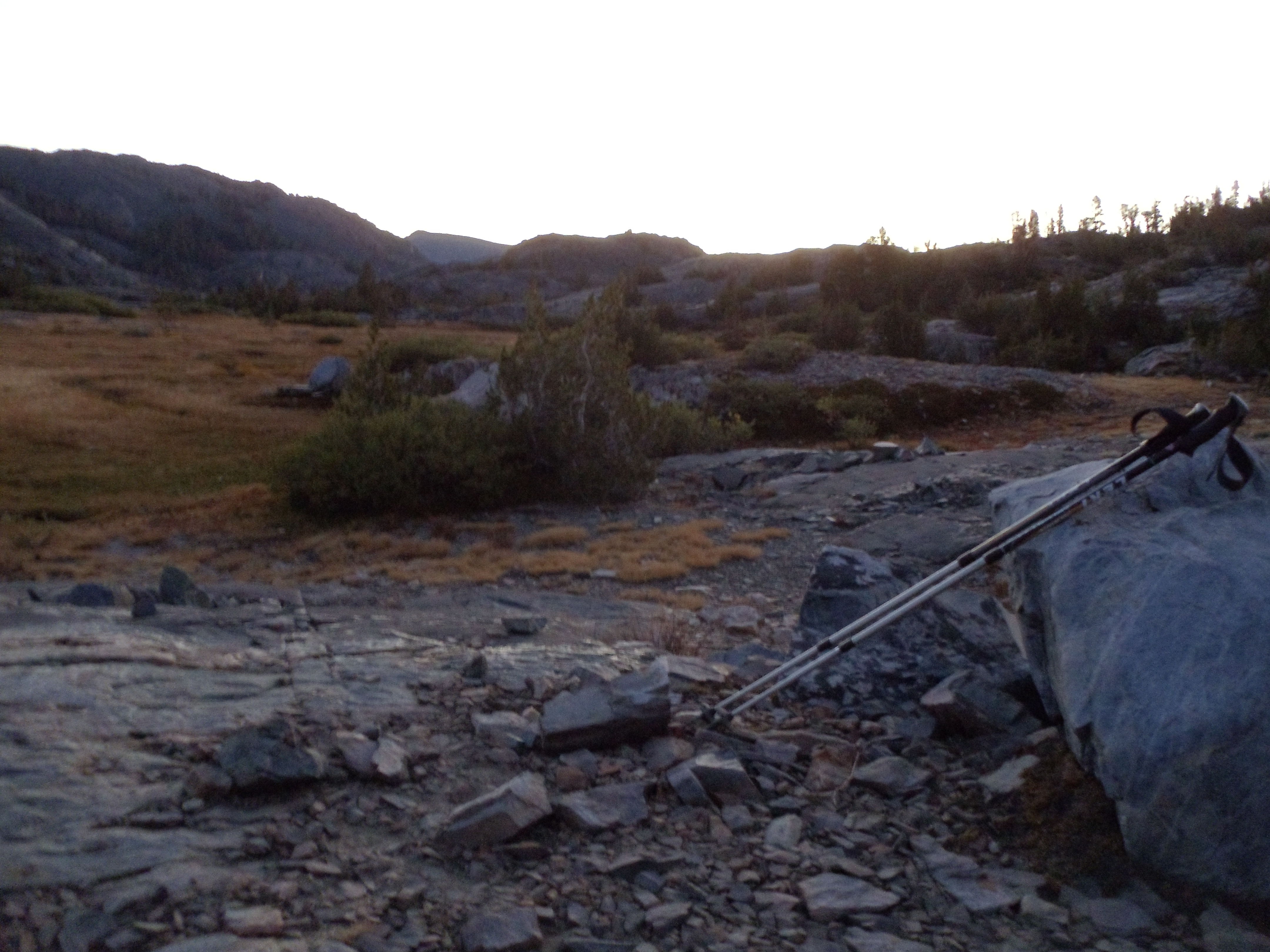
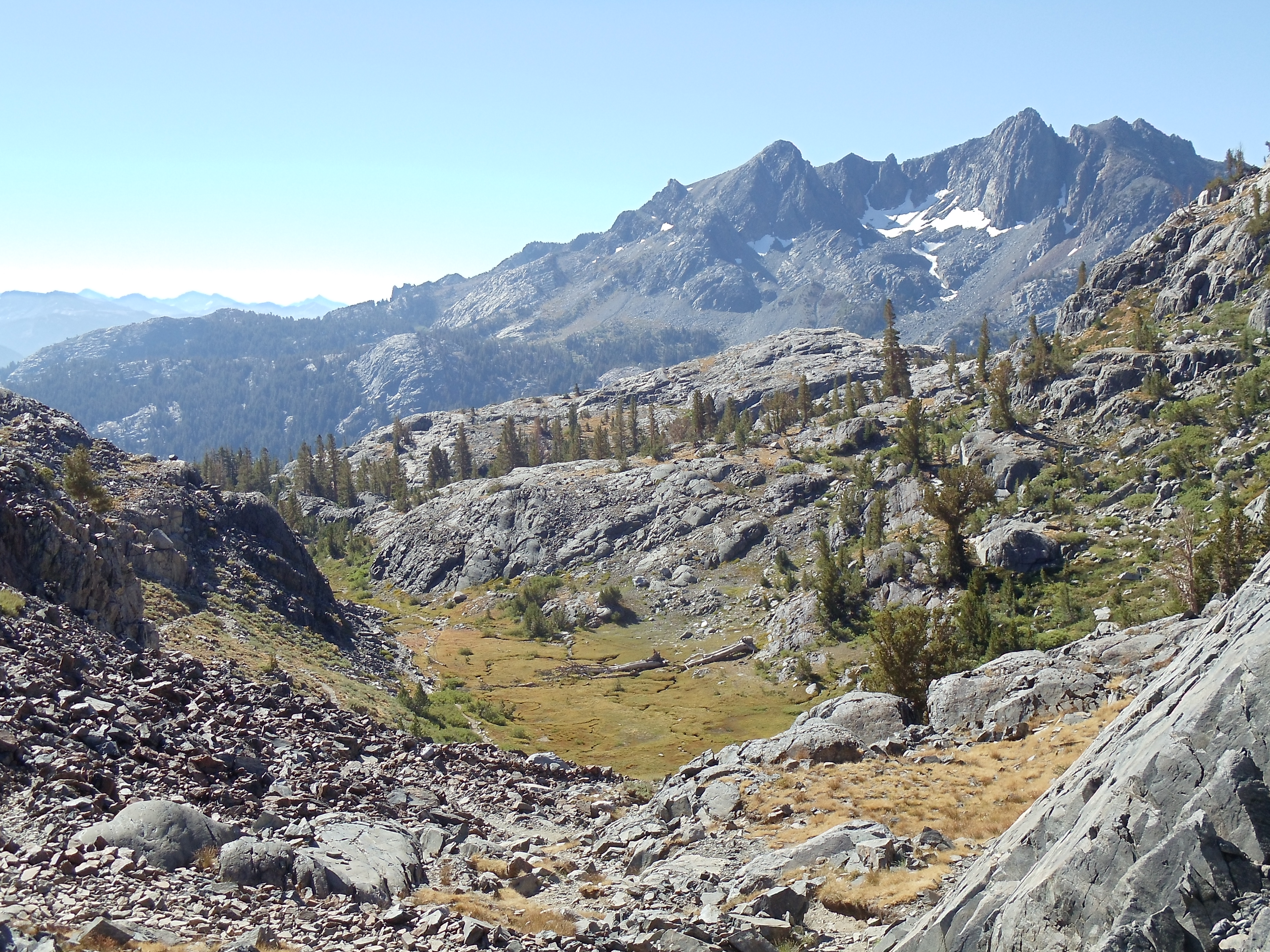
A pre-dawn panorama from my campsite of Banner Peak and the surrounding area
As planned I wake up early enough to catch the tail end of darkness before sunrise; this being the middle of a fairly large valley, I should be able to see it unimpeded. Surprisingly, given last night, little wind blows past the lake, and it’s much more comfortable than it was or than I had expected it would be. The sunrise is excellent but blinding; my camera has some difficulty capturing both brightness of the sky and comparative darkness of the ground. Nevertheless, I take a few pictures as I huddle inside sleeping bag and bivy sack waiting for the sun to rise to provide warmth to leave them.
The light, it burns!
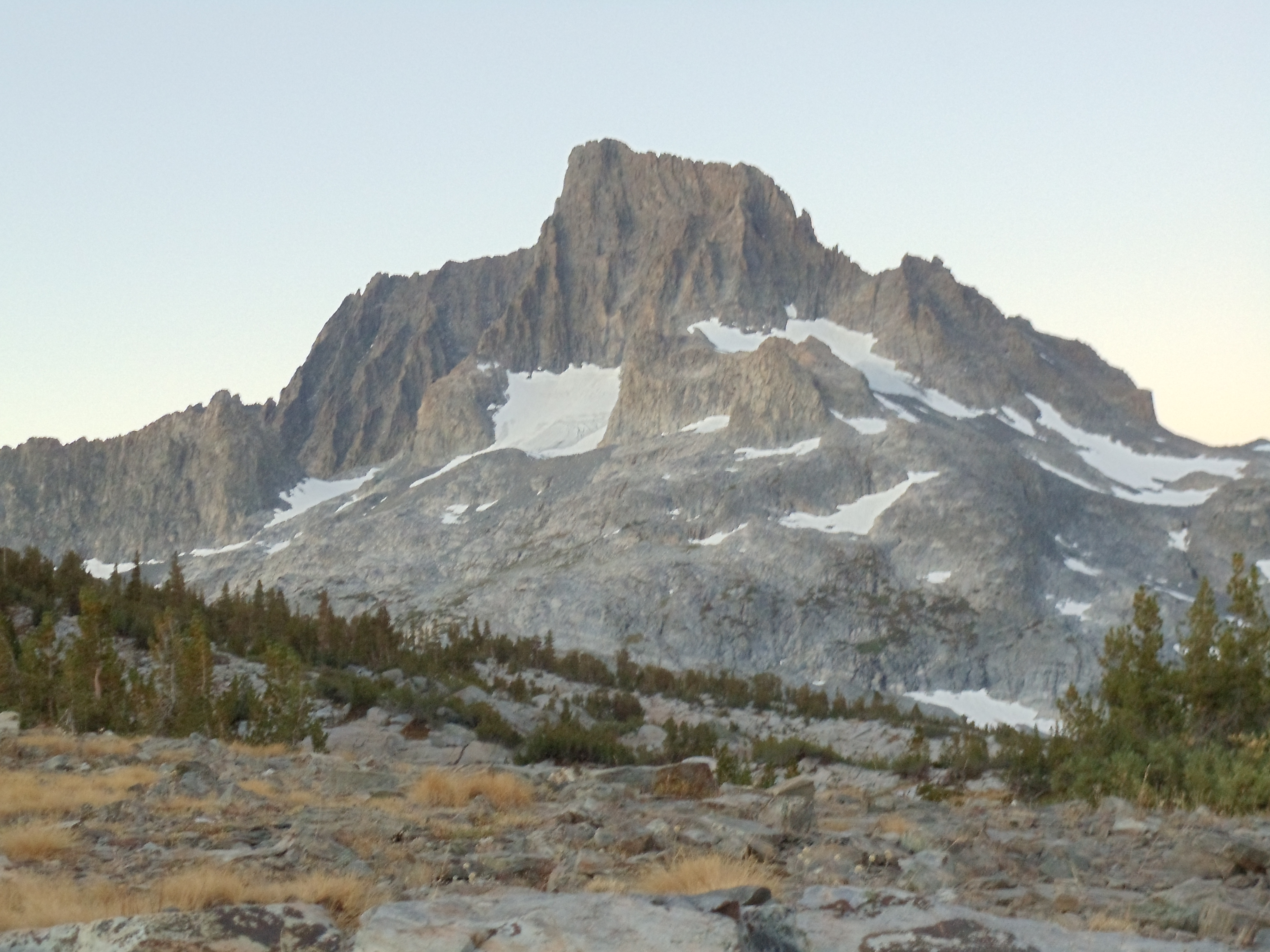
Banner Peak greets the early-morning sunlight
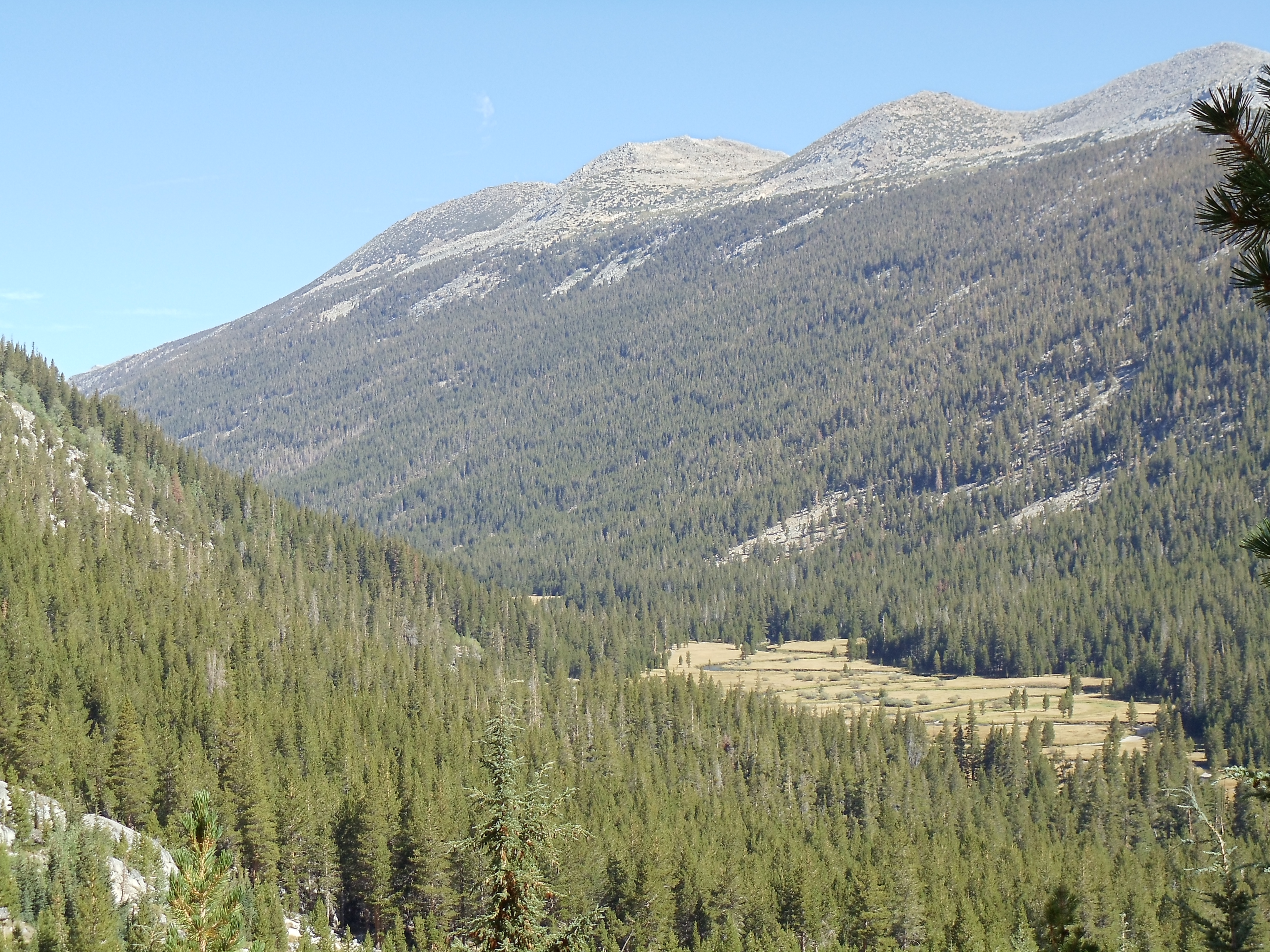
Hiking begins relatively early today, in accord with rising for an early sunrise. The first several miles of trail wind around several lakes named for gems, climbing up and over and down ridges along the way. Today is the fourth day of hiking, and my ankles are beginning to adjust to the inclines and constant pounding through which I’m putting them. But for now, I’m far more engrossed in enjoying the thoroughly ridiculous scenery than in feeling any lingering pain.
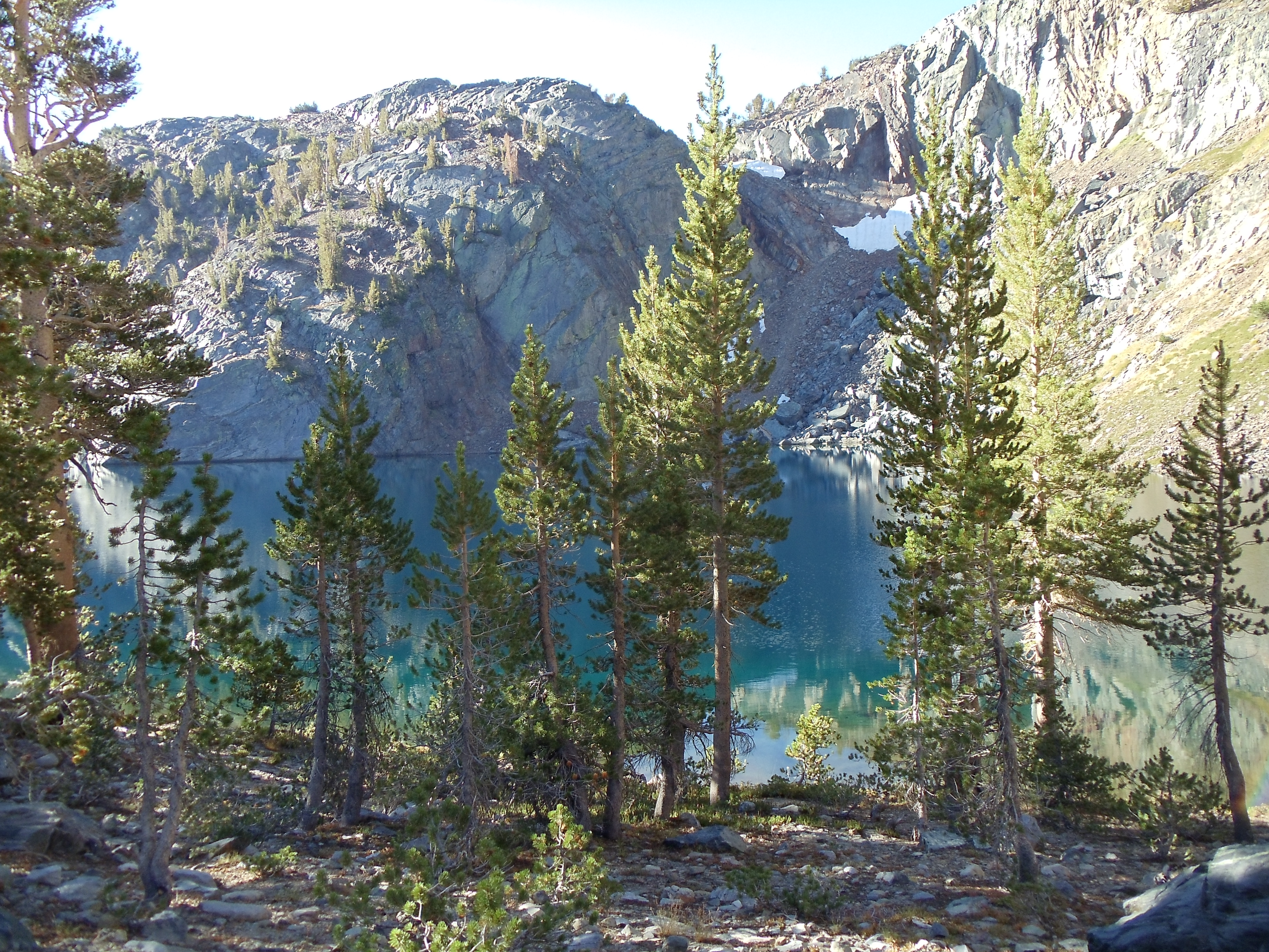
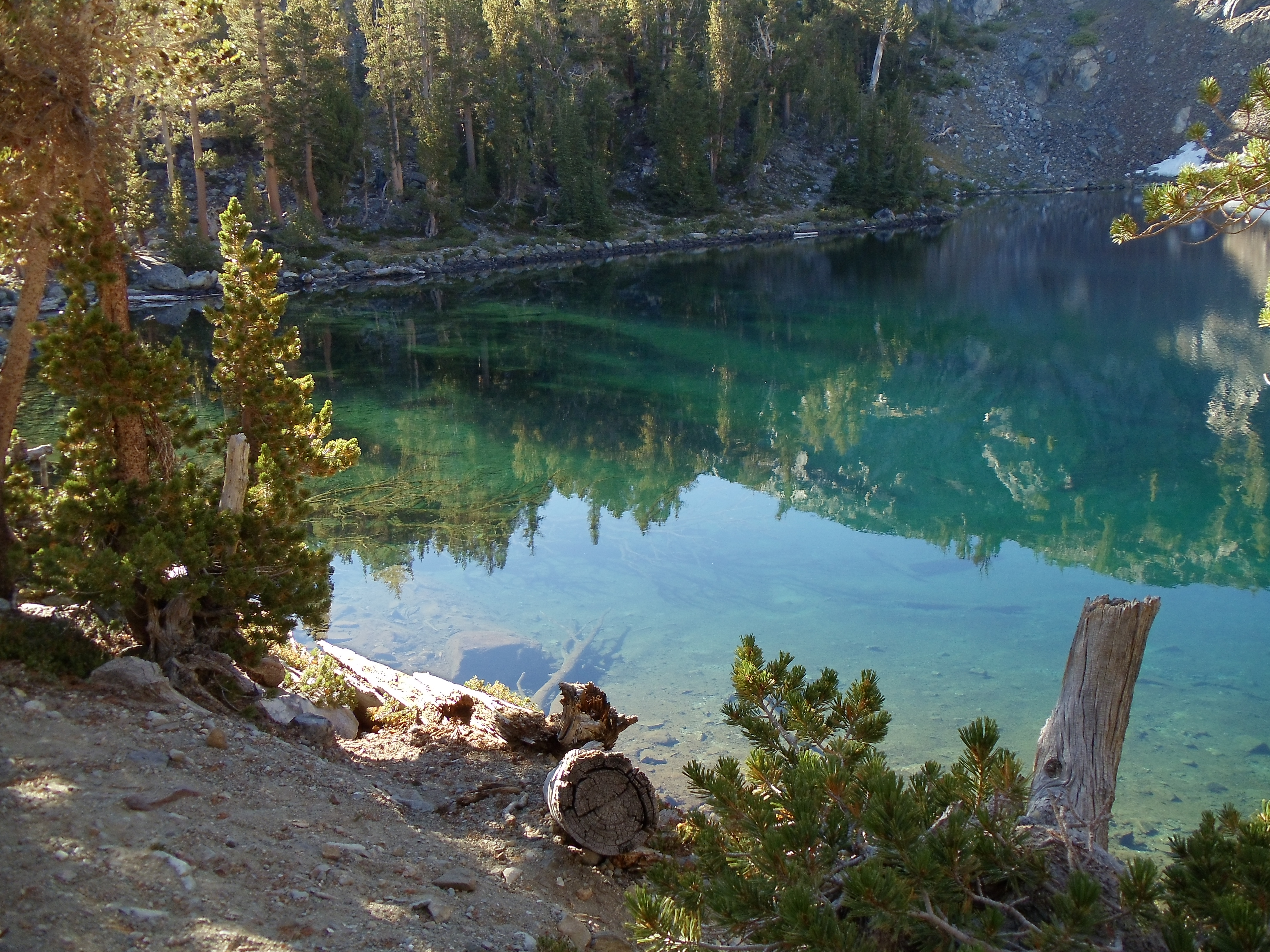
Ruby Lake
Reflections and color against the shallows of Ruby Lake
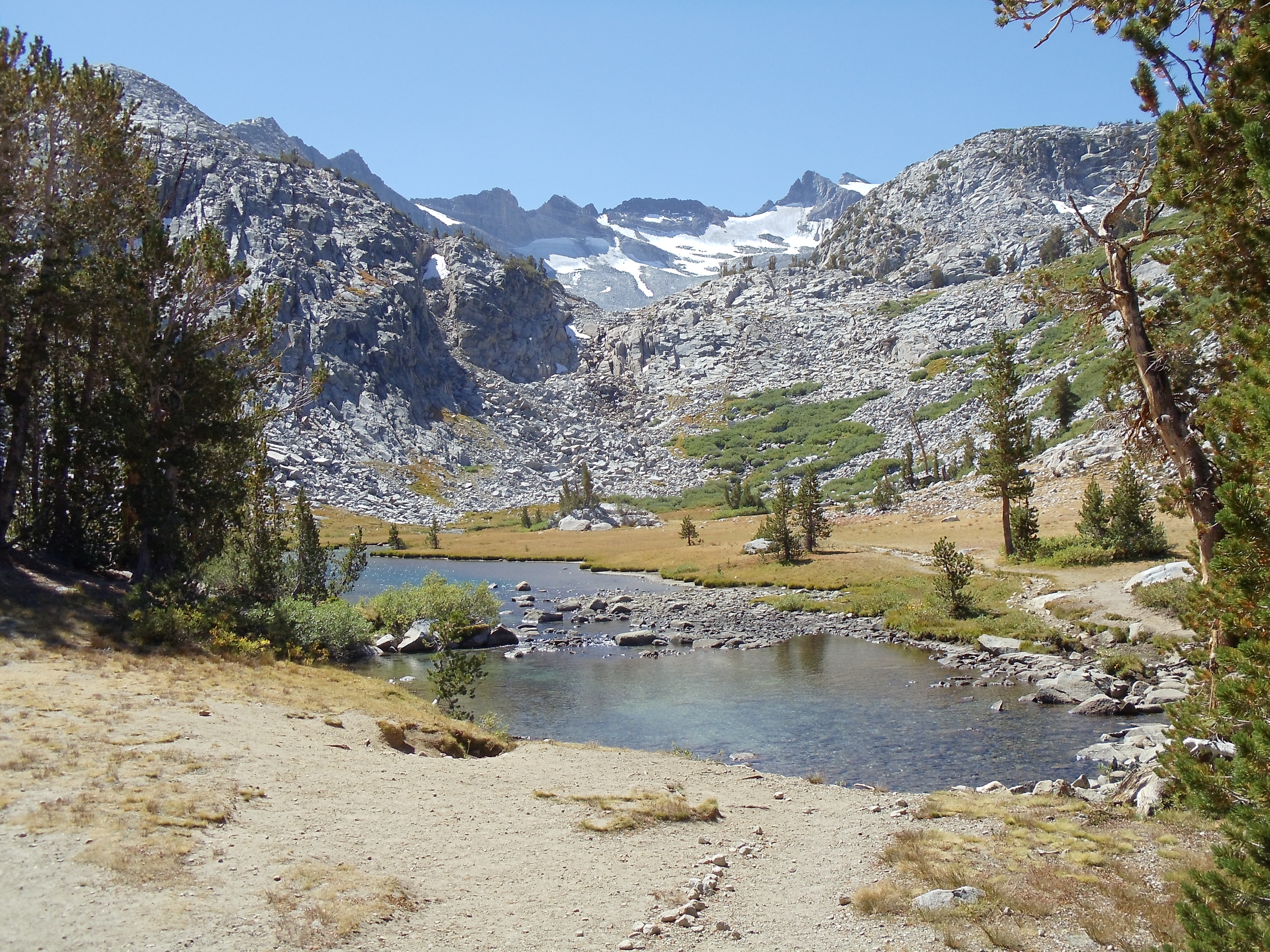
The largest of the precious-stone lakes, Garnet Lake, provides the greatest views. It dominates the landscape through its size, and its gently-rippling waters are a blurred mirror for the peaks in the distance behind it.
Mount Ritter (left) and Banner Peak (right), seen over the rocky shore of Garnet Lake; curiously, Mount Ritter is the taller of the two — a matter of perspective
(Interestingly, my first picture of it and the mountains in the background is a near-exact copy of the cover of the guidebook I carried, even though I didn’t intend to precisely replicate the picture. [I probably aimed for the general idea — towering mountains above lake with some ground and trail in the foreground — but I didn’t notice the exact spot of that picture was mere steps away, even though I usually try to look for the settings of pictures in guidebooks I use.] The guidebook picture is obviously older, but beyond that the major difference is that my picture captures reflection in the lake while the guidebook doesn’t. I suspect it was deliberately airbrushed out of the picture to reduce busyness.)
Looking across the eastern expanse of Garnet Lake toward its outlet, crossed by a barely-visible wooden bridge
Mount Ritter and Banner Peak, mirrored in Garnet Lake, from near the footbridge across its outlet
Past Garnet Lake the trail ascends out of Garnet’s bowl, then generally descends on the way toward Devils Postpile National Monument. I pass by more lakes, none of which strike me enough to merit a picture.
This descent, covered in baseball-sized rocks as it is, reminded me of some of the worst stretches of the Appalachian Trail in Pennsylvania *shudder*
Looking down toward Shadow Lake
Looking across Shadow Lake, with San Joaquin Mountain and Two Tears/Two Teats (web searches find both names: maybe it was bowdlerized?) in the distance
Just past one stream crossing I wander by another deer. Unlike previous deer on the JMT, this one cautiously watches me as I stop and take its picture, starting briefly at my experimental, abrupt move intended to gauge its reaction. Yet as with earlier deer, it generally ignores me. In the past I’ve considered this unnatural: wild animals should be afraid of humans, and they should retreat when humans approach. Yet this deer makes me reconsider. The primary problem with Shenandoah deer (often brazen beggars) was not their willingness to be near humans: it was their willingness to be near humans to beg. Proximity, and even some level of ease, is not inherently bad. The problem occurs when this is taken for granted: then, fearlessness and misguided beneficience produce a vicious cycle by which wildlife becomes no longer truly wild.
Shenandoah is too easily accessible for wildlife’s cautious acceptance of human presence to be workable. Throngs of visitors will to a sufficient extent ignore signs, act carelessly, and inexorably lead deer and other wildlife to mendicancy. In Shenandoah it really would be better for deer and other wildlife to be fearful of human presence to the point of fleeing it. (Bears in Shenandoah actually do this, mostly, I suspect, because SNP deals with problem bears much more aggressively than it deals with the vastly greater multitude of problem deer. Of course, bears being much more fearsome than deer also reduces interaction. 😉 )
But in many sections of the John Muir Trail, in the middle of remote wilderness, the deer that turns a wary eye in my direction yet continues about his business presents no problem. Nor does he induce any. Backpackers generally well-educated about interacting with wildlife (and usually not carrying food to spare!) won’t be much of an issue. Horseback visitors from nearby Devils Postpile are inherently hindered from over-close interaction, and they’re often supervised by informed guides. Less-educated day hikers are most problematic, but fewer of them will be here simply because it’s difficult to get to much of the JMT, severely blunting their ill effects. Complete lack of fear in wildlife is likely unworkable; it lowers barriers to interaction too far. But wildlife’s cautious acceptance along the JMT of human presence at a small distance, so long as the JMT remains remote, is a fragile yet stable equilibrium.
The aforementioned deer
After much more descent I finally reach relatively flat ground: Devils Postpile National Monument is at hand. Devils Postpile’s main attraction is its bizarre natural rock formations: tall, regular hexagonal basalt columns (other sidedness less frequently) formed by volcanic action. The JMT passes through Devils Postpile’s periphery, so I’d have to detour to see the formations, partly contributing to my decision not to go see them. But more than the delay, I decide not to go because the monument feels like it’s a Pacific Crest Trail experience, not a JMT experience. If I’m not deliberately visiting Devils Postpile, I’m going to leave seeing it for when I thru-hike the PCT. (For the same reason you won’t find me hiking a section of the PCT to hike it, except as part of a thru-hike.)
Now entering Devils Postpile National Monument
The trail north bifurcates as the JMT winds around several lakes while the PCT travels the crest
I follow the trail through Devils Postpile, guided mostly by a picture I took of the map at a trail junction shortly inside it. (The guidebook strangely foregoes a map to awkwardly describe it in prose, making it less useful and more confusing than one might hope.) It’s mostly deep sand, so the going is a bit slow. Finally, I reach the turnoff to visit Reds Meadow, a campground, store, and restaurant just off-trail where I hope (likely quixotically, given the wide variety of digital cameras and batteries) to find a replacement camera battery. The meter on my camera’s been declining much more quickly than I’d expected, so I’m worried about running out partway down the trail and thus missing the end. I’m not in luck: the store has nothing more than standard batteries and regular rolls of film. I consider eating dinner at the restaurant, but I propel myself southward in hope of reaching a camping spot with some daylight. It’s now 17:00, and if I move quickly I can reach Crater Meadow in daylight.
The San Joaquin Fork heads south to Rainbow Falls
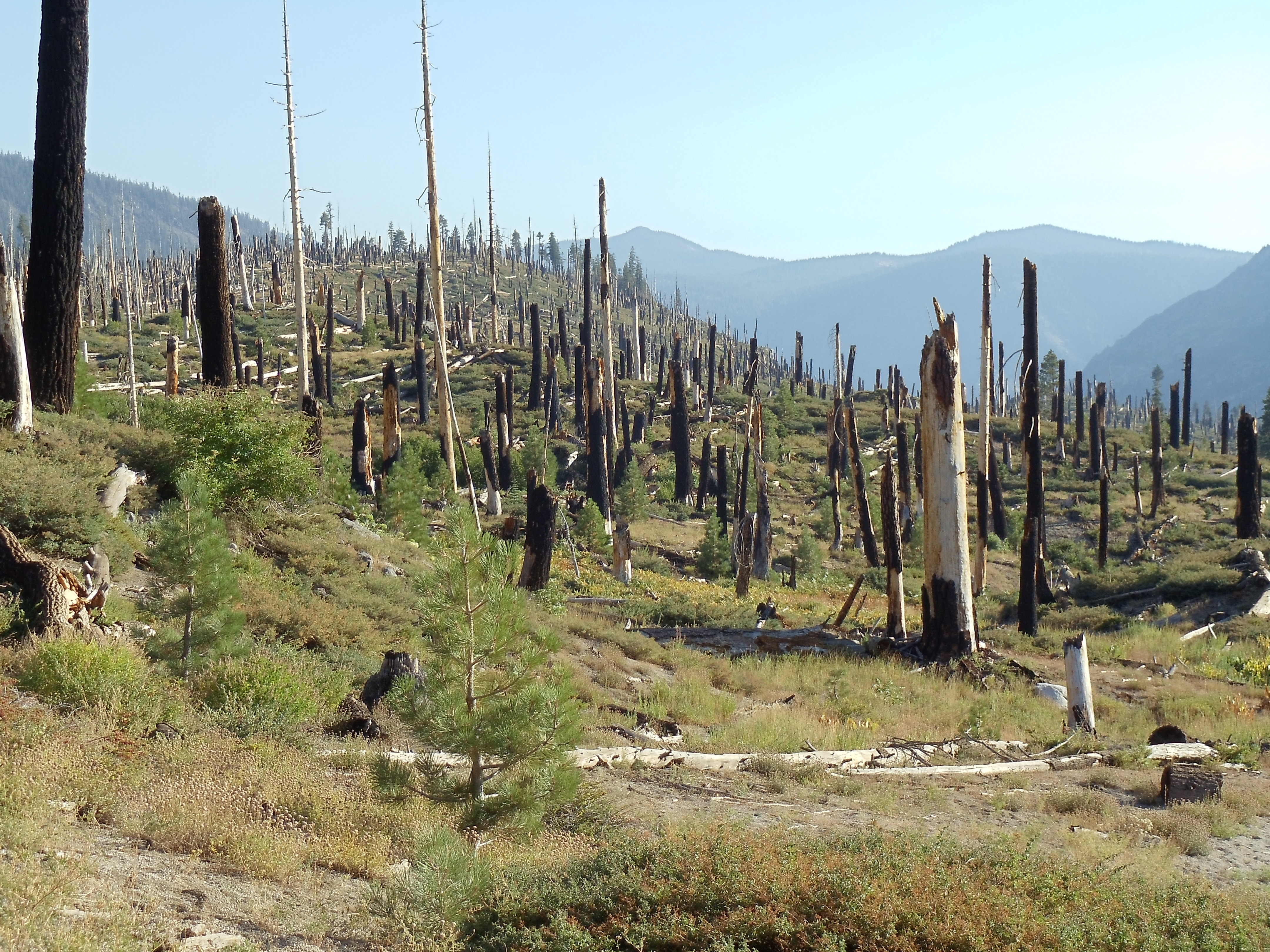
Trail south of here turns a bit eerie as I pass through the remains of a forest fire eighteen years ago. Blackened trees are everywhere, but smaller growth abounds. The trail curves through the area before heading up into the mountains again, and I hit a solid pace as I push to the end of the day.
The tree cemetery south of Devils Postpile, devastated by the 1992 Rainbow Fire
Edible (insides only 😉 ) reddish-yellow gooseberries; if only I'd known what they were, and that they were edible, at the time...
The trail leaves the burned area and starts ascending, and I notice a few decent campsites. However, having noted Crater Meadow as a goal, I feel compelled not to stop until I reach it. It starts to get dusky as I finish out the day, but I make it to a campsite near a small river crossing with light to spare and call it a day. The site’s partially occupied by Michelle, another JMT thru-hiker (albeit one starting from Tuolumne Meadows due to scheduling mishaps, hiking the entire stretch without resupply — a very aggressive pace/load that’s still not inconceivable). She’s started a small campfire, which provides for a nice break from my usual habit of not having campfires while backpacking. I eat dinner and we talk off and on as night falls.
I’m still carrying that boxed wine, but there’s a lake roughly a day’s hike from here. Maybe I can break it out tomorrow night, cool it in the lake, and finally get rid of its weight with dinner.
September 15
(18.5; 0 side; 78.5 total, 132.5 to go)
It’s up and out around the usual time this morning. Michelle and I end up leaving about the same time, but I overtake her shortly as I move faster with much less food to carry. I speed through the first six-odd miles of the day: there’s some scenery but no water, so I have little reason to stop.
Double Peck East, seen over Cascade Valley from the JMT as it carves across a mountainside near Mammoth Crest
A panorama of Double Peck East from the trail
A less-obscured view of Double Peck East
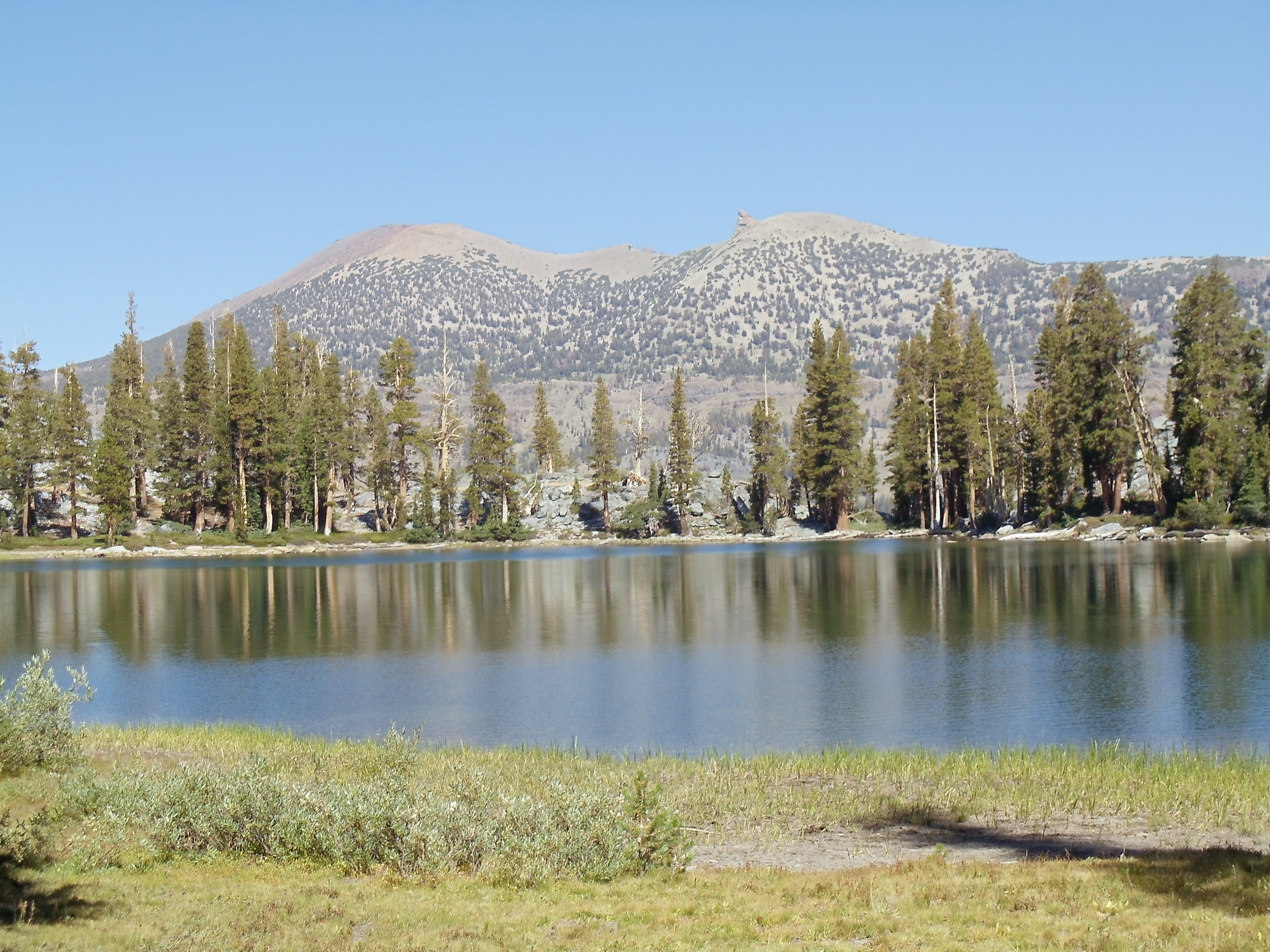
Duck Creek ends the drought, and even though it’s a little early in the day I take the opportunity and stop for lunch, Michelle passing me as I eat. Readily-available water is always good at mealtime, especially as tortillas with thick peanut butter or Nutella contain little water. I continue south again after lunch, curving around a small mountain before descending to Purple Lake. It looks like a nice camping spot, if I had reached it at the end of the day. I exchange pleasantries with a few people near the lake’s outlet, learning that Michelle is shortly ahead of me, and ascend again toward windswept Lake Virginia, passing Michelle along the way. Lake Virginia’s slopes are much flatter than those of other recent lakes, probably because it’s a larger lake.
Past Lake Virginia the trail switchbacks steeply descending into Tully’s Hole, then follows a creek to a trail junction. It’s around 17:00 now, so if I move quickly and keep moving I should reach Squaw Lake a bit short of nearby Silver Pass with daylight to spare: just about perfect for lightening my pack of a liter of wine. I do so, arriving at the sublime Squaw Lake shortly after 18:00.
Squaw Lake against the mammoth expanses of part of the Silver Divide, from the rocks where I stayed for the night; that's Michelle in the bottom right, with her tent just barely in view in the foreground in the bottom left
I scout around for some sort of decent campsite before settling for bare rock halfway between the lake and the trail proper. (Bivy sacks are versatile — and mine is certainly more versatile than my non-freestanding tent.) Michelle arrives and contemplates continuing to Pocket Meadow, which looks to be about five miles south (most of which she’d be traveling after dark) before deciding to stop here as well.
Dinner is scampi (Knorr pasta as always) with salmon and a splash of pinot grigio. I have no idea whether I’m significantly improving the taste, or if I’m adding the optimal amount at the correct time, but I figure I can’t go wrong (and in any case, there’s nothing wrong with the placebo effect 🙂 ). I have more than I really need to drink, so it’s painless to experiment. Michelle also takes a splash in her dinner since I have so much.
I finish off dinner, then the remaining part of the liter, as darkness falls. But it’s not dark! Entirely by accident I have scheduled my hike to occur during the moon’s waxing phase, ending a couple days into its waning phase. (I don’t believe I could have timed my hike any better if I’d tried.) The moon is large and bright in the sky, enough so that I eventually turn off my flashlight as darkness falls; I really don’t need it to see as long as I don’t have to walk around much. Once I finally finish off the wine it’s off to sleep underneath stars and moon by an alpine lake. Can it get any better than this? I am extremely hard-pressed to think how.
…but, as has happened before, this is not the end of the day! Around 03:00 I wake up to the flashlights of two hikers passing from the north. They don’t stop, perhaps recognizing a campsite with sleeping hikers when they see it, and I’m in no mood to wake up and find out why they’re hiking now, so back to sleep I go.
Deep in Lyell Canyon sunrise starts at its usual time, but direct sunlight doesn’t reach the floor until hours later. I eat my breakfast near the campfire with the other nearby backpackers, and we have some reasonable conversation as I eat my oatmeal. The fire provides a nice bit of warmth in the not-quite-sunlight. Once food’s finished it’s time to head back down the trail to wherever I end up today.
The trail continues to wind through Lyell Canyon a little longer
Lyell Canyon, through which the serpentine Lyell Fork passes, seen shortly up the ascent toward Donahue Pass
My stumbling continues, but when the ascent out of the canyon starts it necessarily slows as the trail begins crawling up and over rocks. I pass by a couple also doing a thru-hike of the JMT at one point; they’ve been out since a little before me, and they plan to leisurely hike the trail into early October. We leapfrog a few times until I pass them for a final time after lunch today.
Lyell Fork, from a bridge partway up the ascent out of the canyon
The majestic Lyell Canyon
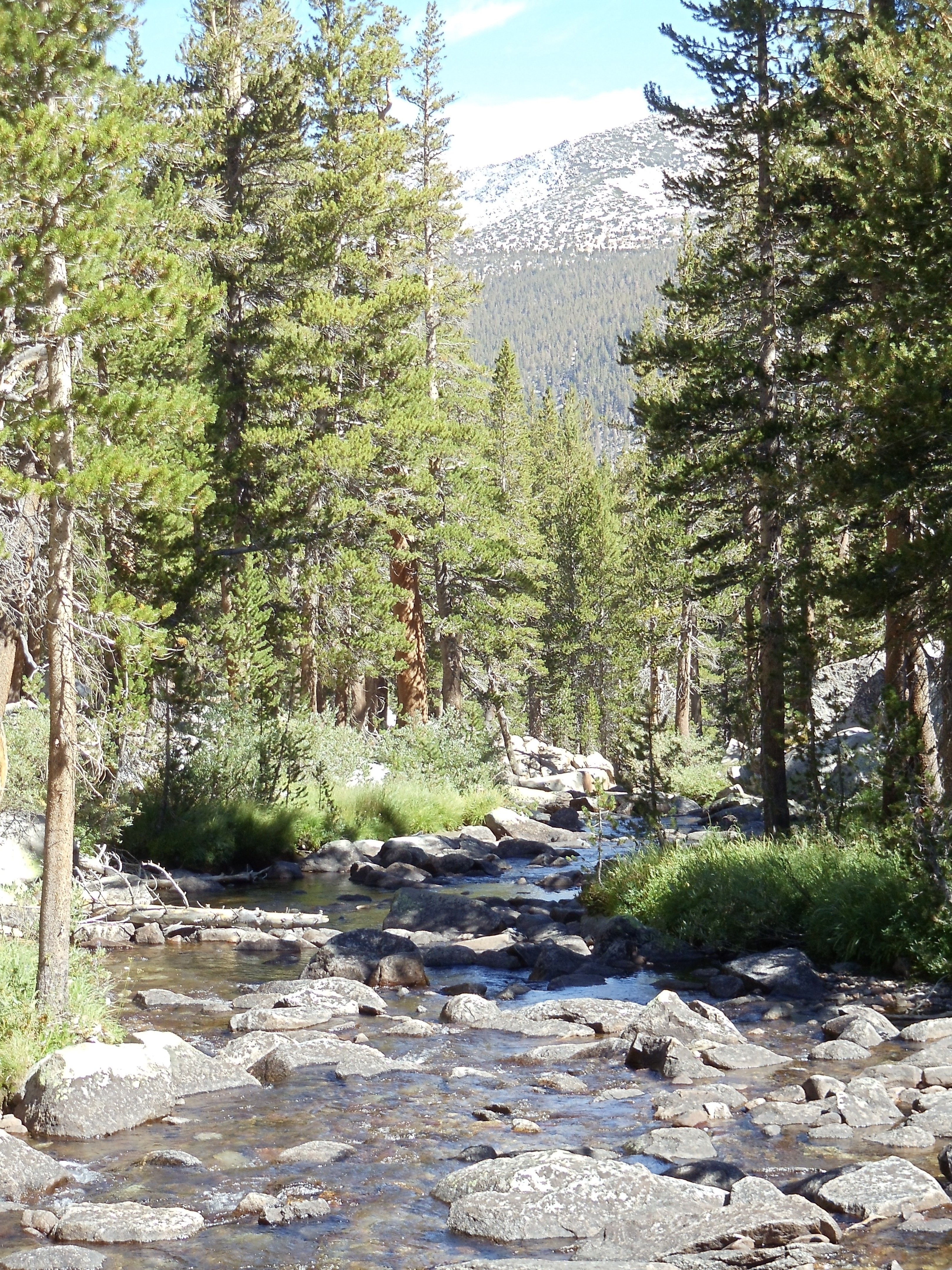
The ascent continues past several tarns, mountain lakes fed by glacial runoff. The lakes are connected by the Lyell Fork, which is much smaller at this elevation than it was from even the earlier bridge (let alone the canyon itself). It’s also much smaller now than it was a couple months ago; this late in the season I can cross it on rocks without getting my feet wet.
Along the upper Lyell Fork toward Mount Lyell and Mount MacClure; I believe Lyell is the furthest-right peak in this picture
Panorama view just past a river crossing, 1 of 3; note the camera's image-splicing glitch near center
Panorama view just past a river crossing, part 2 of 3
Panorama view just past a river crossing, part 3 of 3
Looking further up near one of the "fords" of the Lyell Fork, which would be far more menacing earlier in the season
Just above the lip of rocks in the near foreground is a flat area with another tarn whose outlet the trail crosses. Now seems like a good time for a lunch break, and I stop and cool off my feet and swollen ankles in the water for a brief moment (this being snowmelt water after all) before I eat lunch. There’s another group of other hikers here already doing the same things I’m doing; they head off before I finish.
Lunchtime scenery; yes, the whole John Muir Trail really is like this
After lunch the ascent resumes. It’s pretty gradual as ascents go, which also means it’s rather long. Donohue Pass may be a pass, but it’s not nearly the sight to see that later passes are, clearly occupying a narrow ridge between peaks. It’s more accurate to call it Donohue Plain or Donohue Plateau, I think.
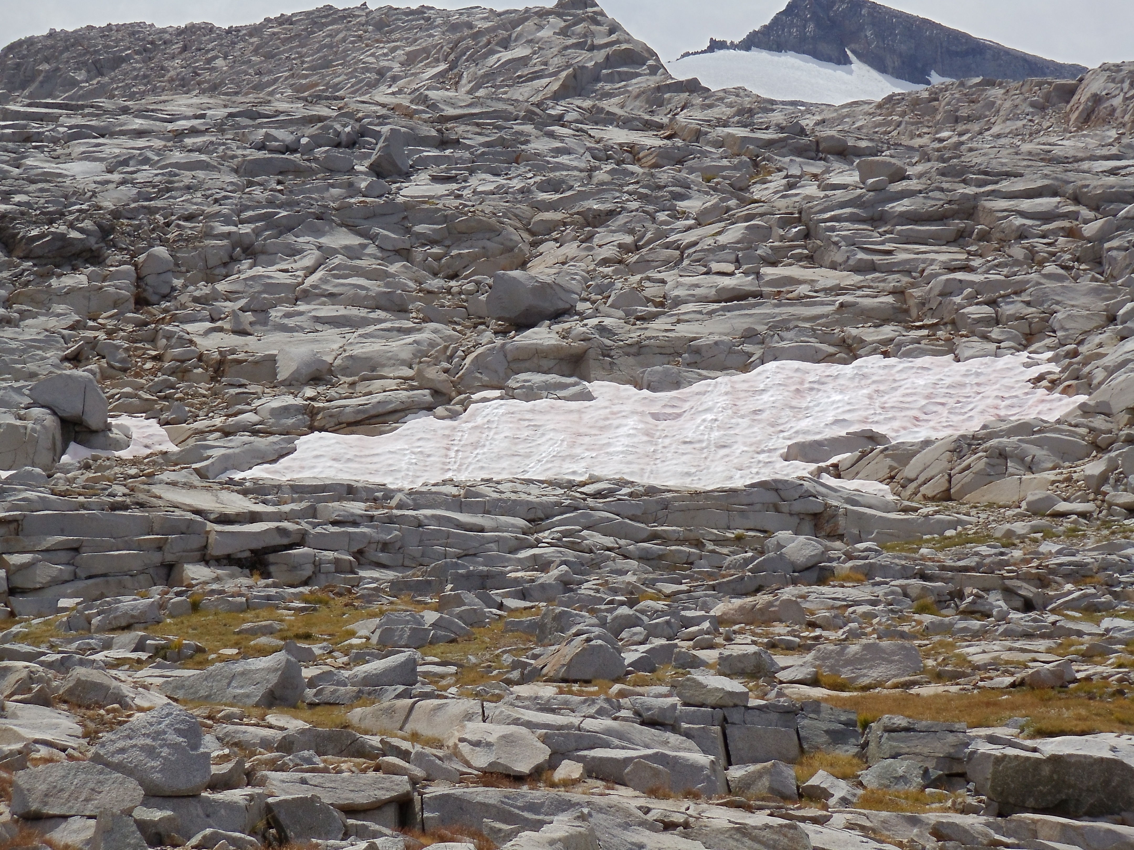
Algae produce this snow's watermelon coloring and even smell; anecdotally, eating such snow is a good way to get sick, so it's unclear whether the snow tastes like watermelon
A late-summer alpine pool
Atop Donohue Plain, er, I mean Pass
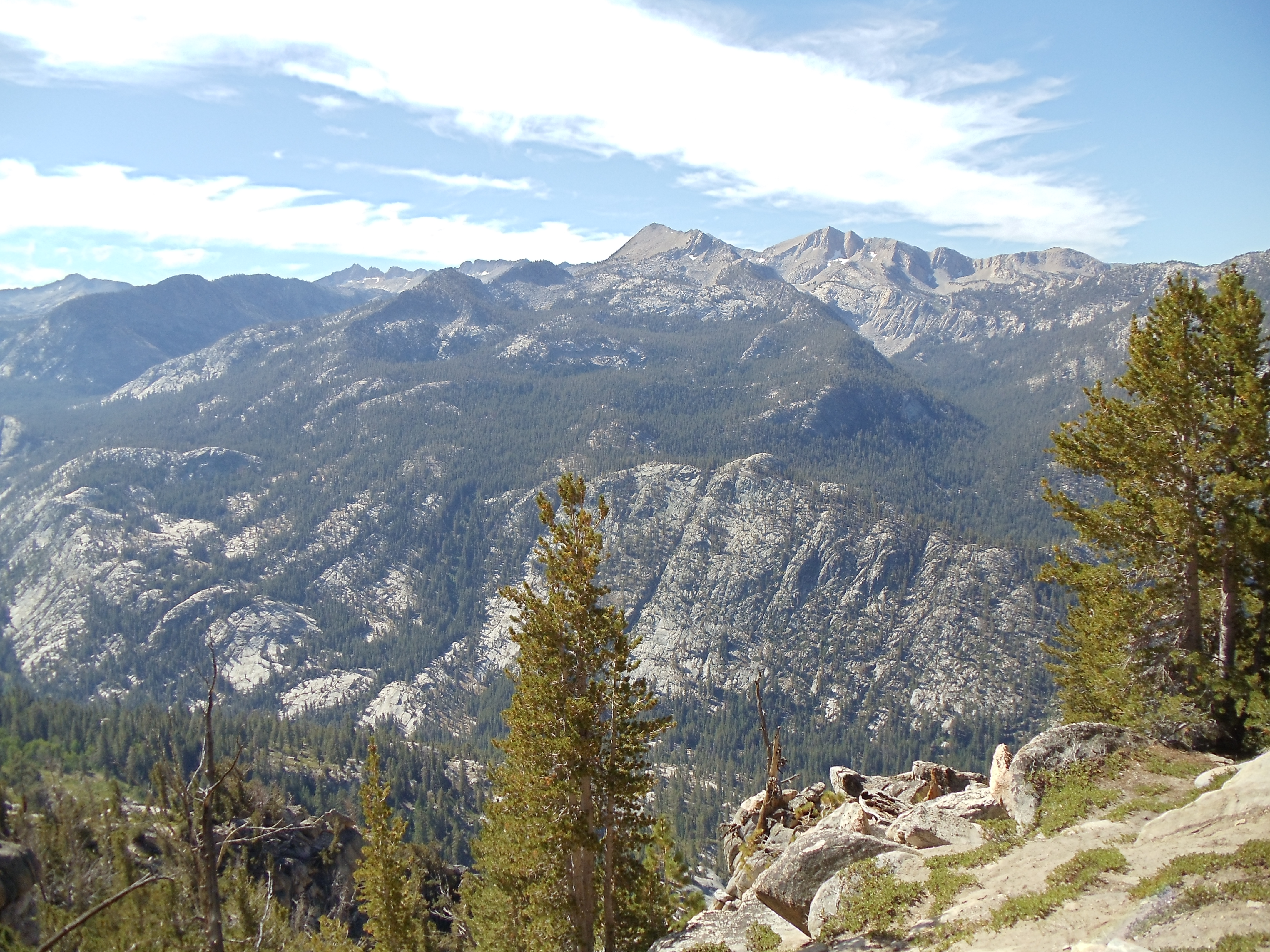
Donohue Pass marks the end of the first recreational area the JMT passes through, as I leave Yosemite National Park and enter Ansel Adams Wilderness, not surprisingly named for Ansel Adams, a noted black-and-white photographer of nature, most particularly Yosemite — try a web search to see his work.
Welcome to Ansel Adams Wilderness
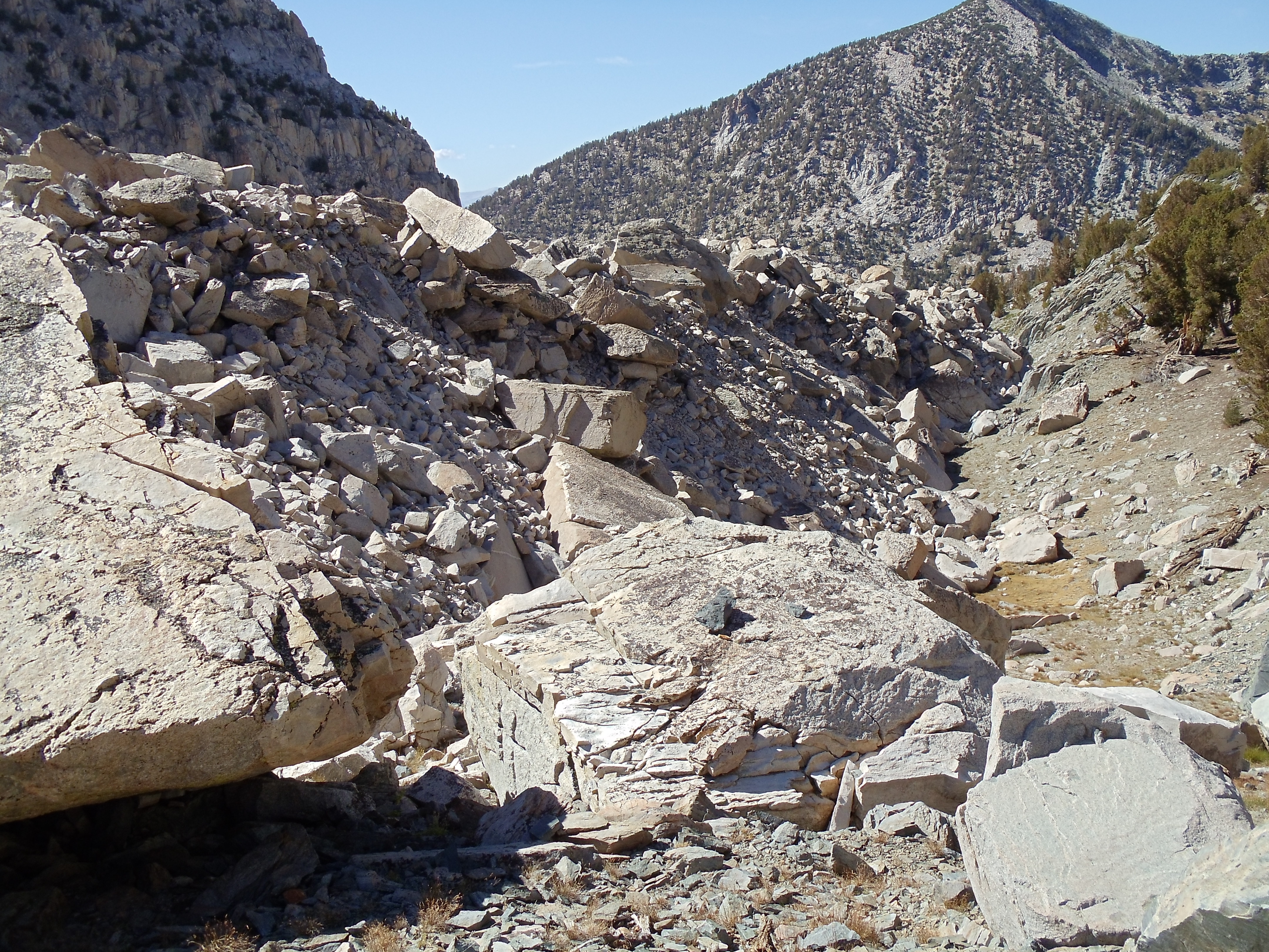
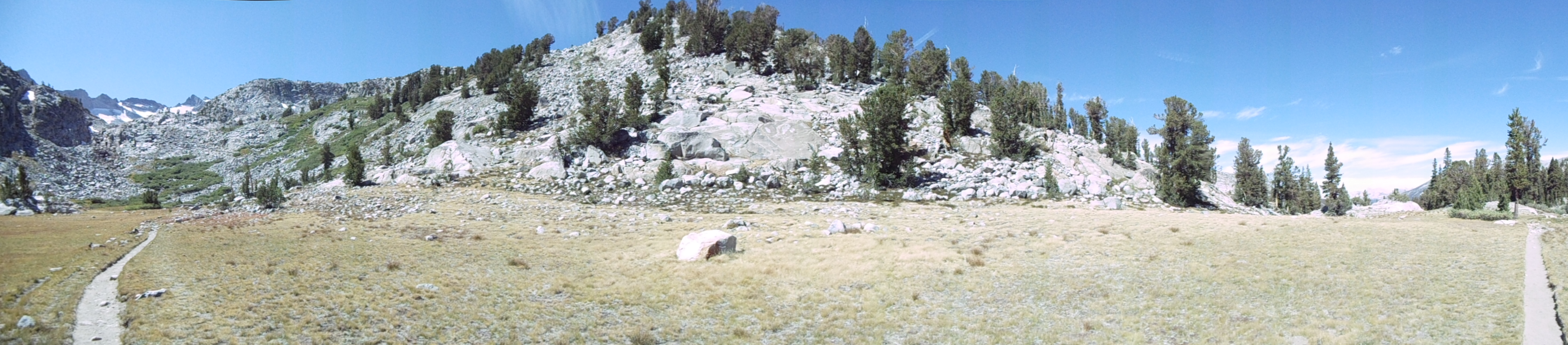
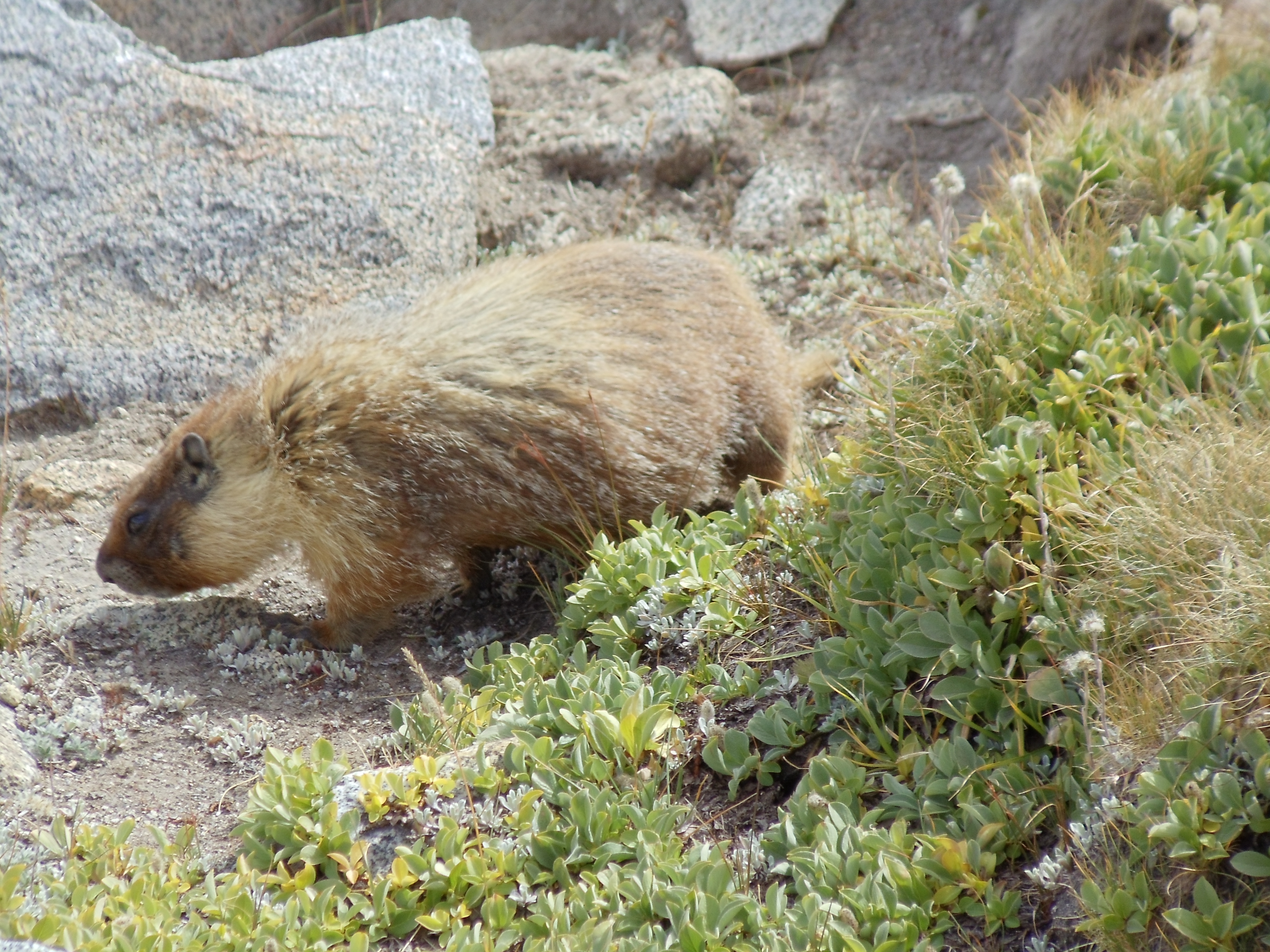
From here south through the end of the day is mostly a blur. The scenery is impressive as always along the JMT, but it is not particularly more memorable than other sections, perhaps because the lakes being passed by are a bit smaller, peaks are further in the distance, and there aren’t many people out and about. My biggest recollection from this descent, and from some others, is of a marmot or two living at high elevation.
A marmot forages for food just south of Donohue Pass
I wonder if this rock is edible...
Aroo?
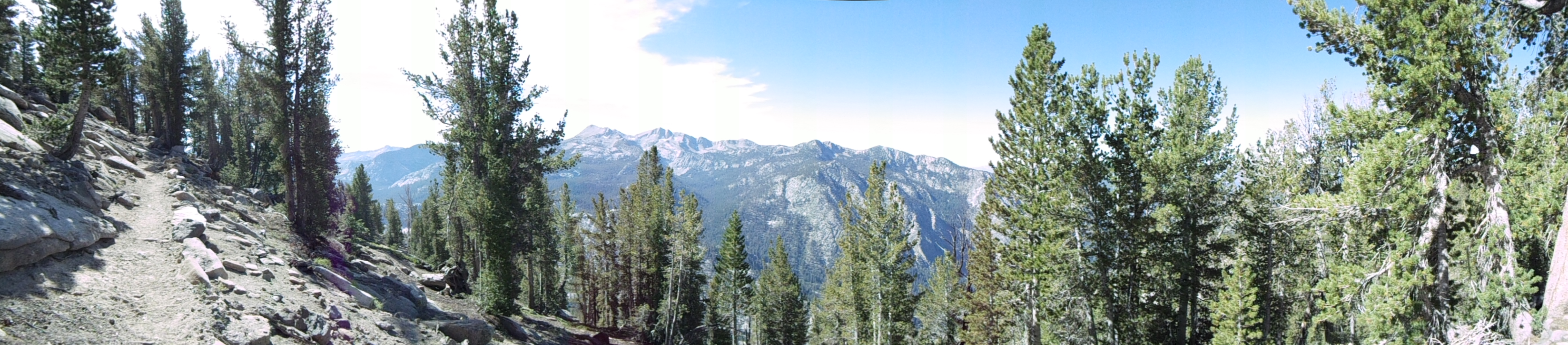
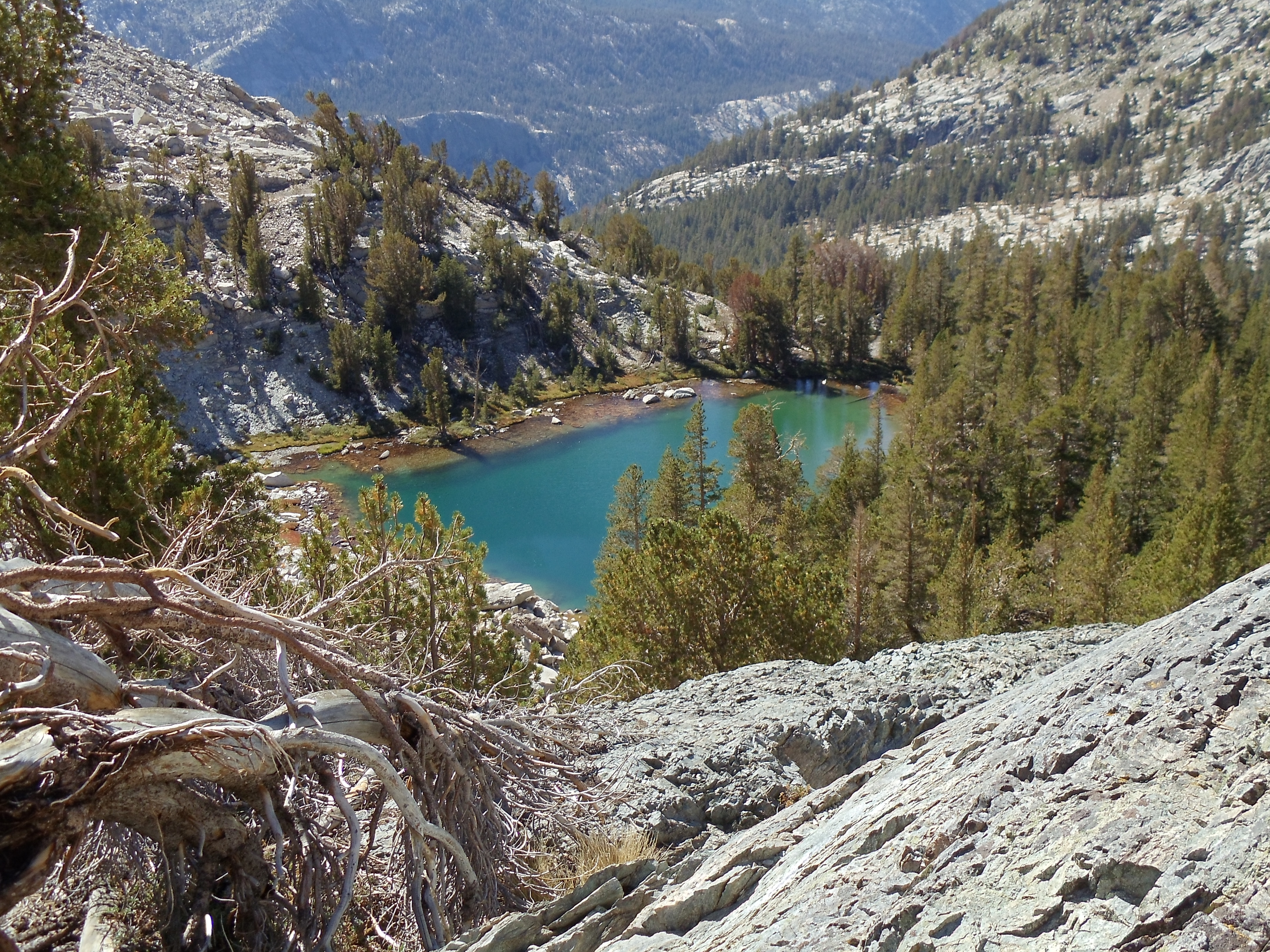
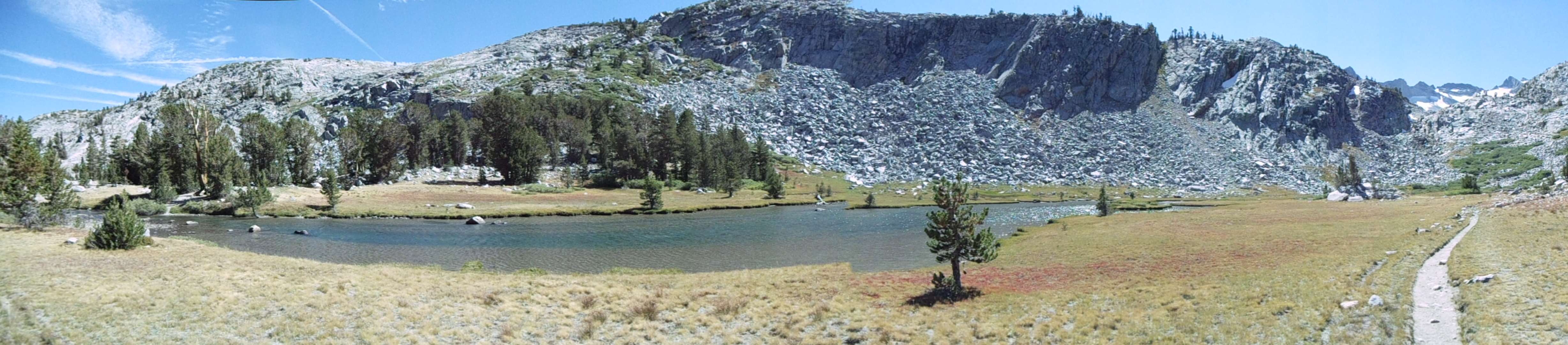
The initial descent from Donohue Pass presents some nice views, and the gradual winding around lakes, over small streams, and through some trees makes for a comfortable, leisurely section. I have no particular goal for the day, but as I approach it Thousand Island Lake seems like a good stopping point: reasonable mileage for the day, going by my map, great views, plenty of space nearby for camping.
It is definitely late summer/early fall in the Sierra Nevadas
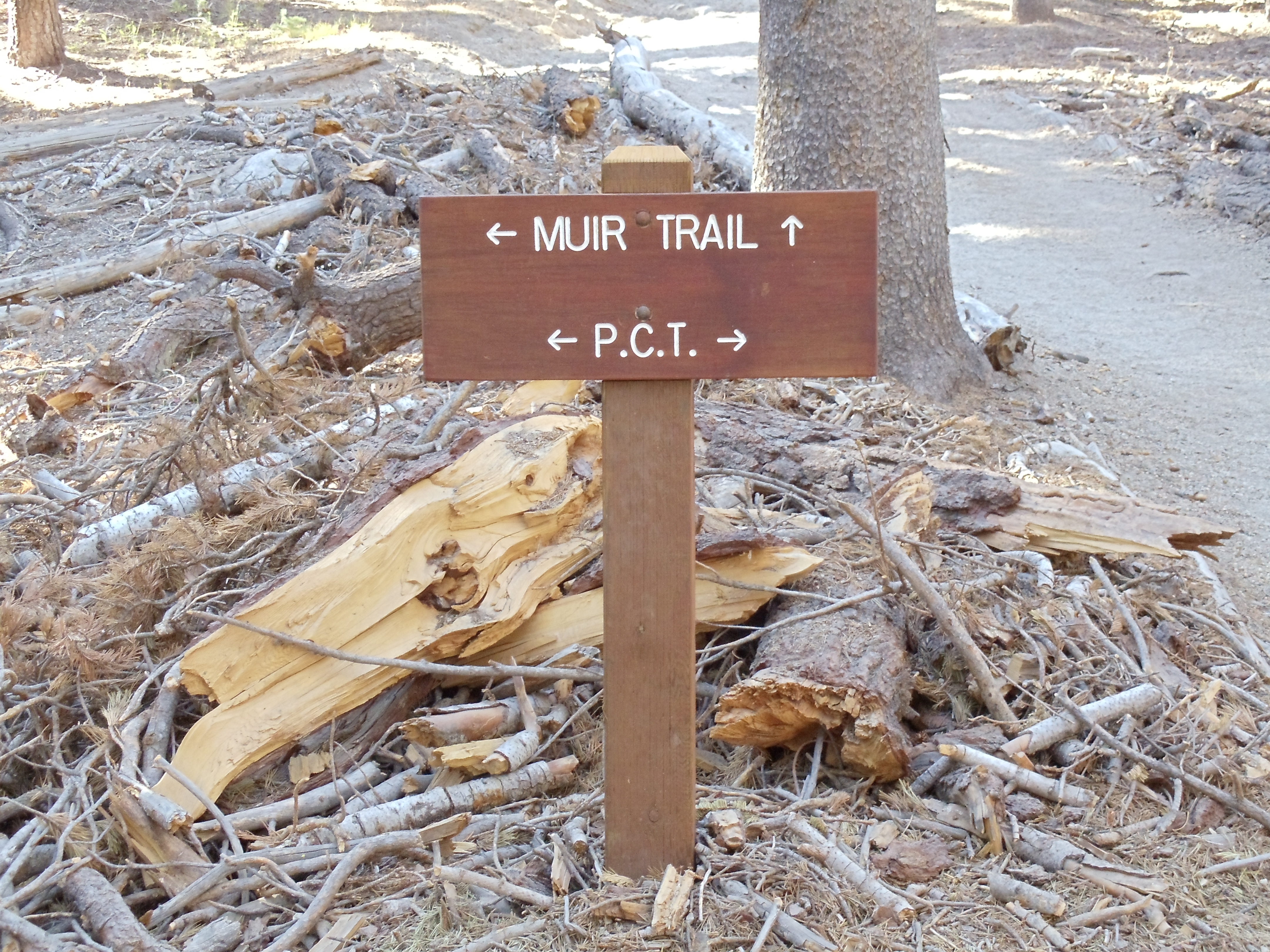
A signpost on the JMT and PCT; the JMT and PCT follow the same path for around 175 miles, minus a stretch just south of here
An unusual-looking section of tree
I descend near Thousand Island Lake around 17:00, although the lake has been visible for awhile (Banner Peak behind it even moreso). I haven’t filled up on water in awhile, so I’m going to need to do that when I get to the lake, and by the time I reach wherever I end up staying near it the iodine I’ll add to it should have purified it.
Banner Peak towers over Thousand Island Lake
The PCT and JMT split at Thousand Island Lake for fifteen to twenty miles, the PCT taking a ridge and the JMT winding around lakes and up, over, and through smaller mountains
A handful of lakes in this section of the trail don’t permit camping within a quarter mile of their outlets. I pass by most of those lakes without stopping for the night, but Thousand Island Lake is the one exception. I attempt with partial success to follow the path around the lake past the edge of the no-camping zone, and I reach a flat, rocky area a short distance from the lake itself around 18:00. Daylight disappears as I cook dinner, made slightly more interesting by the constant wind blowing along the lake. Constant wind is the harbinger of a cold night, so I put on some long underwear. I can see more stars in the sky than I’ve seen in a long time, including all of the generally-too-faint-to-be-seen Little Dipper, as I head to sleep.
I took enough pictures this day and the next that each warrants its own post. These days are probably the most gorgeous of the whole trail, but the passes in the latter half of the trail are more breathtaking. (Literally.) This isn’t to say that either is more beautiful than the other but rather to say that they’re beautiful in different ways — about what I’d say if asked to compare the Appalachian Trail to the John Muir Trail. It’s apples to oranges as far as I’m concerned. (What if I really had to choose A.T. versus JMT, with no further distinction? 139 days versus 15 days is a no-brainer. But taken day by day, the JMT easily wins.)
After I thru-hiked the Appalachian Trail from June through October 2008, I began to consider which hike would follow it. For better or for worse, my sense of scale in backpacking is now irreparably skewed: any trip less than several hundred miles feels “short” to me. While “short” trips (most particularly weekend and extended-weekend trips) are all well and good, they’re too jaunty to really satisfy. Thus I started thinking about my next “long” trip that (ideally) would fit into a normal vacation from work. (Someday I’ll do an Appalachian Trail-length trip again, but I don’t feel compelled to do so immediately. I have other lengthy trips requiring much less vacation time that I want to take, and I’m happy to make those trips first if it simplifies vacation logistics.)
Originally I thought I’d save up and max out on vacation to bike across the United States, but The Gathering (a yearly conference for Appalachian Trail hikers, although its focus goes beyond the A.T. as a large number of attendees have already thru-hiked it) in 2009 sufficiently aggravated my wanderlust that I couldn’t stomach waiting an extra summer for such a bike ride. I had to do something longer than a weekend but shorter than a cross-country bike trip.
The John Muir Trail quickly beckoned. The JMT is a 211 mile western trail (partially coinciding with the Pacific Crest Trail) through the Sierra Nevadas which goes up and over Mount Whitney, the highest point in the lower 48 states. One of the workshops I attended at The Gathering discussed the details of thru-hiking the JMT; given its relatively close proximity to the Bay Area, its ideal distance for completion in a long (but not extended) vacation, and my newly-gained understanding of the logistics of the hike, I made it my next plan.
As with the A.T., the JMT requires surprisingly little pre-planning for a successful completion, if you’ve done a week-long backpacking trip or two before and know you’re capable of doing so again. There’s really nothing more to it than to acquire a permit (168 days in advance, note), provide for mid-hike resupply, prepare for the few quirks of hiking in the Sierras (mostly bear-proof storage for food, plus perhaps mountaineering gear if you hike early in the season), then to just do it. I might write up a post elaborating the steps to thru-hiking the JMT at some point, if I can find the time. But as for my effort before traveling to Yosemite to do the hike, it basically came down to this (spread over quite a bit of time, due to the rest of my schedule):
Get a permit. (March 2010)
Buy food for the second half of the trip, and mail it in a five-gallon bucket to the Muir Trail Ranch resupply point. (mid-August 2010)
Buy an Amtrak ticket to get from the Bay Area to Yosemite Valley. (day before, September 2010)
Buy food for the first half of the trip, and get stove fuel for the entire trip. (day before, September 2010)
Pack and go!
I’ll note two last things before the actual account starts. The first concerns mileages: I didn’t carry a particularly accurate guidebook with precise mileage information, so all distances are little more than educated guesses based on a not-very-detailed profile of the JMT. The second concerns pictures: I carried a better camera with me on this trip than I did while hiking the A.T., and I passed through generally more spectacular scenery. I therefore took significantly more pictures each day on this hike than I did on the A.T.; the two hundred-plus pictures I took on the JMT in two weeks significantly outpaced the three-hundred-plus pictures I took on the A.T. in twenty weeks. So for the most part, you can expect my JMT days to be longer than my A.T. days space-wise — not because the JMT is superior to the A.T. (in some aspects it is, in others it isn’t), but rather because more pictures take up more space. (In the mark of the amateur, I usually post every picture of the relative few I take, excepting only duplicates and complete botches.)
September 9
Today’s an odd day, as my last day working before the JMT thru-hike and as my only day in Mountain View after returning last night from working remotely at my parents’ house in Michigan. I kick if off buying food for the first half of the trip — standard fare from the A.T. except that I swap off-brand Pop-Tarts for oatmeal. (Pop-Tarts don’t compress well in bear canisters, unfortunately.)
I then head into the office for a day of feverish work on all the big bugs on my plate, for which I hope to at least get patches posted which others can then carry across the finish line while I’m gone. These bugs are to implement Object.{preventExtensions,isExtensible}, Object.{seal,isSealed}, Object.{freeze,isFrozen}, and last but not least, proper support for this in ES5 strict mode. I get the patches for the first three finished except for responding to review comments, and I get the patch series for the last posted. All four bugs are picked up by jimb; he lands the first three soon after I depart, and he finishes up the fourth in mid-October.
Around mid-evening I take a break to run a couple last-minute errands. First I head to REI to pick up stove fuel and a guidebook or map of some sort. Recognizing the trail should be no problem, but intersections may not always be marked to indicate the JMT, so I’m looking for something to help with that and perhaps point out interesting side trails to hike. I end up selecting Day & Section Hikes along the John Muir Trail, which turns out to be suitable, but not well-suited, for thru-hiking. See my review of it if you’re interested in details, although odds are you’ll probably get the gist if you stick around for this entire series of JMT posts and my editorializing in them.
Next stop is Best Buy for a digital camera. I had intended for months to do some actual research into options before buying a new camera, but eventually I ran out of time, so I now have to just skim the options and pick one. (My old camera lacked image stabilization, decent resolution, and…really just about everything, given it was a Kodak EasyShare. Its original intended use was in just about the least demanding possible situation you could imagine, I should say, so it was capable of serving its original purpose. Beyond that it was woefully lacking, as I think many of my Appalachian Trail pictures generally demonstrate.) I go with the Sony Cyber-shot DSC-W370, and aside from a possible user error, it works reasonably well on the trip and is worlds better than my old camera. My only complaint is that extremely well-lit pictures (as many of mine on this trip will be) tend to be washed out, although some of this might be my misuse of the camera.
Those errands finished, it’s back to the apartment where I try to clear out my review queue so I’m not blocking anyone during my time away. Except for (maybe, memory hazy) one request I punt, and another I finish partially before realizing I lack both the time and lucidity to properly complete it, I get it all clear. But by then, it’s so late that between assembling gear, repackaging foodstuffs so I can fit nine-ish days of food into a bear canister (difficult but doable, requires careful selection, sometimes repackaging, and elbow grease to pull it off in the end), I must forego sleep.
As I walk out the door after hitting Publish on a goodbye post, my pack weighs 44 pounds, of which the fully filled bear canister is 19 pounds. This isn’t great, and it’s nowhere near what a true ultra-lighter would carry even for this distance, but it’s reasonable. Given that I used everything in my backpack at one point or another on the hike, I don’t know offhand what I’d remove to substantially reduce that weight. (Which is not to say I couldn’t easily cut weight by replacing a decent number of gear items with lighter versions, if I chose to spend the money. 😉 It’s always possible to reduce weight by throwing money at lighter gear.)
September 10
I end up delaying a few minutes too long to catch the first Caltrain south to the Amtrak station in San Jose, turning a $4.25 train trip into a $47 taxi ride in order to make my first bus of the day. It’s a costly mistake, but it could be worse: it would be far costlier (in a different way) to be delayed seven hours through missing that bus. It occurs to me the time flexibility of stringing together disjoint public transit options is a nice benefit to that mode of travel, in terms of ability (if at some cost) to absorb minor delays and surprises.
Following the taxi ride is the first in three separate modes of travel to reach Yosemite Valley: bus to Stockton, train from Stockton to Merced, bus from Merced to the Yosemite Valley Visitor Center, at an overall cost of $44. (I think it would have been $37 if I’d bought the ticket earlier.) It’s roughly 13:30, and I have plenty of time to do just about anything I want. I begin with the wilderness permit office to get my permit. (I reserved the permit months ago, but I must show up day-before or day-of to claim it, else it’s made available to walk-ins.) Next, I pick up some sunscreen from a valley store for use during the hike. Apparently sunlight at high elevation is murderous, and even though I shouldn’t have much in the way of exposed skin amongst long pants, long sleeves, a hat, and sunglasses, it’s probably best to have it just to be safe. After that it’s mostly wandering around the valley, going into a few exhibits and galleries to look around and bide time.
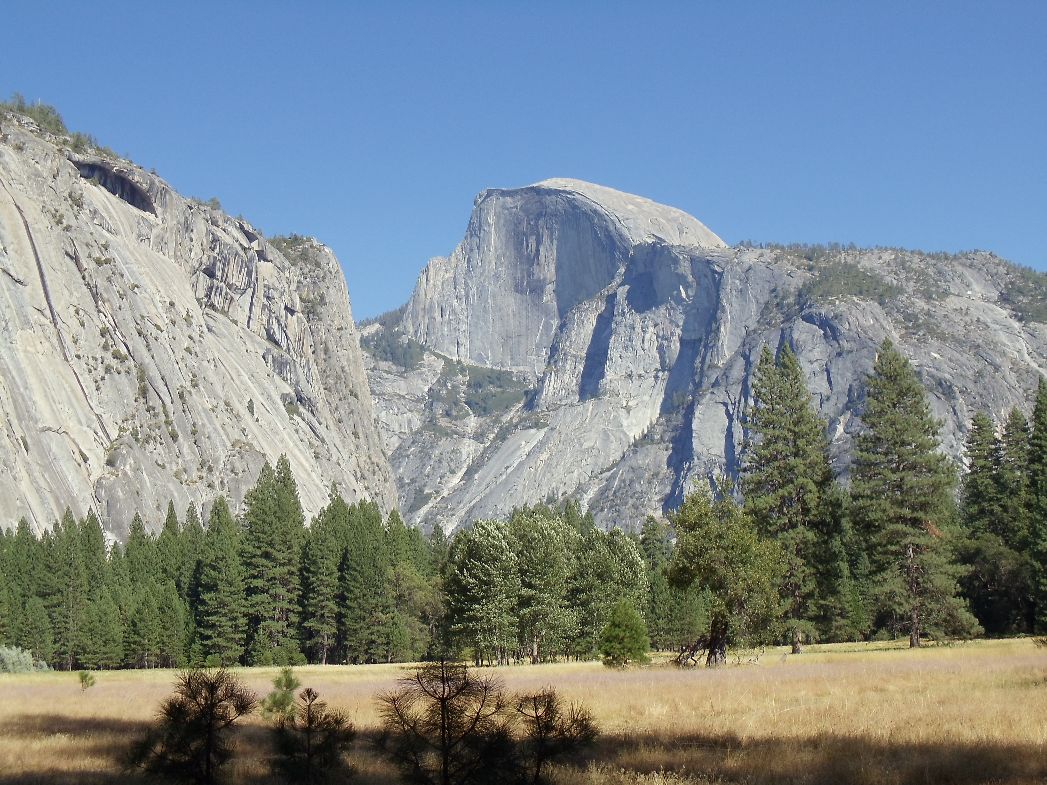
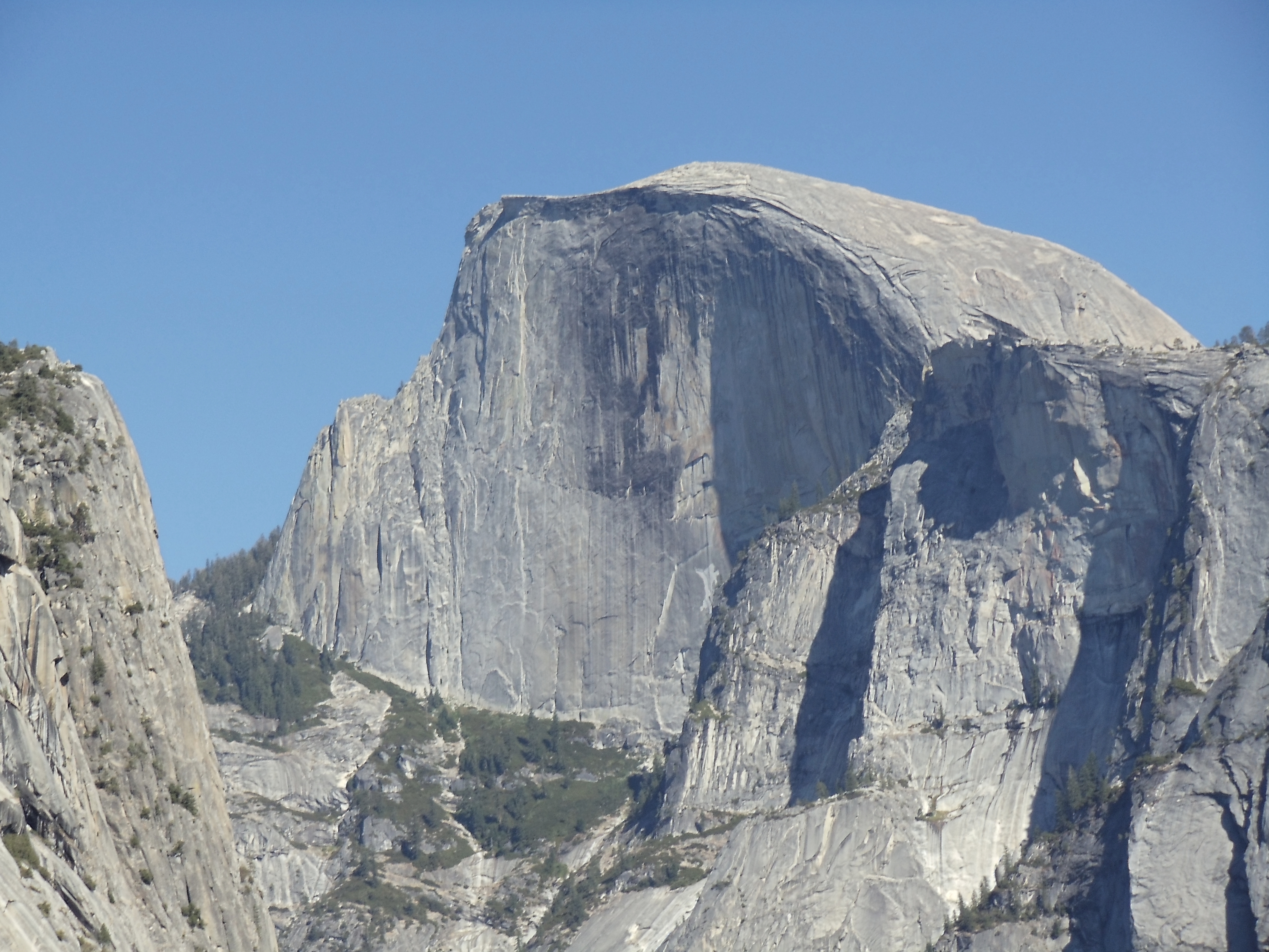
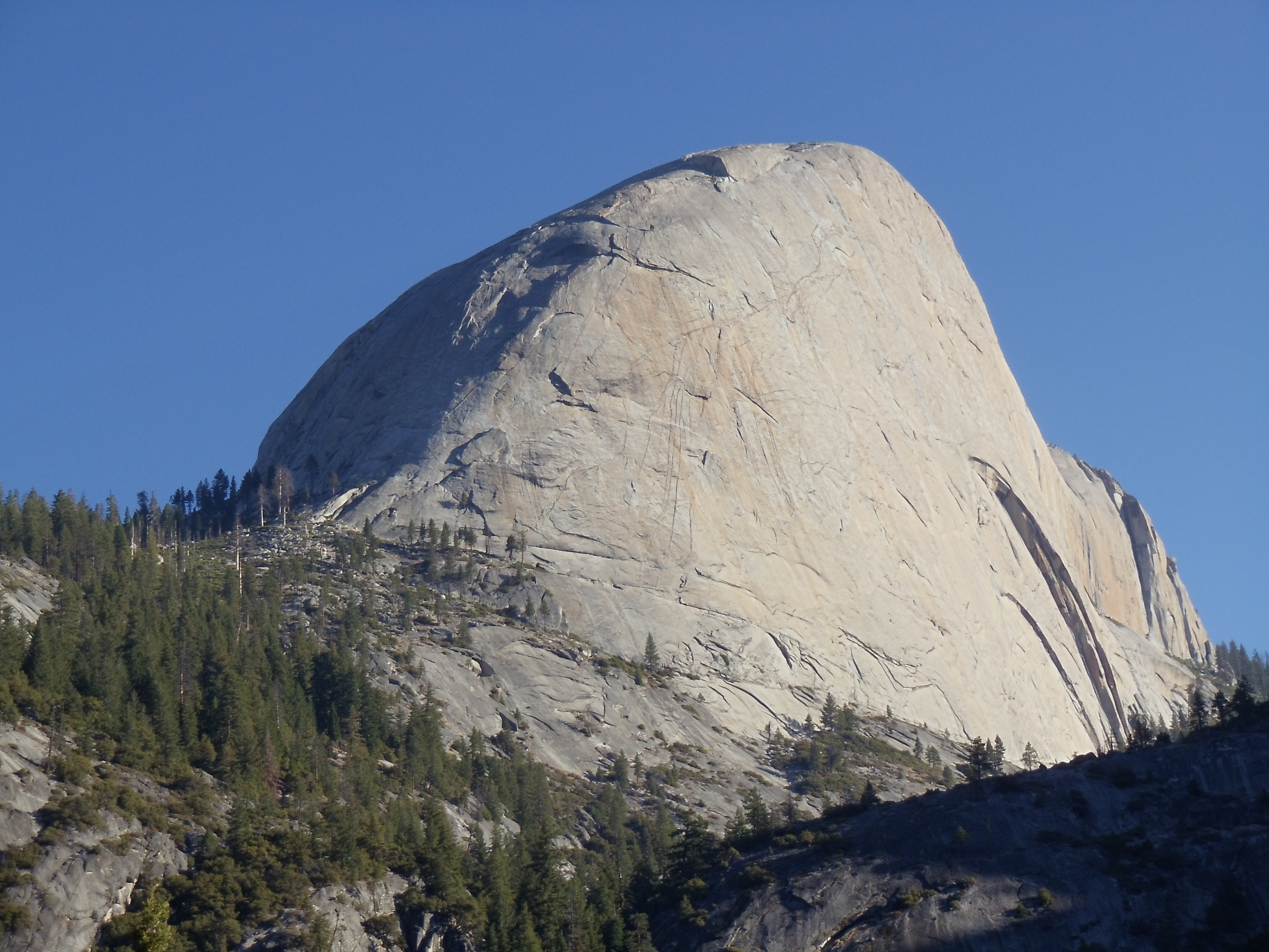
Half Dome, seen from Ahwahnee Meadow
Half Dome seen from Yosemite Valley
Cliffs along Yosemite Valley through trees
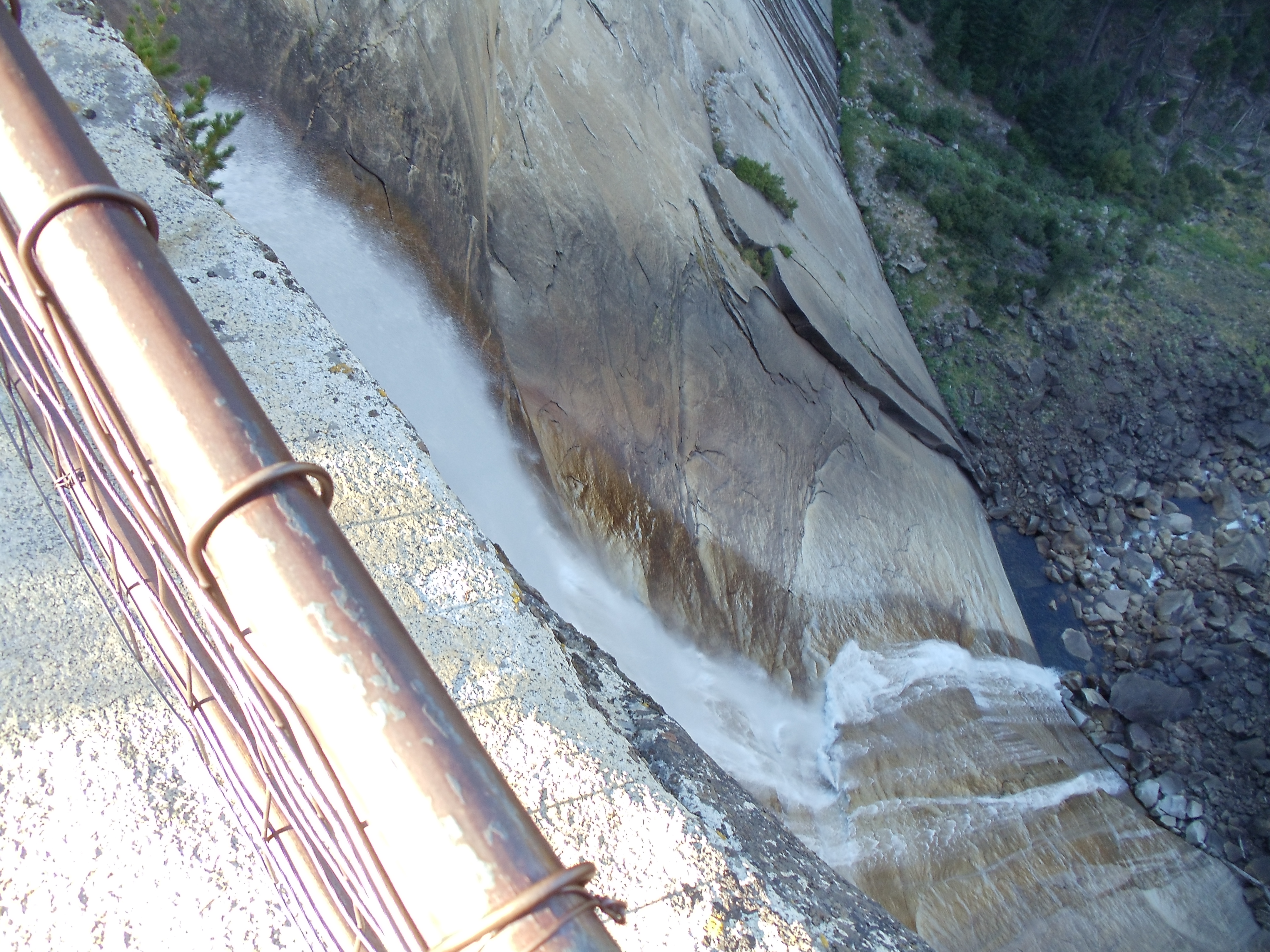
It’s still early enough in the afternoon to take a quick hike, so I walk out to Lower Yosemite Falls to kill time. This late in the summer, so long after winter snows started melting in early summer, the waterfall isn’t much to behold, and the warning sign is mostly unnecessary.
Lower Yosemite Falls
Half Dome again, through some trees
Eventually it gets to be late afternoon, and I head to the backcountry campground where I can stay for $5 for the night before my hike. I run into a few other soon-to-be JMT thru-hikers as I eat dinner, but otherwise it’s a quiet wrapup to the day, and I head to sleep shortly after dark.
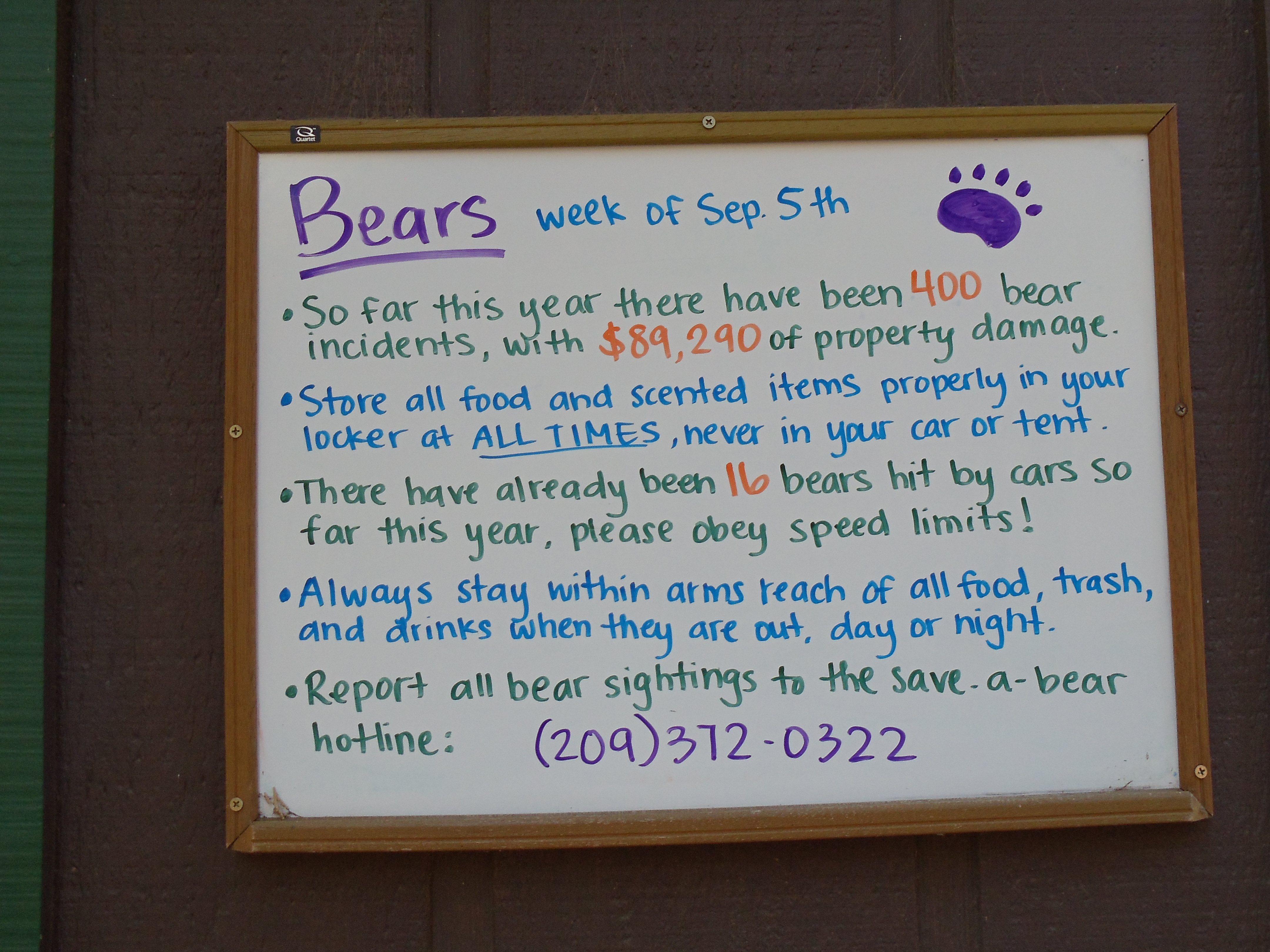
FOUR HUNDRED BEAR INCIDENTS
September 11
(14; 4 side; 14 total, 197 to go)
I set my watch alarm to wake up shortly after 5:00 to get an early start to beat the crowds on a long day, but I don’t wake up to it and end up sleeping until just short of 6:00. No big deal; after breakfast and packing up I’m walking out of camp toward the trailhead at 7:05. And so it begins:
The John Muir Trail trailhead sign: 211 miles to Mount Whitney
Yosemite Valley is at a relatively low elevation, and it’s mostly a constant climb from here through the first place I can stop for the day. My permit allows me to be in the backcountry from September 11 through September 27, and other than the first night I can camp pretty much anywhere, so long as the particular spot respects the usual Leave No Trace principles. For this first night, however, I have to camp past Little Yosemite Valley and Moraine Dome (the latter is not directly on the JMT). My map/guidebook tell me where Little Yosemite Valley is, but I’m not 100% certain where Moraine Dome is, except that it’s before Sunrise High Sierra Camp, so I’m mostly aiming to get to Sunrise for the night.
A view back toward Yosemite Valley shortly into the hike
The trail starts out easy (paved, even!), gradually sloping upward and out of the valley. Just past views of Vernal Falls the JMT veers away from the beaten path most day hikers take to get to Half Dome, taking a more gradual (and much less wet, misty, and slippery, at least during some seasons) path through the valley toward Nevada Falls. With switchbacking the trail’s pretty easy as I ascend, with Half Dome and the falls gradually coming into view. With the switchbacking complete it’s a somewhat level cut across the side of the valley over to the falls.
The back side of Half Dome
Nevada Falls is reasonably impressive, at close to six hundred feet tall, and the JMT offers some nice views of it from a distance, where its full scale is more apparent. The guardrail-protected viewpoint just near the top also serves to put it in perspective, for those not prone to acrophobia.
Nevada Falls from the approach on the John Muir Trail
Nevada Falls, above and from the side
At the precipice
Past the falls it’s a quick bit of hiking to the Half Dome side trail to commence a two-mile hike to the top. I begin to pass people (even large groups) looking for extra permits to hike to the top. I’m skeptical that such efforts are usually successful, but if it’s the only option, it might be worth the gamble.
A panorama view from just off-trail, shortly before real ascent starts (and well before the surreal ascent)
Just before the start of the first notably steep section, I encounter the ranger on the trail who checks permits; given Half Dome’s popularity I half-expected to see a ranger. This ranger’s the only one who checks my permit (and he only examines the Half Dome permit, not the wilderness permit) the entire trip, and I only see two others the entire time, which suits me just fine.
The ascent now turns from gradual uphill to a steep, vaguely-defined rock stairway. Hiking poles in the hands of a practiced hiker really shine on steep downhills, but they provide a bit of a boost on steep uphills as well. On this stretch of trail, they come in handy during both ascent and descent (but most particularly on the descent). Soon the trail levels off for a few hundred feet, and I reach the base of the steepest part of the ascent.
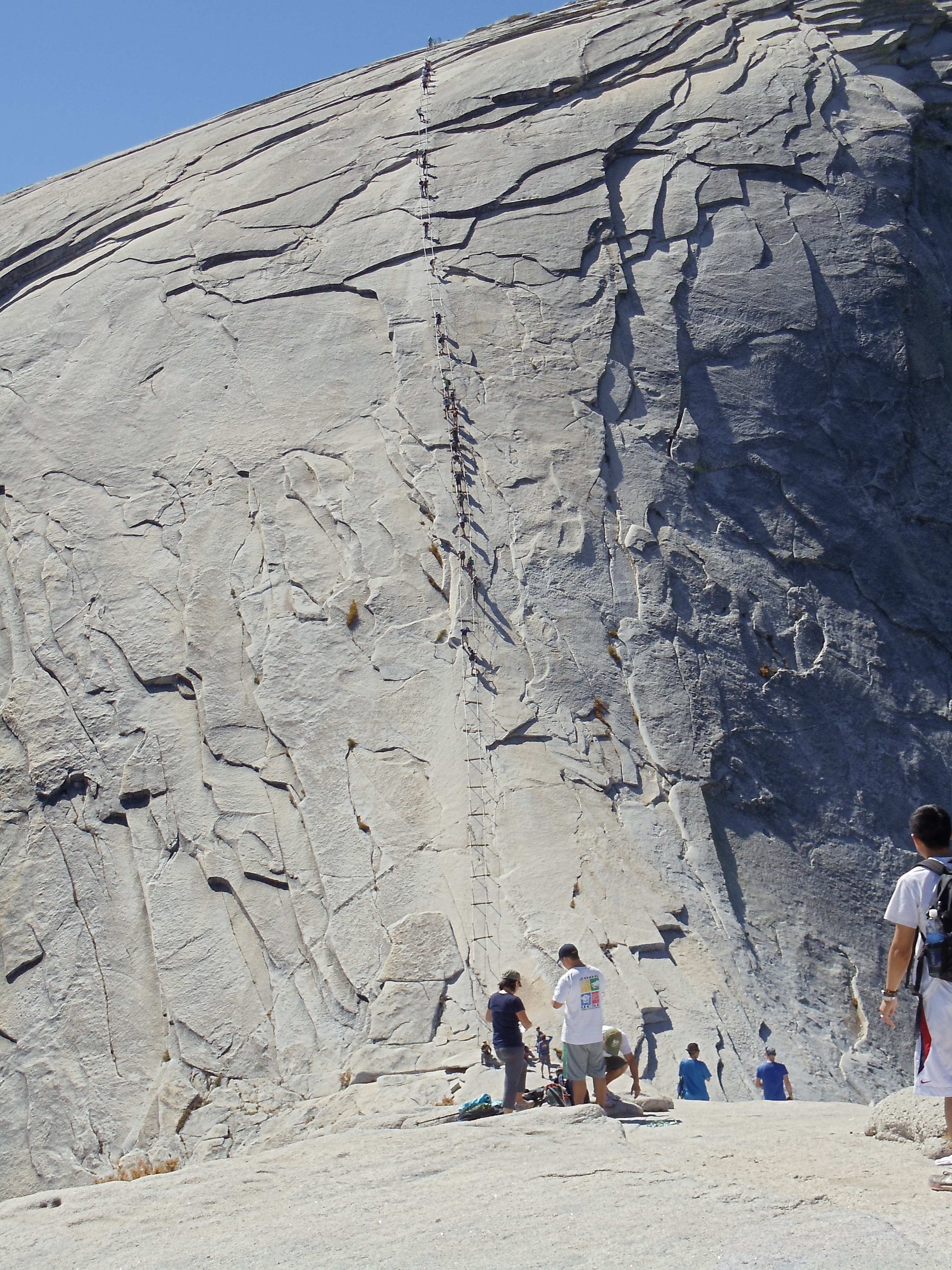
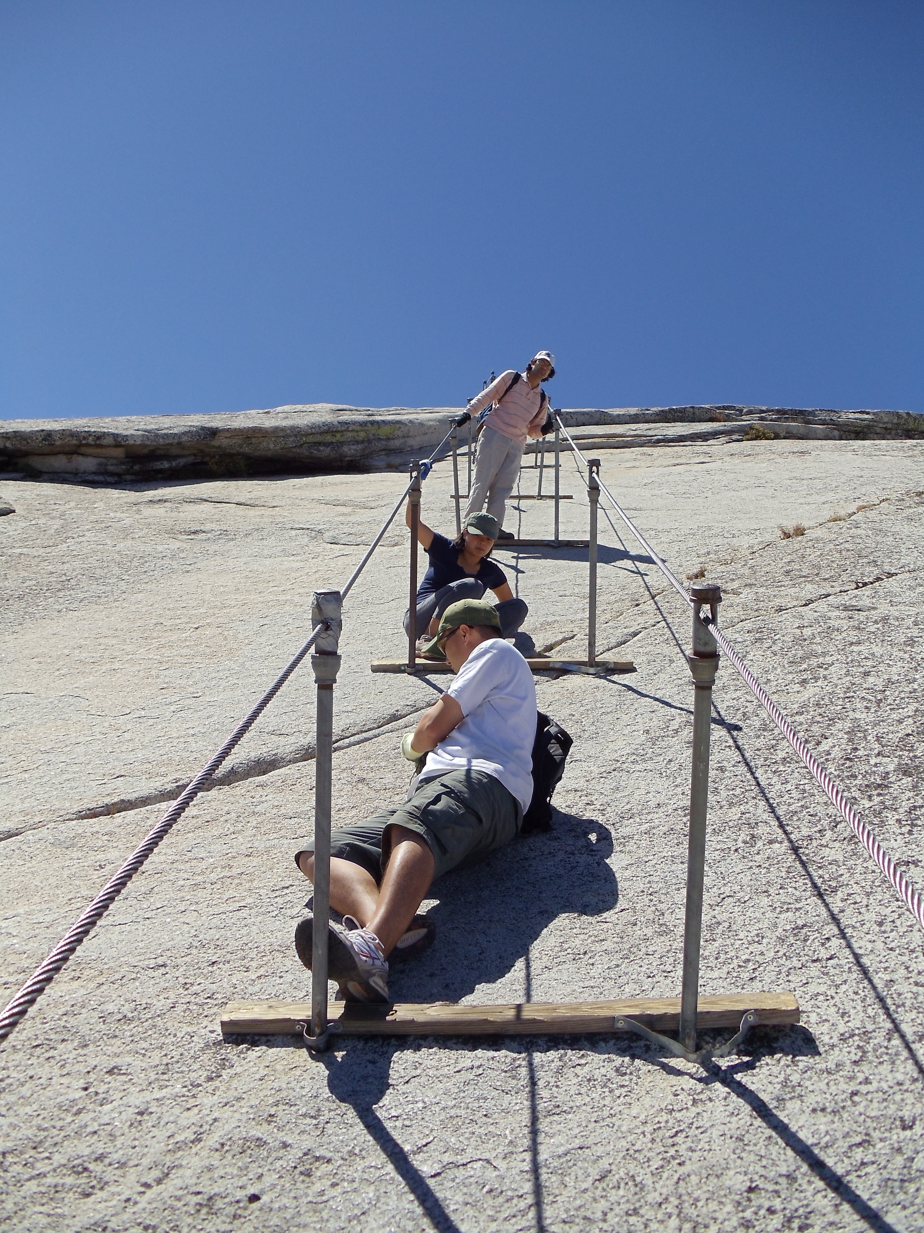
The final insane ascent up Half Dome; the cables (and pile of gloves found at the base, if you arrive early enough) are absolutely necessary
The final Half Dome ascent, from closer to it
Despite my later-than-intended departure, I’m still ahead of most people hiking up Half Dome, so there’s no wait to borrow a pair of gloves or to continue up the cables.
On the cables looking back up Half Dome, during the descent
I could never forgive myself if I ditched my backpack somewhere rather than at least attempt to take it up with me, so my arms and legs have to deal with forty-odd pounds of weight up top for the ascent. It’s understandably tiring; as I say to someone heading down as I head up, I picked a bad week to quit smoking. (Unfortunately she doesn’t get the reference — maybe if I’d stepped it up to glue or amphetamines she’d have realized I wasn’t serious.) But eventually I do reach the top without real problems.
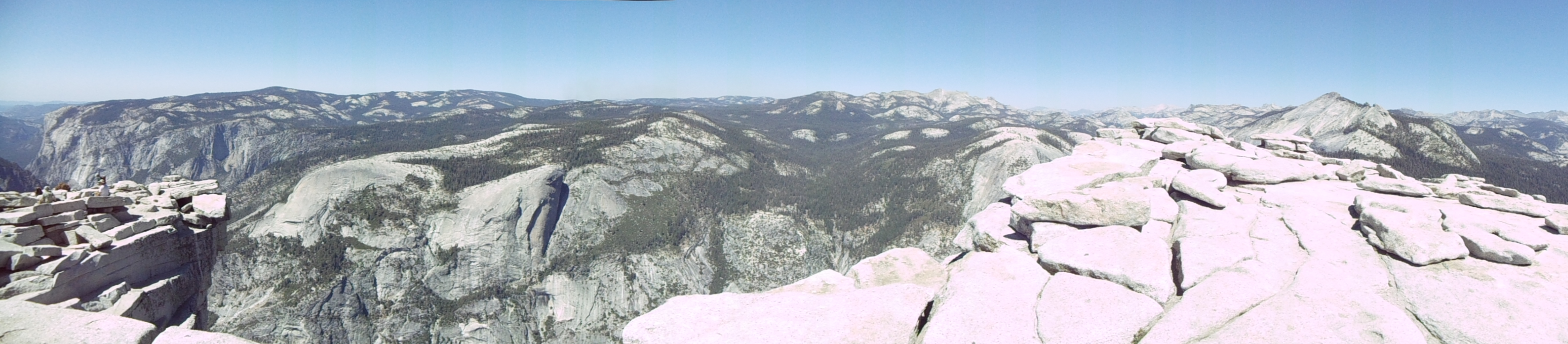
Panorama view atop the Half Dome plateau
Yosemite Valley from the top of Half Dome; the roughly triangular grassy meadow on the right side is Ahwahnee Meadow, where I took two earlier Half Dome photos
I wander around the top a bit (it’s a lot larger than you’d think from just the classical view of Half Dome), walk over to a few of the edges (but not too close, since I still have the backpack on), then sit down and eat a lunch of half-shredded tortillas and Nutella. Mm…
A panorama near one of the sheerer cliffs of Half Dome
Now it’s time to head back down and finish out the day. The ropes are much more crowded on the way down, and the line of descending hikers frequently comes to a standstill. A few people hop to the outside of the ropes to get down faster, but I’m not willing to consider this with a fully-loaded backpack. I bide my time by taking some pictures of the descent and of the views during it.
Near the top of the descent
Another look down a littler later; the people at the bottom look much smaller because the "bottom" in the previous picture was a plateau a bit higher than the start of the ropes
The surrounding mountains and valleys, facing forward during the descent of Half Dome
Once I’m past the ropes I descend much faster, well-aided by hiking poles and a quick step. (It’s actually too quick a couple times, as I roll each ankle several times these first several days, before they adjust to the demands I’m putting on them. I had intended to avoid this process by regularly ice skating in the weeks up to the trip, but multiple trips to relatives over the preceding months working remotely shot that plan all to pieces.) Once back on the JMT, I stop to refill on water at one point from a handy stream (climate this time of year is that of a desert, but strangely streams, lakes, ponds, and water in all forms is readily available almost all the time). The remaining hiking proceeds more slowly, and around 17:00 I feel tired enough to stop for an early dinner before hiking the remaining miles to Sunrise Camp.
Yosemite's backcountry trail signs have a certain elegance
Echo Peaks and Matthes Crest
Sunrise High Sierra Camp is run similarly to a White Mountains hut, and it’s one of a number of High Sierra Camps in Yosemite, albeit the only one directly on the JMT. Amazingly its pricing is even worse than that of the White Mountains huts. On the other hand, this camp has a free backpacker campground (no amenities except bear boxes and a pit toilet), so at least backpackers (whether thru-hiking or not) who don’t want to be gouged have a real choice. (If you weren’t an Appalachian Trail thru-hiker, and you were hiking in the White Mountains, I’m not actually sure where you’d stay in some parts of it if you didn’t want to overpay to stay in a hut.) I arrive at Sunrise just early enough to be able to nearly walk to the backpacker’s campground there without needing to ask for directions through twilight darkness. I walk through trying to find the extent of the campsites, and eventually I stumble to the end, find a rock ledge with a view over Long Meadow toward the east, and quickly head to sleep.
September 12
(16; 2 side; 30 total, 181 to go)
Mountains to the east of Long Meadow at sunrise, from my overnight camping spot
I’ve set my watch to wake me up sometime before sunrise, and I wake up on time today. As one would expect, the sunrise at Sunrise is very nice, if quite bright. After a breakfast eaten sitting on the rock ledge, it’s back on the trail heading trail-south but geographically north, hiking even before 8:00, surprisingly early for me.
Morning frost on the Long Meadow flora indicates just how cold the night was, although it was fairly nice inside a thirty-degree bag
A trailside view
A less-impeded trailside view
Cathedral Peak framed by trees
Today’s hiking is pretty easy. After some meandering through Long Meadow, it’s a short bit of hiking up, then some mountainside wandering, then passing through some valleys with assorted lakes and ponds, then a long, gradual descent down to Tuolumne Meadows and something vaguely like civilization. I don’t need to stop by Tuolumne Meadows, but the trail passes close to a road along which lies a grill and small store. I’m feeling hungry, and I could use some Gold Bond powder if I can find it in the store, so I hop off the trail and road-walk the mile to it. Lunch is a cheeseburger with fries and all the condiments I can get; I even eat the dill pickle that comes with it (only because I know I can use the energy). The store doesn’t have Gold Bond power, alas, but it does have something as magical: boxed win! Er, I mean, boxed wine! (I hear snobby readers saying “Quelle horreur!” as I type this. You know who you are.) I couldn’t have fit it in my bear canister a couple days ago, but I now have the space to make it work with a little effort, so I get a half liter of pinot grigio before heading back to the trail.
Tuolumne Meadow
A mother mule deer and her fawn, near Lyell Fork
For whatever reason I find that I’m dragging a bit when I hit the trail again. It doesn’t help that the guidebook and signs are a bit unclear as to how to return to, and continue upon, the JMT. Nor does it help that my ankles are (both) in considerable pain from stumbling; I would likely be in trouble now if I didn’t have hiking poles to arrest my falls. I take it somewhat slowly heading south to enter Lyell Canyon, which isn’t a sheer canyon but rather four miles of essentially level trail along Lyell Fork toward the ascents and passes beyond. It’s getting late in the afternoon, but there’s no camping in the first four miles of the canyon, so I keep hiking to the trail junction just past the four mile limit.
Lyell Fork to the north as I collect and purify water
South down Lyell Canyon as I gather and purify water
This buck shouldn't be this unconcerned about me, but at least he's not begging
The junction is a well-frequented camping area, and there are at least a couple dozen people around. I pick a spot near a few backpackers and their fire ring, eat dinner (chipotle-flavored salmon and Mexican rice, most excellent — because I’m just weird, the rather-heavy wine will wait until I arrive early enough somewhere to attempt to cool it before dinner), and shortly head to sleep.
…and that wraps up the first of several posts covering the entire JMT. With the number of pictures I’m taking, it’s clear the fewer days I batch up at a time, the better, as far as keeping post “height” reasonable goes. Thus you can expect at least four or five more of these posts to cover the roughly two weeks that remain of the trip and hike. Until next time…
So goodbye Internets, goodbye Mozilla, goodbye cruel world: I’m off to thru-hike the John Muir Trail. I should be back on approximately September 28, depending on how my transportation connections match up on the way back from the other side of Mount Whitney. (And yes, Mozillians who will be in Mountain View for the platform work week next week, I’ll miss it — a regrettable peril of needing to schedule a vacation 168 days in advance.)
(5.0; 1330.9 total, 843.1 to go; -10.0 from pace, -109.1 overall)
After this brief interlude with family, it’s time to get moving again. Mom makes some effort to get me to not hike for another day, but I’m somewhat leery of taking two zeroes as I’ve never done so before, and I dig in my heels. I’m back on the trail shortly after 11:00.
It’s only five miles to the first shelter, and strangely I complete them at a three-miles-an-hour pace despite it not being the afternoon, eating a Granny Smith apple as I hike. Mm, delicious absurdly heavy foods…. I arrive at the shelter to unexpectedly find someone there — Smoothie again! He’s now hiking for a few days with a girl he met at a yoga class in Delaware Water Gap. I stop to eat and lighten my pack, pulling out a loaf of raisin bread to attack. Between the weighty pack and another southbounder I’m not in much of a rush to get moving again; when the Honeymooners walk up, my plans to hike further today vanish. Four southbounders all in one place — it’s been ages since this has happened to me.
But wait, there’s more! In walks a hiker with her father, and she looks familiar — turns out it’s Kat, whom I met at Wintturi Shelter back in Vermont. I’d thought she was a northbounder, but it seems she’s really flip-flopping around Waynesboro, hiking south for a few days with her father before he heads back to work. So, all total we have five different thru-hikers here for the night, four of them true southbounders — crazy…
The rest of the day is pretty lackadaisical. The only memorable bit occurs while I’m making dinner, something Knorr-ish as usual. Smoothie’s hiking companion, a vegetarian, looks aghast at the amount of sodium in my overall meal; she calculates somewhere around 2000mg total. I take a look and see she’s wrong — one of my food items is actually two servings, not one. Mm, sodium…
September 13
(15.8; 1346.7 total, 827.3 to go; +0.8 from pace, -108.3 overall)
Today’s goal is a shelter about twenty miles south, but my hiking pace just isn’t feeling up to it,. It’s starting to get pretty dry, and water is somewhat scarce. I hike south in the latter half of the mob moving south: Honeymooners in front, Smoothie and girlfriend next, me, then Kat and her dad, in rough order. I last see Kat maybe a dozen miles into the day when I stop briefly at a road crossing to eat an apple; I assume they’re heading to the next shelter a few miles south, but after I leave it sounds like they made a very abrupt decision to spend the night in town; combined with my pace this is therefore the last time I see them.
The morning's view
I travel the next several miles to Maupin Field Shelter, arriving maybe around 17:00. I plan to only briefly stop to fill up on water, but a certain lack of energy, plus the meagerness of the water source, mean it makes more sense for me to stop for the night here. The shelter is initially occupied by someone who’s set up his tent in it; I don’t mind this when a shelter’s empty enough, but it’s not here. Eventually enough people show up that I manage to argue the owner into moving into a perfectly serviceable campsite instead. Besides Smoothie and companion there are a couple random backpackers and one flip-flopper named Toad. Toad’s from Pennsylvania somewhere around Pine Grove Furnace State Park, and he started near there June 7, hiked north, then flipped back to hike south again. He carries a rather large Jetboil stove with him as a luxury item. The Honeymooners are characteristically efficient in their hiking and thus end up at Harpers Creek Shelter about five miles south, rather than this one. (They later express surprise I didn’t make it there; I do tend to be a bit erratic in my pace at times.)
Even later yet, however, another backpacker arrives, and from our (Smoothie, Toad, me) first sight of him alone it’s clear he’s a very special hiker. He’s lean and thin, he’s hiking quickly with poles pumping, and his backpack — if you can call it that — isn’t much more than Camelbak-sized. (He tells us his base weight — what he always carries, then additionally supplemented with food and water, is something like four pounds. Total, he’s at about a dozen.) This guy’s someone we’re going to see tonight and never see again. Brian (no trail name, nobody sees him long enough for him to pick one up) isn’t just a crazy thru-hiker, he’s a yo-yo. (That’s a technical term: he’s hiking the Trail first one direction, then the other, so south to north, then north to south, all at once, for a total of 4352.4 miles by his count.) You might think he runs when he hikes, but really he just hikes at a good pace without stopping. He hikes maybe 2.8 miles an hour, which is actually slower than my comfortable top pace when I reach it. I stop way more, and I don’t always hit that pace, and start to stop I probably am out shorter periods of time, so overall I travel comfortably less distance than he does, and I’m not really a slouch by thru-hiking standards myself. We see him tonight and tomorrow morning, then never again. (One last comparison to illustrate the enormity of his hiking prowess: he takes 24 days to hike the remaining 827.3 miles, ending October 7; I take 42 and end October 25.) It’s amusing to contemplate a pace like that, but I couldn’t do it over the long haul. Nevertheless, Hike Your Own Hike.
September 14
(20.5; 1367.2 total, 806.8 to go; +5.5 from pace, -102.8 overall)
I get a good start on the day today with an early (for me) departure, which I then promptly squander/invest in stopping at the following vista for awhile to enjoy the view and eat an apple:
The morning view from Hanging Rock Vista (I think); the mountain in the distance is The Priest
The nearby mountain in that picture is The Priest, and my hiking today goes down, then up and over it. It’s the first elevation above 4000 feet since Massachusetts: the long stretch of relative flatness is ending. Still, the ascents aren’t tiring or steep like Maine or New Hampshire were. I’m sure at least some are comparable, but for the most part I barely notice them as requiring extra physical exertion: it’s where the trail goes, and thus I follow it. It’s so nice to be in thru-hiker shape. As you can see I’m at a bit of an elevation for that picture, and I stay up for a little longer before starting the descent all the way to the bottom of the valley (in preparation for the ascent right back up the other side 🙂 ).
A view a little later, with Three Ridges in the distance
And panned a little
The descent from the heights is great as I pass by Harpers Creek Shelter, refilling on water from the creek. South and down from there I pass over the Tye River and a road crossing, then it’s up the other side again. By now it’s mid-day, and the physical exertion plus beating sun make it pretty hot. The view from the top is great:
The view from near the top of The Priest
Past there it’s only a mile or so, descending to a slightly lower elevation, to reach The Priest Shelter where, as usual, I stop to read the register and get a bite to eat. This register is particularly memorable for being placed by northbounder Don Juan, who declares that entries must, being near “the priest”, make a confession of some sort; it makes for entertaining reading. My “confession”, I’m certain, some would call a conceit: I confess that I don’t think someone who hikes the Trail in segments over extended time deserves to be called a thru-hiker. (The ATC explicitly recognizes anyone who walks or makes a good faith effort to walk the entire trail, ignoring timing, carrying of supplies or not, &c. However, they recognize with the moniker “2000-Miler”, in reference to the original expected length of the Trail, and they don’t distinguish anyone as a thru-hiker.) To me a thru-hike implies, well, that you began the hike, hiked through the trail, and completed the hike, all in one go. You didn’t hike part, stop, then hike more of it some vastly different time, and so on until completion, you started hiking and didn’t fully return to non-hiking life until you’d walked every bit of the trail. Even flip-floppers kind of leave me feeling a little weird due to “through” being a little twisted geographically, but they do hike the entire thing, in one go, without stopping, so it’s enough for me. A section hiker still can claim to have walked the entire Trail, which is certainly no mean feat! He just shouldn’t (by my opinion, take it or leave it) imply he hiked it all at once by calling it a thru-hike. (As I’ve noted before, I’ll make one exception to this rule: the northbounder K1YPP, who claims his medically-required triple-bypass surgery caused him to take “three hundred zeroes”, for the sheer audacity of the claim 🙂 .)
At this point Toad catches up to me and stops for the day. It’s still before 17:00 or so, I haven’t done enough mileage to be above pace yet, and it’s not that much further (couple hours or so) to get to Seeley-Woodworth Shelter, so I head on. Smoothie and the girl he met are jumping off the trail again at a road crossing near here, so I’m pretty sure I’ll be alone at the shelter for the night, which does turn out to be the case. Seeley-Woodworth is most memorable for its spectacular water source: a piped spring with excellent clear water practically gushing out of it, the best water source on the entire Trail in my opinion. The shelter has a bag of wild apples hanging from one of its vertical supports, and I avail myself of a few. I still have Granny Smith apples from the store (have I mentioned how weight-unconscious a backpacker I am?), but wild apples have a different flavor — stronger, but not necessarily better, and variety is good. Also, in a bizarre occurrence, I find what I think is a tick on one of my toes tonight, in a location so far within boot and sock that I have no idea how it could possibly have gotten there.
Future plans now begin to impose upon my hiking schedule, as I consider when I’ll reach where, with whom, and so on. I have enough food to reach Daleville, ninety miles south, and ideally I’d like to stay there for the night. Unfortunately, since I’m near the front of the southbounder pack, and as Daleville doesn’t have hostel-style accommodations, doing so could be expensive. There aren’t any southbounders that close in front of me with whom I could split a room, and I’m not aware of anyone sufficiently close behind, either, that’s likely to hike far and fast enough to catch up. (Smoothie, as far as I can tell, doesn’t usually hike the sort of days I’ll be hiking over the next few days, although he’s certainly capable of doing so.) Further compounding the problem is that Daleville’s at the start of a 26-mile section of trail where camping is only permitted at a few specific sites, the first being nine miles in — so resupply in Daleville without staying longer means I have to reach it by midday. Camping between here and there means the most plausible schedule involves me hiking 24, 25, 24, and 18 miles the next several days (and maybe nine more the last day if I can’t figure out a way to stay in Daleville without spending more than I want to do so), so it looks like my schedule is going to be fairly inflexible for the next several days. None of the mileage is excessive, so it won’t be too much trouble, but it does mean I probably will push late if necessary to make a planned stop even if I’d rather stop earlier.
In the end I decide I’ll act in anticipation of something happening that permits me to spend a night in Daleville. I have no idea what that might be right now, but if worst comes to worst I’ll end up resupplying in Daleville and heading on for a twenty-seven mile day through it. With scheduling considered and resolved as best as I can with what knowledge I have now, I head to sleep on a very windy night.
September 15
(25.3; 1392.5 total, 781.5 to go; +10.3 from pace, -92.5 overall)
It’s up and out and hiking again, with a few wild apples stashed in my pack. The morning is perhaps more sluggish than usual; around noon I stop on a hillside for lunch and find Toad’s caught up to me. He’s thinking of doing a crazy long day today, just for the heck of it, since he didn’t do the semi-traditional Four State Challenge when he was passing through Harpers Ferry. If that happens, he’ll spend the night at Johns Hollow Shelter, 34.1 miles south of where I started today and 41 miles south of where he started today. Maybe I’ll try another super-long day at some point (that twenty-four hour challenge is particularly tempting), but that day isn’t today. At about twenty-five miles away, Punchbowl Shelter will make a solid, non-crazy day.
Along the day goes, traversing ridges and eventually descending to U.S. 60. About ten miles one direction (I’m in the middle of a ridge with nothing around) is a city, but I’m all set for another eighty miles or so, so I’m just passing by. While doing so, however, I take advantage of the small picnic area there to throw away trash — nothing better than trailside trash cans.
Past the road the trail remains flat, paralleling a decrepit creek with a few crayfish in sight, all the way to Brown Mountain Creek Shelter. The valley seems to be some sort of historical hike; there are signs along the way pointing out that a community of freed slaves lived in the area from after the Civil War until around 1918, illustrating way of life, pointing out remnants of buildings, and so on. Somewhere around here I briefly catch up to Toad again, but my slightly less energetic pace means he quickly leaves me behind again. I hike the last 9.5 miles to Punchbowl to arrive around dusk. As I’d expected the Honeymooners are here, and strangely enough, Toad is too — I’d figured he’d have moved on given his goal of 41 miles for the day, with 8.8 to go. We all talk briefly as I unpack food and get water from the nearby small pond, and Toad prepares to head back to the trail for some quality night hiking.
This shelter’s most memorable for its association with Ottie Cline Powell, who is — I am not making this up — a four-year-old ghost claimed by some to haunt the shelter. In November 1891 Little Ottie’s teacher sent his class outside to gather firewood to keep the schoolhouse warm, after winter’s first snow and in anticipation of more cold weather to come; the other students returned, Ottie did not. His body was eventually found by accident months later atop Bluff Mountain (over which the A.T. travels tomorrow) a full seven miles away. Surely it was a different time, when four-year-olds were sent to gather firewood like this…
Little Ottie's memorial marker, from early during tomorrow's hike over Bluff Mountain
Claims of haunting notwithstanding, I find the shelter no more or less eerie than any other, and I see no sign of menacing Little Ottie at any time.
September 16
(25.1; 1417.6 total, 756.4 to go; +10.1 from pace, -82.4 overall)
The Honeymooners leave well before I do, and my typically slow morning pace means I don’t see them for the first half of the day. Mostly the trail sticks to the ridge; at one point I look down toward the upcoming James River, over which the trail crosses, to see a train passing by. It’s far enough away that I can’t hear the train, and its apparent glacial pace reinforces just how high and how far from it I am. I take a couple pictures, but the distance is too great and the camera’s too weak to get anything decent. From here it’s a descent down to Johns Hollow Shelter. I lack much energy or enthusiasm, so I stop for lunch; my entry in the register is a very rough recreation of the “Lunch break! Lunch break!” scene from A Charlie Brown Christmas (apologies to Charles Schulz noted explicitly in the illustration). It seems Toad made it here last night, found in the register that the northbounder Don Juan from this year had somehow managed to become caretaker of a house in the area for a brief period of time just about now, and was opening it up to southbounders — so presumably he’s there relaxing after a forty-miler now. There’s no sign of the Honeymooners, who probably came through hours ago; I hope they stopped, if only to experience the amazingness that is the privy at this shelter. Cedar wood, hand rails, handicap-accessible-sized, it’s a real thing of beauty.
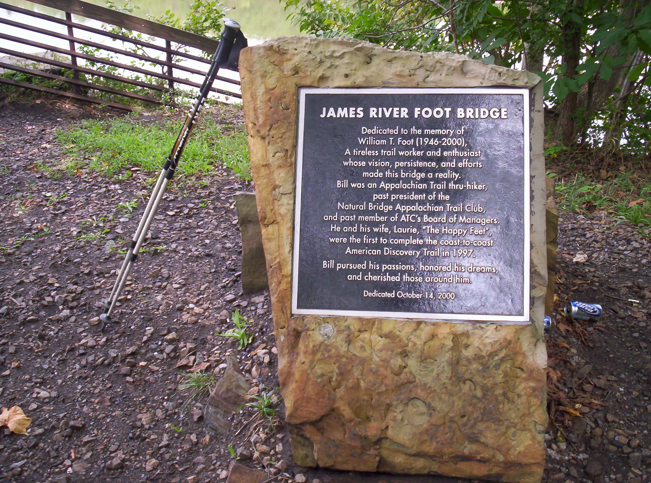
Fooded up from lunch, I head on again. It’s only a mile and a half or so to the James River, where I catch up to the Honeymooners. They’ve hitchhiked into town and eaten and resupplied, all in the ponderous time it took lazy me to get here. I definitely could make better time out here if I put some effort into it. But where would be the fun? Why restrict myself to a schedule of when and how long to hike each day, just to go a little further, a little faster? I pass them by and head across the James River Footbridge, the longest foot-travel-only bridge on the trail.
Dedicated to William Foot, one of the first thru-hikers of the coast-to-coast American Discovery Trail
You can get a feel for the size of the bridge from this picture, which going from overhead views appears to be just over six hundred feet long. I understand the pilings were already there before the bridge was constructed, but even still, I have no idea how this bridge ever managed to get funding. I suspect I largely have my American readers’ knowing and gracious generosity (wink wink, nudge nudge, say no more!) to thank for this:
One of my better-structured pictures from the entire hike, I think, save for being slightly too zoomed-in
How did hikers travel this section prior to installation of the bridge? It looks like if you head around half a mile east you’ll hit U.S. 501, which travels south over the river, and which hikers could cross, then travel the same distance back along the river to reach the spot where the current footbridge’s south end is. Tedious and boring (and depending on the condition of the crossing, plausibly dangerous), and I can certainly see why you’d want something else instead, but I can’t help think that, for the number of people who go across it and for the appreciation of it they have, it wasn’t worth the costs as they were likely apportioned. (Subsequent searching reveals a brief overview of the bridge’s genesis which suggests that the bridge owes its existence to a few hundred thousand dollars in donations plus several times more state funding. It looks like the creators were moderately successful at funding it in non-coercive ways, which is a small comfort — plus it seems Virginia properly took on the cost of its own project, rather than trying to live off the federal dole.)
Now being in front of the Honeymooners spurs me to hike more quickly, and I keep a brisk pace to Matts Creek Shelter. I stop and say hi to the guy already there and write something in the register. This register also contains the most brilliant combination of an entry from Thought Criminal (first noted in registers back in mid-Vermont) and a couple responses (a postscript in the first photo, an unknown person’s side note in the other). Beware: Authentic Marxist Gibberish ahead! 😀
Thought Criminal: "May 30, 1984. Thought Criminal pitching my Duermo Baggie Transnational Corporation sweatshop factory labor produced Casa de Silnylon next to the creek for the night." Red: "ps. I love my Duermo Baggie"
A further note: Duermo Baggie ("sleeping bag" in Spanish) as such doesn't exist according to Google, so I'm not sure how to interpret his rant against it.
A followup entry by Thought Criminal:
"May 30, 1984 - More advertising pitching for DuermoBaggie from Thought Criminal. For each DuermoBaggie Casa de Silnylon tenting domicile you purchase, a portion of the purchase price will trickle down to enable a Mexican family of 12 to subsist on a diet of the finest plain oatmeal for one breakfast meal. DuermoBaggie Transnational Corporation is also proud to pronounce that we have a very progressive retirement* program. DuermoBaggie sweatshop laborers retire by the age of 15 (* no benefits). DuermoBaggie's full line of products will be coming soon to a Dollar General store near you. DuermoBaggie is the 73rd name in fine Mexican-American outdoor adventure equipment. At DuermoBaggie Transnational Corporation, we aspire to achieve adequacy."
Someone else has written "AUTHENTIC MARXIST GIBBERISH" with an arrow pointing at the entry.
I move along just as the Honeymooners catch up to me, as I keep ahead of them for a little bit longer, but they catch up when I stop a couple miles south to refill water bottles from a small stream the trail crosses. From here we hike the next several miles together, following and curving along the ridges in the area. My mental distance counting notes that some of the claimed mileages near here are wrong, with the mistake being, as I recall it, that two segments’ distances are transposed. No worries — and it should have since been fixed in more recent Companions (whether by my notes at the 2009 Trail Days or prior to that, I don’t remember).
The view of a valley the trail curves around; the trail heads south to the left
A view further left of the valley, looking closer to the direction I'm heading
Shortly after this we reach Marble Spring, site of a spring and a campsite. It’s around 17:15 now, and we’ve hiked a solid 18.2 miles, so the Honeymooners stop for the day. There’s still plenty of daylight for me to get to Thunder Hill Shelter without hiking in too much darkness, which puts me that much closer to the people ahead of me that I’m attempting to catch (most immediately Grettle, Mango, Cubby, Spoon, and Santana), and on pace to make Daleville at a reasonable time, so I continue on after refilling on water.
The hiking goes ever so slightly more slowly now that I have no pace car to follow, but I still make good time. I pass by another apparent mileage anomaly, making two in the space of one day (in the space of several hours, even) — very strange. It’s getting later into fall, so I’m now starting to race against dusk when I hike past 19:30 or so, as this picture from Thunder Ridge Overlook demonstrates:
Definitely one of my hike's best pictures, top five or so for sure
I’m only 1.4 miles from the shelter now, and as you can see darkness threatens, so I keep up a good pace to make it the rest of the way. Ten minutes or so before reaching the shelter I hear a crashing noise (in nighttime-level darkness) off to my right, which puts me on my guard for the possibility of there being active bears in the area. A short bit of hiking later finds me at the shelter, where I eat dinner and head to sleep in short order. Twenty-five miles: definitely a good day’s hike despite a somewhat slow start, and progress consistent with making Daleville in two days.
September 17
(23.6; 1441.2 total, 732.8 to go; +8.6 from pace, -73.8 overall)
I get a decent start today out of the shelter, leaving a little after eight. The morning is cool and slightly foggy and cloudy, if memory serves, as I head underneath The Guillotine toward Apple Orchard Mountain.
Off with his head!
The mountain isn’t much of a mountain, but it’s still the highest point between Chestnut Knob, roughly two hundred miles south, and Moosilauke, slightly over 1000 miles north. There’s an old Air Force radar base atop it with a distinctive spherical radar dome, surrounded by fences with no-trespassing warnings, but otherwise there wasn’t much to see, so I kept moving along to Cornelius Creek Shelter, where I stop for a second to eat. The shelter’s reading material includes an Appalachian Trail guide from around 1992, and I crack it open to see how similar the trail and side features along the way were then to now. Running a hostel is a labor of love, and to be completely honest I’m not sure how one can actually make money on it, so it’s unsurprising that there’s a lot of changes on that front. I continue south to Bryant Ridge Shelter, perhaps the most architecturally significant shelter on the entire trail: it literally has three stories. The Companion suggests it sleeps 20; it could sleep many more if necessary (more still if people moved onto the lowermost floor’s porches, rather than restricting themselves to the “living” areas).
While I’m at the shelter, a hiker walks up, coming from the north. It turns out to be Cubby, another southbounder, who’s been ahead of me since the beginning of the trail, whom I now seem to have finally caught up with. He’s walking with little more than a day pack (possibly not even that), slackpacking south for the day, along with the rest of a group that’s been hiking together for, as I remember it, a bit under a thousand miles at this point: Grettle, Mango, Spoon, and Santana constitute the remaining members. Santana arrives as we sit, and Spoon follows shortly. Cubby and Santana depart shortly, as do I, but since neither is wearing a backpack I find myself unable to keep up with them without excessive effort. Spoon, on the other hand, is wearing a slightly more loaded day pack and has a pace just slightly faster than mine would be if I were hiking alone. The result is that I make excellent time as I hike with him the next ten miles or so to the road where he and the others are being picked up for the day. Along the way I get an update on current events: Lehman going under and the ensuing mass financial hysteria. When we eventually reach the road (I meet Grettle and Mango there, as they arranged the ride to pick the others up), I’m left with much to think about, if not much detail about which to really, deeply consider matters. The excellent pace of the last few hours means that I still have a good deal of daylight in which to hike to Bobblets Gap Shelter. Were I an hour earlier I’d probably even consider moving beyond that, but as it is dusk makes that unpalatable.
The southern side of this sign does not have any misspellings, in case you were wondering
After I fill up on water from the creek just the other side of the road, I head along to the shelter, arriving around 18:15. It’s comfortably evening, but there’s plenty of daylight and time to eat (my meal for the night is potatoes with bacon bits, a fact I take pains to note after seeing Flashdance’s entry express a hunger for bacon) and read awhile before heading to sleep. I still have no idea what I’m going to do about Daleville, but if I push it I can make Daleville, resupply, and be on my way to the shelter after if nothing pans out.
September 18
(18.5; 1459.7 total, 714.3 to go; +3.5 from pace, -70.3 overall)
I wake up early to head out and start hiking…or rather, I’m woken up early. Unexpectedly, out of nowhere, comes Medicine Man for an early-morning stop, and shortly behind follows Smoothie. Hmm…this could be the answer to where to stay tonight! Medicine Man remarks that I must have sped…up, in order for him to have seen me again (he’s still hiking, stopping off-trail for a bit, then continuing again). I quickly pack up, pop a Pop-Tart, and head south with them.
Hiking goes well today; we tend to take a break about every hour or so, with fast-paced hiking in between. My pace now seems to be almost the same as Medicine Man’s on flat terrain. Heading uphill he moves noticeably faster than either Smoothie or I do; downhill we make up what we lost to him on the uphills. We stop at Wilson Creek Shelter and regroup as Cubby, Spoon, Santana, and the rest of that group also pass by, then again at Fullhardt Knob Shelter a handful of miles out of Daleville. The shelter has a unique water source based on retaining runoff from the roof in a well. I skim the register and make some offhand comments about entries, including one by the Four Sisters, and someone else says they didn’t complete the trail — and even stranger, they decided this halfway into the 100 Mile Wilderness after hitting a lot of rainy weather. It’s true there were also college deadlines in play, making it necessary to keep an accelerated pace to finish — but still, I can’t imagine what would possess someone to walk 2100 miles and then give up with only 75 to go. (I hear they did have plans to reunite to finish out the trail in summer 2009, but I don’t know whether or not it actually happened.)
We arrive in Daleville by early afternoon, Smoothie and I slightly ahead of Medicine Man because the last five miles from the shelter include more downhill than flatland or uphill. The three of us split a room at the Howard Johnson’s just a few hundred feet down the road the trail crosses in Daleville. Since it’s still fairly early in the afternoon there’s lots of time to relax. I get a shower, laze around a little, resupply on groceries, head across the street to a Mexican restaurant for dinner, and return in time to catch a college football game Medicine Man in particular is intent on watching. A good day all around…
Thirty-seven days, just under a third of the trail’s mileage to go…