23.10.10

John Muir Trail: Yosemite Valley to Lyell Canyon

After I thru-hiked the Appalachian Trail from June through October 2008, I began to consider which hike would follow it. For better or for worse, my sense of scale in backpacking is now irreparably skewed: any trip less than several hundred miles feels “short” to me. While “short” trips (most particularly weekend and extended-weekend trips) are all well and good, they’re too jaunty to really satisfy. Thus I started thinking about my next “long” trip that (ideally) would fit into a normal vacation from work. (Someday I’ll do an Appalachian Trail-length trip again, but I don’t feel compelled to do so immediately. I have other lengthy trips requiring much less vacation time that I want to take, and I’m happy to make those trips first if it simplifies vacation logistics.)

Originally I thought I’d save up and max out on vacation to bike across the United States, but The Gathering (a yearly conference for Appalachian Trail hikers, although its focus goes beyond the A.T. as a large number of attendees have already thru-hiked it) in 2009 sufficiently aggravated my wanderlust that I couldn’t stomach waiting an extra summer for such a bike ride. I had to do something longer than a weekend but shorter than a cross-country bike trip.

The John Muir Trail quickly beckoned. The JMT is a 211 mile western trail (partially coinciding with the Pacific Crest Trail) through the Sierra Nevadas which goes up and over Mount Whitney, the highest point in the lower 48 states. One of the workshops I attended at The Gathering discussed the details of thru-hiking the JMT; given its relatively close proximity to the Bay Area, its ideal distance for completion in a long (but not extended) vacation, and my newly-gained understanding of the logistics of the hike, I made it my next plan.

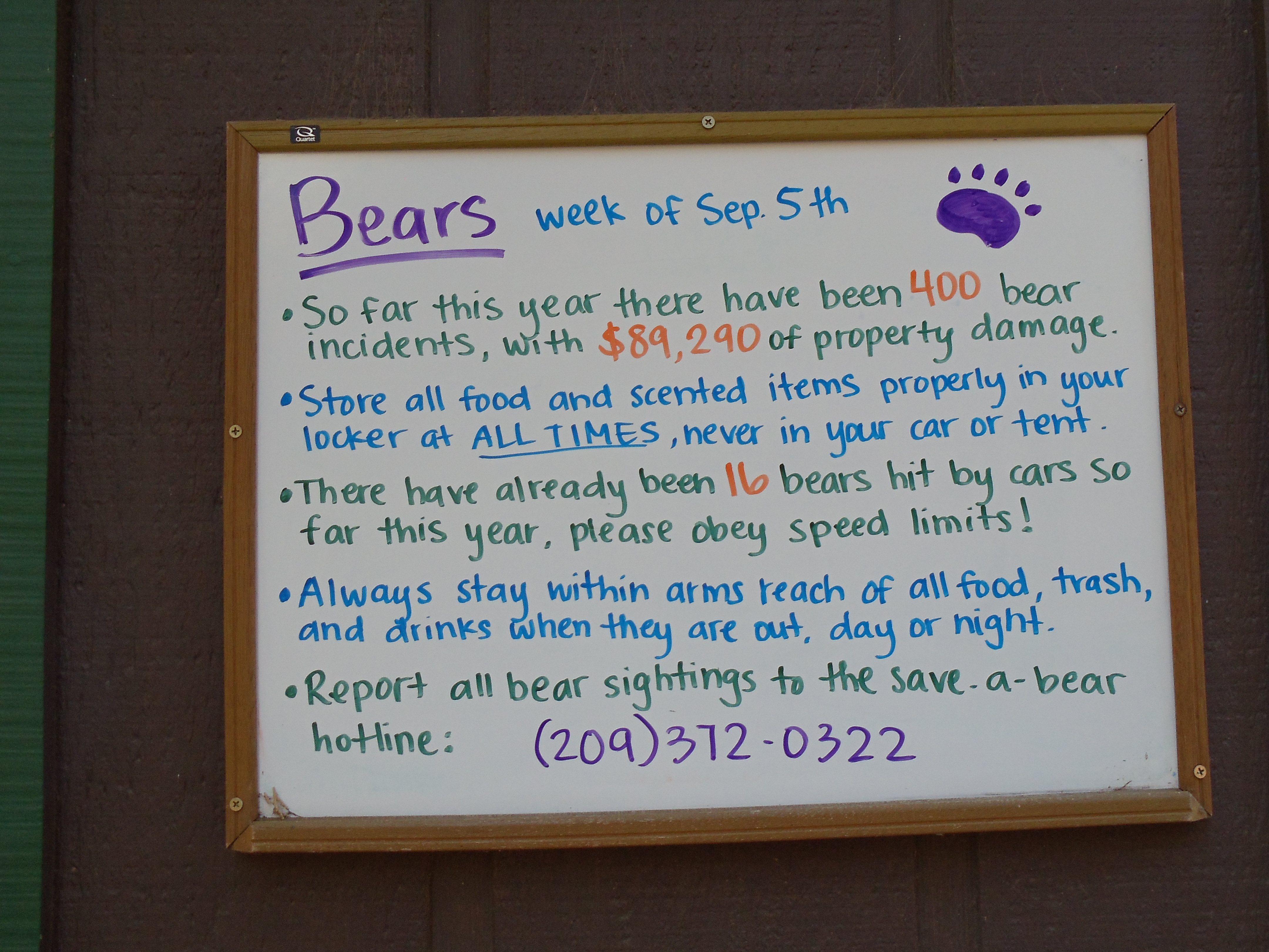
As with the A.T., the JMT requires surprisingly little pre-planning for a successful completion, if you’ve done a week-long backpacking trip or two before and know you’re capable of doing so again. There’s really nothing more to it than to acquire a permit (168 days in advance, note), provide for mid-hike resupply, prepare for the few quirks of hiking in the Sierras (mostly bear-proof storage for food, plus perhaps mountaineering gear if you hike early in the season), then to just do it. I might write up a post elaborating the steps to thru-hiking the JMT at some point, if I can find the time. But as for my effort before traveling to Yosemite to do the hike, it basically came down to this (spread over quite a bit of time, due to the rest of my schedule):

  1. Get a permit. (March 2010)
  2. Buy food for the second half of the trip, and mail it in a five-gallon bucket to the Muir Trail Ranch resupply point. (mid-August 2010)
  3. Buy an Amtrak ticket to get from the Bay Area to Yosemite Valley. (day before, September 2010)
  4. Buy food for the first half of the trip, and get stove fuel for the entire trip. (day before, September 2010)
  5. Pack and go!

I’ll note two last things before the actual account starts. The first concerns mileages: I didn’t carry a particularly accurate guidebook with precise mileage information, so all distances are little more than educated guesses based on a not-very-detailed profile of the JMT. The second concerns pictures: I carried a better camera with me on this trip than I did while hiking the A.T., and I passed through generally more spectacular scenery. I therefore took significantly more pictures each day on this hike than I did on the A.T.; the two hundred-plus pictures I took on the JMT in two weeks significantly outpaced the three-hundred-plus pictures I took on the A.T. in twenty weeks. So for the most part, you can expect my JMT days to be longer than my A.T. days space-wise — not because the JMT is superior to the A.T. (in some aspects it is, in others it isn’t), but rather because more pictures take up more space. (In the mark of the amateur, I usually post every picture of the relative few I take, excepting only duplicates and complete botches.)

September 9

Today’s an odd day, as my last day working before the JMT thru-hike and as my only day in Mountain View after returning last night from working remotely at my parents’ house in Michigan. I kick if off buying food for the first half of the trip — standard fare from the A.T. except that I swap off-brand Pop-Tarts for oatmeal. (Pop-Tarts don’t compress well in bear canisters, unfortunately.)

I then head into the office for a day of feverish work on all the big bugs on my plate, for which I hope to at least get patches posted which others can then carry across the finish line while I’m gone. These bugs are to implement Object.{preventExtensions,isExtensible}, Object.{seal,isSealed}, Object.{freeze,isFrozen}, and last but not least, proper support for this in ES5 strict mode. I get the patches for the first three finished except for responding to review comments, and I get the patch series for the last posted. All four bugs are picked up by jimb; he lands the first three soon after I depart, and he finishes up the fourth in mid-October.

Around mid-evening I take a break to run a couple last-minute errands. First I head to REI to pick up stove fuel and a guidebook or map of some sort. Recognizing the trail should be no problem, but intersections may not always be marked to indicate the JMT, so I’m looking for something to help with that and perhaps point out interesting side trails to hike. I end up selecting Day & Section Hikes along the John Muir Trail, which turns out to be suitable, but not well-suited, for thru-hiking. See my review of it if you’re interested in details, although odds are you’ll probably get the gist if you stick around for this entire series of JMT posts and my editorializing in them.

Next stop is Best Buy for a digital camera. I had intended for months to do some actual research into options before buying a new camera, but eventually I ran out of time, so I now have to just skim the options and pick one. (My old camera lacked image stabilization, decent resolution, and…really just about everything, given it was a Kodak EasyShare. Its original intended use was in just about the least demanding possible situation you could imagine, I should say, so it was capable of serving its original purpose. Beyond that it was woefully lacking, as I think many of my Appalachian Trail pictures generally demonstrate.) I go with the Sony Cyber-shot DSC-W370, and aside from a possible user error, it works reasonably well on the trip and is worlds better than my old camera. My only complaint is that extremely well-lit pictures (as many of mine on this trip will be) tend to be washed out, although some of this might be my misuse of the camera.

Those errands finished, it’s back to the apartment where I try to clear out my review queue so I’m not blocking anyone during my time away. Except for (maybe, memory hazy) one request I punt, and another I finish partially before realizing I lack both the time and lucidity to properly complete it, I get it all clear. But by then, it’s so late that between assembling gear, repackaging foodstuffs so I can fit nine-ish days of food into a bear canister (difficult but doable, requires careful selection, sometimes repackaging, and elbow grease to pull it off in the end), I must forego sleep.

As I walk out the door after hitting Publish on a goodbye post, my pack weighs 44 pounds, of which the fully filled bear canister is 19 pounds. This isn’t great, and it’s nowhere near what a true ultra-lighter would carry even for this distance, but it’s reasonable. Given that I used everything in my backpack at one point or another on the hike, I don’t know offhand what I’d remove to substantially reduce that weight. (Which is not to say I couldn’t easily cut weight by replacing a decent number of gear items with lighter versions, if I chose to spend the money. ๐Ÿ˜‰ It’s always possible to reduce weight by throwing money at lighter gear.)

September 10

I end up delaying a few minutes too long to catch the first Caltrain south to the Amtrak station in San Jose, turning a $4.25 train trip into a $47 taxi ride in order to make my first bus of the day. It’s a costly mistake, but it could be worse: it would be far costlier (in a different way) to be delayed seven hours through missing that bus. It occurs to me the time flexibility of stringing together disjoint public transit options is a nice benefit to that mode of travel, in terms of ability (if at some cost) to absorb minor delays and surprises.

Following the taxi ride is the first in three separate modes of travel to reach Yosemite Valley: bus to Stockton, train from Stockton to Merced, bus from Merced to the Yosemite Valley Visitor Center, at an overall cost of $44. (I think it would have been $37 if I’d bought the ticket earlier.) It’s roughly 13:30, and I have plenty of time to do just about anything I want. I begin with the wilderness permit office to get my permit. (I reserved the permit months ago, but I must show up day-before or day-of to claim it, else it’s made available to walk-ins.) Next, I pick up some sunscreen from a valley store for use during the hike. Apparently sunlight at high elevation is murderous, and even though I shouldn’t have much in the way of exposed skin amongst long pants, long sleeves, a hat, and sunglasses, it’s probably best to have it just to be safe. After that it’s mostly wandering around the valley, going into a few exhibits and galleries to look around and bide time.

Half Dome, seen from Ahwahnee Meadow
Half Dome seen from Yosemite Valley
Cliffs along Yosemite Valley through trees

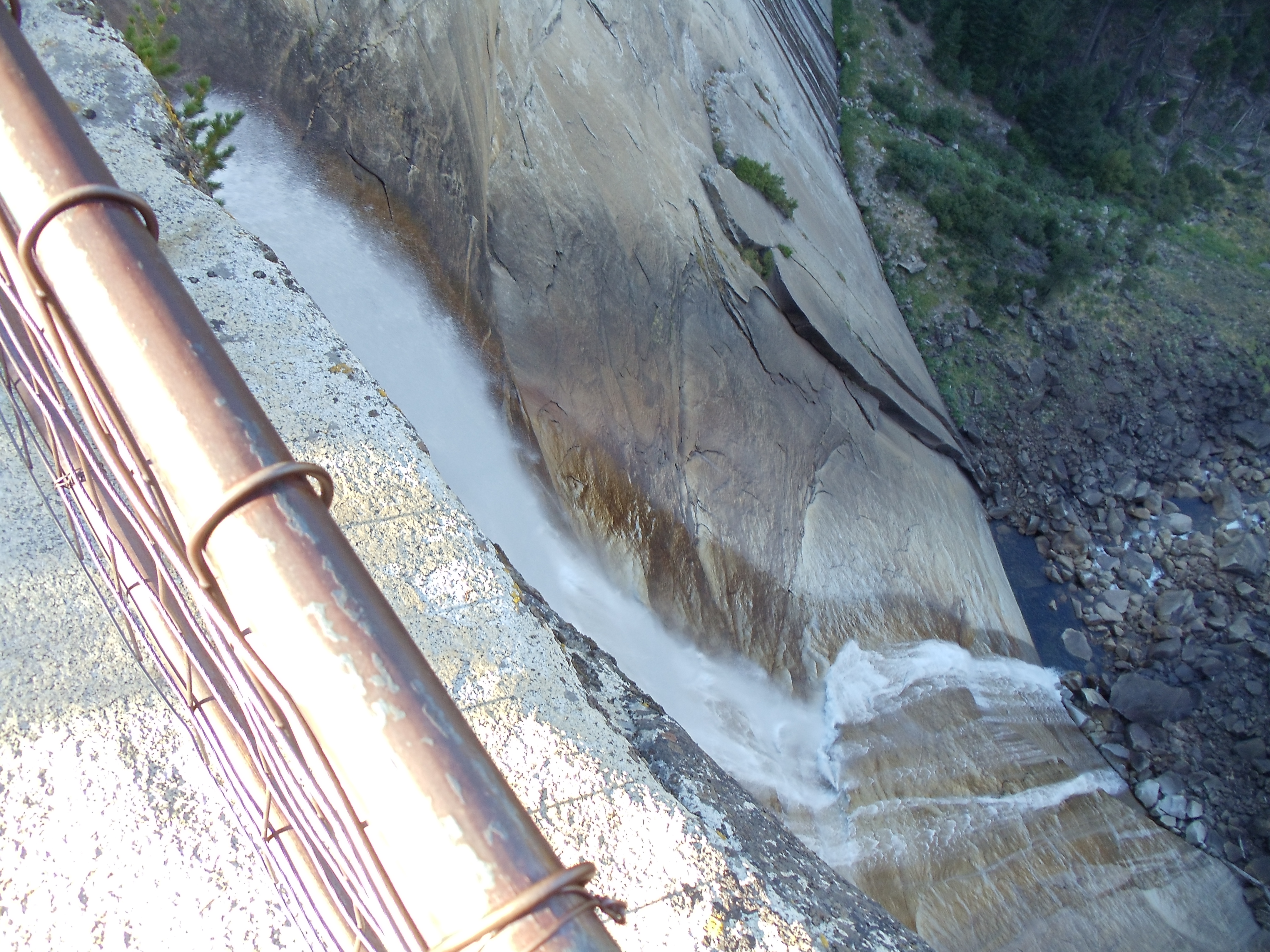
It’s still early enough in the afternoon to take a quick hike, so I walk out to Lower Yosemite Falls to kill time. This late in the summer, so long after winter snows started melting in early summer, the waterfall isn’t much to behold, and the warning sign is mostly unnecessary.

Lower Yosemite Falls
Half Dome again, through some trees

Eventually it gets to be late afternoon, and I head to the backcountry campground where I can stay for $5 for the night before my hike. I run into a few other soon-to-be JMT thru-hikers as I eat dinner, but otherwise it’s a quiet wrapup to the day, and I head to sleep shortly after dark.

Notice board with bear information; one bullet reads, "So far this year there have been 400 bear incidents, with $89,290 of property damage."
FOUR HUNDRED BEAR INCIDENTS

September 11

(14; 4 side; 14 total, 197 to go)

I set my watch alarm to wake up shortly after 5:00 to get an early start to beat the crowds on a long day, but I don’t wake up to it and end up sleeping until just short of 6:00. No big deal; after breakfast and packing up I’m walking out of camp toward the trailhead at 7:05. And so it begins:

The John Muir Trail trailhead sign: 211 miles to Mount Whitney

Yosemite Valley is at a relatively low elevation, and it’s mostly a constant climb from here through the first place I can stop for the day. My permit allows me to be in the backcountry from September 11 through September 27, and other than the first night I can camp pretty much anywhere, so long as the particular spot respects the usual Leave No Trace principles. For this first night, however, I have to camp past Little Yosemite Valley and Moraine Dome (the latter is not directly on the JMT). My map/guidebook tell me where Little Yosemite Valley is, but I’m not 100% certain where Moraine Dome is, except that it’s before Sunrise High Sierra Camp, so I’m mostly aiming to get to Sunrise for the night.

A view back toward Yosemite Valley shortly into the hike

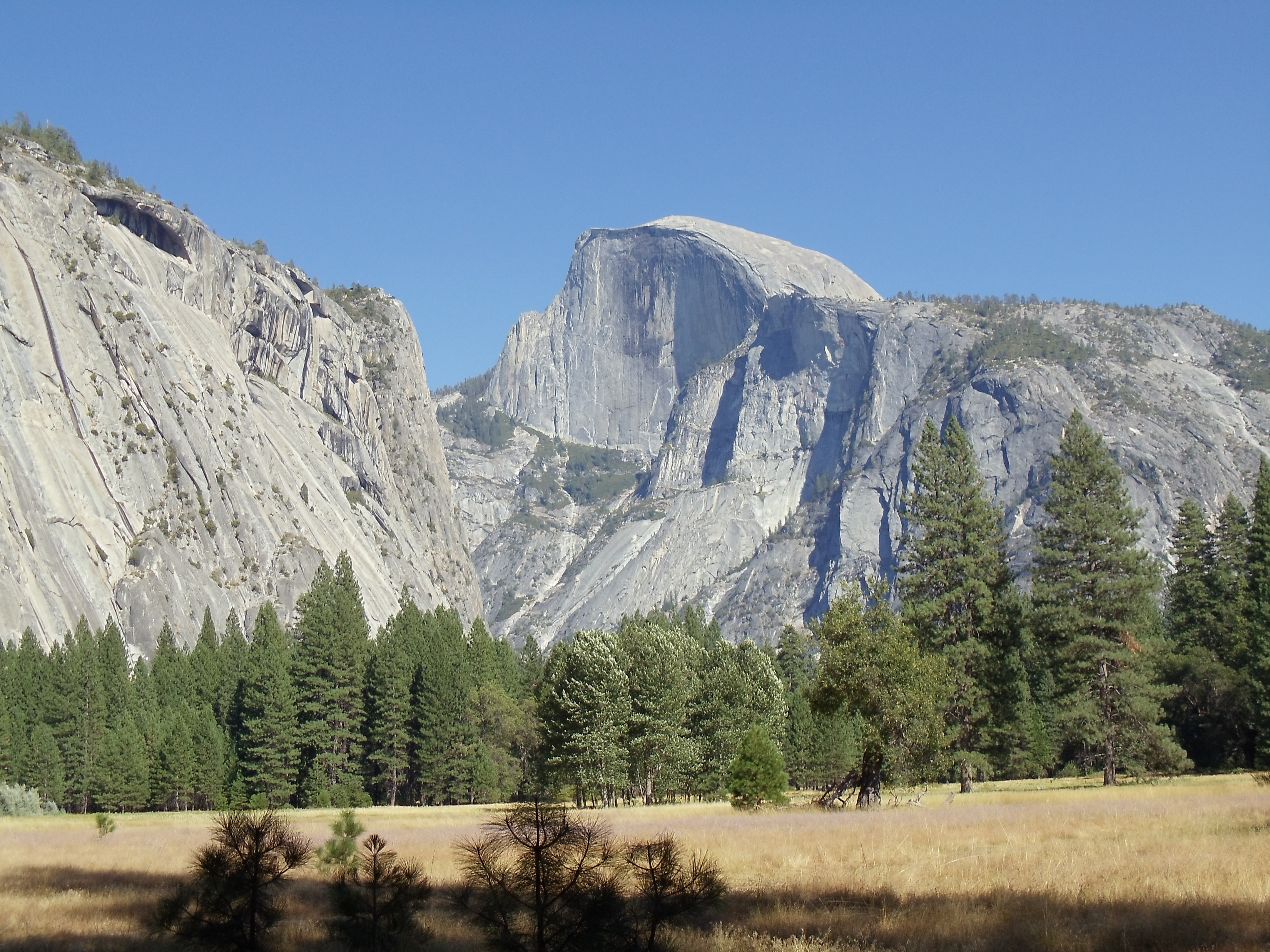
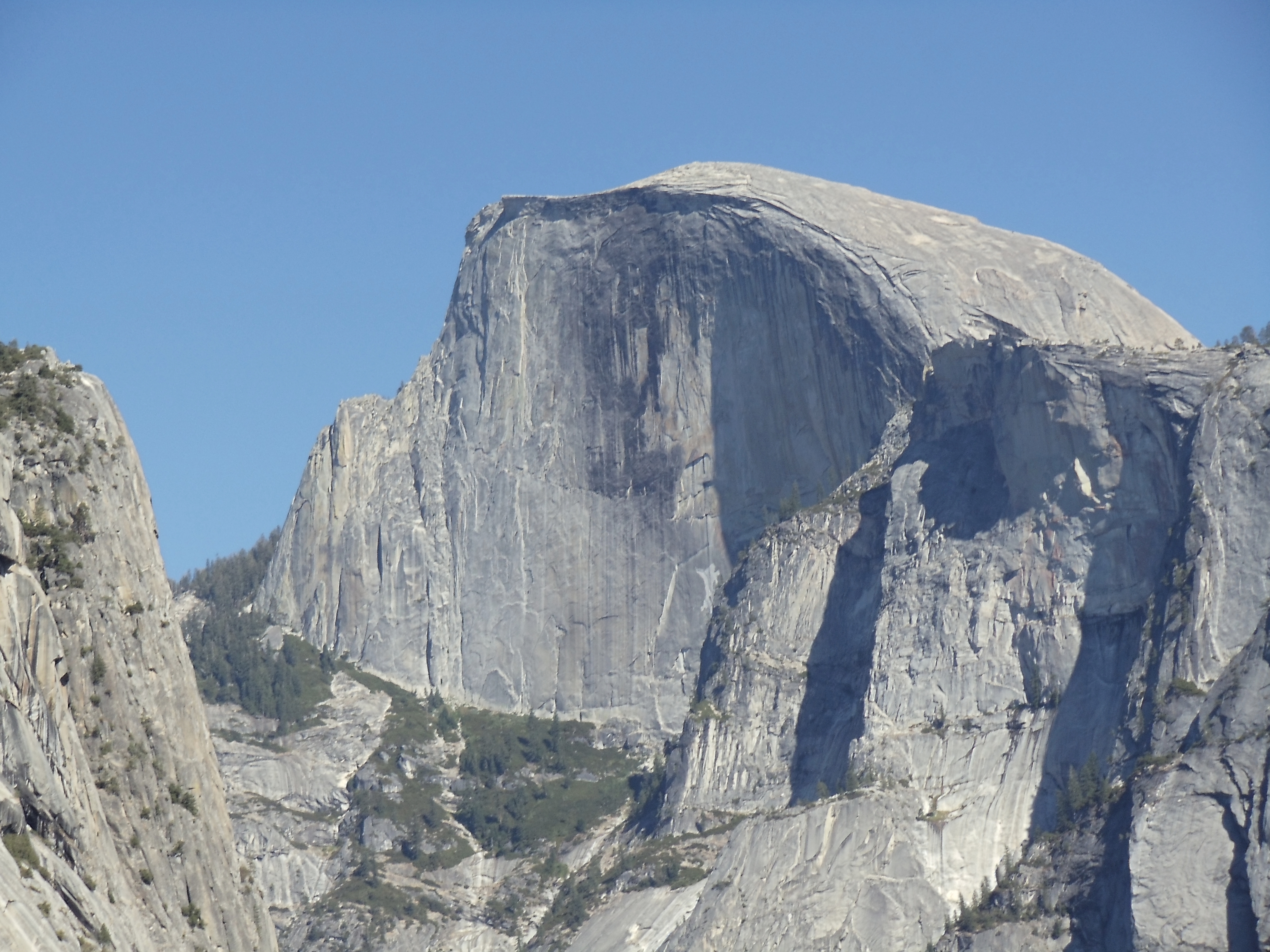
The trail starts out easy (paved, even!), gradually sloping upward and out of the valley. Just past views of Vernal Falls the JMT veers away from the beaten path most day hikers take to get to Half Dome, taking a more gradual (and much less wet, misty, and slippery, at least during some seasons) path through the valley toward Nevada Falls. With switchbacking the trail’s pretty easy as I ascend, with Half Dome and the falls gradually coming into view. With the switchbacking complete it’s a somewhat level cut across the side of the valley over to the falls.

The back side of Half Dome

Nevada Falls is reasonably impressive, at close to six hundred feet tall, and the JMT offers some nice views of it from a distance, where its full scale is more apparent. The guardrail-protected viewpoint just near the top also serves to put it in perspective, for those not prone to acrophobia.

Nevada Falls from the approach on the John Muir Trail, a short distance away and from a slightly higher elevation
Nevada Falls from the approach on the John Muir Trail
Nevada Falls, a hundred feet or so above it from the side
Nevada Falls, above and from the side
Nevada Falls, from the precipice, looking down over a guard rail at the water crashing down
At the precipice

Past the falls it’s a quick bit of hiking to the Half Dome side trail to commence a two-mile hike to the top. I begin to pass people (even large groups) looking for extra permits to hike to the top. I’m skeptical that such efforts are usually successful, but if it’s the only option, it might be worth the gamble.

A panorama view from just off-trail, shortly before real ascent starts (and well before the surreal ascent); the view is roughly level with the mountains surrounding Yosemite Valley
A panorama view from just off-trail, shortly before real ascent starts (and well before the surreal ascent)

Just before the start of the first notably steep section, I encounter the ranger on the trail who checks permits; given Half Dome’s popularity I half-expected to see a ranger. This ranger’s the only one who checks my permit (and he only examines the Half Dome permit, not the wilderness permit) the entire trip, and I only see two others the entire time, which suits me just fine.

The ascent now turns from gradual uphill to a steep, vaguely-defined rock stairway. Hiking poles in the hands of a practiced hiker really shine on steep downhills, but they provide a bit of a boost on steep uphills as well. On this stretch of trail, they come in handy during both ascent and descent (but most particularly on the descent). Soon the trail levels off for a few hundred feet, and I reach the base of the steepest part of the ascent.

The final 400 feet of ascent up Half Dome (covering a somewhat greater horizontal distance, at angles approaching 45 degrees) require use of installed cables and wooden bracing, up which hikers must pull themselves to reach the top; the descent requires the opposite effort
The final insane ascent up Half Dome; the cables (and pile of gloves found at the base, if you arrive early enough) are absolutely necessary
The final Half Dome ascent, from closer to it; it's a little less steep in this view as I'm more level with the base of the ascent
The final Half Dome ascent, from closer to it

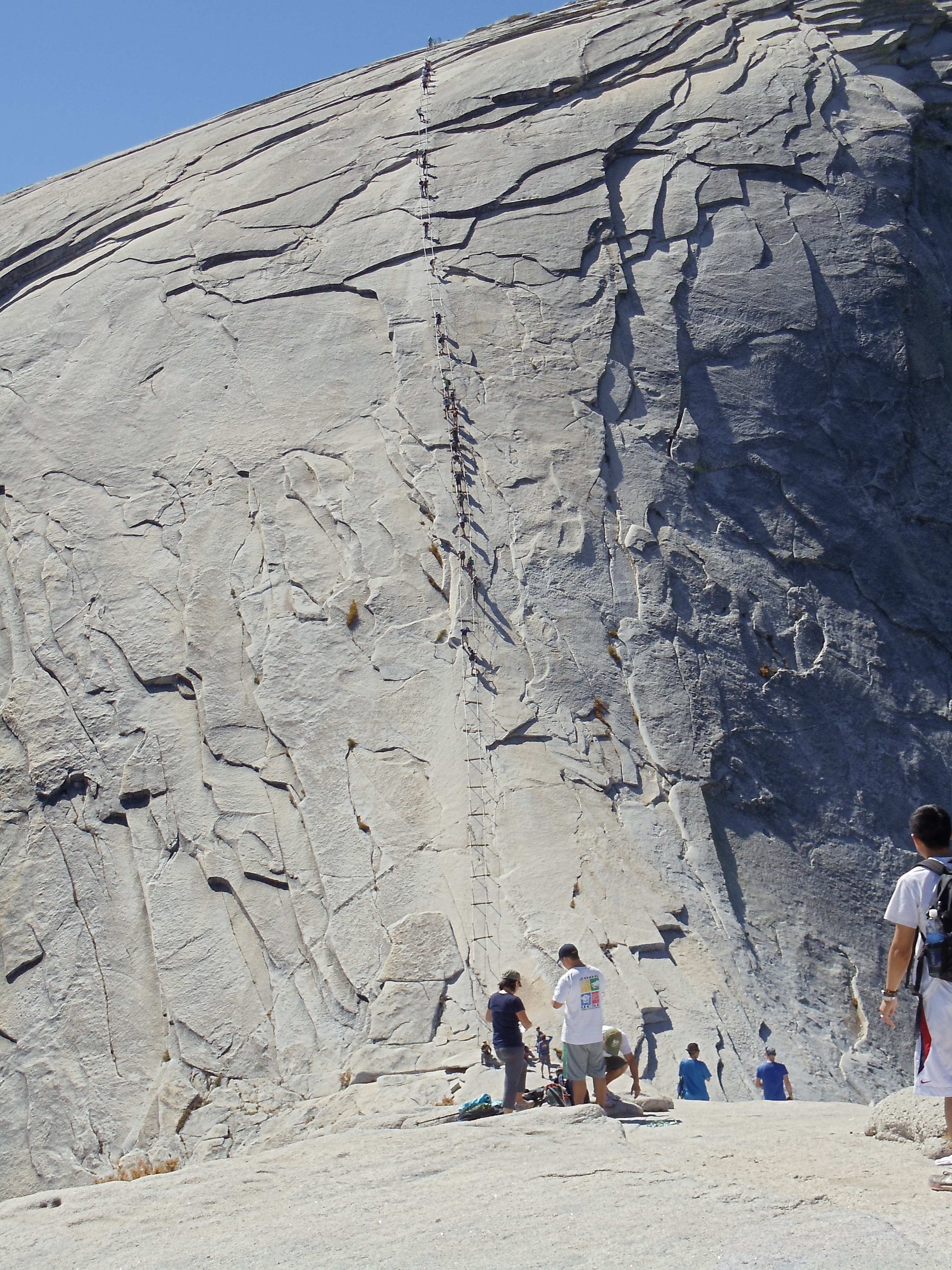
Despite my later-than-intended departure, I’m still ahead of most people hiking up Half Dome, so there’s no wait to borrow a pair of gloves or to continue up the cables.

On the cables looking up Half Dome
On the cables looking back up Half Dome, during the descent

I could never forgive myself if I ditched my backpack somewhere rather than at least attempt to take it up with me, so my arms and legs have to deal with forty-odd pounds of weight up top for the ascent. It’s understandably tiring; as I say to someone heading down as I head up, I picked a bad week to quit smoking. (Unfortunately she doesn’t get the reference — maybe if I’d stepped it up to glue or amphetamines she’d have realized I wasn’t serious.) But eventually I do reach the top without real problems.

Panorama view atop the Half Dome plateau
Yosemite Valley from the top of Half Dome
Yosemite Valley from the top of Half Dome; the roughly triangular grassy meadow on the right side is Ahwahnee Meadow, where I took two earlier Half Dome photos

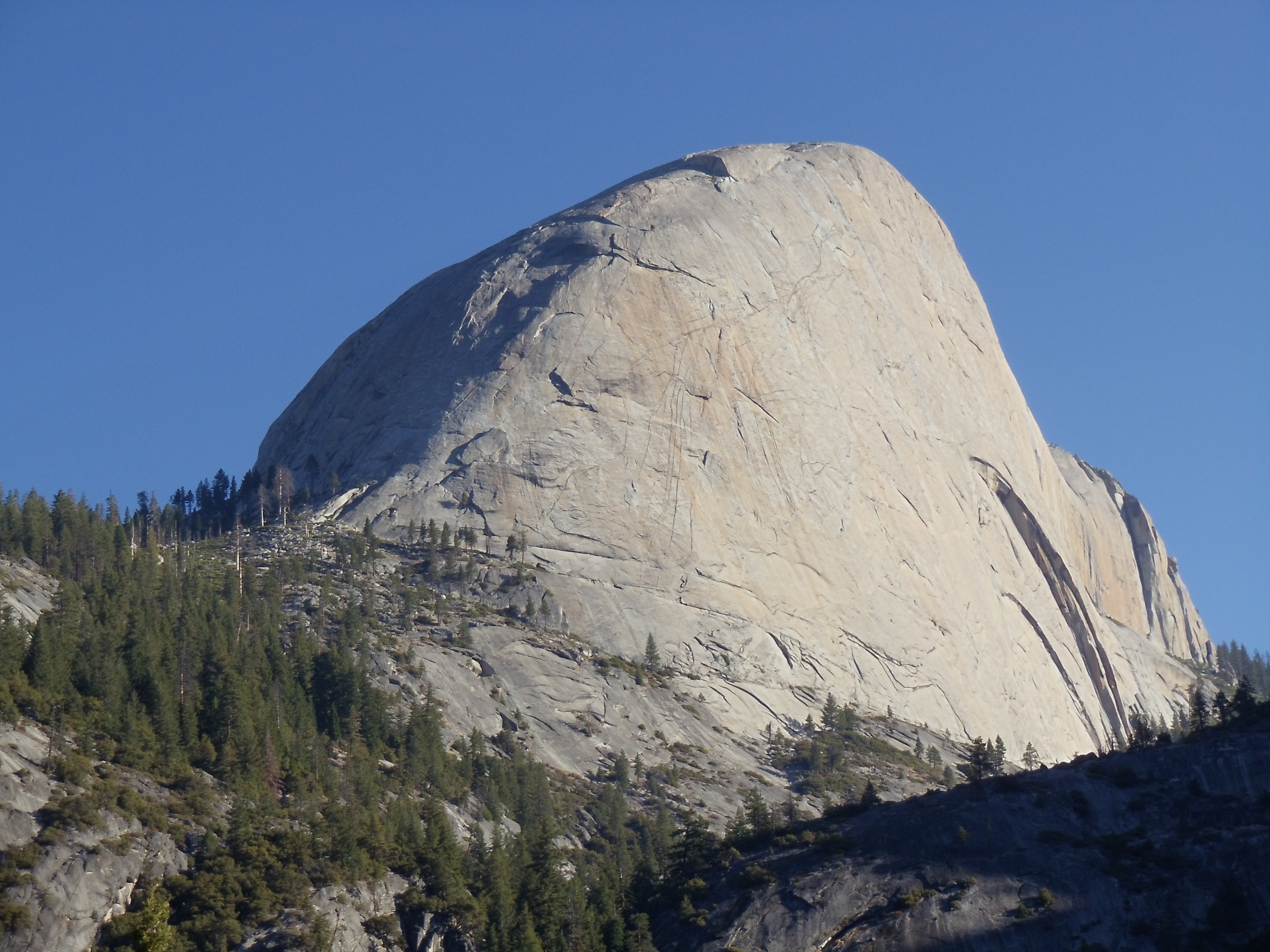
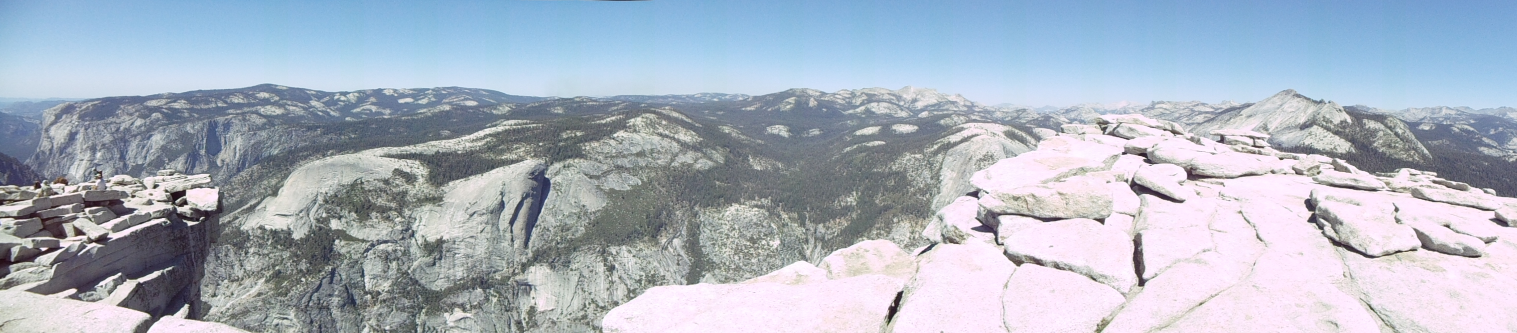
I wander around the top a bit (it’s a lot larger than you’d think from just the classical view of Half Dome), walk over to a few of the edges (but not too close, since I still have the backpack on), then sit down and eat a lunch of half-shredded tortillas and Nutella. Mm…

A panorama near one of the sheerer cliffs of Half Dome

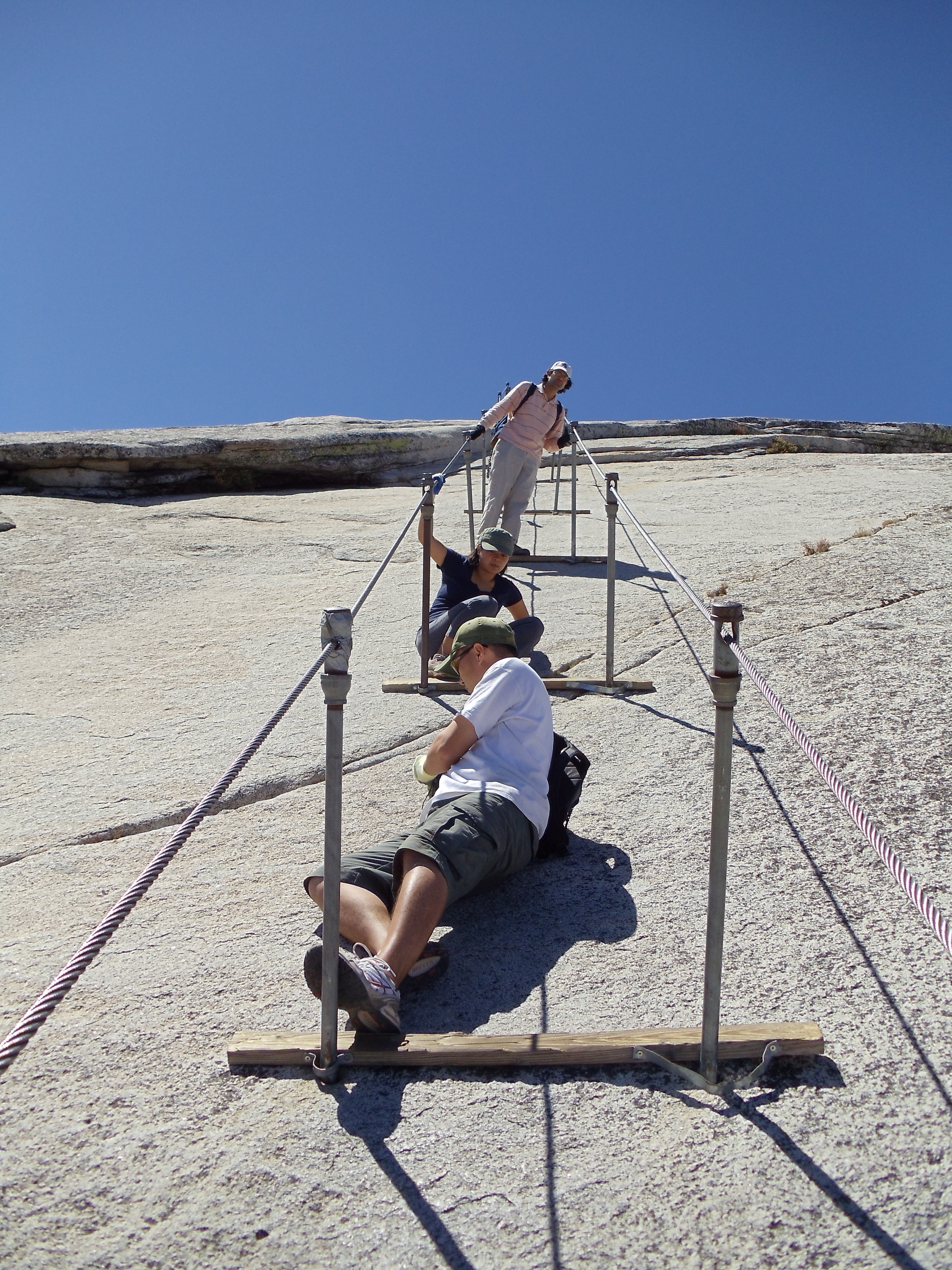
Now it’s time to head back down and finish out the day. The ropes are much more crowded on the way down, and the line of descending hikers frequently comes to a standstill. A few people hop to the outside of the ropes to get down faster, but I’m not willing to consider this with a fully-loaded backpack. I bide my time by taking some pictures of the descent and of the views during it.

Near the top of the descent
Another look down a littler later
Another look down a littler later; the people at the bottom look much smaller because the "bottom" in the previous picture was a plateau a bit higher than the start of the ropes
The surrounding mountains and valleys, facing forward during the descent of Half Dome

Once I’m past the ropes I descend much faster, well-aided by hiking poles and a quick step. (It’s actually too quick a couple times, as I roll each ankle several times these first several days, before they adjust to the demands I’m putting on them. I had intended to avoid this process by regularly ice skating in the weeks up to the trip, but multiple trips to relatives over the preceding months working remotely shot that plan all to pieces.) Once back on the JMT, I stop to refill on water at one point from a handy stream (climate this time of year is that of a desert, but strangely streams, lakes, ponds, and water in all forms is readily available almost all the time). The remaining hiking proceeds more slowly, and around 17:00 I feel tired enough to stop for an early dinner before hiking the remaining miles to Sunrise Camp.

A Yosemite backcountry trail sign, marking Sunrise Trail, made of rusted metal with lettering cut through it, followed by a long midafternoon shadow, in which the gaps of the sign's letters are visible
Yosemite's backcountry trail signs have a certain elegance
Echo Peaks and Matthes Crest, with a sunset glow
Echo Peaks and Matthes Crest

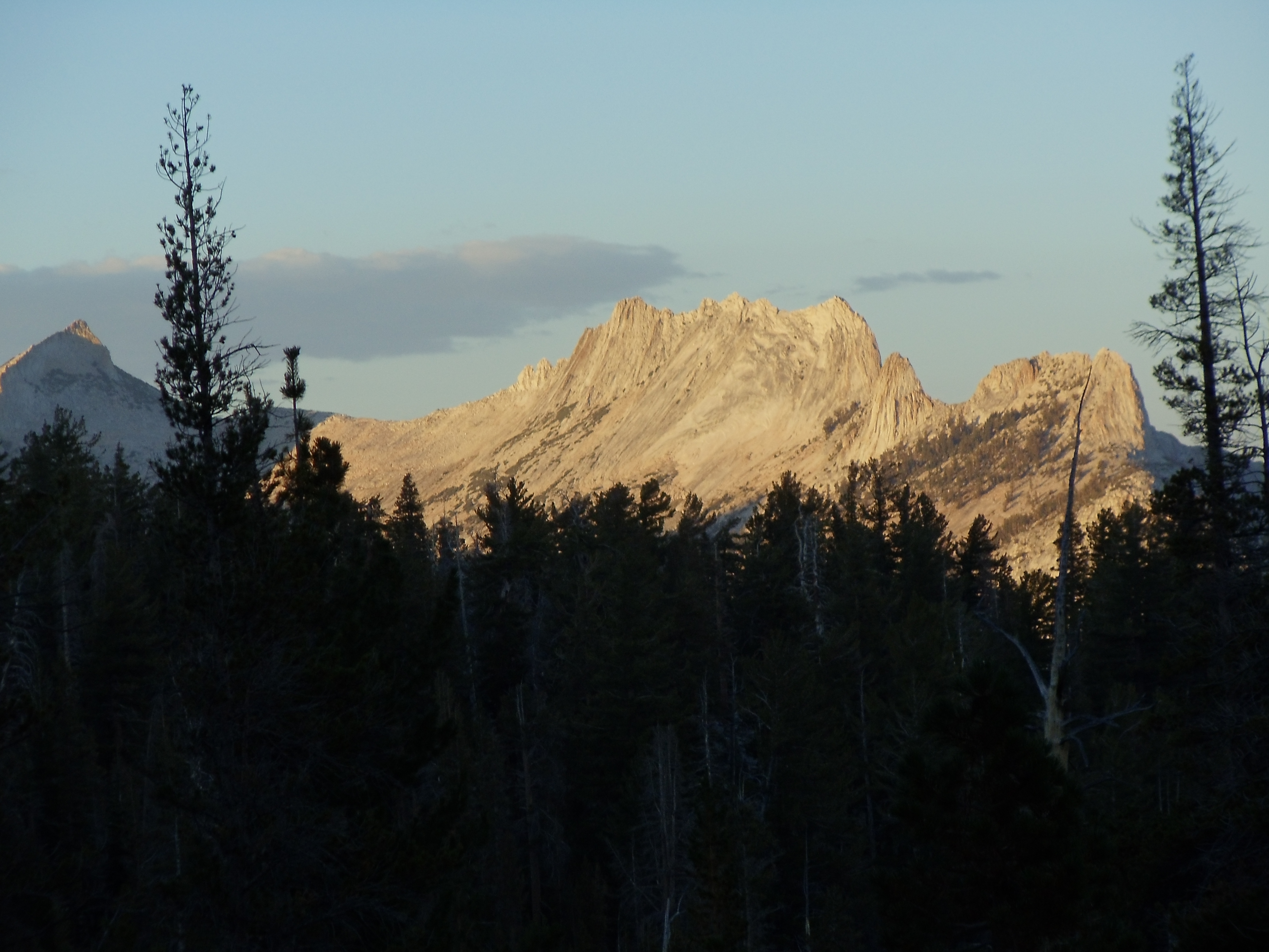
Sunrise High Sierra Camp is run similarly to a White Mountains hut, and it’s one of a number of High Sierra Camps in Yosemite, albeit the only one directly on the JMT. Amazingly its pricing is even worse than that of the White Mountains huts. On the other hand, this camp has a free backpacker campground (no amenities except bear boxes and a pit toilet), so at least backpackers (whether thru-hiking or not) who don’t want to be gouged have a real choice. (If you weren’t an Appalachian Trail thru-hiker, and you were hiking in the White Mountains, I’m not actually sure where you’d stay in some parts of it if you didn’t want to overpay to stay in a hut.) I arrive at Sunrise just early enough to be able to nearly walk to the backpacker’s campground there without needing to ask for directions through twilight darkness. I walk through trying to find the extent of the campsites, and eventually I stumble to the end, find a rock ledge with a view over Long Meadow toward the east, and quickly head to sleep.

September 12

(16; 2 side; 30 total, 181 to go)

Mountains to the east of Long Meadow at sunrise
Mountains to the east of Long Meadow at sunrise, from my overnight camping spot

I’ve set my watch to wake me up sometime before sunrise, and I wake up on time today. As one would expect, the sunrise at Sunrise is very nice, if quite bright. After a breakfast eaten sitting on the rock ledge, it’s back on the trail heading trail-south but geographically north, hiking even before 8:00, surprisingly early for me.

Brownish grass surrounds patches of ground-hugging plants with reddish leaves, all covered in frost from the night
Morning frost on the Long Meadow flora indicates just how cold the night was, although it was fairly nice inside a thirty-degree bag
A trailside view
A trailside view
A less-impeded trailside view
Cathedral Peak framed by trees

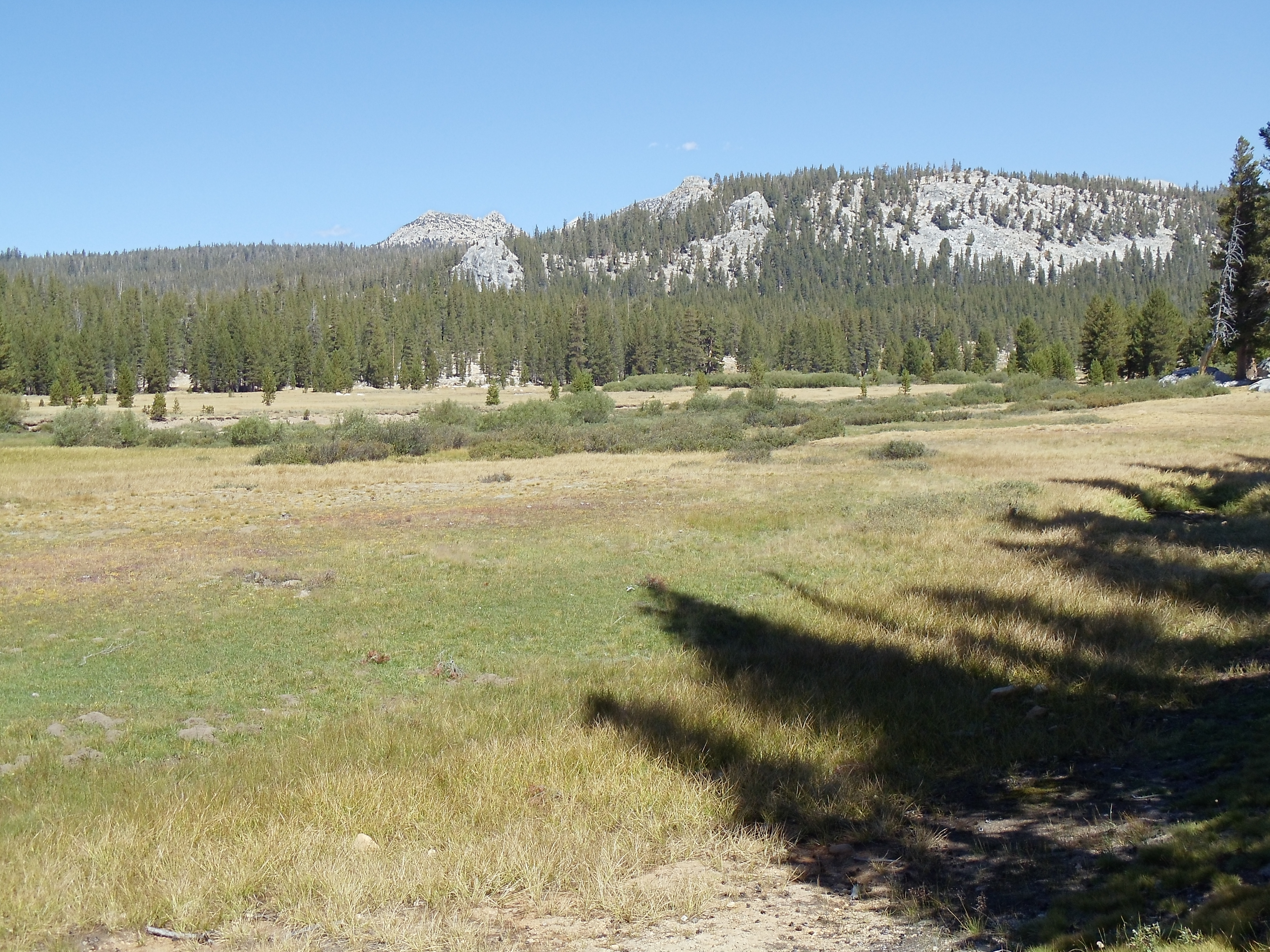
Today’s hiking is pretty easy. After some meandering through Long Meadow, it’s a short bit of hiking up, then some mountainside wandering, then passing through some valleys with assorted lakes and ponds, then a long, gradual descent down to Tuolumne Meadows and something vaguely like civilization. I don’t need to stop by Tuolumne Meadows, but the trail passes close to a road along which lies a grill and small store. I’m feeling hungry, and I could use some Gold Bond powder if I can find it in the store, so I hop off the trail and road-walk the mile to it. Lunch is a cheeseburger with fries and all the condiments I can get; I even eat the dill pickle that comes with it (only because I know I can use the energy). The store doesn’t have Gold Bond power, alas, but it does have something as magical: boxed win! Er, I mean, boxed wine! (I hear snobby readers saying “Quelle horreur!” as I type this. You know who you are.) I couldn’t have fit it in my bear canister a couple days ago, but I now have the space to make it work with a little effort, so I get a half liter of pinot grigio before heading back to the trail.

Tuolumne Meadow, surrounded by low-lying hills and mountains
Tuolumne Meadow
A mother mule deer and her white-spotted fawn, seen through trees near Lyell Fork
A mother mule deer and her fawn, near Lyell Fork

For whatever reason I find that I’m dragging a bit when I hit the trail again. It doesn’t help that the guidebook and signs are a bit unclear as to how to return to, and continue upon, the JMT. Nor does it help that my ankles are (both) in considerable pain from stumbling; I would likely be in trouble now if I didn’t have hiking poles to arrest my falls. I take it somewhat slowly heading south to enter Lyell Canyon, which isn’t a sheer canyon but rather four miles of essentially level trail along Lyell Fork toward the ascents and passes beyond. It’s getting late in the afternoon, but there’s no camping in the first four miles of the canyon, so I keep hiking to the trail junction just past the four mile limit.

Looking north along the gentle Lyell Fork past various boulders submerged in it
Lyell Fork to the north as I collect and purify water
South down Lyell Canyon as I gather and purify water, viewing Kuna Crest
South down Lyell Canyon as I gather and purify water
An eight-point buck who should consider himself lucky to be in a national park
This buck shouldn't be this unconcerned about me, but at least he's not begging

The junction is a well-frequented camping area, and there are at least a couple dozen people around. I pick a spot near a few backpackers and their fire ring, eat dinner (chipotle-flavored salmon and Mexican rice, most excellent — because I’m just weird, the rather-heavy wine will wait until I arrive early enough somewhere to attempt to cool it before dinner), and shortly head to sleep.

…and that wraps up the first of several posts covering the entire JMT. With the number of pictures I’m taking, it’s clear the fewer days I batch up at a time, the better, as far as keeping post “height” reasonable goes. Thus you can expect at least four or five more of these posts to cover the roughly two weeks that remain of the trip and hike. Until next time…

10.09.10

It’s 211 miles to Mount Whitney, I’ve got a full bear canister of half my food, the remaining half is staged halfway down-trail, it’s dark, and I’m wearing sunglasses

All work and no play makes Jeff a dull boy.

All work and no play makes Jeff a dull boy.

All work and no play makes Jeff a dull boy.

So goodbye Internets, goodbye Mozilla, goodbye cruel world: I’m off to thru-hike the John Muir Trail. I should be back on approximately September 28, depending on how my transportation connections match up on the way back from the other side of Mount Whitney. (And yes, Mozillians who will be in Mountain View for the platform work week next week, I’ll miss it — a regrettable peril of needing to schedule a vacation 168 days in advance.)

25.03.10

Bluemont, VA to Waynesboro, VA: Shenandoah NP is overrated

September 4

(0.0; 1185.4 total, 988.6 to go; -15.0 from pace, -134.6 overall)

I intend to get up and hike today, but laziness and a ready Internet connection distract me. I spend most of the day reading email and feeds as well as working on a web tech blog post about a feature I implemented shortly before starting this hike: the DOM Text.wholeText and Text.replaceWholeText APIs. It was an interesting little bit of hacking I did in an attempt to pick up as many easy Acid3 points as possible for Firefox 3 with as little effort as possible. I have more to say on this topic, but at the request of a few people I have split it into an extended, separate post so that my thru-hike ramblings don’t distract from it. Beyond writing the web-tech post and catching up on things, one other minor anecdote sticks out from today: at one point Lydia, the daughter, has a screaming fit. Red Wing tells me how he responded: he told her that she should be quiet because her stuffed rabbit was trying to sleep — and it worked. Heh. ๐Ÿ™‚

The Honeymooners walk in later in the day to again catch up to me (not unexpectedly, as I knew the Four State Challenge would not be an efficient way to make good miles in the long run), and I round out the day again by taking advantage of the same $25 hostel deal available last night. Also, since I ended up staying this extra day at the hostel, I’m now slightly rushed to meet up with family at the south end of Shenandoah National Park, at around 1325 miles down the trail. I’m currently at 1185, with the plan being to meet them at the end on September 10, so I’ve eaten up my margin for error today: The Hike Must Go On again in earnest tomorrow.

September 5

(18.3; 1203.7 total, 970.3 to go; +3.3 from pace, -131.3 overall)

Yesterday was a recovery day, so today it’s back to business, as I work to remain mostly even with the Honeymooners and to catch back up to Smoothie. Of course, that still doesn’t stop me from dallying in the morning, and after I post the web-tech article alluded to yesterday, I finally roll out of the hostel at around noon, well after the Honeymooners leave.

Not much sticks out in today’s hiking. I don’t see the Honeymooners again, which is a little odd since I’d assumed they would plan to hike further than I intended to hike, having left several hours before I did. The first bit of the day is just getting out of the Roller Coaster (a 13.5 mile stretch of trail with ten viewless ascents and descents necessitated by a narrow trail corridor; see also my previous entry), and there’s not a lot to see. By the time I get through to Rod Hollow Shelter at its end it’s just about 17:00. I consider stopping for the day, but I haven’t even gone ten miles at this point, and I still have daylight and energy left in me; onward another 8.4 miles I go to the next shelter.

I have to keep up the pace to get there before it gets too ridiculously dark, but it’s a nice bit of hiking. Later on I pass through Sky Meadows State Park as dusk hits; I feel a sprinkle every so often, providing further incentive to keep moving to avoid real rain if it happens. I get to the shelter as darkness hits, and it’s an unusual one — probably the most unusual since Hexacuba Shelter in Vermont. Dick’s Dome Shelter is on private land, was constructed by a PATC member out of (as best as I recall) fairly artificial materials, and — strangest of all — is shaped like a d20 (icosahedron, for the culturally challenged) with three adjacent faces omitted to serve as an opening. It’s small (claimed to sleep four), and luckily I’m the only person in it for the night. I fill up on water from a small stream passed en route to the shelter, and I hang my food bag from a bear cable placed between trees a little distance from the shelter — it’s great not to have to search around for a plausible tree branch in the darkness. Rain falls at a moderate rate — no longer sprinkles, but not in particular earnest — as I head to sleep. 18 miles for the day is a reasonable distance given my late start, but I have 122.2 miles to hike in the next five days to meet family at the south end of Shenandoah National Park, and an 18-mile day just doesn’t cut it if I want to hike those days without feeling rushed.

September 6

(18.0; 1221.7 total, 952.3 to go; +3.0 from pace, -128.3 overall)

I wake up in the morning to the same rain from last night, and it shows no signs of stopping. (I eventually learn that this rain is the continuation of Hurricane Hanna, explaining the rain’s persistence over the next several days.) At least it’s not turning into a downpour, but this won’t be much fun to hike through. Off I head into the rain; it’s not stopping, and I can’t stop either.

Rain continues up to the first shelter stop of the day at Manassas Gap Shelter, where I take an opportunity to duck inside and out of the rain for a bit. The shelter has a note prominently posted in it talking about a semi-residential rattlesnake, noting that anyone who sees it (I do not) should mention it in the register. I fill up my water bottle with rainwater pouring off a corner of the shelter roof (I still purify, of course) before returning to the rain. I continue hiking through the rain to the Jim and Molly Denton Shelter, where I again stop out of the rain for a bit. I save its register from being soaked beyond its current state; someone’s left it on one of the porch benches, fully exposed to rain. Past that the trail passes by a fenced-in National Zoological Park Research Center, which the Companion says occasionally provides views of exotic animals; I see none in this weather.

A few more miles of walking and drizzle take me to Tom Floyd Wayside, the first shelter in the Shenandoah National Park section of the trail as delimited by the Companion. (Technically, I have a little more hiking before I’m inside the park proper.) The site has a nice cable for hanging food, and as usual these days I have the shelter to myself. It’s somewhat odd, this being a Saturday night when usually others are out camping, but I suppose the near proximity of Shenandoah makes the difference: if you’re going out for a weekend trip, you’re probably not going to go just next to a national park but rather into it. Among the shelter’s decorations: a charming poster warning of the possible dangers of accidentally inhaling fecal dust from mice or rats infected with disease.

Today’s hiking would have been shorter and more pleasant if I didn’t have the looming deadline to get out of Shenandoah to meet family. Given the remaining distance, however, I couldn’t make any further curtailments; 104.8 miles in the remaining four days is already pushing pretty hard, and the rainy weather makes that even worse. Why didn’t I learn the lesson the last time I had a hard deadline to make that deadlines are bad?

September 7

(23.6; 1245.3 total, 928.7 to go; +8.6 from pace, -119.7 overall)

Today’s hiking is much more pleasant than yesterday’s soggy mess as I enter Shenandoah National Park.

Mid-day view of Skyline Drive in Shenandoah NP

Shenandoah National Park consists, roughly speaking, of a hundred-mile road called Skyline Drive that follows the ridges of the Appalachians in the area, surrounded by a fair amount of forest, cut through with hiking trails, horse riding paths, and other nature-y things of that nature. Sounds vaguely nice, right? Well, yes and no. First, it’s a national park, which means, relative to its attractions, it receives an outsize number of visitors. I don’t mind people when I’m hiking, but I’d prefer there not be too many people, and national parks can push it, even on hiking trails. Second, it’s a national park whose chief attraction is a road. Many, possibly most, visitors drive down Skyline Drive looking at scenery, maybe stopping at overlooks, and consider that their park experience. Fine, you go do that if you want and miss out on all the interesting bits, but leave me out of it. Unfortunately, for this park, hiking on the A.T., there’s no choice: the trail roughly parallels Skyline Drive for roughly 100 miles of trail, crossing back and forth over it 28 times according to the Companion. Thus, you’re never very far from something approximating civilization. Great national park experience, eh?

The only good thing about being near a road so much is that you’re also near Shenandoah’s “waysides”, convenience stores along the road at which it’s possible to resupply. (The stores also sell bottles of wine, which seems like an incredibly stupid idea given clueless tourists’ penchant for careless littering.) This is almost convenient, except that the waysides are all run by a single entity, Aramark, so you get markedly higher pricing than you’d get at any other resupply point in the area. Some of the difference is due to the waysides’ remoteness, to be sure, but some is certainly the result of Aramark’s government-licensed monopoly on services in the park.

More mid-day views from Shenandoah

Shenandoah’s a bit different from most of the Trail, for backpackers, in that you have to get a permit to backpack through it. The permit’s basically a formalism: if you enter Shenandoah via the A.T. you pass by a small sign-in station. There you pick up a carbon-copy form, fill it out with your rough itinerary of camping locations and dates, deposit one copy at the station, and visibly fasten the remainder on the outside of your backpack with a small wire. There’s no fee for doing this (people who drive into the park have to pay for that privilege), which is pleasantly surprising. I pick mine up at the station, which is just a mile into today’s hiking.

Much of today’s hiking consists of me marveling at so many people as I cross and recross Skyline Drive. Parking lots filled with cars and the occasional people disembarking from them present a marked contrast to anything I’ve seen this close to the trail since probably Bear Mountain in New York. The highlight of the day happens around noon when I get a definite sighting of a black bear. I’d seen what might have been one in New Jersey, but I get a good, long view of this one. He’s eastward of the trail maybe fifteen or twenty yards over — and ten or fifteen yards up. See a bear like this, and you’ll realize why the prospect of climbing a tree to get away from a bear is such an utterly ridiculous idea. The bear’s up there, just nibbling away on leaves or acorns or whatever it is they like to eat, certainly aware of the people around him but not sufficiently rushed to stop eating immediately. After a minute or so some people I’d just passed catch up, and they stop to watch the bear as well. Shortly after the bear leisurely and gracefully climbs down the tree. He turns, looks at us briefly, then ambles off into the trees and brush in the opposite direction. Good stuff — now if only I’d remembered to pull out the camera before he was walking away…. Shenandoah is the big spot on the Trail for seeing bears — if you see one, you’re probably going to see it here. I see a few more bears through my hiking hear, and I hear what are probably about an equal number crashing through the bushes and trees running away from me. This one was really one of the more fearless bears I saw both in Shenandoah and on the entire hike.

My goal for the first bit of the day is to get to Elkwallow Wayside, 16 miles south, so I can resupply. The Companion notes this is the last opportunity for northbounders to get blackberry shakes, so I’m planning on getting one to see what it’s like. Once there I resupply and discover the aforementioned prices. Where usually Knorr noodles (the mainstay of my dinners) go for $1.25-1.50 or so, here, as best as I recall, they’re around $2.30. Other items are similarly marked up; had I known beforehand I would have made an effort to avoid resupplying here, since resupply here was more a matter of convenience than anything else. The attached burger/milkshake fast-food counter is similarly overpriced, with the milkshake going for around $4.00 as I recall (and it’s unremarkable to boot), and the entire meal coming to around $11 including tax. Oh well, at least it’s only the once.

After lazing around for a bit eating and relaxing, watching people pass by, it’s time to start hiking again, newly burdened with food to last through the rest of SNP. It’s only 7.4 miles to go, and I hit a good pace and the miles go by effortlessly. I walk up to Pass Mountain Hut (as shelters are named in SNP) with some day to spare.

I share the shelter with three other people. One is a middle-aged man who says he’s doing a long-distance northbound hike, starting from some location I can’t quite remember, maybe the south end of Virginia. The other two men are in their thirties or forties and, as best as I can recall, are hiking together. One of them, upon hearing at some point that I’m going into the software industry after I finish my thru-hike, vigorously attempts to dissuade me from such, based upon his experiences at IBM (in sales or something like that, I hasten to note), wherein he discovered just how far he was willing to betray his principles. (The furthest such case involved eating food from the foot of a quadriplegic client, or something approximating that scenario. I am not making this up!) I’m not sure if I ever stated that I was going to work for Mozilla. I’m not sure it would have made a difference even if I had, given the extent of his bitter-and-jadedness.

The shelter register here provides good entertainment in the form of stories from other insane thru-hikers. Several northbounders, when they passed through, arbitrarily decided to complete a Twenty-Four Hour Challenge. Their full day of hiking ended at this shelter, after a sixty-plus mile day including a few-hour detour into nearby Luray for food and entertainment resulting in an entertaining picture of, of all things, clogging, which they left in the register. Another potential challenge, maybe? This one doesn’t require any particular time or location to attempt, so it’s easier to work into the hike any time it’s convenient. We’ll see…

The other fun thing about Shenandoah is that they have somewhat unusual food-storage requirements at campsites: large, dozen-foot poles stuck in the ground with hooks at the top, from which you’re to hang bags of smellables using an attached pole. (If you’re stealth-camping and not staying at an established campsite you hang your smellables in the usual way, with rope over tree branches.) It takes some dexterity to get my pack up, mostly because it’s still mostly filled with food. It’s not necessary to send the full pack up, but — particularly in a national park — the shelter mice population will be considerable. Even emptying a pack out isn’t proof against mice chewing their way in after smells of foods since removed. Opening up all zippers and pockets as far as possible helps, but it’s no guarantee like removing it from their reach completely.

September 8

(26.8; 1272.1 total, 901.9 to go; +11.8 from pace, -107.9 overall)

Today it’s up and out pretty early since I have so much distance to cover: nearly 27 miles to where I plan to stay for the night, Bearfence Mountain Hut. As a result I scare a couple bears down from trees as I walk back along the trail to the shelter to get back to the A.T. itself. These bears are both a good ten or fifteen yards up, and they’re down on the ground in two or three seconds bolting the other way, yet again demonstrating that climbing trees to escape bears is pointless and that the bears are more afraid of you than you are of them.

Continuing on, I meet my first truly unwelcome wildlife in Shenandoah: a deer on the trail who won’t move. (The trail’s too narrow to safely walk around it given its hind legs.) As I approach the deer is clearly aware of my presence, but it makes no effort to move. I keep walking until I’m perhaps a dozen feet from it, and it still hasn’t moved! This is ridiculous. I yell at it a little, and it remains unfazed (and unmoved). I take a step or two toward it while attempting to appear as aggressive as I can; it backs up (WIN), but then it takes a step or two toward me (FAIL), and I just as quickly take a couple steps back. This deer is clearly used to Not Taking Nothing From Nobody Nohow. Eventually it takes a step or two halfway into the bushes next to the trail, and I decide that if I move as far to the left on the trail as possible I’ll be comfortably far from the deer’s hind legs, so I pass the “wild” deer on the momentarily-congested trail.

A deer munching on leaves at close range, entirely unafraid of my presence
Mm, doesn't that venison look tasty?

This isn’t the only deer I see in SNP that’s overcomfortable with people. The situation eventually gets so bad that I start counting the number of deer I see each day I’m hiking through, and I don’t think I had a day where the number was in single digits. Sometimes the deer run; mostly they stand and watch lazily. The deer know I can’t do anything to them, and indeed they hope for the opposite: that I’ll give them food. There are signs everywhere telling visitors not to feed the deer (I took a moment to admire one while at Elkwallow Wayside yesterday), but effectively prohibiting deer-feeding is about as likely as being able to effectively administer Prohibition. Through this food, the deer have lost much of their natural respect (with some amount of fear) for humans. Now to be sure, education is a worthy goal, and the fewer people who actually do feed the deer, the better — but it’s not realistic to ever think education alone will cure the deer of their fearlessness.

What SNP really needs, and what would address this problem, is the introduction of limited hunting. Shenandoah is a national park, so hunting in it is prohibited. This doesn’t have to be the case! A very little bit of hunting, carefully overseen by the park, would very quickly make the deer realize that humans are not risk-free potential sources of food, that humans can mean danger, and that it’s best to maintain a healthy distance from them. I don’t suggest open season — but if portions of the park were periodically opened to hunting for very short periods of time (so as to minimize disruption to the activities of other visitors), the deer would learn quickly enough how to behave in a way that minimizes dangerously close interactions between deer and humans. Limited hunting for such purposes is not an unusual concept; when I lived in Michigan we had a similar problem at some state parks (except even worse, because those parks had far more trail and road coverage than SNP does), and the problem got so bad that the state actually hired sharpshooters to come in to thin the herds and reduce excessive interaction. (Why they hired sharpshooters rather than opening it up for local hunters, who would have done the same work for free, is beyond me.) Unfortunately, getting traction on the problem will be a horrendous matter of politics, so I don’t expect such sensible measures to be taken any time soon.

Morning hiking proceeds slowly as usual. At one point the trail passes by the Pinnacles Picnic Ground, with picnic tables, water, restrooms, and so on, and I stop for a bite to eat. While there I meet a man who, upon hearing what I’m doing, says he thru-hiked the Appalachian Trail back in the 1970s when the A.T. was thru-hiked much less often; his year saw maybe a dozen or so thru-hikes (or perhaps completions, memory hazy), total. (For comparison, there were 419 reported thru-hikes going north to south or south to north in 2008 when I completed my hike, a further 39 hikes which took some other route covering the entire trail [say, starting halfway walking north, then returning to finish hiking south], and 96 full-trail hikes completed in multiple segments.) I continue hiking toward Skyland, a lodge roughly 11 miles into my hiking for the day, arriving sometime after 13:00.

Skyland is a small lodge/resort/restaurant/tap room in SNP that dates to the 1800s; it precedes the park itself, and its owner, George Freeman Pollack, was a strong advocate for creating a national park in the area by taking the necessary land from its owners using eminent domain. From what I understand he took this position not because he thought the country needed a national park, or SNP in particular, but because he figured it would be a good way to drum up extra business at his resort. It’s ironic, then, that through his success in seeing SNP created he himself was among those who had his resort and land taken from him. It’s a dirty little story I doubt you’d see mentioned in many of the displays there, a strong warning to those considering harnessing leviathan for private gain.

In other circumstances I would be taking this opportunity to visit the tap room at Skyland, the better to fully enjoy the unique experience of a good, backcountry, restaurant. But that’s out of the question now if I have to get to the south end of the park in two days. ๐Ÿ™ (Have I mentioned how incredibly bad deadlines are?) Instead I buy a (vending-machine) bottle of root beer, glance at a nearby newspaper (Hurricane Hanna and the nationalization of Fannie Mae and Freddie Mac dominate headlines), and search for a phone to call family and update them on current progress. I have almost 70 miles to go, another 16 still for today, to meet family where I’d intended to meet them. We discuss for a little, but there really isn’t a good place to meet up other than the end. There are a number of random overlooks at which we might be able to meet, but that’s kind of a dicey plan. There’s one major road crossing that’s feasible, except that it’s so much further from the end that getting there in two days would be absurdly easy. In the end I decide there’s really nothing to it but to hike through to where we were going to meet originally — serves me right for setting a deadline.

Call completed, it’s back out to hiking again. It’s getting close to 15:00, so I need to make miles quickly to avoid night hiking. Thankfully, as usual my afternoon-hiking legs kick in, and I churn out the next 16 miles of trail almost without stopping, to arrive at Bearfence Mountain Hut as darkness hits around 20:30. I have the shelter to myself, it being a Monday night, and there’s a very convenient water source. After that it’s off to sleep to the sound of more-present-than-typical shelter mice (zippers and pockets opened) — two more big-mile days until family…

September 9

(25.8; 1297.9 total, 876.1 to go; +12.8 from pace, -97.1 overall)

It’s up and out for a long day today, either thirty-plus miles to Blackrock Hut or something less than that with stealth camping. It’s drizzly and rainy for much of the day, making hiking more drudgery than otherwise. Still, it could be worse — I pass Smoothie, hiking in the opposite direction, hoping to find a camera he thinks he dropped somewhere back on the trail. (I find out in shelter register reading tomorrow that he successfully retrieved it, getting a ride back to where he was on the trail and thus leapfrogging me.) Hiking continues into the afternoon; I see several turtles on the trail:

A handspan-sized turtle with a brown shell mottled with yellow
A turtle (possibly an eastern box turtle) on the trail

The trail drags today; eventually I find myself at a road crossing with a ranger station (and, more importantly, a water spigot) 0.2 miles away, and I head there to consider my options. It’s getting pretty late in the afternoon, and I’m not much above halfway for the day if I wanted to go to Blackrock Hut. For the moment I decide to punt on a decision and make and eat dinner. I hope maybe that’ll help me decide what do to. While eating I have perhaps my most disgusting deer interaction of the trip, as a deer walks up to within a dozen paces of me and proceeds to pace back and forth, looking at my Knorr rice dinner with obvious interest, clearly begging for food. This deer knows what he can get from stupid tourists, but I’m not one.

The extra energy from dinner (I really ought to use this tactic more often), however, helps me decide what to do: hike another seven miles or so to an area of trail nestled carefully between a campground and a wayside (safely further than the required 0.25 miles distance from either) and stealth-camp there, or hike further if there’s no obvious camping space. By now it’s late enough that I know I’ll be night-hiking. With the extra energy I have now, that just makes it all the more fun — after all, if you don’t night-hike, how will you ever get to wonder if that crashing noise from up in a tree just off the trail is a bear fleeing your presence or not? (This actually happens to me tonight; highly recommended. Remember: the bears fear you more than you fear them.) My pace isn’t fast, particularly due to encroaching darkness, but that no longer matters mentally, so it’s all okay.

My aim brings me to a field with somewhat high grasses and a fair number of trees. The trees provide good branches to hang smellables, which makes it basically adequate for me — hanging food in a bad location is a bigger chore than suffering a little while sleeping. This is definitely an area where I’d have been out of luck with the tent; I’m glad to have the bivy sack.

September 10

(28.0; 1325.9 total, 848.1 to go; +13.0 from pace, -84.1 overall)

Sleep last night wasn’t very comfortable, nor was it very dry. This bivy sack may keep out water when properly set up, but if the hood at top is mis-deployed it’s hopeless. I find if I roll over slightly I’m in a half-puddle of water, fun times. I get up, put on not-dried socks and wet boots, and start hiking with a minimum of delay. Hiking is slow this morning (what’s new?) as I head toward the first shelter of the day at Blackrock Hut, eating a Pop-Tart breakfast (“breakfast”? so it goes) as I walk. This trail is interesting because it was the site of a controlled burn in the spring, according both to signs and scorched, er, “blackery”. There’s not a whole lot of green through here, certainly none of it as trees, and I’m sure some northbounders had to skip trail in this area to avoid the fires when they were originally started. I reach Blackrock Hut having covered seven or so miles in way too long, and by the time I leave it’s past noon, and I have twenty miles to go to meet family at an unspecified time at a location that hopefully isn’t too hard to figure out (it’s a large road crossing, but beyond that I have no idea).

I continue hiking, being careful about what I eat because I have little of it — a handful or so of large Snickers bars is about it. This doesn’t help hiking speed much, but the problem is likely more mental than physical. I’m helped out a bit when, in talking to some passing day hikers (Trail fans, one a section hiker as I recall; they talk a bit about the Mayor with me), they give me an extra Clif bar to eat. After eating that and getting a little mental boost from talking and explaining where I have to be at end of the day, hiking pace picks up again to its normal top speed, and the miles start flying again. At this pace I should finish hiking just before dark.

The miles pass as I hike out of SNP. As I approach the first shelter just outside the park I see wild turkeys off the side of the trail; they’re making me hungry. The shelter’s far enough off-trail, and I’m in enough of a groove, and my time is just limited enough, that I keep moving past the shelter and don’t bother stopping. (An idle idea: could you carry a road bike in along the Appalachian Trail, past the gates, to avoid paying an entry fee?) I reach the southern self-registration backpacker kiosk, where northbounders would have registered. There’s a note waiting from Dad, maybe 15-30 minutes ago, saying they were waiting with the car at the road perhaps 0.8 miles away. A bit more walking and I’m there! The very first task is to quickly run to the promised nearby convenience store that closes at 20:00 in the hopes of getting some proper ice cream, but the store’s empty (and clearly has been for some time, sigh; another thing fixed in more recent Companions).

That done, and greetings complete (I’m told quite accurately that I reek), it’s on the road to drive to the resort where we’re staying (with a grocery store stop along the way, to get that half gallon of ice cream I’d been hoping to eat — and it’s not a proper half gallon either ๐Ÿ™). It’s about an hour away (perils of trying to meet a hiker who doesn’t have a planned schedule), but once we arrive it’s dinnertime — barbecued ribs tonight, as I recall. For kicks I pull out the wrappers from all the various food items I ate today and count calories; the total is upwards of 3000 calories, maybe just under 4000 — and all of it except maybe the Clif bar was junk food. ๐Ÿ™‚ Fun times…

September 11

(0.0; 1325.9 total, 848.1 to go; -15.0 from pace, -99.1 overall)

Today’s pretty lackadaisical, and mostly it’s just a chance to relax. We don’t make an effort to do very much. Shopping for supplies for the next section of hike is the biggest task I remember (although it seems like we still spent a fair amount of time running errands even if we didn’t do much). As usual the candy haul (thirty-odd bars) gets me some looks. This next section of trail’s fairly remote, arguably the most so since the Hundred Mile Wilderness. While there are towns off-trail, they’re all a fair distance along the roads, so the most convenient destination for someone not interested in dealing with the unpredictable delay hitchhiking entails is 134 miles south at Daleville. My food supply, therefore, is probably the third-largest I end up carrying during the entire trip. (The two long stretches in Maine are the only larger hauls.) Once back at the resort we take the opportunity to swim in the resort pool; for me it’s the first swimming since Massachusetts. But mostly, today’s just a day to relax, without deadline or plan to fulfill.

I don’t know it at the time, of course, but I have 44 days of hiking to go to reach Springer…