22.07.08

Andover, ME to Gorham, NH: I dare you to step across this line!

Tags: , , , — Jeff @ 14:25

July 3

(4.1; 250.5 total, 1923.5 to go; -10.9 from pace, -124.5 overall)

After a full breakfast of pancakes and an omelette at the store (it’s a diner as well as a general store), I get back on the trail, but not before being told that there’s a nice storm coming through in the afternoon and that it might be wise to consider my schedule once I’ve reached the first shelter.

The first big trail feature of the day is Moody Mountain; by Maine standards it’s not especially big (2440 feet), and it’s a reasonably nice hike up the side. By the time I arrive at Hall Mountain Lean-to on the other side it’s early afternoon and the rain hasn’t come; since it’s ten miles to the next lean-to, I decide to stop early and avoid getting wet.

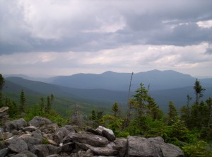
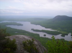
A view from the side of Moody Mountain

Given the time, it’s not surprising that it takes a few hours for anyone else to show up. By the end of the day I share the shelter with three other people: Laserchuck (apparently it’s a sailing term, not associated with speediness) doing a northbound thru-hike, Sunday going southbound (I apparently just crossed his path back in Monson when he was laid up for a week due to injury), and a guy on his second day out doing a section hike north. Since it’s so early and I’ve got a little extra food due to the Andover layover, I cook and eat two dinners tonight.

Just as I’m heading to sleep, Sunday asks if he can have a match to light a cigar, and he and the guy whose name I don’t remember each smoke a cigar before going to sleep. It’s strange, but I’ve seen a fair number of hikers smoking on the trail; I wouldn’t have expected it given that smoking’s not particularly good for your lungs. There’s certainly much talk on the trail of stops at pubs and breweries in towns along the way; I recall once seeing wine juice boxes that look like they’d be awesome at the end of a day, perhaps in a short stretch between towns (water’s heavy and all). The big difference there is that alcohol, in moderation, is good for you and not actively harmful, but smoking, in any quantity, isn’t. Even weirder, I’ve seen a hiker or two rolling weed joints at the end of the day, which makes even less sense than a cigar, so I suppose it could be worse. (This was just after Monson, for what it’s worth; apparently he “resupplied” in Greenville, although how in the world you’d know where to find a resupply spot in a city you don’t know is beyond me. I really should have asked him when I had the chance — not to use said knowledge but rather just to know it for the pedagogical value, in the same way that when I enter a store with signs mentioning closed-circuit cameras I feel obligated to look and find them as if to scout out the best way to rob it. It’s all shades of this xkcd comic, really.)

I end the day, as I’ve nearly always (sans a night or two in hostels, to the best of my memory) done so far, reading a bit of the Bible I’ve carried with me. Typically I’ll read a few chapters before going to sleep; I started at the beginning of Romans and have been working my way forward from there (as of July 22 I’m in 2 Timothy, for what it’s worth). Sometimes, however, I’ll get sidetracked with something like Saul’s reign or something else; tonight it was the book of Ecclesiastes. (Yes, I did say “book” — it’s only eight or ten pages, not too long.) Having read it, I have to say it’s by far the weirdest passage in the Bible I’ve ever read. Anyone out there done any studying of it? I can’t imagine it’s possible to get too much out of it without having some sort of “guidebook” to help you through it and its content, to be honest.

July 4

(14.0; 264.5 total, 1909.5 to go; -1.0 from pace, -125.5 overall)

Whee! Fourth of July! Happy Independence Day!

I need to start writing these entries while I’m on the trail; it’s now (the 22nd) nearly three weeks since I actually finished this day, and things are starting to get hazy.

I get a relatively early and quick start out of the lean-to and head over to the next one, Frye Notch Lean-to, just over ten miles away. Along the way next to Wyman Pond I meet a sectionwise thru-hiker, Ol’ Graceful. He says he’s on his seventeenth year of section hiking and will complete the full thru-hike with this section. To be honest, I find this achievement in many ways more impressive than a one-shot thru-hike like I’m doing; consistently committing time every year for that long to doing sections is something I can’t imagine I’d be willing to do, to be honest. There are too many other things I’d want to do (cross-country bike trip, I’m looking at you!) for me to be likely to continue doing it year after year like that. There’s also the conditioning: getting in shape again every time you start has to make the hike far less fun than it would otherwise be.

I stop for lunch at Frye Notch as a couple is sitting there doing the same, heading north on a day hike. They say the climb ahead up Baldpate Mountain is fairly intense; at this point, as a thru-hiker, I’m not sure whether to believe them or not. Unfortunately, all my sources of information are suspect at this point. Northbounders are in far better shape than me, so their analysis doesn’t apply. Day hikers are an entirely different breed from backpackers. Section hikers are closest, but there aren’t that many of them out on the trail. I leave a nice 4th of July note in the register and encourage other hikers to read the Federalist Papers as I’ve slowly been doing along the trail. (I also mentioned that I’d be dropping my copy off somewhere along the trail when I finished it, but as it turns out I only just finished them before my thru-hike experience ended, so nobody else got to read my copy.)

As it turns out, the 3.5 miles to the next lean-to over the mountain are initially easy going, temporarily very difficult (right up a sheer rocky slope), a reasonable stroll down and over to the second of the mountain’s peaks, and another steep descent to the lean-to. Since it’s the 4th I consider making the shelter, packing up a few things, and heading back to the top of the second peak (1.6 miles round trip) to try to catch fireworks, but unfortunately the peak is wooded, and three miles to get to the top of the first, clear summit and back (in the dark!) is too far, so I stop.

Tonight’s shelter is where I finally meet Spanky, he of the long shelter register entries accompanied with Bible verses (Sunday referred to him as “preacher-man” once), website, and a fairly relaxed pace. Spanky did a southbound trek in ’02 as well (his home is near Springer, hence the direction), and he says he’s doing the hike and then living out the rest of his life with his wife. He’d get along with my mom well, because he talks quite a bit. (I’m not much of a conversationalist, but I’ll talk when there are other people around or they try to draw me into discussion, generally.) We see a snowshoe hare run across the clearing in front of the lean-to; I lust for a gun, a license, and hunting season. It appears it’ll just be the two of us for awhile, but eventually four or five northbounders walk in from Carlo Col, 16.5 miles south and just before the NH-ME border, and we share the shelter with them. One’s British and mentions having made an entry in the next shelter’s register noting “Happy Insurgency Day”, which I find moderately amusing.

July 5

(11.5; 276.0 total, 1898.0 to go; -3.5 from pace, -129.0 overall)

Today is the day that I finally meet that most vaunted adversary along the Appalachian Trail, Mahoosuc Notch. Some thru-hikers describe it as the most difficult mile on the entire trail; I have customarily reserved judgment and set no expectations regarding it.

Today is the first day of the trail where I’m not in Maine ATC land any more. Once I pass Maine 26, I enter AMC land. The Appalachian Mountain Club is old — older than the Appalachian Trail itself — and is probably most closely associated with the White Mountains. Today also marks the start of an abomination upon the trail: fee sites. The AMC is a non-profit organization, but frankly, from the way they operate, it’s not obvious. Most sites in the area of the trail they maintain have an overnight use fee of $8; even worse, camping is prohibited within a quarter mile of all such sites (to preserve the land, which is probably accurate but is a stunningly convenient excuse), and they require non-site camping to be off the trail by 200 feet, so you can’t just hike until you find a nice place to stop, generally.
A view from Old Speck Mountain toward the depression where Speck Pond lies
A view from Old Speck Mountain toward the depression where Speck Pond lies; Speck Pond is the highest body of water in Maine

The hike up to Speck Pond Shelter goes over a mountain to Speck Pond, the highest body of water in Maine. I pass two thru-hikers named Pickle and Garlic while doing so, one of whom has apparently just completed a Triple Crown due to having sectioned in Maine previously. The Triple Crown of hiking is the Appalachian Trail, the Pacific Crest Trail, and the Continental Divide Trail; if you think just the AT is insane, well, there are gradations of insanity. 🙂

I arrive in Speck Pond to catch up to Spanky, who says he’s stopping for the day. I’m still aiming to finish the Notch and get to the shelter on the other side of it, so I continue on. I’m starting to run low on trail snacks now, which isn’t good; I have plenty for meals, but a hiker can’t survive on just meals unless he’s willing to make very long breaks to cook meals on the trail — not good for hiking pace. Spanky gives me some of the food he’s carrying; it’s not trail food, but it’ll help, and oatmeal can be trail food in a pinch.
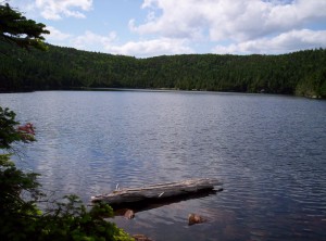
Speck Pond
Speck Pond; the entire place feels more than a bit surreal, given that you're at such a high elevation
A view toward what I believe is the Notch prior to descending from Speck Pond

First, however, I have to hike down from Speck Pond to the bottom of the Notch; that hike goes slowly, as all descents do, and I finally decide that when I reach Gorham I’m going to get a set of hiking poles (really could have used them through Maine, but a bit late for that now). Finally, I reach the Notch.
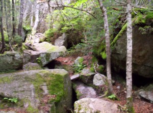
The start of Mahoosuc Notch, which is basically a scramble among rocks ranging from car-sized to house-sized with little actual ground in sight

Mahoosuc Notch is about a mile of ravine traveling over, under, and around house-sized boulders. It’s sheltered from the elements and contains scattered patches of ice/snow year-round, and the temperature’s easily twenty degrees lower than elsewhere. My pace slows quite a bit, and I have to plan my footing and route much, much more carefully than I usually do. I can see why they call it the most difficult mile, but frankly, after going through it, I don’t understand that sentiment. The only proper way to approach this is to budget a few hours and to look at it as rock-hopping through a giant’s playground; it’s absolutely a blast if you don’t care how little progress you’re actually making. Of all the miles of trail I’ve hiked, both on and off the Appalachian Trail (which at this point are of comparable magnitude, although probably not equal), this mile is by far the best mile of trail I’ve ever hiked. If you’re ever up in this area, give yourself a day to do it and hike through Mahoosuc Notch; you’ll be glad you did.
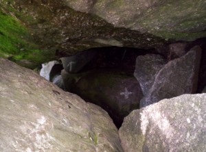
Yes, the trail does go under the boulders sometimes, following the usual white blazes (which through here are arrows rather than stripes of paint)
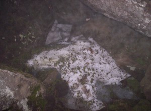
A patch of snow in the Notch
The Notch is very cool year-round, although winter must be worse than summer. I tried to make a snowball, but truth be told it's more ice than snow.

The Notch progresses slowly. Spanky apparently decided to move on, and he catches up to me perhaps halfway through the Notch. We pass by a dead moose carcass, which the AMC has chosen to leave there to let it decay naturally. It’s a very powerful odor, and between that and my route-finding skills taking me a bit away from it I end up not taking a picture of it.

Eventually, after many false finishes, we exit the Notch. It’s pretty late at this point — at least 7 or so — and there’s still a mile and a half to Full Goose Shelter. Spanky’s headlight broke in the 100-Mile Wilderness, and it’s only dusky, so I let him borrow mine as I carefully and slowly step up Fulling Mill Mountain.

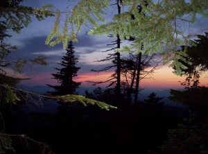
A sunset from the side of Fulling Mountain

We reach the top just as it gets dark, and as we only have one working light (and an underpowered one at that for night-hiking) between us, we stop atop the mountain for the night. I pull out a meal and eat; the stars are awesome tonight. Spanky raves about how he wanted to sleep atop a mountain in Maine and finally got the chance on his last night in Maine. We’re 5.4 miles from the border now, and I can’t wait to see the back side of Maine!

July 6

(15.0; 291.0 total, 1883.0 to go; 0.0 from pace, -129.0 overall)

I wake up around 6:30 or so to sunlight and dew; conveniently I’d put my sleeping bag inside my tent, used bivy-style on the rocks atop the mountain, so it’s not very wet. Sunlight dries things pretty well atop the rocks on the mountain, and I eat oatmeal for breakfast. A few northbounders — Topo, Cookie, and Kirby are the names I remember — pass us pretty early. Topo asks how many packets I eat a day; I’m currently at around two, and she says she and her companions are up to five now.

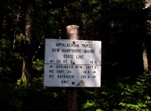
The morning progresses at about an average pace over a couple mountains. The trail to the top of one is pretty amusing, because, standing atop the highest point, I can clearly see the trail making a 30-degree bend to reach it — no taking the shortest path between two points around here! Trail snacks are now almost entirely depleted, and after passing the state line (NEW HAMPSHIRE!) I have to stop and cook a dinner for energy.
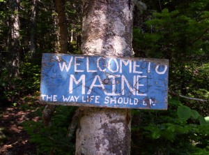
The sign welcoming thru-hikers to Maine, which reads "WELCOME TO MAINE: THE WAY LIFE SHOULD BE"
The sign welcoming thru-hikers to Maine; for northbounders it's their last state line, for southbounders merely the first (and the hardest)
A very utilitarian sign welcoming southbounders to New Hampshire
Second state!

Another five miles down and I reach Gentian Pond Campsite, closely followed by a southbounder named Moose. He’s hiking with a girl named Duckie who apparently also attends or attended MIT (or maybe just lived in Boston? memory hazy), but she doesn’t catch up by the time I get there, and given my snack situation I want as short a trip into Gorham the next day as possible, so I continue on another 4.9 miles to Trident Col Tentsite after being given an energy bar by a hiker in the shelter. It’s a good thing, too — at this point I’m down to eating powdered hot chocolate dry for the energy. I leave Gentian at 19:30 or so, and it takes me until 22:30 to get to Trident, the last two hours of it in darkness save for my flashlight at a snail’s pace. Thankfully the blazes are pretty thick, so it’s not too hard to follow the path (although I do stumble about twenty feet down the trail to the tentsite without noticing until I look up to see a blue blaze rather than a white one). I make and eat dinner and fall asleep quickly, hoping to wake up and get into Gorham early.

July 7

(6.9; 297.9 total, 1876.1 to go; -8.1 from pace, -137.1 overall)

My plan to wake up early fails miserably, but at least I’m not sleepy. I eat a breakfast and a dinner as preparation for the walk in, still mostly snackless save for some hot chocolate packets, and hit the trail at 10:30.

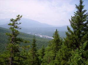
A view from on high toward Gorham, my next big stopping point

I make reasonable progress down the trail and don’t hurt too much until the last few miles, when I’ve depleted my energy from breakfast and hot chocolate. The last miles really drag, and it’s a relief to finally hit US 2. My target for the day is White Birches Campground a mile and a half towards Gorham, which has a hiker bunkroom and some ability to shuttle into Gorham. I start walking, thinking to look for a reasonable place to sit and put out the thumb, when a white van stops and picks me up. Turns out the guy lives at the campground and drives hikers around a bit in his spare time. I get to the campground, drop my backpack inside, say hi to yet another hiking couple named Dan and Leah (from Texas or thereabouts, married since December, recent college graduates, were going to go as the Honeymooners but the name was taken and so just go by their real names), whose entries I’ve seen as I’ve hiked the trail, and get a shower. Once that’s completed, I get a ride in to a Shaw’s grocery store between Gorham and Berlin, where I pick up 1.75 quarts of mint chocolate chip ice cream. Ice cream containers have had horrible size deflation recently; I wanted a half gallon, but the only option for half gallons was Shaw’s ice cream, and they didn’t have mint chocolate chip, sadly. After eating that and reading several of the Federalist Papers, I order a pizza from Mr. Pizza in town, eat that, and head to sleep. The plan in the morning is to head into town, eat a breakfast at Welsh’s, hit up the library to write some updates, get hiking poles and fuel, and get groceries for the next leg of travel.

The biggest change going forward, now, is that unless I bivouac in non-site sites, I’m going to be paying camping fees when I stay at campsites. There are good reasons for the fees: they sometimes support a site caretaker, help defray the costs of dealing with human waste (privies aren’t all that cheap to operate in the middle of nowhere and often involve chartering a helicopter periodically), and advance other AMC goals. That said, nearly all the rest of the trail is free, so it comes as a bit of a slap in the face. Many thru-hikers are fairly antagonistic towards the AMC, and (speaking from outside AMC-land now) I can understand why, although I’ll probably talk more about that in the next update. Right now I’m in Hanover, NH (Dartmouth College land) heading into Vermont; I’m guessing my next stop with Internet access will be Rutland, but we’ll have to see, since I might not have time to take advantage of it.

On the topic of pictures, they’re still coming, but it’s a slow process. The problem is I have to upload them in bulk, usually, because individual pictures just takes too long. I’d prefer to self-host them as well, so no Flickr. Last, WordPress doesn’t seem to have a good way to use a picture already on the server within a post unless it’s previously been used by WordPress; I’d like to say “use this URL”, but I need the thumbnailing to save people some bandwidth (kinda, I’ve flouted that nicety in the last posts, but especially going forward now that I have the ability to take full-res images [more on that in the next update] it’s getting pretty size-heavy to do that). To top it off, uploading big huge files isn’t all that easy anyway; sometimes I don’t have an SFTP client to do it (the computers I’m using don’t always allow software installation), and the file size is too big for a CGI script to accept the upload. Expect pictures to come, but slowly. :-\
19.07.08

Stratton to Andover: switchback (n): a trail feature not found in Maine

Tags: , , , — Jeff @ 02:37

June 27

(7.3; 195.1 total, 1978.9 to go; -7.7 from pace, -89.9 overall)

The next morning I wake up, finish off the second pound of strawberries and apple juice I’d purchased yesterday, add some photos to the first trail journal post. Incidentally, the laptop the hostel has for our use is running Firefox 2; I download and run the install program for Firefox 3 (released to the masses during my time hiking, and with a world record to its name, no less!) to find — gasp! — that the laptop is running that marvel of stability, Windows ME, while Firefox 3 requires Windows 2000/XP or newer. No upgrade for this machine! :-\ No Unicode love for the Firefox 2 users, either.

I then hit the trail with The Honeymooners at around 9:30 or so. I immediately confirm a fact I’d suspected yesterday: I bought way too much food when I did my shopping on an empty stomach. Best of all, we’re starting to hit the more mountainous part of Maine, and my pace becomes abysmal. Today I’d planned to hike to Spaulding Mountain Lean-to, a distance of 13.5 miles. Instead, I reach the Crocker Cirque (fun fact: the word cwm is defined by the official Scrabble dictionary as “cirque”; it is actually not a “Scrabble word” for me, because I’ve seen it labeling one of the features in the map in Jon Krakauer’s Into Thin Air) tent site, a grand total of 7.3 miles up the trail, of which the last mile or so is a rocky downward scramble — the absolute worst thing possible for my making any sort of speed.

A view out across what I presume is Crocker Cirque

The silver lining of this overfull pack, however, is that I eat very well today: two apples, three tortillas with peanut butter and honey, and a lot of gorp (with M&Ms added, naturally), and that’s just on the trail. (I’d planned to eat the bagels and apples anyway since they’re heavy, but I did eat them a bit more hurriedly than I’d expected.) Dinner is a Knorr chicken meal to which I add real chicken! Apparently, in addition to tuna in a pouch, there also exists chicken in a pouch! The miracles shall never cease. Mine is a lightly-garlic-flavored breast, although I hear they also sell unflavored breasts (not in Stratton, it seems). It goes pretty well, all told, and I sleep sated, again on a tent platform with a rigged-up staking system for my not-freestanding tent.

June 28

(6.2; 201.3 total, 1972.7 to go; -8.8 from pace, -98.7 overall)

The next day goes, if anything, worse than the previous day. I start the day pretty late, eating the remaining apples I’d started with and a few of the bagels I’d brought (which actually contain a pretty hefty number of calories, a fact I’d not noticed before in normal life). I’m still carrying far too much.

The trail is relatively uneventful. I pass South Branch Carrabassett River, a “ford” but in reality a bit of rock-hopping followed by walking an uncertainly-anchored plank across a ten-foot stretch of water, around noon, finishing off the bag of dried fruit as trail mix that I’d started the previous day. (I picked it up from the hiker box at the hostel; it was amazing stuff but pretty heavy even after drying.)

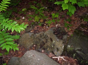
An unusual rock in the trail with numerous pocks in it that make me think of coral
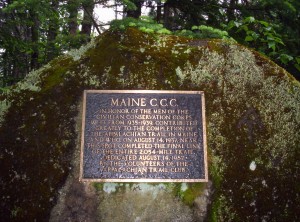
A plaque on a large rock along the trail recognizing the final constructed section of trail to make it a complete pathway
A plaque on a large rock along the trail recognizing the final constructed section of trail to make it a complete pathway; note, however, that the trail has had numerous reroutings since then to reduce walking along roads and to reduce trail erosion, so it's not necessarily as meaningful a milestone as it might sound

The day ends just short of six in the evening at my target for yesterday: Spaulding Mountain Lean-to. I note in the trail register that The Honeymooners did stay last night here, and I make a note in my entry warning hikers not to buy groceries on an empty stomach.

The lean-to is a full house tonight: a couple on a three-day trip, it being the weekend and all, and a bevy of northbounders (five, the most I’ve seen yet in the same place). The northbounders are Crazy Legs, Water Bear, Marathon, Strides, and one last person whose name I’ve sadly forgotten. Dinner tonight is another modern miracle: beef Knorr with dried beef slices (again from a pouch). The slices are, of course, heavily salted; the instructions on the label suggest running the slices under warm water for fifteen seconds to wash off excess sodium, which I don’t do, much to my chagrin: this stuff’s wicked salty, nearly to the point of not being readily edible. The northbounders remark on the quantity of food I have (with good reason!) and say the bear canister I’ve been using on the trail is superfluous, with bear lines or boxes at every shelter (and perhaps tent site as well? I don’t remember the exact wording) where you’d actually need them. Given my pack weight now, I’m inclined to agree with just about any suggestion that reduces its weight.

Some fun facts about some of the northbounders from late-night flab-chewing:

One of them is from the upper peninsula of Michigan near Marquette (I believe the exact town mentioned was Big Bay, but I’m not 100% sure). He worked for the National Park Service on Isle Royale several years ago doing wildlife surveys, among other things, and once while hiking with a partner saw three gray wolves approaching him. He called to his partner hiking fifty or so feet ahead of him, and when the partner turned they’d all scattered. Since this was a bit unnerving, they quickly continued on for another mile or so before stopping to regroup. Then, on a whim, they checked whether any of the wolves had been radio-tagged: turns out one of them had been, and furthermore, it was only thirty or so yards away and had followed them the entire time. According to him, this was at the time the closest incident to a wolf attack in NPS history (!).

Another of the northbounders (perhaps the same one, perhaps a different one, perhaps the one who would then quite aptly have been named Marathon) has so far logged three forty-mile days on the trail during his thru-hike. I doubt I’ve broken fifteen more than a handful of times, ever, so this is an almost-incomprehensible feat. We shall see what flatter trails do to what I consider achievable.

June 29

(10.4; 211.7 total, 1962.3 to go; -4.6 from pace, -103.3 overall)

I get a nice quick start this morning in 75 minutes from in sleeping bag to hiking down the trail; I’m pretty sure it’s my fastest start yet out of a shelter (out of a tent is naturally slower), but I haven’t been paying much attention so far.

The first few miles are across reasonably flat ground, and I make nice time — for a moment I become optimistic that I can do well for the day. The first real stop is Poplar Ridge Lean-to at eight miles out, occupied by a couple guys drying out tents and other gear. I talk for a second to them (one has the same Eureka Solitaire tent I have), and they mention an under-construction tent site (not listed in books yet, of course) a little further down the trail between mountains — they inadvertently stayed there the previous night to be awoken by a trail crew coming in to work on the second of three days installing a privy. I then continue down the trail a touch and stop to use the shelter privy before heading along further; it’s too early and too short to stop here for the night. I pass over Saddleback Junior and stop at what I think is the nascent tent site, although it’s not marked by the orange tape that had been mentioned as denoting it. There’s a large number of boot prints from the south which stop right at the place where I turn off, so I think I’m there, even if I can’t find the aforementioned half-built privy.

The site itself is pretty nice; it’s not too buggy, although I pull out my rain coat to reduce the need to ward them off, set up my tent in a nice cushioned spot, and start making dinner. While making dinner, I hear some loud grunting noises from the east by the trail — turns out it’s a porcupine about ten or fifteen yards away! I don’t know for sure it was one since it was dusky, but it looked a lot like one; since I’m in the middle of dinner preparation the last thing on my mind is taking a picture — I’d rather he leave me (and my smellable goodies) alone now.

June 30

(10.4; 222.1 total, 1951.9 to go; -4.6 from pace, -107.9 overall)

Often trail magic, as it’s called, comes in edible form, a fact which should not be surprising given just how much energy hikers require to move from place to place (particularly through places like Maine which are particularly hilly). Today, trail magic was not edible but rather white and stored on a roll. More on that in a bit…

It turns out I’d stopped short of the nascent campsite, which I pass a bit down the trail this morning. Nobody’s there, and the privy looks complete, so sadly I can’t celebrate its existence; it looks pretty awesome. The morning continues with a nice hike up The Horn, yet another mountain in Maine. Saddleback Mountain itself follows next, and it has good views all around.

The most interesting part of the early day, however, isn’t what’s listed in the Companion. Strangely, it’s also not on any of the Maine maps I’ve seen. It’s definitely mentioned in a lot of books, but my available guide resources have both inexplicably missed it. It is a feature, located between The Horns and Saddleback Mountain, known as Saddle Point:

Saddle Point, the trail landmark omitted from the Companion and Maine A.T. maps

I fully expect the ALDHA and the Maine ATC to rectify this serious omission from their literature at the earliest time possible.

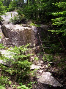
A thin (but sturdy) metal ladder over which the trail passed due to the steepness of the trail
A thin (but sturdy) metal ladder over which the trail passed due to the steepness of the trail; I don't remember whether I had to go down or up this ladder
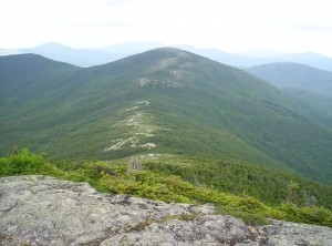
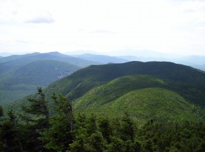
A view back toward The Horn, as best as I can remember; it's either that or toward Saddleback Mountain

Finally, I take the customary 360-degree video from the top of Saddleback Mountain:

360 degrees of Saddleback Mountain

I continue down the trail toward the next lean-to, Piazza Rock Lean-to. Along the way I pass a guy wearing bug netting trimming along the trail; turns out he’s the lean-to’s caretaker out for a bit of maintenance. Since I’m hoping to make it six miles further that day to Little Swift River Pond Campsite, I continue on.

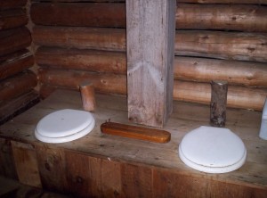
When I reach the lean-to, I decide to stop in to check when the Honeymooners passed through. Before doing so, I stop to use the privy. This privy has all the amenities:

A two-seater privy with a cribbage game while you do your business
How about a nice game of cribbage?

Incredibly, while using the privy, I run out of toilet paper. I’d resupplied with a small partial roll in Stratton, but somehow, due to a ridiculously (but not perilously, as I note in the shelter register) active bladder, my supply (intended to reach Gorham) is already depleted! The options aren’t good. I’m right near a road into Rangeley, so I could hitch in in the morning just to get toilet paper, which would eat up a good hour, and that’s if I get lucky. I could experiment and see just how well leaves work, but I’d rather not find that out until I’m forced to do so. I also have one last option: see if the caretaker has a phone I could borrow to call for some to be delivered by friendly people in the area (there’s a nearby place with five people willing to put up and party with hikers that would probably work). I head back to the trail to think about how to find the caretaker without walking back too far, but amazingly he comes around the corner at exactly that moment! I make my request, and he goes one further and outright gives me a roll! It’s an absolutely monster roll that’s at least three inches in radius before flattening, but I don’t care: it’s saved me a lot of trouble.

Reinvigorated from this unexpected bit of magic, I complete the remaining 1.8 miles to the road in 48 minutes, at the strong pace of 2.25 miles an hour. If I keep that up for the next 4.8 miles I can make my intended destination with a little time to spare. Naturally, the uphills start again and I fail to do so, but I do make it two miles further down and set up camp just off the trail and next to South Pond, so water’s readily available. Bugs are out but not too bad as I make dinner and go to sleep.

July 1

(11.8; 233.9 total, 1940.1 to go; -3.2 from pace, -111.1 overall)

I’d planned to wake up around 6:30, thinking to pack up and be out before anyone else can pass by. Since I’m two miles from a road (and shuttles from town wouldn’t arrive until far later) and four miles from the nearest shelter, I don’t really expect anyone until at least eight. It’s really strange, then, when someone walks by at 6:35 as I’m slowly thinking about getting up and says hi. You meet all kinds on the trail, I guess.

After breakfast and packing up I head further south. I don’t go far before I pass a treasure: a Maine map for the section of trail I’m hiking! The Maine topos are pretty awesome: profiles, notes on trail features passed along the way, and so on. I haven’t bought them because they’re expensive, and many thru-hikers have done fine with trail signs combined with the white blazes on trees and rocks along the way. This map is only good another few miles, but I’ll take what I can get. It’s probably the early hiker’s map, but if it isn’t, I’ve got a nice shiny map (and if it is, he’ll be happy to get it).

A few hundred yards later I stumble on an even better treasure: the map for the next section of trail. Again, it’s probably the early hiker’s map, but whatever: I have far-seeing guidance for a little while.

Later down the trail I meet another hiker heading north named Saxifrage (a thoroughly awesome name). After inquiring where he’s heading to make sure he’s not doubling back for maps (he’s not), he mentions that a guy up the trail, a Seth of the American Hiking Society, had asked him to look for the maps. I tell him I picked up the maps and will pass them along when I see Seth.

I eventually catch up to Seth at Sabbath Day Pond Lean-to, where I eat lunch and pass on the maps. He’s delighted and passes along contact info in case I need any trail magic in the D.C. area; we’ll see how I feel when I get there.

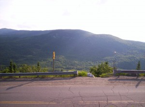
I’m hoping to head on to the next lean-to, Bemis Mountain Lean-to, so I hurry on, past an awfully large number of hikers — I think I pass around twenty total today (twelve or so from a camp group). Before getting to the lean-to I have a road crossing and a ford, not to mention the mountain itself. The road crossing is a definite candidate for best road-crossing view; I’ll post the picture when I have more time later here’s a picture out across the road showing how good it is:

The view's better looking off to the right just a little, but I didn't get a picture, or at least I didn't have space to keep it

The descent from crossing to ford is steep and takes a lot of time, so I decide to stop just after the ford and pitch the tent. This isn’t actually a good idea: the bugs are the worst they’ve been since the one site in the 100-Mile Wilderness, and I pull out the raincoat and forego a cooked dinner in favor of energy bars and call it a night.

July 2

(12.5; 246.4 total, 1927.6 to go; -2.5 from pace, -113.6 overall)

I get a late start in the morning; bugs are out again for breakfast, so I pack up quickly and don’t heat water for oatmeal. First stop is the lean-to I’d intended to hit the previous day, after a long hike over Bemis Mountain. I see I’m still behind the Honeymooners, and I discover that the two hikers with whom I’d hiked Katahdin oh-so-long-ago are now known as Asgask and Slowpoke. I sign the shelter register and include the birthday song in my entry, because it’s my birthday today! Happy birthday to me! (22, a pretty unremarkable number, but still a new age.)

Travel is fine until just before Old Blue Mountain at about ten miles in. I hope to go seven miles further to a shelter, but just then it starts to rain pretty hard, and even with a rain coat I’m completely soaked when I reach the top of the mountain. Since I’m just short of a road to Andover, I decide to stop there and hitch in to a hostel for the night — a birthday present, or something. The only problem is that the Companion says of the two roads into Andover that, “Neither road has much traffic.” I hurry as fast as I can and hope for the best.

I reach the road at 20:15, at which point it’s not yet dark but is starting to get there. One vehicle passes heading in the opposite direction as I descend the last few feet to the road; I then wait fifteen more minutes, during which time exactly two vehicles pass heading in the direction I want to go. Miraculously (and I mean that in the literal sense) the second vehicle offers me a ride, next to their two dogs in the back seat of their pickup truck. They take me nine miles into town, and I arrive at the Andover Guest House at 20:52. I say hi to the hostel owners, who tell me I probably want to head over to the store across the street to get something to eat — just before it closes in eight minutes. (See what I meant about miraculous? You can’t cut it any closer than that!) I get food and eat it while talking to family back home on the phone; when the conversation ends I check email and deal with a post here while laundry cycles, then I head to sleep.

The main theme of southern Maine is that it’s a lot of up and down. Northbounders are blowing past us, fresh from 2000 miles of hiking and the White Mountains as conditioning for the ups and downs (south of the Whites is actually considered pretty easy — the “hiker superhighway”, actually, where twenty-mile days are neither uncommon nor generally difficult if you get up early and keep a nice, long stride going), so their pace can be a bit depressing if you don’t take it in context. Right now I’m just anticipating Glencliff in New Hampshire, where, as I’ve been told by the two hikers at the lean-to just before Saddleback, the mountain climbing ends and the hiking starts.

03.07.08

Monson to Stratton: In Which the Waters Gradually Receded From the Earth

Tags: , , , — Jeff @ 02:47

June 20

(0.0; 114.5 total, 2059.5 to go; -15.0 from pace, -65.5 overall)

Today is my first “zero” day: a day where I don’t do any hiking down the trail. Excepting a very few crazies, everyone takes zero days every so often, to give the body time to regenerate and the morale time to be uplifted. There’s also a related type of day colloquially called a near-o day, in which you hike only a few miles and then fiddle around the rest of the day burning time rather than Roming great distances down the trail. (I’m pretty sure I misspelled a word or two in that last sentence, but I can’t be bothered to go back and fix the mistakes.)

The day starts off with an “all-you-can-eat” breakfast at Shaw’s. The A.T. Thru-Hikers’ Companion uses the abbreviation AYCE for such spots, since they tend to be popular with famished hikers. Breakfast starts at 7 and goes until around 8ish, so it’s really all-you-can-eat-while-the-grill-runs-and-you’re-waiting-in-line; I miss the memo about the start time and head down near the end of it, but I get a good helping of food, to be sure.

I first stop off at the Monson library for some Internet access, which I mostly spend catching up on web feeds, dealing with scads of incoming email, and doing a little work on the first series of reports. I notice a decision has been made in Boumediene v. Bush but sadly don’t have time to read it; I think I agree with the decision at its highest level, but I’m concerned about how its practical effects will actually fall out — concern that must be substanceless without reading the opinion or any of the dissents to learn details. (I listened to the oral arguments, but the details were arcane and too reliant on having read the associated briefs, quite different from the argument in, say, D.C. v. Heller.) Finally, I forget to purge pictures from my camera before the library closes, hence why my pictures are Katahdin to Stratton and not to Monson. (The next two places where I have access it isn’t a library and there’s no nanny, so I’m not nearly as rushed to get the pictures off. Hopefully I’ll be able to get a monster memory card in Gorham, just the other side of the New Hampshire border, so the problem of storage never manifests itself again.)

Next, I hit up the Monson General Store; the Companion says it offers “long-term resupply”, but that’s something of a lie: it’s more like “long-term resupply, but options are limited”. (Had I been around I could have joined a caravan to Greenville for shopping at real stores, but I didn’t happen to be at Shaw’s when it left.) In particular they don’t sell peanuts, M&Ms, or raisins in reasonable bulk, so I am trail mix-less for the next stretch of trail. I continue in the tradition of Knorr dinners and try to scrounge up a bunch of granola bars and such for breakfast and snacking; lunches are tortillas with peanut butter and honey. Also, tuna in a pouch is nothing short of miraculous when added to some of the Knorr dinners. Last, I visit the post office to pick up a box in which to put stuff I don’t need; that overheavy pack cannot be tolerated.

I sort of combine lunch and dinner into one by eating a BBQ pork sandwich from Spring Creek BBQ in town. There’s a pub down the street which I consider visiting but eventually decide to be cheap; I’m not sure that was a great decision, in retrospect. The rest of the ice cream from yesterday tops off the day.

That done, I proceed to packing. Among the things I drop are a third set of hiking clothes (leaving two sets, one of which is for use after I shower in towns I visit, plus fleece pants and sweater for cold-weather use), bowl and cup (titanium conducts heat extremely quickly — you can drink boiling water straight from the pot with a little care, so the cup is superfluous) and an extra spoon, and a pack towel intended for use in towns. I’ve probably forgotten a thing or two, but that’s about the gist of it, all total about four pounds dropt. Food packs up easily enough too, and newly-clean clothing rounds things out. On the porch other thru-hikers are fashioning alcohol stoves from pop cans for the first time; they’re welcome to it, but I’ll take known-working options over untested options when doing a thru-hike.

It continues intermittently raining today while I’m going through town today, raising fears about fords and rivers down the trail. The immediate next fords are of the Piscataquis River, and a bit later is the Kennebec. The latter is billed as “the most formidable unbridged water-crossing on the Appalachian Trail” by the Companion, which ominously notes a thru-hiker drowned in 1985 trying to ford it. The current ferry service started the next year as I understand it; it’s basically a guy with a canoe and some life jackets, with set hours of operation depending on time of year. Anyway, the water’s so high on the Kennebec the ferry isn’t even running, which could be interesting later down the trail.

Coincidentally, I happen to be sitting in the lounge watching a game show run out of some guy’s cab (the “Cash Cab”), and one of the questions he asks some passenger-contestants is, “In which state can you go rafting on the Kennebec and Kennebunk Rivers?”

I share the hostel itself for the night with numerous other people: one guy admitted to Harvard but deferring for a year to hike the trail and do other stuff, along with a cousin from Britain; a couple who go by the trail name The Honeymooners (just got married a month ago); Dan, who has now adopted the trail name “Two-Liter” for his habit of using two-liter pop bottles to transport water on the trail; Casey, with whom I shared the Newhall lean-to several nights back; and two others just arriving that day. Speaking of trail names, I adopt one myself: Mercury, from the winged appearance of my boots when I wear socks encased in grocery bags within the boots in an attempt to dry them. (I’d previously half-heartedly used Waldo, but that didn’t seem very trail-namey as it wasn’t acquired on the trail itself.)

June 21

(22.0, really 9.9; 136.5 total, 2037.5 to go; +7.0 from pace, -58.5 overall)

A motley crew of hikers heading out of Monson
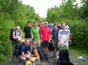
The group that headed out of Monson with me; from left to right we have Jessica and Andrew (the Honeymooners), Colin and his cousin (can't for the life of me remember his name, and I might have mixed them up), Lucky, 2-Liter, Smoothie, and Mercury (me)

The Piscataquis is unfordable, so we “yellow-blaze” just past the last ford of it, shaving 12.1 miles off the trail. Since it’s a weather-related shave I feel no guilt, although some will doubtless wait it out as purists. The mud returns, along with a spat of rain, and we hike over a small mountain and into the lean-to ridiculously early in the day. By my watch the ten miles of hiking take five hours, so I sustain a two-mile-an-hour pace — madness! My first fuel canister finally runs out on dinner; I started with two 15.9oz canisters (one full, one full minus some small number of meals) not knowing how far they’d go, and I’ve been amazed to see how long it took to empty just one. We share Bald Mountain Brook Lean-to with essentially the same people from the hostel in Monson, minus Two-Liter and Lucky (who stayed at a different spot in town), who decide to take it easy since the Kennebec ferry’s out anyway. Discussions about the right to bear arms, habeas, Iraq, and other such fun topics fill out the night — the Brit provides a unique perspective on the former, which to a large extent doesn’t exist in Britain.

June 22

(14.7; 151.2 total, 2022.8 to go; -0.3 from pace, -58.8 overall)

Today’s a long but pretty easy day, past a Moxie Pond and over a mountain but otherwise fairly easy, if long. The others get out earlier than I do, planning to meet up at a takeout place with milk shakes in Caratunk. I go slower and end up arriving at U.S. 201 after 6, when the place closes; I head west intending to stay at a hostel listed in the Companion, but as it turns out, the place is closed. Perhaps I should have checked the errata before leaving Monson. A mile further up the road (two total) is Northern Outdoors Campground, so I grab a tent cabin (tarp on a stereotypical house skeleton, with a light, a screened door, and four beds with mattresses inside) there and eat a dinner at the accompanying brewpub — a BBQ burger with a pint of their home-brewed “Class V Stout”, which the table placard describes as their version of an English stout. I try that because it sounds essentially like a Guinness, and Guinness is good. It is, but the final verdict is that it’s not a Guinness.

June 23

(0.0; 151.2 total, 2022.8 to go; -15.0 from pace, -73.8 overall)

After a breakfast from my trail supplies, I head up to the brewpub to refill water bottles, access the Internet (mostly epic fail since their computer doesn’t allow USB hookups, so I can’t dump pictures), and inquire about a shuttle back to the trail. Turns out the time to ask for the shuttle was the previous night, but at two miles it’s not worth the hassle of seeing if they’re in a good mood, so I start walking. I arrive at the ferry point, 0.4 miles up the trail, at around 10:30 to find the ferryman there waiting to direct people accordingly. Ferry’s still out, but wonder of wonders, it’s set to resume the next day, so I decide to take an unplanned zero and wait it out. I hear a few horrendous stories about mad efforts to not wait — a $220 taxi fee for eight hikers, a river rafting trip for two others, the Honeymooners who exploit a local connection somehow to go around the river — and decide waiting is an easy choice.

I could head back to the campground, but I don’t have a good reason to spend the money to stay there when I have a tent that’ll work fine in the current nice weather, so I hike back up the trail half a mile to get out of the no-camping zone and set up. I do some reading (the famous Federalist Paper No. 10, accompanied by an unending mental chorus of, “but, but, parties!”) and sleeping, cook a trail dinner, and sleep.

June 24

(14.0; 165.2 total, 2008.8 to go; -1.0 from pace, -74.8 overall)

I wake up late in the morning since the ferry doesn’t start until 9, passed by Two-Liter (post office-bound to get a mail drop, then to the ferry) and Lucky (ferry-bound) as I pack up; their leisurely pace gets them to the Kennebec right on time. I arrive right at 9 to see the first crossing underway, with Lucky and the aspiring women’s record-setting trail hiker (to hike the entire trail — was averaging around 44 [!] miles a day last I heard) as passengers. An hour, a life jacket, a release form later, and I’m across the beast. Even now the water’s still pretty high — I have no idea how you’d actually ford sans ferry. The claim is you can do it by wrapping your pack in an inflated sleeping pad and floating/swimming it across, but that just seems like insanity of the first degree.

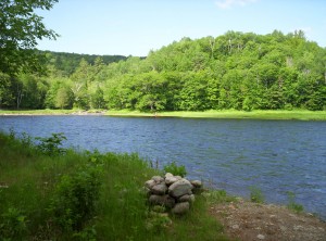
A view across the Kennebec River, the largest unbridged water crossing on the A.T.
A minor water crossing a mile or so south of the Kennebec across three logs suspended in the air; two serve as handholds while a hiker walks across the third
A minor water crossing a mile or so south of the Kennebec across three logs suspended in the air; it's not exactly walk-in-the-park quality, but it's sturdy and perfectly functional

Hiking’s easy; I stop for lunch at the first lean-to after the crossing, but it’s too early in the day for a stop at only four miles. I instead continue another ten to West Carry Pond Lean-to, around a few lakes along the way, chased by something buzzy (fly? bee?) around one of them. I share the lean-to with Jukebox, a fellow southbounder, whose planned pace is 8 miles a day (for now, ramping up in later sections of trail) but who is doing much better in practice. He’s got a fire going, which I use to try to dry out my boots (they’re far enough back to prevent burning or melting that I’m not sure it does much).

June 25

(14.6; 179.8 total, 1994.2 to go; -0.4 from pace, -75.2 overall)

Jukebox is up and out early; I follow shortly thereafter. Today’s big feature is Bigelow Mountain near the end of the day. I notice while hiking today that my legs don’t really hurt, even very late in the day — I’m at the point where I’ve been out long enough that things stop aching to a large extent. You can imagine this happening when you’re on a week-long trip, but you never quite hit it in that little time. The ups and downs agitate the knees, ankles, feet, and perhaps a tight calf muscle or two, but otherwise the legs, hips, etc. are all in spiffy shape.

Hiking goes fine, but it’s getting late in the day when I top the first of two peaks of Bigelow. The lean-to I want to hit is past the second peak, and it’s late, and there’s Avery Memorial Campsite between the two peaks, so I call it a day there after filling up at a slow-dripping spring just before the site. This is high-elevation camping in fragile areas, so my only option is a tent platform, which doesn’t work well with a non-freestanding tent but which can be made to work, given enough effort — so I do. Dinner and sleep follow quickly.

June 26

(8.0; 187.8 total, 1986.2 to go; -7.0 from pace, -82.2 overall)

I’m up pretty late today, and not hitting the lean-to yesterday makes me decide to stop in Stratton just down the trail a bit for the night, rather than just for food as I’d intended. Since I don’t have a cell phone and Stratton is five miles away, this is my first true hitch into a town, after about twenty minutes of waiting (about average from what I hear). I get in, take a shower, buy food plus a half gallon of apple juice, two pounds of strawberries, a can of pineapple, six or so apples, and two cartons of yogurt for food while I’m in town, and unwind. The Honeymooners and Jukebox are also here for the night as well, and Jukebox is here a further day beyond that (at least). While Batman Begins plays in the background on the TV, I pack up my food, offload pictures from the camera, make some posts here, and then go to sleep for the night.

This section of trail was pretty quick and easy: nothing too big in terms of elevation, not too much food to carry, and the miles just flew by. Things get more interesting in the next section of trail. Pictures are still forthcoming on parts of the last update; it takes some effort on my part to get them into place, sadly. As before, I’ll notify here when I complete that work.

27.06.08

Katahdin to Monson or: How I Learned to Stop Worrying and Love the Water

Tags: , , , — Jeff @ 03:12

June 7

Today’s move-out day at MIT for graduating seniors, so I’m busy packing my stuff and deciding what should go with me on the trail. Everything else is getting shoved in the van the family brought up here, to be taken home and not touched quite possibly until I’m ready to get it in November, when I plan my thru-hike should end. I do that, see off the family, visit a graduation party, travel to REI for a few last-minute purchases, buy food for the first leg of the trip, do a last walk through the institvte, and hit the sack.

Today I make my first mistake, although I don’t know it at the time: I decide what to take without consulting a scale. I don’t yet know how bad this is, but all shall be revealed later.

June 8

I sleep a little later than I’d intended and don’t end up having time to make the bus I’d planned to make, but no worries: there’s another bus later in the day. I pack up everything, eat a few last bits of food I have lying around, and head to South Station for a bus to Medway, ME. Katahdin lies in Baxter State Park, and compared to much of the trail it’s a royal pain to deal with — you have to make reservations for sites, and it’s 17 or so miles from the nearest town of Millinocket.

The bus ride, which first goes to Bangor, ME and then transfers to a different bus from there to Medway, is uneventful. I spend the time sleeping and reading from the Federalist Papers (my only reading material on the trail save for a Bible). My plan at Medway is to call a taxi to go to a campground just past Millinocket, but Paul from the Appalachian Trail Lodge is there to give a ride and overnight shelter to two other hikers. That plus breakfast and a ride into Baxter is $70, which might seem steep but from what I’ve since heard is reasonably competitive. Convenience wins out, and I spend the night at the A.T. Lodge after getting a bowl of French onion soup at the associated restaurant. (Good soup, recommended if you’re there and it’s still around — apparently the stuff takes forever and a day to make, so its being around that late at night was fortuitous.)

June 9

(5.2; 5.2 total, 2168.8 to go; -9.8 from pace, -9.8 overall)

Rejoice! First day of hiking! After breakfast and a shuttle into the park, I hit the trail along with Toby and Eric, recent Penn State graduates. (I get the impression many if not most south-bounders right now are grads, to be honest.) We go up and down the mountain using daypacks borrowed from the ranger’s station (as do most thru-hikers); some crazies hike with a full pack, but nobody really recommends doing so, and the terrain involves enough bouldering it’s kind of insane.

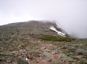
A fog-shrouded view of part of the trail up Katahdin, Eric and Toby in the distance

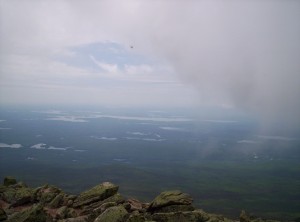
The views from the top are pretty awesome, taken within minutes of each other:

The view from Katahdin when fog surrounds the peak
The view from Katahdin when it's clear, minutes later

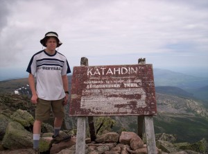
And here I am next to the sign at the top:

The obligatory stand-next-to-the-sign picture

Last, take a look at this brief 360-degree movie from atop Katahdin:

360 degrees atop Katahdin

Once the summit is achieved, I return, set up camp, eat dinner, and sleep.

(Explanation of the secondary header here: (5.2; 5.2 total, 2168.8 to go; -9.8 from pace, -9.8 overall). 5.2 indicates I traveled 5.2 miles on the trail; 5.2 total indicates I’ve gone 5.2 miles from the northern terminus of the AT on the summit of Katahdin; 2168.8 to go is how many miles until the southern terminus on Springer Mountain; -9.8 from pace is how I did compared to the 15 mile per day pace I need to average, more or less, over the trail to complete it by November; -9.8 overall is how much further I’d need to be to be on that desired pace. All numbers are from the 2007 A.T. Thru-Hikers’ Companion, which is basically the same as the 2008 edition and the actual numbers when I hike the sections over the next several months. For the initial stages the pace is kind of a joke — terrain and condition coming in dictate that pretty much nobody’s consistently doing that sort of mileage for awhile. I’ll probably make it up further down the trail, and if not, there’s a little slack for start of November anyway — no worries yet.)

June 10

(0.0; 5.2 total, 2168.8 to go; -15.0 from pace, -24.8 overall)

My initial plan was to hike six miles to Katahdin Stream Campground in Baxter from the entrance yesterday, summit Katahdin today, and continue tomorrow, so I have an extra night of reservation to burn here. Since I fell a touch weird on an ankle yesterday on a descent, I decide to take it easy a day and do a day hike to Daicey Pond and back, 4.8 miles round-trip down the A.T. using a borrowed daypack again. On the way back I catch a moose in one of the lakes and get a picture, but my camera has very little storage space and it got punted later for other pictures. That and dinner make it a day.

June 11

(13.4; 18.6 total, 2155.4 to go; -1.6 from pace, -26.4 overall)

After breakfast, weighing my pack on the scale at the ranger station (58 pounds, sans three liters of water and one Nalgene — this is at least 10-15 pounds more than it should be now!), and filling those three bottles and adding iodine to purify them after time, I hit the trail. The going’s easy, but I hit the first river crossing, see a high-water trail, and take that instead — I’m off the trail and it’s only the second day of hiking! That trail leads me through a portion of the river that’s only about knee-deep — I switch shoes, make the crossing, and continue.

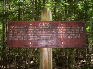
Near the end of the day I hit the park boundary, after which most campsites are once again free. A little down the road and I enter the 100 Mile Wilderness:

It is 100 miles south to the nearest town at Monson.  There are no places to obtain supplies or help until Monson.  Do not attempt this section unless you have a minimum of 10 days supplies and are fully equipped.  This is the longest wilderness section of the entire A.T. and its difficulty should not be underestimated.  Good hiking!  MATC
The 'Be Afraid' sign at the start of the 100-Mile Wilderness heading south, placed by the Maine Appalachian Trail Club

This stretch of trail is the longest stretch not passing by cities or well-used roads, or something like that. It’s supposed to be scary and all, but it’s really not that wilderness-y, actually — it’s just long and early (for us south-bounders; most hikers do the other way and have this when they’re already in good shape).

A few miles in I hit the first shelter (lean-to, in local parlance): Hurd Brook Lean-to. I end up sharing the place with three other hikers: another college grad named Dan, a chauffeur whose trail name is Lucky, and A.T. “Almost There” Dave.

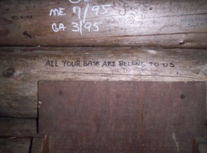
Carving or writing things in lean-tos may be highly frowned upon, but of course that doesn’t stop people from doing it. This lean-to happens to have the following carved into it::

All your base are belong to us

June 12

(11.5; 30.1 total, 2143.9 to go; -3.5 from pace, -29.9 overall)

I take my time getting up and out this morning, or maybe I don’t: I seem to have trouble getting up and out quickly in mornings. It doesn’t help that for this first part, I’m eating oatmeal for breakfast, and heating the water to make it is time-consuming. The hike today goes up and over a small mountain (hill, really, it’s only up at 1517 feet):

The view from atop the small mountain, back toward Katahdin

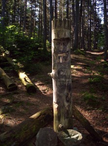
It then meanders next to a lake. I see a duck in the water but can’t get a camera out before it’s gone, and I think I scare a moose away when I’m hiking (big crashing noises heading away from me). The day goes slowly, and I get into Rainbow Stream Lean-to kind of late, sharing it with the same set of people. Out comes the raincoat to ward off bugs (June is black fly season in Maine, but for the most part it’s the mosquitoes that are the killers right now). This lean-to has a funky totem pole outside it:

A small totem pole
A small totem pole

June 13

(13.9; 44.0 total, 2130.0 to go; -1.1 from pace, -31.0 overall)

The day goes pretty well; I make Wadleigh Stream Lean-to, 8.1 miles up the trail, and decide it’s not far enough, so I head on to a campsite 5.8 miles further up. Along the way I encounter my first stretch of trail that’s underwater — it’s along a lake, and the water’s higher at this time of year. I cut a trail along the shore to avoid the water. About this time the mosquitoes descend in force, and I practically run the next several miles into Nahmakanta Stream Campsite (passing by the first northbounder I’ve seen, although I only learn this from reports of others), where I drop the pack, pace for a minute, grab the raincoat and don it, set up the tent and huddle inside it for an hour to wait for the bugs to go away. They do, I set up a little more and secure smellables from wandering rodents, and go to sleep. Lucky’s the only other person in the site; Dan stayed at the previous lean-to, and Dave pushed on a little further.

Another view back to Katahdin from above a beautiful lake

June 14

(7.8; 51.8 total, 2122.2 to go; -7.2 from pace, -38.2 overall)

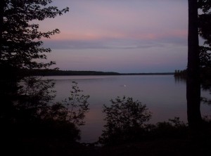
Today I encounter the first civilization in the middle of the “wilderness”: White House Landing. Take a side trail off the AT and you hit a lake; blow an airhorn and Bill Ware jumps in a motorboat, runs over and picks you up, and takes you across to the Ware house (pun intended). Nearly anything you could want except long-term resupply is available here, but it’s not necessarily cheap — AT Dave and Lucky are both here, and Dave says he spent over $150 for a two-night stay. (Dan apparently stayed the night and showed up after I left.) I settle for what the Companion calls “Linda’s famous one-pound burger”, a cold pop, and some matches, which come to $13.60 total — a very reasonable price if you ask me, all things considered. I head back over after lunch and continue to Antlers Campsite to get some reasonable mileage and avoid paying for lodging at White House Landing. Bugs are a little annoying for dinner, but I have a nice night with the tent fly rolled back on my full-length mesh tent.

A pink-and-purple cloudset across the lake from Antlers Campsite

June 15

(16.0; 67.8 total, 2106.2 to go; +1.0 from pace, -37.2 overall)

Whee! First day in the black! (Am I the only person who never remembers whether red or black is good?)

First landmark today is Jo-Mary Road. If you set it up, you can get people to securely store your pre-packaged-up food along the road for you to pick up when you’re here. I stop for water and a snack break, staying long enough to see Lucky, AT Dave, and Dan at the same time. I’m also passed by a couple, Andrew and Jessica, married barely a month ago, who go by the name of The Honeymooners. When I get going again, I pass by Cooper Brook Falls Lean-to; I stop for another snack as it starts to rain; the shelter’s pretty full. It’s getting pretty late in the day when the couple peels off for an unofficial trailside tent site. I know I’m just short of East Branch Pleasant River (supposedly the first ford of the hike according to the Companion, but I barely have to get one boot wet), and just beyond that’s East Branch Lean-to, so I press on. Lucky’s there, and AT Dave and Dan show up after me.

Man, it feels good to have hiked better than my intended pace.

June 16

(10.8; 78.6 total, 2095.4 to go; -4.2 from pace, -41.4 overall)

The big attraction of the day is White Cap Mountain at 3650 feet. True to its name, the spectacular view from the top extends about 100 feet in front of me. The trail up is wicked steep; not much in the way of switchbacks at all. On the way down I encounter one tree that’s across the trail at just the right height to make it impossible to go over or under it; it’s the sort of thing I’d expect trail maintenance people to have removed. To add insult to injury, the other side has a white blaze on it (the trail’s marked with stripes of white paint, 2.5″x5.5″ or so, well enough that many thru-hikers don’t even carry maps; it’s really odd not carrying a map as I’ve chosen to do, because practically every “ten essentials” list includes maps of the area), almost as though they wanted to rub it in our faces. Better yet, it starts to rain, and I stumble into Carl A Newhall Lean-to half-soaked.

Here’s where it gets really fun, because the shelter’s full. There’s space for a tent, but I’m in no mood to set up a tent. As it happens, some amazing people backpacking with their dog (bowl and all) decide to de-shelter and use their tent, so I get a dry place to sleep and avoid needing the tent! Two further hikers who arrive after me also cram in, and we’ve got a cozy night all around. Since then I’ve slept in and out of lean-tos, but I’ve never minded so much one way or another as I did that night.

June 17

(11.9; 90.5 total, 2083.5 to go; -3.1 from pace, -44.5 overall)

We have our first real ford today, across the West Branch Pleasant River. There’s a ranger (or at least uniformed person) there, and I catch up to Dan just at the ford. It’s maybe mid-calf deep or so, and it’s mostly pretty simple.

Continuing on, we go up Chairback Mountain. I feel pretty good, so I pull out the stove and eat a dinner (something teriyaki-flavored, noodles maybe, with a package of tuna) even tho there’s more hike to do. I think I’m at the top of the mountain, but it’s really probably the “seat”; after dinner I have a nice stretch of bouldering, after which I hit a lean-to. There’s space, but I feel like pushing on to the next one — a mistake. It’s late but not dark, and I really should be stopping now, but I don’t.

Hiking goes okay, and I pull out a headlight when it gets too dark to see well. Problem is there’s fog out, so it’s not the greatest thing for visibility. I stop atop one of the mountains and even get in a sleeping bag, but eventually I’m convinced it’s too exposed (and a smattering of raindrops on my exposed bag help too), so I pack up and move on. Eventually I see a decent spot and set up my tent in the rain; it’s now nearly midnight, as I recall.

Today’s mileage is an educated guess, but it’s the best there is.

June 18

(8.9; 99.4 total, 2074.6 to go; -6.1 from pace, -50.6 overall)

Today goes slowly; I don’t pull out the stove to make breakfast, so I settle for dry oatmeal mixes with gulps of water. I also run out of trail mix, and my energy sags a bit.

A view of Lake Onawa, according to Google
A view of Lake Onawa, according to Google; I didn't know it was that lake at the time, of course, because I wasn't carrying a map

I don’t know why, but I think about continuing five miles past Long Pond Stream Lean-to to the next one, across one named ford 0.8 miles up the trail. I see the ford, make two attempts, and declare failure. The water’s wicked deep — we’re talking waist-high or so, and I think knee level is about what boy scouts say is “too much” (there’s an interesting game in this, figuring out when Boy Scout over-safety can reasonably be broken, and when it can’t) — and the river’s choked from so much rain recently. I give up and return to Long Pond to see Dan, Lucky, and a northbounder named Crazy Diamond. This sets up an epic 15.1-mile day to reach Maine 15, which leads to Monson and the end of the 100-Mile Wilderness.

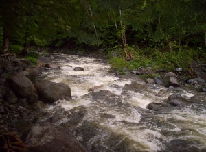
Long Pond Stream just before I turned back from it to return to Long Pond Stream Lean-to
Long Pond Stream just before I turned back from it to return to Long Pond Stream Lean-to; it looks shallower than it was

June 19

(15.1; 114.5 total, 2059.5 to go; +0.1 from pace, -50.5 overall)

If yesterday started slow, today was worse. At that lean-to I mentioned as a target yesterday, after hiking some very overgrown sections of trail (usable if you look at your feet, invisible if you look at eye level), I stop and cook two of the three remaining dinners I have and just sit there and eat. Without trail mix or a good breakfast (I don’t remember what I had, but it wasn’t more than an oatmeal or two), I’m dead. After the two dinners I feel much better, and I keep walking.

Remember that ford I attempted yesterday? With some people watching and helping, I make it across. The water’s maybe five inches shallower, thankfully, but still way above the level at which it’s really safe. I get the help of a hiking pole and continue on, changing shoes for the ford. However, more fords follow — and where I’d made a habit of changing shoes for fords before, I decided I’d had it — no more changing shoes for fords. (This clip from Network about sums up my attitude at that point; don’t ask me anything else about the movie, because I’ve never seen it before and have only seen that part via YouTube.) No more two-stepping around mud puddles, no more gingerly care around standing water, no nothing — just tromp right through (waring only roots, mud since it gets in boots, and unexposed stones that can turn an ankle). It was great fun! The remaining fords were pretty nice too, particularly once I got the hint that a good walking stick (plenty left on the shores) is essential for any non-trivial ford.

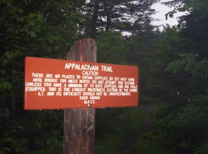
There are no places to obtain supplies or get help until Abol Bridge 100 miles north.  Do not attempt this section unless you have a minimum of 10 days supplies and are fully equipped.  This is the longest wilderness section of the entire A.T. and its difficulty should not be underestimated.  Good hiking!  MATC
The sign at the southern end of the 100 Mile Wilderness; mutatis mutandis, it's the same words as the one at the north end, but it's much newer and more readable than the northern one.

A bit more walking and I hit Maine 15; it’s 3.5 miles east to Monson, and since it’s raining, I figure if I start walking someone will stop and pick me up. (If I had a cell phone I could have called for someone at my destination in town, but I maintain that cell phones are a menace to society.) I don’t walk far before I encounter success; after a shower, I head over to the local gas station to pick up two sandwiches and a half-gallon of ice cream to eat (the sandwiches actually make a large enough dent that the ice cream doesn’t all disappear that night), after which point I kick up my feet and relax at Shaw’s Lodging in Monson. I plan to take a zero day here (no miles) to give the body time to recover a bit; also, it’s been so rainy that several rivers south of us are unfordably (and in one case un-ferryably!) high.

So far, if there’s been one word I’d use to describe Maine right now, it’s “swamp”. As I said mostly seriously to the ranger at the river crossing, there’s water about every hundred feet practically through here. On that last day I think I finally got over it, and from now on I think I’ve learned to live with wet boots.

I’m writing this in Stratton now; I could add another week’s worth of entries here, but I should get some sleep, and there’s no rush on these anyway. The big thing is to get images off my camera, which has anemic storage capacity; two-thirds of my hike so far I’ve been choosing which picture to punt every time I want to take a shot. They’re off now, but I don’t feel like spending the time to insert them here [edit: some images inserted, some left to go]; see either the archive of the images (I assume the images include dates for correlation with actual events but haven’t checked) or wait for me to insert them in this post; I’ll mention it in a future post when I’ve updated this one with pictures. And now all the pictures for this section are inserted, finally!

26.06.08

Hello Planet!

Tags: , , — Jeff @ 23:48

Whee! I’ve “just” been added to p.m.o now, so the peoples of the Mozilla worlds should now be getting my posts. Even better, for those of you who hate having to subscribe both to a planet and to a personal feed to read all their posts, fear not! Every glorious word I write is delivered in full to planet, so no need to waste time on duplicated entries. You’ll be reading my every word in raw, uncensored form. For everyone else, I recommend the “next” or “delete” key in your feed reader.

(Aside: I’ve idly wondered whether or if Atom includes a globally unique id field which could be used to consolidate duplicate entries; it seems like an obvious addition if it’s not there already.)

Long-term, I’ll be posting about lots of things: Mozilla, politics, economics, law, and whatever else happens to strike my fancy. In the short term, relatively speaking, I’ll primarily be posting about my progress along the Appalachian Trail. Since graduating MIT a few weeks ago, I’ve been thru-hiking the trail from Mount Katahdin in Maine to Springer Mountain in Georgia. I expect posts will, through October, primarily consist of trail updates as I pass through towns along the way. (This will also affect comments, which I currently moderate if you’ve not posted before.)

Anyway, I’ve rambled on long enough by way of an introductory post — we now return to your regularly-scheduled Mozilla postings.

« Newer