June 7
Today’s move-out day at MIT for graduating seniors, so I’m busy packing my stuff and deciding what should go with me on the trail. Everything else is getting shoved in the van the family brought up here, to be taken home and not touched quite possibly until I’m ready to get it in November, when I plan my thru-hike should end. I do that, see off the family, visit a graduation party, travel to REI for a few last-minute purchases, buy food for the first leg of the trip, do a last walk through the institvte, and hit the sack.
Today I make my first mistake, although I don’t know it at the time: I decide what to take without consulting a scale. I don’t yet know how bad this is, but all shall be revealed later.
June 8
I sleep a little later than I’d intended and don’t end up having time to make the bus I’d planned to make, but no worries: there’s another bus later in the day. I pack up everything, eat a few last bits of food I have lying around, and head to South Station for a bus to Medway, ME. Katahdin lies in Baxter State Park, and compared to much of the trail it’s a royal pain to deal with — you have to make reservations for sites, and it’s 17 or so miles from the nearest town of Millinocket.
The bus ride, which first goes to Bangor, ME and then transfers to a different bus from there to Medway, is uneventful. I spend the time sleeping and reading from the Federalist Papers (my only reading material on the trail save for a Bible). My plan at Medway is to call a taxi to go to a campground just past Millinocket, but Paul from the Appalachian Trail Lodge is there to give a ride and overnight shelter to two other hikers. That plus breakfast and a ride into Baxter is $70, which might seem steep but from what I’ve since heard is reasonably competitive. Convenience wins out, and I spend the night at the A.T. Lodge after getting a bowl of French onion soup at the associated restaurant. (Good soup, recommended if you’re there and it’s still around — apparently the stuff takes forever and a day to make, so its being around that late at night was fortuitous.)
June 9
(5.2; 5.2 total, 2168.8 to go; -9.8 from pace, -9.8 overall)
Rejoice! First day of hiking! After breakfast and a shuttle into the park, I hit the trail along with Toby and Eric, recent Penn State graduates. (I get the impression many if not most south-bounders right now are grads, to be honest.) We go up and down the mountain using daypacks borrowed from the ranger’s station (as do most thru-hikers); some crazies hike with a full pack, but nobody really recommends doing so, and the terrain involves enough bouldering it’s kind of insane.
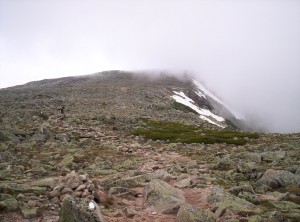
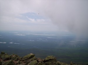
The views from the top are pretty awesome, taken within minutes of each other:
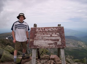
And here I am next to the sign at the top:
Last, take a look at this brief 360-degree movie from atop Katahdin:
Once the summit is achieved, I return, set up camp, eat dinner, and sleep.
(Explanation of the secondary header here: (5.2; 5.2 total, 2168.8 to go; -9.8 from pace, -9.8 overall). 5.2 indicates I traveled 5.2 miles on the trail; 5.2 total indicates I’ve gone 5.2 miles from the northern terminus of the AT on the summit of Katahdin; 2168.8 to go is how many miles until the southern terminus on Springer Mountain; -9.8 from pace is how I did compared to the 15 mile per day pace I need to average, more or less, over the trail to complete it by November; -9.8 overall is how much further I’d need to be to be on that desired pace. All numbers are from the 2007 A.T. Thru-Hikers’ Companion, which is basically the same as the 2008 edition and the actual numbers when I hike the sections over the next several months. For the initial stages the pace is kind of a joke — terrain and condition coming in dictate that pretty much nobody’s consistently doing that sort of mileage for awhile. I’ll probably make it up further down the trail, and if not, there’s a little slack for start of November anyway — no worries yet.)
June 10
(0.0; 5.2 total, 2168.8 to go; -15.0 from pace, -24.8 overall)
My initial plan was to hike six miles to Katahdin Stream Campground in Baxter from the entrance yesterday, summit Katahdin today, and continue tomorrow, so I have an extra night of reservation to burn here. Since I fell a touch weird on an ankle yesterday on a descent, I decide to take it easy a day and do a day hike to Daicey Pond and back, 4.8 miles round-trip down the A.T. using a borrowed daypack again. On the way back I catch a moose in one of the lakes and get a picture, but my camera has very little storage space and it got punted later for other pictures. That and dinner make it a day.
June 11
(13.4; 18.6 total, 2155.4 to go; -1.6 from pace, -26.4 overall)
After breakfast, weighing my pack on the scale at the ranger station (58 pounds, sans three liters of water and one Nalgene — this is at least 10-15 pounds more than it should be now!), and filling those three bottles and adding iodine to purify them after time, I hit the trail. The going’s easy, but I hit the first river crossing, see a high-water trail, and take that instead — I’m off the trail and it’s only the second day of hiking! That trail leads me through a portion of the river that’s only about knee-deep — I switch shoes, make the crossing, and continue.
Near the end of the day I hit the park boundary, after which most campsites are once again free. A little down the road and I enter the 100 Mile Wilderness:
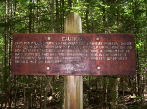
This stretch of trail is the longest stretch not passing by cities or well-used roads, or something like that. It’s supposed to be scary and all, but it’s really not that wilderness-y, actually — it’s just long and early (for us south-bounders; most hikers do the other way and have this when they’re already in good shape).
A few miles in I hit the first shelter (lean-to, in local parlance): Hurd Brook Lean-to. I end up sharing the place with three other hikers: another college grad named Dan, a chauffeur whose trail name is Lucky, and A.T. “Almost There” Dave.
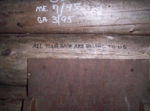
Carving or writing things in lean-tos may be highly frowned upon, but of course that doesn’t stop people from doing it. This lean-to happens to have the following carved into it::
June 12
(11.5; 30.1 total, 2143.9 to go; -3.5 from pace, -29.9 overall)
I take my time getting up and out this morning, or maybe I don’t: I seem to have trouble getting up and out quickly in mornings. It doesn’t help that for this first part, I’m eating oatmeal for breakfast, and heating the water to make it is time-consuming. The hike today goes up and over a small mountain (hill, really, it’s only up at 1517 feet):
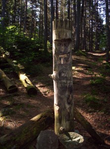
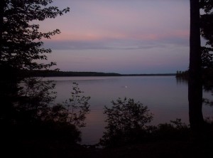
It then meanders next to a lake. I see a duck in the water but can’t get a camera out before it’s gone, and I think I scare a moose away when I’m hiking (big crashing noises heading away from me). The day goes slowly, and I get into Rainbow Stream Lean-to kind of late, sharing it with the same set of people. Out comes the raincoat to ward off bugs (June is black fly season in Maine, but for the most part it’s the mosquitoes that are the killers right now). This lean-to has a funky totem pole outside it:
June 13
(13.9; 44.0 total, 2130.0 to go; -1.1 from pace, -31.0 overall)
The day goes pretty well; I make Wadleigh Stream Lean-to, 8.1 miles up the trail, and decide it’s not far enough, so I head on to a campsite 5.8 miles further up. Along the way I encounter my first stretch of trail that’s underwater — it’s along a lake, and the water’s higher at this time of year. I cut a trail along the shore to avoid the water. About this time the mosquitoes descend in force, and I practically run the next several miles into Nahmakanta Stream Campsite (passing by the first northbounder I’ve seen, although I only learn this from reports of others), where I drop the pack, pace for a minute, grab the raincoat and don it, set up the tent and huddle inside it for an hour to wait for the bugs to go away. They do, I set up a little more and secure smellables from wandering rodents, and go to sleep. Lucky’s the only other person in the site; Dan stayed at the previous lean-to, and Dave pushed on a little further.
June 14
(7.8; 51.8 total, 2122.2 to go; -7.2 from pace, -38.2 overall)
Today I encounter the first civilization in the middle of the “wilderness”: White House Landing. Take a side trail off the AT and you hit a lake; blow an airhorn and Bill Ware jumps in a motorboat, runs over and picks you up, and takes you across to the Ware house (pun intended). Nearly anything you could want except long-term resupply is available here, but it’s not necessarily cheap — AT Dave and Lucky are both here, and Dave says he spent over $150 for a two-night stay. (Dan apparently stayed the night and showed up after I left.) I settle for what the Companion calls “Linda’s famous one-pound burger”, a cold pop, and some matches, which come to $13.60 total — a very reasonable price if you ask me, all things considered. I head back over after lunch and continue to Antlers Campsite to get some reasonable mileage and avoid paying for lodging at White House Landing. Bugs are a little annoying for dinner, but I have a nice night with the tent fly rolled back on my full-length mesh tent.
June 15
(16.0; 67.8 total, 2106.2 to go; +1.0 from pace, -37.2 overall)
Whee! First day in the black! (Am I the only person who never remembers whether red or black is good?)
First landmark today is Jo-Mary Road. If you set it up, you can get people to securely store your pre-packaged-up food along the road for you to pick up when you’re here. I stop for water and a snack break, staying long enough to see Lucky, AT Dave, and Dan at the same time. I’m also passed by a couple, Andrew and Jessica, married barely a month ago, who go by the name of The Honeymooners. When I get going again, I pass by Cooper Brook Falls Lean-to; I stop for another snack as it starts to rain; the shelter’s pretty full. It’s getting pretty late in the day when the couple peels off for an unofficial trailside tent site. I know I’m just short of East Branch Pleasant River (supposedly the first ford of the hike according to the Companion, but I barely have to get one boot wet), and just beyond that’s East Branch Lean-to, so I press on. Lucky’s there, and AT Dave and Dan show up after me.
Man, it feels good to have hiked better than my intended pace.
June 16
(10.8; 78.6 total, 2095.4 to go; -4.2 from pace, -41.4 overall)
The big attraction of the day is White Cap Mountain at 3650 feet. True to its name, the spectacular view from the top extends about 100 feet in front of me. The trail up is wicked steep; not much in the way of switchbacks at all. On the way down I encounter one tree that’s across the trail at just the right height to make it impossible to go over or under it; it’s the sort of thing I’d expect trail maintenance people to have removed. To add insult to injury, the other side has a white blaze on it (the trail’s marked with stripes of white paint, 2.5″x5.5″ or so, well enough that many thru-hikers don’t even carry maps; it’s really odd not carrying a map as I’ve chosen to do, because practically every “ten essentials” list includes maps of the area), almost as though they wanted to rub it in our faces. Better yet, it starts to rain, and I stumble into Carl A Newhall Lean-to half-soaked.
Here’s where it gets really fun, because the shelter’s full. There’s space for a tent, but I’m in no mood to set up a tent. As it happens, some amazing people backpacking with their dog (bowl and all) decide to de-shelter and use their tent, so I get a dry place to sleep and avoid needing the tent! Two further hikers who arrive after me also cram in, and we’ve got a cozy night all around. Since then I’ve slept in and out of lean-tos, but I’ve never minded so much one way or another as I did that night.
June 17
(11.9; 90.5 total, 2083.5 to go; -3.1 from pace, -44.5 overall)
We have our first real ford today, across the West Branch Pleasant River. There’s a ranger (or at least uniformed person) there, and I catch up to Dan just at the ford. It’s maybe mid-calf deep or so, and it’s mostly pretty simple.
Continuing on, we go up Chairback Mountain. I feel pretty good, so I pull out the stove and eat a dinner (something teriyaki-flavored, noodles maybe, with a package of tuna) even tho there’s more hike to do. I think I’m at the top of the mountain, but it’s really probably the “seat”; after dinner I have a nice stretch of bouldering, after which I hit a lean-to. There’s space, but I feel like pushing on to the next one — a mistake. It’s late but not dark, and I really should be stopping now, but I don’t.
Hiking goes okay, and I pull out a headlight when it gets too dark to see well. Problem is there’s fog out, so it’s not the greatest thing for visibility. I stop atop one of the mountains and even get in a sleeping bag, but eventually I’m convinced it’s too exposed (and a smattering of raindrops on my exposed bag help too), so I pack up and move on. Eventually I see a decent spot and set up my tent in the rain; it’s now nearly midnight, as I recall.
Today’s mileage is an educated guess, but it’s the best there is.
June 18
(8.9; 99.4 total, 2074.6 to go; -6.1 from pace, -50.6 overall)
Today goes slowly; I don’t pull out the stove to make breakfast, so I settle for dry oatmeal mixes with gulps of water. I also run out of trail mix, and my energy sags a bit.
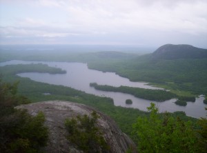
I don’t know why, but I think about continuing five miles past Long Pond Stream Lean-to to the next one, across one named ford 0.8 miles up the trail. I see the ford, make two attempts, and declare failure. The water’s wicked deep — we’re talking waist-high or so, and I think knee level is about what boy scouts say is “too much” (there’s an interesting game in this, figuring out when Boy Scout over-safety can reasonably be broken, and when it can’t) — and the river’s choked from so much rain recently. I give up and return to Long Pond to see Dan, Lucky, and a northbounder named Crazy Diamond. This sets up an epic 15.1-mile day to reach Maine 15, which leads to Monson and the end of the 100-Mile Wilderness.
June 19
(15.1; 114.5 total, 2059.5 to go; +0.1 from pace, -50.5 overall)
If yesterday started slow, today was worse. At that lean-to I mentioned as a target yesterday, after hiking some very overgrown sections of trail (usable if you look at your feet, invisible if you look at eye level), I stop and cook two of the three remaining dinners I have and just sit there and eat. Without trail mix or a good breakfast (I don’t remember what I had, but it wasn’t more than an oatmeal or two), I’m dead. After the two dinners I feel much better, and I keep walking.
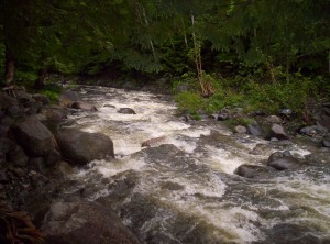
Remember that ford I attempted yesterday? With some people watching and helping, I make it across. The water’s maybe five inches shallower, thankfully, but still way above the level at which it’s really safe. I get the help of a hiking pole and continue on, changing shoes for the ford. However, more fords follow — and where I’d made a habit of changing shoes for fords before, I decided I’d had it — no more changing shoes for fords. (This clip from Network about sums up my attitude at that point; don’t ask me anything else about the movie, because I’ve never seen it before and have only seen that part via YouTube.) No more two-stepping around mud puddles, no more gingerly care around standing water, no nothing — just tromp right through (waring only roots, mud since it gets in boots, and unexposed stones that can turn an ankle). It was great fun! The remaining fords were pretty nice too, particularly once I got the hint that a good walking stick (plenty left on the shores) is essential for any non-trivial ford.
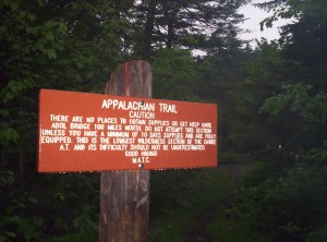
A bit more walking and I hit Maine 15; it’s 3.5 miles east to Monson, and since it’s raining, I figure if I start walking someone will stop and pick me up. (If I had a cell phone I could have called for someone at my destination in town, but I maintain that cell phones are a menace to society.) I don’t walk far before I encounter success; after a shower, I head over to the local gas station to pick up two sandwiches and a half-gallon of ice cream to eat (the sandwiches actually make a large enough dent that the ice cream doesn’t all disappear that night), after which point I kick up my feet and relax at Shaw’s Lodging in Monson. I plan to take a zero day here (no miles) to give the body time to recover a bit; also, it’s been so rainy that several rivers south of us are unfordably (and in one case un-ferryably!) high.
So far, if there’s been one word I’d use to describe Maine right now, it’s “swamp”. As I said mostly seriously to the ranger at the river crossing, there’s water about every hundred feet practically through here. On that last day I think I finally got over it, and from now on I think I’ve learned to live with wet boots.
I’m writing this in Stratton now; I could add another week’s worth of entries here, but I should get some sleep, and there’s no rush on these anyway. The big thing is to get images off my camera, which has anemic storage capacity; two-thirds of my hike so far I’ve been choosing which picture to punt every time I want to take a shot. They’re off now, but I don’t feel like spending the time to insert them here [edit: some images inserted, some left to go]; see either the archive of the images (I assume the images include dates for correlation with actual events but haven’t checked) or wait for me to insert them in this post; I’ll mention it in a future post when I’ve updated this one with pictures. And now all the pictures for this section are inserted, finally!



Wow, impressive! Good luck on the rest of your trip, we’ll see you in November.
Comment by Ted Mielczarek — 27.06.08 @ 13:02
This is a fun read, please keep it up. 🙂
Comment by crowder — 27.06.08 @ 14:30
This series will be a nice change-of-pace from the meeting minutes and other informative Mozilla posts on planet; thanks for sharing your trek with us.
We used to day-hike Blood Mountain in the winter when I was in Scouts, and did another section (I can no longer recall which) in preparation for Philmont; I still can’t fathom doing that every day for six months. 🙂 Best wishes for a safe journey, and enjoy the hike!
Comment by Smokey Ardisson — 27.06.08 @ 19:30
When you’re back and looking for podcasts, you might enjoy these: http://www.trailcast.org/. Pretty cool that you’re doing the AT. God bless you on your way.
Comment by David Humphrey — 29.06.08 @ 13:24
Great to see your update. Have fun and stay safe!
Love,
Aunt Jan
Comment by JB — 30.06.08 @ 13:57
I suggest the next time you hit a town of any size you buy a memory card. Your mom had a 1G card, which lasted over 2 weeks in Europe last summer. Even 512K should be plenty for you. (I assume you use a standard SD card.)
[Yeah, that’s on the agenda for Gorham, which probably has enough store depth to cover it.]
Comment by Dad — 01.07.08 @ 09:15
hey jeff- also great to see your updates! happy birthday, man! i hope u had a little trail mix birthday cake or something on you. 😉
[Nope, tho I’m staying at a hostel tonight rather than in a lean-to or tent. 🙂 Rain at around five put a damper (pun intended!) on plans to set up somewhere trailside.]
Comment by spark — 02.07.08 @ 09:40
I recall climbing Katahdin; instead of hitting the Appalachian Trail, I (with my sisters and some family friends) hiked over Knife’s Edge. For those of you not acquainted with Baxter State Park, Knife’s Edge is the path that is obscured by clouds in the first pictures. It’s a rather narrow trail which involves at some points a bit of “rock scrambling” while on either side is a very steep drop. And, by the end, you’ve lost the notion of ever having thighs at one point (it’s a steep climb *down*).
[Yeah, the downhills are the real pains. Uphill you might go slowly, but you’re not giving your knees nearly the pounding they get from each step with the force of your entire body and pack decelerating.]
Comment by Joshua Cranmer — 03.07.08 @ 20:11
How did you get to Katahdin? I am trying to figure out a goo way to access the trail up north.
[Concord Trailways bus service from Boston, to Bangor, ME and then to Medway, ME. Shuttle from there to Millinocket and Baxter via the A.T. Lodge up there.]
Comment by Mike — 14.09.08 @ 14:43