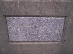
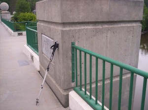
I’ve gone back through previous entries and attempted to link to each thru-hiker or section hiker’s website or trail journal the first time it’s mentioned in each entry (if I knew it or could find it), so if you still feel like reading about hiking on the A.T. after what I’ve written, you might want to return to past entries and skim through their journals as well. NB: I haven’t seen anyone write with nearly the level of detail that I do, so doing so is probably not quite the time sink you might first think it is. Caveat lector: trail journals are like Wikipedia (except less highly linked), and if you start reading those you might get sucked in even more journals, from which you could get sucked into even more, &c.
August 2
(16.8; 594.7 total, 1579.3 to go; +1.8 from pace, -230.3 overall)
The first stop this morning is a little cafe in downtown Bennington for breakfast. I have a small map of the town given to me yesterday by the outfitter, and I select what looks like a reasonable little place just a couple hundred feet from the intersection on which the outfitter sits. It’s something of a mistake, because it’s more a pastry shop than a place to get a full breakfast, but it suffices. After a brief bite it’s time to head back to the trail.
I walk most of the way out of town before I sit down on the side of the road and put out a thumb, figuring I should get out of the busier areas to not interfere with traffic. I wait. And wait. And wait. And wait. And wait some more. Eventually it’s been 45 minutes, and I realize this isn’t going to work, so I start walking. The Companion says it’s 5.1 miles from the center of town of which I’ve probably walked a mile, so I might be out awhile, but from the looks of things getting a hitch back out is hopeless. I manage to walk most of the way out before a guy picks me up and drives me the last mile or so to the trail crossing; he says he saw me when I was waiting earlier as he was heading into Bennington and knew I wasn’t going to be successful.
The first obstacle of the day is the dreaded, the fearsome, Harmon Hill! I note this only because Sweet Sweet noticed a register entry from a thru-hiker (!) irrationally fearful of the ascent up it; it’s somewhat steep, and it’s more steps made of stone than a hiking trail, but to have such fear of a hill is absurd, especially for a thru-hiker. Spanky passes me again near the top of the hill as I water up, and after passing through a field of raspberries (my entry in a trail register nearby is, “Nothing is real – except raspberry fields, forever!”) I arrive at Congdon Shelter, where I stop to eat lunch. Over time Spanky, Sunday, Hungarian, and Sweet Sweet all arrive at the shelter. It’s another nice one with a picnic table, a shelter register with crayons (there are some absurd drawings as entries), bunks, and a fire pit. Just as I’m finishing lunch it starts to pour; everyone else stays at the shelter for the moment, but I can’t possibly stop this early in the day, nor am I content to stop before Massachusetts today, so I head out into the rain rather than wait it out.
The rain’s not too bad, but I’m pretty soaked most of the day. Sunday eventually catches up and then surpasses me, and the trail is mostly uneventful until I reach Country Road, the last road crossing in Vermont. There’s a guy with a pickup truck there, and he’s giving out trail magic! I eat a hot dog and have a pop while I stand and talk with him. Another thru-hiker, Old Buzzard, walks up with — I kid you not — an umbrella. As it turns out he’s famous for it; he started hiking with a red umbrella and got ridiculed for it, but by four hundred or so miles into the trail people were often more envious than derisive. That, however, was when he reached Damascus in Virginia for Trail Days, a thru-hiker festival. Somehow, he claims, some other thru-hikers absconded with his umbrella, and he decided to completely and utterly fly off the handle about it. He never did get the umbrella back, but he decided this would make a great excuse to pretend to be schizophrenic in shelter registers. For the past thousand miles he’s pretended to have multiple personalities which he’s working through on the trail at the advice of his therapist and his wife. Subsequent entries from him appear in a variety of styles of handwriting signed by various different aspects of his personality — Jhonny (“Here’s Johnny!”), Onroy (written in an atrocious left-handed mess), Shelia [sic], and Ol’ Buzzard-Tonto (his main moniker). Future entries talk about how his wife and therapist are hoping one of his personalities will emerge dominant over the course of the hike and how he’s on a course of thorozine [sic].
Old Buzzard clearly doesn’t actually have these problems once you listen to him (although some south on the trail get suckered into believing him — well trolled, Old Buzzard!). At the same time, I get the feeling it’s not entirely just an act. Adam Sandler does the exact same shtick in every movie he acts in; he’s not really like that in real life, but if you ever watch an interview with him you realize he has some of the lack of seriousness that his characters always have — to nowhere near the same degree, but you realize it’s not all a sham. I think to convincingly pretend to be a person with multiple personalities or to be an Adam Sandler character it’s not enough to just be a really good actor, you have to have some of it to start. Reading his entries the rest of the way south and imagining the reactions of people reading them was a great treat.
Heading south further I hit Seth Warner Shelter, the last shelter in Vermont. There are a few other people there, including a physical education teacher out until classes start in a few weeks, looking to hike as much of the Long Trail as possible. I try to dry out a little before heading on; Spanky arrives and tries to convince me to stay to be able to walk back to the road for further trail magic, but no way am I stopping before crossing the state line today.
It’s still raining somewhat, and the trail I pass through is definitely putting paid to the nickname “Vermud” that Vermont has (although to be honest I didn’t think it was that bad given how much rain there’d been, and I didn’t even know the nickname until this last day of hiking out of it). I reach the state line with Massachusetts (whee!) by early evening, and I note in the state line register that a hike such as the A.T. easily might not have been possible if federalism hadn’t been a principal component of the American system of government. (Imagine, if you will, the absurdity of a border crossing station on a hiker trail, and consider that in such a case the trail more likely would never have been created.) It’s only another couple miles to Sherman Brook Campsite, the first spot in Massachusetts (where, I point out, camping is only permitted in designated sites), and I walk in as twilight hits, catching up to Sunday in the process (who unfortunately completely missed the trail magic back at the road crossing). It’s stopped raining enough that setting up camp is painless, and the site’s awesome — it has a bear box, a privy, and even a register! I haven’t seen a register at any other tent site so far. I quickly head to sleep in a new state.
August 3
(11.2; 605.9 total, 1568.1 to go; -3.8 from pace, -234.1 overall)
Today’s start is a leisurely one, because I’m stopping in North Adams for breakfast and resupply at a local grocery store. Sunday tells me that he’s arranged a ride from a friendly local named Rob, who runs a place he calls the Birdcage, in Dalton, 24.9 miles down the trail, and says I could probably do likewise if I got down to North Adams in time. My disinclination to slackpack prevents me from accepting. As it turns out, I arrive in North Adams just as Rob and Sunday are about to head out, more or less, and I manage to get Rob’s phone number in case I want to stop when I pass through. That done I head into the adjacent Friendly’s for breakfast and then over to Price Chopper (its actual name; I’d never heard of the chain before) for supplies, noting while shopping that some items in the store (M&Ms for one) are actually more expensive when purchased in the largest container than when purchased in the not-quite-largest container. Maybe this is a way to catch unwary customers who don’t look at price per ounce and just assume bulk equals savings; I’m not sure what else it might be. That done I hike the 0.6 miles back to the trail and head south again toward Mount Greylock.

Mount Greylock is the highest point in Massachusetts, which might sound impressive, but at 3491 feet it’s not particularly tall by anything but eastern seaboard standards. Still, it’s enough height to make the hike up it strangely slow. The first three miles drag on quite awhile, and near the very end of that it starts to pour; I refill a water bottle from water runoff flowing over a tree root on the trail (adding iodine, of course) and head on to Wilbur Clearing Lean-to to eat lunch, hole up, and wait out what looks like a fast-moving storm. While there I discover the solution to the riddle of Dan and Leah and their mysterious White Mountains disappearance — turns out they got tired of hiking in the White Mountains around Kinsman Notch, stopped at a hostel there, found cheap bus tickets to Boston, went there for some period of time, and returned to the trail just north of here around July 18 — so they’re probably two weeks ahead of me at this point. I also read Old Buzzard’s entry wherein he describes being put on a regimen of thorozine [sic] — hilarious! My entry expresses dire outrage at the injustices perpetrated upon me by Dan and Leah and vow vengeance when I catch up to them. (Unfortunately I never succeed; they remained ahead of me for awhile, but at some point their entries stopped altogether, and I never saw them again.) The rain does indeed pass in short order, and I head on again.
The miles up to the summit pass quickly, and I arrive atop the mountain to take in the war memorial at its top as well as the surrounding views.
The summit is traditionally open to vehicle traffic up it, just as Pikes Peak in Colorado and Mount Washington in New Hampshire are, but for the past two years at the least the summit has been closed due to road maintenance and, as I gathered from a newspaper I rifled through while eating at Friendly’s, some issues at finding someone willing to run it. Had it been open I understand there are some nice views to be had from the top of the war memorial, but such was not to be, so I move on fairly quickly.
The summit may be closed, but the construction equipment is out in full force, and I take advantage of a port-a-potty as I pass. I refill water from a pond just down from the summit and head on, passing northbounders Hot Cheese, Birdbath, and Meltdown. For some reason I’m still moving slowly, and I’m kind of hurting, too, for some reason, so I make it a short day and stop at Mark Noepel Lean-to to end out the day at the end of a measly 11.2 miles. I have the shelter all to myself, but there’s a camp group staying in tents nearby. It’s some sort of UN-type thing as I’m told by one of the two leaders (if I remember correctly one said she went to Michigan for college), because there’s a large variety of nationalities, races, and so on — wonderfully diverse if you think that should matter. They’re incredibly well-behaved for a camp group (not at all like the group just north [and by hearsay the group ten miles south] of Glastenbury Mountain in Vermont), and I don’t notice any noise from them over the night. Strangely, this contrasts with the two people in a tent who are chopping wood for a fire (itself odd) at nearly midnight (no idea why). I cook my food and head to sleep, hoping I’ll have a better day of hiking tomorrow.
August 4
(16.7; 622.6 total, 1551.4 to go; +1.7 from pace, -232.4 overall)
I make a leisurely start today as I head through a section of trail that passes near or through a number of towns. The first stop is in Chesire, and the trail passes directly through part of the town next to the “Cheese Monument”, commemorating a gift of a wheel of cheese from Cheshire to celebrate Jefferson’s presidency. (Viewers of The West Wing might think that story sounds vaguely familiar, with some reason — although it seems another cheese event was the more direct inspiration for that episode.) I stop briefly to remove some anti-blister duct tape from one foot before heading on again. The day continues uneventfully until I reach Dalton.
Dalton, as mentioned earlier, is famous on the trail for both the Birdcage and for Tom “The Ice Cream Man” Levardi. I met the former yesterday morning when Sunday was slackpacking, and I briefly met the latter at the hiker festival in Bennington. My immediate plans are to swing past the library to use the Internet for a bit and maybe type up an entry or two here. The trail passes directly through part of the town, but it doesn’t pass by the library, so I take a slightly different route than the trail itself to go there. Judging by painted-over blazes on telephone poles as I go, I’m actually “retro-blazing”; I may be off trail for a bit, but there are levels of purism (some even go so far as to always leave a shelter by the precise access path used to reach it, even when it’s a loop access or when the shelter site has multiple entrance points, which seems a bit much to me), and as long as I’m walking essentially the same rough path and not cutting out difficult parts unless prompted by weather or adverse trail conditions I’m not bothered. (In any case I would have been rather more bothered by skipping the dozen miles south of Monson in Maine to avoid flooded river crossings if I were that much a purist.) I don’t quite reach the library when, of all people, Tom Levardi stops off the side of the road and offers me a ride to his house, which I accept — after all, it’s Tom Levardi! (Purists gasp again.) I can’t reasonably pass this up even if it cuts down on trail mileage by a small amount (judging by the map in the Companion perhaps by half a mile), and I think the compuhyperglobalmegapurists who would pass this up are insane. 🙂
We arrive at his house, he gets me a complimentary ice cream sundae (hence his name), and we talk for a couple hours or so on various topics. He’s been letting thru-hikers camp/stay at his house for years; if I remember correctly one article posted in his house dates it back at least fifteen years. I ask about the longest anyone’s ever stayed (it’s not uncommon for people to stay multiple days and take a day or two of rest — zeroes — because it’s such a great place to stop). Some people, he says, stay somewhat longer because they need money to keep hiking north (consider the northbounder I met just south of Rutland in Vermont). He also tells of one guy who stayed so he could date someone working at a local store and of another who stayed to date someone he met at a nearby gas station, even going so far as to have her over to Tom’s for a dinner date. It’s amazing; I’m sure I could be hospitable to a point if I were doing something like Tom does, but even I couldn’t imagine pushing it that far. I borrow Tom’s phone and use my calling card with it to call home and talk for a bit, and then, before I can be sucked in further, I head south again so I can make reasonable mileage today. It’s kind of difficult — I can understand why people would want to stay — but I don’t feel like I really need a break, and I’d like to hike more than 13.7 miles today, at least to hit the 15-mile-a-day goal I set before I started. When I originally arrived it might have been possible to hike another ten miles, but it’s now late enough that the only feasible option is another three to Kay Wood Lean-to, not as far as was possible but “enough”.
The remaining miles pass quickly, particularly after I rejuvenate with a can of pop from trail magic placed just south of Dalton, and I pass a weekend backpacker and the first deer I recall seeing on the trail as I do the last three miles. Silver Potato and Cracker passed through recently according to the shelter logs (if I remember correctly they use their entry here to point out the joy of wine with dinner while backpacking), as have various other southbounders I’m trying to catch. I spend the night there with a couple other hikers, including the one I just passed (but none thru-hikers); they remark on my pace, but I say what I always say: when you’re thru-hiking all hiking scales are heavily skewed. Before heading to sleep I make plans for the next couple days: tomorrow it’s Upper Goose Pond Cabin, famed on the trail for its pancake breakfasts, and the day after it’s Tom Leonard Lean-to. The pace is aggressive (~18 miles and ~21 miles) but not overly so as long as I keep moving, and it’ll be good to feel like I’ve made substantial mileage after a few days of feeling like I’ve been poking alone more slowly than I really want.
August 5
(17.6; 640.2 total, 1533.8 to go; +2.6 from pace, -229.8 overall)
Today’s hiking goes slowly for the first half of the day as I enjoy the weather and the copious blueberries I’m passing through. One of the other backpackers at the lean-to heads out before I do, and I don’t see him all morning. It takes me until almost noon to arrive at another institution of the Massachusetts trail: the “Cookie Lady”.
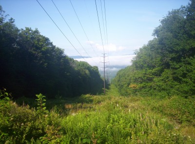
The Cookie Lady is about what you might expect: a woman who gives cookies to hikers as they pass by. She lives with her husband on a blueberry farm a scant 0.1 miles off the trail, allows hikers to camp there if permission is asked first (this was the stop ten miles up the trail had I had time to reach it), and offers a water hose for refilling water bottles. I don’t meet her, but I do meet her husband and their dog, and I spend some time talking to him (I refer primarily but not exclusively to the former) and reading the register they have on their front porch. An attempt is made to convince me to pick blueberries to take to the cabin for pancakes the next morning, but from here it’s another 11.5 miles to the cabin, and it’s getting late, close to 13:00 if I recall correctly. I worry that if I stop to pick blueberries and then have to walk with them, I won’t make it to the cabin at a reasonable time (before dark, basically), so I head on sans blueberries.
After detouring for half an hour walking down a road that appears to be the trail and then backtracking to the turnoff a scant hundred feet or so down it, I continue, taking a fairly even pace to October Mountain Lean-to a couple miles south. I arrive to a scene of controlled madness — the roofs of the shelter and the privy are being replaced (and apparently Kay Wood’s roof was replaced just before I arrived there, by the same trail maintenance club). The backpacker I didn’t see this morning is there intending to stay the night; I wait around for a bit to see if the privy will be completed in time for me to use it, but eventually I have to give up and move on. It’s getting really late in the afternoon now, perhaps close to 15:00 — I really need to get moving, and fast.
Strangely enough, I don’t just start moving at top normal speed, I start hiking at hyperspeed. Up until now my usual target pace has been two miles an hour not including breaks, but when I kick it into overdrive here to get to Upper Goose Pond Cabin as early as possible I discover my hiking pace goes to almost three miles an hour, even with a backpack with fifty miles of food on my back. This comes as a complete surprise, and not only do I achieve this pace, I continue it for three hours to arrive at Upper Goose Pond Cabin well before dark, definitely before 19:00 and possibly even before 18:00. I lament my previous lack of knowledge of this ability in one trail register as I pass, semi-lightly condemning myself for thinking I didn’t have time to pick blueberries — but as far as I knew I didn’t, so I can’t bring myself to feel too guilty. Today also marks the first hiker-only overpass bridge I remember seeing on the trail as I pass over the Massachusetts Turnpike (I-90, that is) with around a mile and a half to go to the cabin.
Upper Goose Pond Cabin’s a hopping place tonight, full of both short- and long-distance backpackers. There are a bunch of northbounders, one of whom I meet as we walk the 0.5 miles off the A.T. to get to the cabin, but Troutbum, Just Mike (back before he had a trail name when people would ask he’d answer that way, and eventually it just stuck), and Darci are the only names I remember. As a thru-hiker I manage to snag one of the bunks inside the cabin (it’s two stories, with the second floor devoted to bunks), lucky me — we’re grateful to have first call on them if we want, and given the bugs outside recently we’re all too happy to be inside behind screened doors at night. I take a brief swim in the lake, attempt to clean out my clothes in the water, partake of some delicious and juicy cantaloupe being cut up on the front porch, cook my dinner on a gas stove (!) inside the cabin, and relax and talk to people. Sweet Sweet and Hungarian walk in after dark (too late to get bunks, so they stay on the porch) surprised to see me, expecting I’d be further south by now; they started out from Dalton very late this morning, possibly even after noon (don’t quite remember), making great time to get here (great by my two-miles-an-hour standards, that is, since I’m not sure yet that the latter half of today wasn’t a fluke; three is roughly in the ballpark for their pace if they didn’t stop much).
Upper Goose Pond Cabin’s actually a bit unusual in that it’s run by the AMC on an entirely donation basis. Given the AMC’s reputation acquired through their monopoly on camping space in the White Mountains, this is extremely surprising, and I ask the caretaker about it. As it turns out, the reason they charge fees in the Whites is because they can — the White Mountains are a national forest, and it’s permissible. The reason they don’t charge fees here is that the cabin is on national park property, and they’re forbidden from doing so. (If you ever needed a reason to wish that the White Mountains were a national park, here’s a great one!) Consequently, the cabin makes do on donations. I inquire about a suggested donation amount to hear that they can’t even give one under national park regulations! They say they used to suggest one until they found out they couldn’t, so I, er, allow them to follow the letter of the law if not exactly its spirit by asking what the suggested donation amount was back when they were suggesting one. The wry response is roughly what I’m carrying in change (stupid, I know 🙂 ) and small bills, so I leave that as my donation.
While I’m on the topic of donations, I also ask a followup question I’ve had for awhile about suggested donations: how is such a number chosen? There are a number of different ways one could imagine. First, the amount could be the actual per capita cost. Second, it could be the total cost divided by the actual number of people who donate, so as to take into account freeloaders and not result in budget deficits. Third, it could be the maximum amount they believe people are willing to pay — the profit-maximizing amount, if you will. It’s a philosophical question which of these choices are and are not ethical, but I’m interested mostly from an economic perspective — do charities and not-for-profits act differently from for-profits and companies do in this respect? I’m not sure whether to be surprised or not surprised to find out the answer is that they choose the profit-maximizing amount just as a for-profit would. Of course, this is a sample size of one, and we’re talking about the Appalachian MoneyMountain Club here, so it’s not really possible to generalize, but it’s still an interesting factotum.
August 6
(21.1; 661.3 total, 1512.7 to go; +6.1 from pace, -223.7 overall)
It’s an early wakeup this morning for pancakes. It’s not clear how many there will be, so I eat a few, wait for a call for the next round, lather, rinse, repeat. Eventually at some point there are extras that people aren’t eating, so I sit and eat a pancake or two at a time, leaving plenty of time for other interested souls to partake of the remaining pancakes on the serving platter. Demand trails off somewhat abruptly, and I probably eat a dozen or so pancakes by the time I’m finished, all with that slow, deliberate pace. So tasty…
It’s hard to get moving again when it’s so comfortable here, but move I must to keep to my schedule. (There’s also the little matter that stays at the cabin are limited either to one night or to two; I can’t remember if a zero was permitted.) Eventually I manage to get myself moving again around ten; Sweet Sweet and Hungarian remain yet longer, at least partly because they arrived later last night, I suspect.
The hiking for the first few hours goes slowly, definitely not the three-an-hour pace of yesterday; the pancakes, at that quantity, probably don’t help matters. I reach Shaker Campsite early in the afternoon, refill on water, and use the privy there. A long time ago it was the site of a Shaker settlement, hence its name, as a nearby sign explains. I don’t stay long, as the mosquitoes are incredibly fierce (and neither has anyone else, as the register is full of complaints about the bugs). I later meet a few other hikers heading north and ask where they plan to stay for the night; at least one says he’s headed for this disaster of a campsite, and I suggest he head another three or so miles north to a pavilion off-trail that allows camping.
As it gets later I pick up my pace a bit, and I manage to hit roughly the three-mile-an-hour pace I had last night. I need to move faster to finish sufficiently before dark, and although I’m not in horrible danger of it I can’t really dally — I did enough of that this morning. I pass by two shelters without the usual stop to read registers, even foregoing the one that’s listed as “on” the trail (from looks the trail to it was probably 0.1 miles or so) as opposed to 0.3 miles off it. I pass one road crossing as a cyclist goes by; I have a barely-controllable urge to yell “You’re a smarter man than I am!” as he passes (I do not and did not the rest of the trail when such opportunities presented themselves again). Just past Mass. 23 I pass over a small bridge over water flowing into or out of a nearby lake and refill on water; scuttlebutt back at Upper Goose is that the water south of here is pretty bad (judging by the queries as to whether the water north was good or not), and this looks decent, so I fill up. Tom Leonard has water, but it’s supposedly 0.2 miles from the shelter, which is a bit of a pain when there might not be anyone else there to watch gear and ward off wildlife. I pass by a small ravine that’s reminiscent in some ways of Mahoosuc Notch, in that it’s filled with large boulders and looks like it’d be fun to crawl through. I didn’t notice at the time, but the Companion suggests it’s probably Ice Gulch, and if so the name would perfectly fit my observations of it. Finally I reach Tom Leonard as it turns to dusk; there’s just enough light remaining to hang a bear bag before it gets really dark.
It may be dark, but I still need to eat, so I pull out the usual food and start making dinner. Things might have gone better if my flashlight had fresh batteries, but unfortunately it doesn’t — and the shelter mice take advantage of this, attempting repeatedly to get to the food I have within arm’s reach on the picnic table. I mostly succeed in warding them off, but at least one manages to get through and attack my stuff sack and just barely chew through into a ziploc full of gorp. Stupid mice…
Before heading to sleep (inside my sleeping bag, wrapped within my mesh tent, within the shelter — the mosquitoes are a notable nuisance tonight) I take a look at the reading materials in the shelter; one book in particular, Charlie Company, looks particularly enticing. Vietnam, for the most part, didn’t make it into the US history classes I’ve taken, at least not in any way that communicated the reasons, tactics, effects, and so on of it; I’ve been passively looking for awhile for something to read to remedy that. Charlie Company looks like a reasonable book to do that, so I pick it up and carry it south with me, figuring I’ll drop it off in another shelter for someone else to read.
August 7
(14.4; 675.7 total, 1498.3 to go; -0.6 from pace, -224.3 overall)
As I head out today, it becomes clear to me why northbounders had been asking about water quality: the stream by Tom Leonard from which I fill up (not actually 0.2 miles from the shelter even tho the Companion promised that, thankfully) before heading out this morning contains a heavy dose of tannic acid from the surrounding pine trees. I’m used to water being discolored from iodine, but even without iodine this water is markedly brownish, and it has a distinct pine taste to it. It would take more taste than this to prevent me from filling up, tho, although I won’t hesitate to dump and refill from a cleaner source at the first opportunity.
The first stop for the day is the Corn Crib, a small fruit-and-miscellanea stand just off the trail on U.S. 7. Kay Wood’s register mentioned the pumpkin ice cream here being excellent, and I rarely pass up ice cream, so I stop and have a pint. Berkshire Creamery’s pumpkin ice cream is indeed excellent; I highly recommend it. (One other observation: high-quality ice cream has noticeably more calories than the mass-produced Hershey’s ice cream I’ve usually had so far.) After taking the chance to fill up water bottles again, this time from a clean source, I receive one more tidbit of information from the owner before heading south again: a northbounder passing through earlier saw a rattlesnake roughly the size of a log on the railroad tracks just south of here, so I should watch my step. (Aunt Jan, are you reading this?)
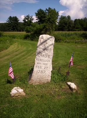
I take my time passing through just to be safe, but wherever the rattlesnake is, it’s not on the railroad tracks any more. Just under two miles south, however, is a landmark that more than makes up for missing the rattlesnake; indeed, it’s one I’ve been waiting for awhile to visit: a monument marking the spot of the last battle of Shays’ Rebellion, perhaps the epitaph for the Articles of Confederation. Recall that after American independence was won, a government for the new nation had to be set up. The Continental Congress might have worked well enough before and during the Revolutionary War, but it wasn’t going to work in the long run, so the Articles of Confederation were drafted to define a new government.
The Articles of Confederation were mostly a failure (some individual clauses excepted, but the broad strokes were demonstrably unworkable). In their zeal for liberty and independence, the authors had granted almost no power to the national government, leaving the vast majority to reside with the states. So little power was granted to the national government, in fact, that among other problems it had severe problems fulfilling its debt and defense obligations. The Federalist Papers, which I have been reading since just before I started my thru-hike, painstakingly describe many of the worst of the limitations of the Articles of Confederation.
Shays’ Rebellion was a painful demonstration of exactly the inadequacies of the current national government. Daniel Shays, a Revolutionary War veteran, led a brief farmers’ rebellion against the government of Massachusetts over taxes and debt concerns. The Articles instructed each state to maintain a militia but forbid them to maintain an army, except as directed by Congress, in Article 6:
nor shall any body of forces be kept up by any State in time of peace, except such number only, as in the judgement of the United States in Congress assembled, shall be deemed requisite to garrison the forts necessary for the defense of such State; but every State shall always keep up a well-regulated and disciplined militia, sufficiently armed and accoutered
I’m not intimately familiar with the details beyond vague familiarity and the small amount of research I’ve done to write this, but I presume there were three problems faced in dealing with Shays’ Rebellion. First, the national government was sufficiently enfeebled by the Articles that it had no army itself which could be asked to restore order, both because it lacked the means to summon the requisite manpower from the states and because it could not raise the necessary revenue without relying on the states to do it (and it lacked the power to deter half-hearted payment efforts). Second (I speculate on this, but it naturally follows from the words of Article 6 given what actually happened), it had not granted Massachusetts leave to maintain bodies of forces adequate to quell the rebellion. Third, Massachusetts’s usual option for dealing with civil unrest, the militia, consisted to an extent of precisely those who were agitating. (Quis custodiet ipsos custodes?) In short the Massachusetts government had little means to restore order either alone or through the national government; the rebellion had to be addressed by a privately-funded, privately-organized army which actually had to illegally commandeer a federal armory after Secretary of War Henry Knox said he couldn’t permit them to use it without getting Congressional approval (a clear demonstration of why war powers now reside in the executive rather than legislative branch, a fact which we would do well to remember).
The Federalists arguing for a much stronger national government to replace the Articles couldn’t have asked for much better a demonstration of the need for a stronger government, or for much stronger an argument against the Articles. The patriot Daniel Shays may not have come through his rebellion any better off, but his brief insurrection was a powerful inoculation of the United States against the spreading disease of powerlessness.
Anyway. Back to hiking…
I continue south again past Jug End, a feature I never recognized nor whose name I could ever interpret, and up into the mountains. I pass two shelters, Glen Brook Lean-to and The Hemlocks Lean-to, even tho it’s getting dark; I have no intention of stopping before I get out of the state, thinking in my head that I’m going to end the day in Connecticut today even if it kills me. I pass one northbounder as I head up Mount Everett; it’s starting to look ominous, but Connecticut lures me on. Maybe half a mile past The Hemlocks, however, it begins to pour. Then the thunder and lightning starts. It’s crashing close. Reeeallly close. Remember the old count-seconds-until-sound trick to determine how far away lightning is? There’s no “second” here — lightning’s crashing within a few hundred feet of me at best. And I’m walking up a mountain in the middle of it.
On second thought, “even if it kills me” really doesn’t sound like a good plan.
I turn around and head back at a fairly quick pace through the rain so I can get out of it and into an area at least marginally safer with respect to the lightning, but it’s definitely way too late to avoid getting wet. I return to the shelter soaking wet and meet three northbounders: Blazing Star (the northbounder I pass after passing The Hemlocks for the first time), Powder River, and Mas (a name which I know only because Powder River mentioned it in his writeup of today; even given that hint the name just doesn’t ring a bell in my memory). I receive an appropriate amount of needling over not stopping before it rained and thus being forced to backtrack. Powder River mentions the upcoming Nuclear Lake in New York as a thing not to be missed (particularly for swimming) and shows some pictures he took of it, and he mentions the location of his trail journal as well (although as I recall it was in shelters south as well, nothing like repetition to aid memory). If I remember right he’s also the one of the three with a small spice set and with a collection of embroidered patches on his pack — his favorite one is a nondescript patch that simply says Don’t give up the ship.
I also finally hear my first direct news of that most dreaded of trail menaces, even moreso than bears or rattlesnakes, the tick. Er, sorry, wrong link — the tick. One of the other hikers finds one and notes it being one of several discovered each day for several days now during self-examination. Ticks themselves aren’t super-dangerous if they’re removed promptly, but they do sometimes (a third of the time, as I recall, at least for rates of infection for thru-hikers constantly in the tick’s milieu) carry Lyme disease. In its most advanced stages the disease results in a permanent, locally-impaired nervous system, such that for example facial muscles don’t respond correctly. Long before that, however, the telltale red “bullseye” rash that often develops around the bite is practically a dead giveaway, and if the rash doesn’t happen the disease will be a very strong sap on energy. If suddenly you find you can’t hike at even your slowest thru-hiker pace, traveling only a few or a handful of miles in a day more than once, it’s time to get off the trail and see a doctor to get treated for it, typically with doxycycline and some rest (particularly as the drug increases sensitivity to the sun, making all-day hiking more painful).
The good news about Lyme disease is that it’s easily treated, but it can still lay you up for awhile doing so, and the constant vigilance needed to search for and remove ticks isn’t always in ready supply in every thru-hiker. Theoretically the search-and-remove operation is a nightly task, but I know not everyone is that attentive, and given the relative weakness of the disease it’s pretty much exactly as effective to be on guard for the symptoms and to seek immediate treatment if they appear. (I remember reading in one shelter log an entry giving a third-person description of this black-helicopter conspiracy theory: Lyme disease was an unintentional escapee from a government bioweapons experiment off the shore of New England somewhere. As the author of the entry noted, it’s almost conspiracy-theorist plausible except that Lyme disease is so utterly trivial to treat and defeat.)
Almost strangely given the hype, I never had a problem with ticks. I only rarely checked myself for them, and I think I might have pulled two or three off at most over the entire trip. My wearing long pants most of the time probably helped, but even that shouldn’t explain it since I wasn’t doing the full Steve Urkel-esque pull-your-socks-up-over-your-pants trick that’s most recommended for avoiding problems (along with long-sleeved shirts and otherwise attempting to cover all exposed skin). True, northbounders travel through their territory during the worst season for them while southbounders mostly miss it (a plus to going southbound), but even those times where I heard of very-recently-encountered ticks, as now, I never had problems. I don’t even remember seeing ticks in Massachusetts or Connecticut, the worst states by reputation for ticks, even passing through days after a northbounder who removed several a day. I wasn’t the only southbounder to completely avoid ticks even with relative carelessness (I don’t remember hearing of a single southbounder who had tick problems), so I’m not sure how to explain this.
But enough of such delightful topics. After I eat dinner, I curl up (still wet, but warm) in my sleeping bag, read about Vietnam for a bit, and head to sleep.
August 8
(17.5; 693.2 total, 1480.8 to go; +2.5 from pace, -221.8 overall)
The weather turns nicer as I head out today, thinking of making it into Salisbury, CT today in time to visit the library.
It gets warmer and sunnier for a time through the morning and into the afternoon; I walk by two northbounders, Y and Vigil Auntie, and reportedly blow off the recent bad weather. I might have — it was nicer for much of the start of the day, nothing like yesterday. I talk to one of them about my experience with Tom Levardi and we briefly commiserate over the willingness of hikers to not actually hike parts of the trail (yellow-blaze, slackpack, skip ahead just to hike a difficult section of trail in the easier direction, &c.); she (still not sure which one) says she hasn’t met many people actually making the effort to do so. I’m also told of another enterprising northbounder named K1YPP (a radio callsign), whose winding trip on the trail reaches back into 2007 — so technically he’s not a thru-hiker but rather a section hiker. However, I’m willing to make an exception for him given the circumstances plus his framing. He attempted a northbound thru-hike last year, but eventually he had to leave the trail for heart problems that necessitated surgery with six bypasses — not exactly something that one can just push through. Just as important, however, is that he has the sheer audacity to describe his time off-trail as “three hundred zeroes” (or so I was told, that is). That’s brilliant — I’ll give it to him and call him a thru-hiker. I never actually knowingly meet him, but presumably I pass him in my hiking today.
Hiking goes slowly today. I’m getting appropriately low on gorp at this point as I’m resupplying in Salisbury, so I take advantage of copious blueberries on the ridge I’m walking as added sustenance. Of course the picking slows me down, but it’s hard to pass up so many blueberries. There are a fair number of other people out today, and I pass various groups of people heading the other direction pretty regularly.
Eventually I reach my intended end destination for yesterday, the Massachusetts state line. State line markers vary widely along the trail. Some have little in the way of trail markers at the crossings due to being in populated areas (New Hampshire to Vermont, New Jersey to Pennsylvania, Maryland to West Virginia); others have minimal, almost-missable trail signage (Connecticut to New York, West Virginia to Virginia); others reuse existing signs but don’t really call out the state line (Virginia to Tennessee); and some state lines and the trail intersect so frequently that it’s nearly impossible to say when one state begins and another state ends (the North Carolina-Tennessee border). Clearly marked state lines, however, are goals, welcomes, and memories. The Companion says the following about this particular border:
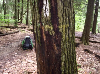
The state line is south of Sages Ravine, near the junction with Paradise Lane Trail. The painted state abbreviations on a tree are so faded they’re almost invisible.
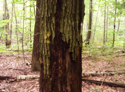
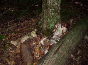
Consequently I’m particularly careful with my hiking today as I pass Sages Ravine, a beautiful little river crossing through a valley that evokes The Lord of the Rings; I don’t want to miss a major milestone such as a state line. Eventually I find what I think is the crossing, marked by this tree:
I am underwhelmed. The A.T. is well-known for its length and for its numerous state line crossings. State lines are arbitrary constructions, but hikers treat them as meaningful markers, both for day hikes to a border and back and for long-distance hikes that might span one or more states at a time. A mostly-unmarked state line might almost as well not have been there; it momentarily serves as a disappointment rather than a celebration of whatever progress was made. In my view once the trail is sufficiently well-marked to follow it (and barring one or two momentary hiccups along the way I believe that it is), the next step is to mark the major attractions along the way, and for this trail in particular, I think state lines rank at the top. It doesn’t have to be anything fancy (I’d find a prominent board with state abbreviations written on it in permanent marker sufficient, if not outstanding), but it has to be easily recognized. This border most certainly is not.
I’m walking too far to suffer a nearly-unmarked state line; if the state line is not well marked, I will mark the state line:
I have no idea how long this not-especially-permanent state line marker lasted, but it lasted long enough for me to derive enjoyment from it; as I noted in the two shelter registers just south of the border (accompanying a gripe to the maintainers about how they need to mark it more clearly — “Even a poor thru-hiker deserves some happiness in life!”), I hope subsequent hikers make it better.
It’s getting later in the afternoon now, and I’m still miles out of Salisbury and at this point foodless. My stop at Brassie Brook Lean-to just across the border is brief, mostly to read the register (Spanky passed through the previous night) and scribble my plaintive cries for a better-recognized state line, but I stay longer at Riga Lean-to as it begins to rain again — not pour as it did last night, but still rain. I contemplate staying at one of the two houses in Salisbury whose owners allow hikers to stay for $35 a night (what a coincidence that they both charge the exact same higher-than-usual rate!) and decide to do so for the night. As I sit there two northbounders (separately) walk in and out of the rain: Warren and Medium Rare (of Texas, as I later discover from his register entries). We briefly talk as it continues to rain, enjoying the only shelter with a view in Connecticut (but not for long, as there are signs suggesting they’re trying to encourage tree growth in the area near the view that would eventually eliminate it). Warren gives me a Pop-Tart to eat before I head out; it’s much appreciated as I’m still running on empty.
I make better time heading into Salisbury, perhaps partly because I’m not walking over varied terrain along a ridge any more, and reach Salisbury by midafternoon. I first try getting space one of the homes in Salisbury, but there’s no response to my knocks, and since it’s still early I don’t technically need to stay here, and I’m not quite disenchanted enough with my smell or wetness (mostly gone as the rain has disappeared) to need a shower that desperately, I decide it’ll be on to the next shelter for the night for 17.5 miles and a decent day’s hiking.
First stop before heading back out again, however, is for supplies. I load up at the local grocery store and pick up a deli sandwich, a banana, and a half gallon of orange juice for a late lunch/early dinner. I also pick up some new batteries for my flashlight, which has been a bit dim lately — turns out it’s not just that the flashlight’s underpowered, it seems! I see a couple other hikers in town but don’t make an effort to find out names. Finally I decide I’ve dallied long enough and head back out to the trail, heading out along a different road than I took walking in. I’ll miss 0.8 miles of trail, but since the road in was 0.8 miles and this road out’s 0.4 miles, by my standards it easily balances out. Along the way I pass this thoroughly unexplainable sight outside a bed-and-breakfast priced way outside my willingness to pay:
And with that riddle wrapped in a mystery inside an enigma, I leave Salisbury. It’s getting late, perhaps 19:00 or later by the time I return to the trail proper, and I have to hurry traveling the last 3.3 miles to Limestone Spring Lean-to to avoid hiking too long in the dark (albeit much less dark than in the past due to my new batteries). It’s pretty uneventful hiking up a few hundred feet and past a meadow or two to reach the turnoff to the shelter, followed by one of the longest access paths I used on the trail, at a par with Upper Goose Pond Cabin, at 0.5 miles. By this time it’s thoroughly dark, and the path isn’t the best-marked path for following in mostly-dark, but I succeed in doing so to arrive at a shelter whose occupants include (possibly exclusively, not certain) Spanky and Homeward Bound. I briefly explain the lateness of my arrival before promising quiet as I head to sleep, which I do fairly quickly after finishing Revelation (I seem to have settled into doing a wraparound “thru-read”, as one might call it) in my nightly Bible reading.
August 9
(19.1; 712.3 total, 1461.7 to go; +4.1 from pace, -217.7 overall)
It’s a leisurely start today for me. Spanky is actually leaving the trail today, possibly for good, due to a business opportunity which presented itself that would have had him move to within easy driving distance of one of his sons in the military in Kentucky or thereabouts. His plan is to see whether that works (he doesn’t have an overriding desire to complete his thru-hike as he already did a southbound thru-hike in 2002), and if it fails he’ll return to where he left off and finish out the trail. I never saw him again after today, which isn’t surprising given that had he returned, I’d have a substantial lead on him. I can’t imagine he’d ever rush himself enough to catch me in the remaining 76 days of hiking I have starting from tomorrow, assuming arguendo that he returned to the trail, and I heard no rumors of his resumed presence on the trail as I headed south, so I suspect the opportunity worked out. He’s hiking to Kent today for a total distance of 29.3 miles to meet his family and drop off the trail; I haven’t even broken 20 on consecutive days yet, so I don’t even bother to try hiking that far today — either 19.1 miles to Silver Hill Campsite or 22.3 miles to Stewart Hollow Brook Lean-to for me.
Homeward Bound, meanwhile, asks me to be on the lookout for a northbounder named TEG, short for The English Gentleman (or maybe The English Guy), saying to pass on the message that she misses her drinking buddy from south on the trail. I later note his entries in registers, but as with most northbounders I attempt to meet, I never meet him either.
The path back to the A.T. is much easier to follow in daylight, and I’m quickly back and heading south again. It’s not far until I reach a bit of civilization again at the Housatonic River and dam; several northbounders partake of swimming opportunities, but I decide it’s better to keep moving. One northbounder mentions that I’m the tenth southbounder he’s met; I hadn’t quite realized I was so early in the pack, but I guess I shouldn’t be surprised. Most people leave in July to avoid Maine’s bugs, and there was only a week and a half from the opening of Katahdin to when I summited it (less, in fact, if you account for reputed inclement weather delaying the opening of the trail to the top). It’s on and across the Iron Bridge over the river, past a hydroelectric plant where I briefly stop for gorp, and back on more trail again. This trailhead features ominous signs warning of both poison ivy and ticks if one strays too far from the trail (or even not, in the case of the ticks), but I see none of either.
A few more road crossings and some more hiking bring me to some elevation gains, and I stop for lunch on the way up. I continue along, lost in thought as I approach a small site known as Belter’s Campsite, when I hear a loud cricket.
Wow, that’s a loud cricket, I think.
Really loud.
Is that really a cricket?
Best to be safe and take a step or two back. Just to be safe.
Oh hey, rattlesnake! Nope, not a cricket. (The sound isn’t so much of a rattle, actually, as of a higher-pitched and sped-up version of the sound made by the spinning wheel in The Game of Life. Describing it as a rattle is probably accurate enough, and in any case this is a sample of one, so it’s hard to say the name’s a misnomer.) Let’s take another couple steps back, actually…
My first thought once I’m back a few more steps is, naturally, to take a few pictures — can’t miss this opportunity. Unfortunately this is before I discover that my camera actually does have zoom functionality, so the pictures are blurry and the rattlesnake may be difficult to pick out. The first picture is taken without flash and is too dark to be usable (the snake looks more directly at me after the picture, so I take a few more steps back), but subsequent ones turn out as best as can be expected given that I don’t know to use my camera’s full capabilities. I first notice the snake off the right side of the trail; as I watch it slowly slithers over a rock, roughly parallels the trail for several feet, and then heads off perpendicular to the trail.
Not surprisingly, it takes awhile for the brief adrenaline rush from the encounter to fade. I pass one northbounder shortly after and note the encounter, and it takes me probably the next four or five miles of walking to return to my usual pace without feeling frazzled and jumpy, by which time I reach Pine Swamp Brook Lean-to. I spend some time reading the register as usual, and I write a full two pages as my own entry.
My first order of business in my entry is to relate in excruciating detail (one of the two pages) my encounter with the rattlesnake, beginning with the exact sentence “I SAW A RATTLESNAKE!” (capitalization in original), as I recall. I’m sure some people won’t care; they can skip it easily enough if they wish. Others will doubtless find it amusing the length at which I describe the encounter; when I meet Sweet Sweet again further south in New Jersey, he bemusedly asks if the encounter I described in the entry actually happened or not. Still others might simply find it nothing more than interesting and perhaps worth reading.
There are no rules for what you can write in shelter registers. Entries might be traditional accounts of the day’s hiking, messages to stragglers behind heckling them to catch up, introspective omphaloskepsis, cryptic musings of no obvious relevance to anything on the trail, or even entirely different things. I remember one register which contained the lyrics of the masterpiece Mercedes Benz, except for being incomplete and filled with blanks, with the accompanying note that hikers who knew the lyrics should fill them in. Another even more awesome entry contained the full words to the F.R.E.E. that spells free jingle in the freecreditreport.com ads, with the accompanying (paraphrased) note, “I’ve had this song playing in my head for the last few hours, and I wanted to share it with everyone else. You’re welcome!”. There would be occasional complaints about entries and on rare occasions a call to forbid someone from writing an entry as they did, but in practice the most part entries are a free-for-all of whatever you want to say.
For my part I only found two classes of shelter entries to be out of line. The first class was for a long-running series of printed and taped ads for the Harpers Ferry Hostel, the first of which I saw in mid-Maine — 900 miles from the hostel. I have no problem with advertisements for hostels, quite the opposite in fact, as they’re amazingly useful if your information isn’t quite up-to-date. However, they shouldn’t be in registers until at least somewhat close to the actual service being advertised — say, 100-200 miles away, which would accommodate a thru-hiker’s elevated pace and allow for adequate pre-planning. The second class was for a few particularly obscene cartoons drawn as entries by a northbounder named Butters. Butters’s cartoons were usually edgy, and I usually didn’t think that highly of them, but they were no more than merely offensive 95% of the time. However, a handful were so graphic (literally), crude, obscene, and generally lacking in any merit beyond shock value that I’d have drawn a line against those few. Of course, this was all just me, and it seems highly unlikely that any sort of register etiquette would ever become commonplace, but if I had that power this is roughly how I’d write the rules.
…and with that, on to page two of the entry. The ziploc containing the register (mostly to prevent mice from chewing them up) also includes an article on a proposed national parks regulation change. I’m not 100% sure, but based on my memory and (particularly) the accompanying picture I think the article in question was Hikers packing concealed heat. As it currently stood at the time I read the article, national parks forbid bringing guns into them — even for visitors with valid CCW licenses. The proposed change would have aligned national park regulations with those of the state in which the park was located. (I don’t know how parks like Yellowstone or the Smokies that straddle state lines would have been treated.) If a state allowed it, the park would allow it; if the state forbid it, the park would forbid it. Readers will not be surprised to find that I am strongly in favor of this decidedly federalist approach that would leave this discretion to the states. As a further step, I’m somewhat less certain that I’d be actively in favor of eliminating restrictions even in states which wished otherwise. First, better to change gradually rather than abruptly as a general rule, so this extra step I’d leave for later if I were to implement it. Second, any concern I have would be more of a constitutional nature than otherwise, as I feel states should have great leeway in writing laws (which is not to say they should exercise that right fully at every opportunity) and as D.C. v. Heller explicitly declined to address the issue of Second Amendment incorporation against the states, and as it primarily addressed restrictions on the right to keep and bear arms in dicta in section III of the opinion, it’s not clear whether such state laws actually are unconstitutional.
(A followup note on the regulation: since the original proposal was made the regulations were indeed changed as originally proposed. The inevitable lawsuit on procedure in enacting the regulation resulted in an initial bar on implementation, and the regulation was eventually overturned for the same reasons [not unfairly, I might add, although it seems to me the true need for the required assessment of the environmental impact of this particular change is minimal]. The response by the new administration [the regulation was promulgated by Bush but overturned under Obama] is that it might “not completely discard[] the Bush rule”, but the response sounds as though it’s kicking the can down the road to avoid confrontation, to either eventually be forgotten or to replace the regulation with a different one more favored by the gun control lobby.)
(And a further followup: the regulation was reintroduced by Congress as part of the recent bill modifying regulation of the credit card industry. [I refrain from using the term “reform” because I believe that word has come to be seen as connoting “good change”, regardless how good or bad the change is in reality. For example, an immigration bill including a general amnesty without meaningful punishment and an immigration bill strengthening border security while greatly increasing the number of immigrants accepted per year might both be called “reform” by the word’s denotation, but only the latter, I believe, further deserves the word’s connotation of being a “good change”.] The amendment passed both houses of Congress, and President Obama signed the bill with the amendment into law late last month. The Bush regulations were effective from the beginning of this year until being overturned; as best as I can interpret the bill’s text in H.R. 627, the amendment will take effect nine months after enactment, therefore late next February. If you happen not to be in favor of this regulation, I suggest you read this commentary to learn how to avoid areas like national parks in which you may be subjected to the dangers of people lawfully exercising their right to keep and bear arms.)
All that said, the legal and policy arguments aren’t especially worth writing in a shelter entry due to the audience and context and the impossibility of discussion, response, and rebuttal. Rather, in my remaining page I address the issue as presented by the ATC. Unsurprisingly the ATC avoids coming down either way on the issue of whether guns should be allowed on the trail. Arguing against guns on the trail would be a surefire way to lose the donations, memberships, and support of hunters and similarly-minded outdoor enthusiasts; arguing in favor of guns on the trail would be a good way to lose the same from their numerous gun control-favoring members. Instead, the ATC’s position is one with which most (I’d be surprised if it’s not at least 95%) serious hikers will agree: they strongly discourage hikers from carrying guns on the premise that guns are unnecessary and that the weight more than offsets any marginal gain in safety. This premise is nearly unassailable; as the article notes (although I believe its statistics are slightly out of date now), only a couple dozen or so murders and rapes have occurred near the trail since 1973, and other violent crime is similarly uncommon. The prominence of unrealistic estimations of the dangers on the trail that a gun can combat seems more to me a matter of people forgetting that just because it’s wilderness doesn’t mean people won’t visit it, and that fewer people will visit it does not mean that people with criminal intentions will not visit it. However, as I argue in my remaining page, the ATC’s argument is a poor one because it so utterly belies most advice about the trail, which is summed up in this phrase: Hike Your Own Hike. Make your own choices about where to hike, how far to hike, what pace to take, what food to carry, the gear you use, the purity of the hike (with respect to taking shortcuts, in whatever form, and not hiking the trail as it lies), &c. Discouraging without offering the HYOH caveat is simply inconsistent with the spirit of the trail and of hiking. If someone wishes to bring a gun on their hike, that’s their decision to make, regardless how nonsensical anyone else might think it is to carry a gun while backpacking. I heard and saw numerous people knowingly carrying things which were just as ridiculous simply because they could: a snorkel and mask, a huge sombrero not primarily intended for actual use, a bicycle (this one I only heard of as a man who carried it the first 800 miles or so), and more. (Arguably, my habit of carrying half a dozen apples out of town, my carrying what amounted to a two-person stove, my ridiculously oversized backpack, and my carrying of a full-sized book the full length of the trail rather than doing without or carrying only sections were just as idiotic.) Were those things condemned? No, and so too do I think carrying a gun should not be condemned nor unequivocally discouraged.
By this time I’ve dallied nearly an hour, long enough for several other hikers to arrive. I’m told of trail magic at a bar in a nearby town, but it’s too late in the day to consider unless I spend the night there, and in any case there’s no hostel or anything similarly inexpensive — on to Silver Hill Campsite I go before it gets too dark.
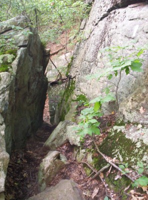
I make much better progress most of the rest of the way to Silver Hill Campsite, and it’s dusk as I stop at Guinea Brook a mile from the site to refill on water, as the Companion claims there’s no water at the site. By the time I start moving again it’s fully dark, and I reach a last road crossing before the campsite.
Road crossings are entirely uncomplicated most of the time; look both ways, quickly move across to the obvious trail on the other side, and continue. In darkness it may be a different matter, as it is here for me. I spend a good forty minutes walking up and down the relevant section of road attempting to follow white blazes to the actual crossing, mostly failing to find the exact location on the other side where the trail continues. I probably hike another mile or two trying to find it, going several tenths of a mile in either direction, as cars occasionally pass by; I’m sure I look ridiculous to their drivers, stumbling around mostly in the dark as I am. 🙂 I consider asking at a nearby house where the crossing is, but it’s late enough I’d rather not disturb people even if it slows me down, and I don’t especially mind night hiking unless it’s for a protracted period of time (which, admittedly, I’m rapidly approaching). Eventually, after much painstaking searching, I find where the trail continues, and I head up Silver Hill through a moonlit night to the campsite. By the time I arrive it’s too late for me to want to cook anything, and I’d like to avoid disturbing the other people at the site, so I quickly set up my tent and head to sleep.
August 10
(22.9; 735.2 total, 1438.8 to go; +7.9 from pace, -209.8 overall)
Today’s start is one of the latest of the entire trail. I cook and eat two meals as I have extra food from not eating dinner last night; it turns out the site does include a newly-working water pump, so I didn’t need to fill up at Guinea Brook after all. Silver Hill used to have a shelter, but now it’s just a pavilion, the foundation of the shelter, and a wide expanse of grass that’s definitely been mowed. I’m not sure how the grass gets mowed; getting a lawn mower up there wouldn’t be easy. I help with a picture for a northbounder who apparently has people form numbers with their hands to show the current number of days she’s hiked; I think the number for today is 110. My register entry at the site consists of commentary on my spectacular ability to cross roads in a timely manner after dark. I leave the campsite after 9:30, an almost absurdly lackadaisical starting time.
Today’s terrain starts out with a descent and then a long, flat stretch along a river. I briefly stop at Stewart Hollow Brook Lean-to to read the shelter register before heading further south. I soon meet a section hiker heading north; as it turns out he recently purchased both a water filter and excess canister fuel for boiling water to purify it, and he’s since decided to just use the filter (wise move, boiling water is incredibly tedious), so he offers me a partial canister of fuel — awesome! How much fuel will I actually have to buy on this hike, discounting what I had when I started and what I pick up for free along the way? I did a quick double-check while writing this, and as far as I can remember (I might remember more when writing actual entries in complete detail) I started with two 15.7-ounce canisters which I used indiscriminately until I figured out how to be efficient; I received two full canisters from Silver Potato and Cracker at two different spots on the trail; I receive a partial canister now; I purchased one eight-ounce canister in Bennington, VT; and I purchased one eight-ounce canister in Damascus, VA — and that was it. All told, then, my total fuel costs were about $11 for the entire trip if I remember right, and I’m certain I’m not off by more than one more canister at most, so say ~$18 as an absolute upper limit. Denatured alcohol stoves may be the fad among thru-hikers, but I guarantee you the freebies I got meant I spent less on fuel than they did. (The advantages of alcohol stoves are weight and cost of the stove; the disadvantages are a cooler, more temperamental flame and less sturdy containers. As I already had my stove at the start of the hike [so relative stove costs are mostly unimportant], I’m not weight-conscious enough to really mind a heavier stove [although I did contemplate buying a smaller, ligher stove at numerous points in my hike], and I don’t mind carrying a little excess free fuel, I consider the canister stove better for me.)
I continue on to St. John’s Ledges, a series of small cliffs reputedly well-suited to rock climbing. It’s a pretty good climb, approaching the incline rate at which I start to become leery, 1000 feet up or down in a mile. For whatever reason I’m still not making very good time, and I elect to pass up Kent, CT to adjust — not a big deal as I didn’t have much reason to enter the town anyway. The target for the day, as usual these days, is to get out of the state, another 12.7 miles to the first shelter in New York. (The shelter also marks one other meaningless milestone: it’s more than a third of the way to Springer by distance!) I move along several miles to what the Companion describes as a state line, but it’s not marked and probably is just a momentary zag across and zag back. Somewhere around there I pull out my stove and cook dinner as an energy boost so I can finish out the night, walk into the shelter, and immediately head to sleep. After finishing that the miles really start flowing, and it’s roughly twilight as I pass Ten Mile River Lean-to 2.8 miles from the state line and 4.0 miles from Wiley Shelter, my final destination. I get into an almost loping gait as I head down from Ten Mile Hill, reached after a small incline and topped with a nice sign and drawing of the view from the top. It’s only another 0.7 miles to the state line, and it’s very nearly dark as I hit it. I look for a state line marker, but the closest thing I see is a double-sided trailhead sign, the side which I see as I pass describing New York trails and the side opposite it describing Connecticut trails. The Companion describes the boundary as a road, so I may have missed the sign there, or it was simply impractical for the trail maintainers to mark it for that reason. In any case it’s too late to dally — on to Wiley in the dark.
Wiley Shelter has me slightly uneasy, because it’s only 0.2 miles from a road. Generally, the closer a shelter is to a road the more likely there are to be problems due to people abusing it because it’s easy to reach. The shelter is empty when I arrive, and thankfully no one bother me while I’m here. (For comparison Governor Clement Shelter in Vermont was 1.4 miles from a road; I conclude that Vermont natives are hardier folk than New York natives. 😛 ) While people aren’t a problem, tho, the shelter itself is pretty dingy all around. (I’m not the only one who thinks this, for what it’s worth, although the picture there doesn’t really show the extent of the dirtiness inside it.) The floor is plywood, which one might naively think would be cheap and easy flat flooring, but as it turns out plywood warps easily, or at least some flavors of it warp easily, making it an uneven sleeping and reading surface. It’s not great, but at least there aren’t random locals harassing me, and I head to sleep.
…but that’s not the end of the day, as around 22:00-23:00 a northbounder of all things walks up to the shelter, says “Don’t mind me”, and heads to sleep. Well, at least I know I’m not the only person who night hikes on occasion. Right, then. Back to sleep I go, this time through til morning.
August 11
(8.0; 743.2 total, 1430.8 to go; -7.0 from pace, -216.8 overall)
What with my late arrival and the late arrival of the northbounder it’s a late start out today. Before heading out I snag a few packages of Knorr sides from the northbounder. He’s having food shipped to him by his mother, but he’s having some amount of difficulty convincing her to buy meal choices that he still likes rather than ones that happen to be on sale. (Score one for buying food as you go!) I also note in the register that Smoothie and the Honeymooners are hiking south together; I think they’d been doing so for awhile now, but this is the first entry I can remember that explicitly notes it. The pen at the shelter doesn’t have any ink, but the point is still sharp, so I spend a dozen minutes pressuring it into the register so that, with effort, an entry can be read.
Today’s initial hiking is through five miles of nondescript forest and some farmlands for a last half mile or so. The weather’s a little damp and muggy, and the sun’s hidden behind clouds. I make good time to N.Y. 22, at which point I head 0.6 miles trail-east toward the first deli near the trail in New York.
The New York section of trail is famous for the preponderance of nearby delis. At some point out of this grew the concept of a “deli challenge”: resupply at delis, and only carry enough to get from deli to deli. A full deli sandwich (or more than one) isn’t exactly lightweight, but it’s infinitely more satisfying than eating more prepackaged pasta. There’s a price to be paid for this culinary profligacy, but unless you’re on a particularly tight budget you can probably absorb it for the ninety-odd miles of trail in New York. Besides, a thru-hike is an exercise in maintaining high morale more than it is in physically exerting yourself once you’ve passed the first several hundred miles, and eating something tasty (usually off-trail in a town, but New York’s just awesome like that) or planning to do so at the end of a stretch of hiking is an easy way to remain in good spirits. I’ll take the opportunity to stop and get a deli sandwich when I can, but I don’t intend to actually follow it through to the fullest and not carry anything else.
I grab a sandwich and a half gallon of mint chocolate chip ice cream, which I then promptly devour as I sit outside watching cars come and go. It starts to sprinkle a little bit as I finish up and head back to the trail, where I immediately pass an entirely unique feature on the trail: a train stop. If I wanted, and if I were a few days earlier, I could have hopped on a train that would take me all the way to downtown New York City; it’s a pretty common side trip for thru-hikers to take. As the stop is only active on weekends and holidays, however, I don’t have a choice about hopping on it and visiting the city for a bit, so I head on.
Around this time the heavens open and it starts raining. This isn’t just a sprinkle, either; the rain isn’t torrential, but it’s a good downpour, and I quickly become soaked. It’s been awhile since I stopped off the trail, and I really am a mess now, so I decide to hop off at the next road crossing and head into Pawling, NY for the night. The Companion lists a bed-and-breakfast with a special hiker rate of $55 a night; it’s more than I’d usually be willing to pay, but I’m a pretty good mess now, and it’s been awhile since I stopped off anyway. When I reach the road into Pawling I head trail-east; New York is one of a couple thoroughly unenlightened states on the trail that prohibit hitchhiking (I don’t know exactly how the term is defined and whether it encompasses mere solicitation or an unprompted offering of a ride by a driver), so my only choice is to walk through the pouring rain all three miles into town. I don’t understand this hitchhiking prohibition at all. Is it misguided governmental paternalism? If so, I have a simple common-sense answer: if you’re a cautious driver don’t pick up hitchhikers, and if you’re a cautious foot traveler don’t attempt to hitchhike. Is it some sense of community aesthetics? Surely not; it’s extremely unlikely the whole state would have been so blighted by hitchhikers, and narrowly tailored bans for individual stretches of road would have been just as effective if so where it mattered. Hitchhiking is a voluntary agreement of a hitchhiker and a driver to share a means of transportation, and absent significant externalities the government has no business restricting or prohibiting such agreements.
The rain only gets worse as I head to town; for awhile it actually become torrential, and I have some difficulty seeing as I continue walking. At this point I could have just emerged from a swimming pool and been no more wet than I am now. I hike for about two miles before a pickup truck heading the opposite direction turns around, offers me a ride, which I gratefully accept. I consider getting a bite to eat, but it’s still early afternoon, so I stop inside the visitor’s center in the middle of the town to dry out and inquire about the B&B. Unfortunately it closed up a year or two ago (another strike against an out-of-date Companion), so it looks like I’m not going to be getting cleaned up while I’m here. I have a backup plan in mind, though, as the city allows hikers to camp in a park a mile outside of town. The park has a pond, restrooms, and showers, but the now-gone pouring rain closed it for the day, unfortunately. I borrow the visitor’s center phone and make a few phone calls to family before heading back outside to attempt to dry out in the newly-arrived sunlight, mostly biding time until dinner by reading about Vietnam. I’d usually head into a library at this time of day in a town, but the Pawling library is closed on Mondays. I head over to the nearby CVS and resupply, then it’s off to the Pawling Tavern for a meal and a Guinness. They have a high school Jeopardy rerun playing; the final answer is roughly, “This is the only state whose official name includes an accented character.” I don’t know the question for certain, but I have a pretty good guess which turns out to be correct, at least for the purposes of getting the question right; Wikipedia claims there’s some controversy. As I head out one guy at the bar says he recognizes me from the deli this morning and inquires if I really ate the entire half gallon. I give my usual answer — yes, but when you’re hiking the sort of distances I’m hiking on a daily basis it doesn’t matter — and walk the mile down a darkened road to the park, where I pull out my sleeping bag and pad and head to sleep.
Maine is so incredibly long and rugged that it makes the subsequent several state lines up to Pennsylvania come like a whirlwind, particularly the states after Vermont. Not much over a week ago I was in Vermont, and now I’m in New York; miles fly when you have goals like that to achieve. I’m still a ways behind my target pace of 15 miles a day, but I don’t have any particular worry that I won’t be able to achieve it if I try. Twenty-mile and nearly-twenty mile days are entirely conceivable, and while I still haven’t managed to string two of the former together in consecutive days, it’s really only a matter of time and geography of off-trail attractions until I do. New York and New Jersey round out the short states, then it’s two hundred miles of Pennsylvania, a brief tour through Maryland and West Virginia, and on into the largest of the states, Virginia.
Northbounders are starting to peter out now, and I’m increasingly focused on catching up to the southbounders who are ahead of me, as best as I can do so without moving faster than is enjoyable. I’m also into the stretch of trail where everyone gets spread out; we’re all in good shape, but the fastest hikers do the extra few miles at the end of the day more often (or stop less during the day) to reach the next campsite or shelter and accumulate a greater and greater lead over time. There’s plenty of time and distance remaining, though, for me to meet or catch up to any of the fifteen southbounders I know to be ahead of me. There’s nothing to it now but to let the miles flow.


