June 27
(7.3; 195.1 total, 1978.9 to go; -7.7 from pace, -89.9 overall)
The next morning I wake up, finish off the second pound of strawberries and apple juice I’d purchased yesterday, add some photos to the first trail journal post. Incidentally, the laptop the hostel has for our use is running Firefox 2; I download and run the install program for Firefox 3 (released to the masses during my time hiking, and with a world record to its name, no less!) to find — gasp! — that the laptop is running that marvel of stability, Windows ME, while Firefox 3 requires Windows 2000/XP or newer. No upgrade for this machine! :-\ No Unicode love for the Firefox 2 users, either.
I then hit the trail with The Honeymooners at around 9:30 or so. I immediately confirm a fact I’d suspected yesterday: I bought way too much food when I did my shopping on an empty stomach. Best of all, we’re starting to hit the more mountainous part of Maine, and my pace becomes abysmal. Today I’d planned to hike to Spaulding Mountain Lean-to, a distance of 13.5 miles. Instead, I reach the Crocker Cirque (fun fact: the word cwm is defined by the official Scrabble dictionary as “cirque”; it is actually not a “Scrabble word” for me, because I’ve seen it labeling one of the features in the map in Jon Krakauer’s Into Thin Air) tent site, a grand total of 7.3 miles up the trail, of which the last mile or so is a rocky downward scramble — the absolute worst thing possible for my making any sort of speed.
The silver lining of this overfull pack, however, is that I eat very well today: two apples, three tortillas with peanut butter and honey, and a lot of gorp (with M&Ms added, naturally), and that’s just on the trail. (I’d planned to eat the bagels and apples anyway since they’re heavy, but I did eat them a bit more hurriedly than I’d expected.) Dinner is a Knorr chicken meal to which I add real chicken! Apparently, in addition to tuna in a pouch, there also exists chicken in a pouch! The miracles shall never cease. Mine is a lightly-garlic-flavored breast, although I hear they also sell unflavored breasts (not in Stratton, it seems). It goes pretty well, all told, and I sleep sated, again on a tent platform with a rigged-up staking system for my not-freestanding tent.
June 28
(6.2; 201.3 total, 1972.7 to go; -8.8 from pace, -98.7 overall)
The next day goes, if anything, worse than the previous day. I start the day pretty late, eating the remaining apples I’d started with and a few of the bagels I’d brought (which actually contain a pretty hefty number of calories, a fact I’d not noticed before in normal life). I’m still carrying far too much.
The trail is relatively uneventful. I pass South Branch Carrabassett River, a “ford” but in reality a bit of rock-hopping followed by walking an uncertainly-anchored plank across a ten-foot stretch of water, around noon, finishing off the bag of dried fruit as trail mix that I’d started the previous day. (I picked it up from the hiker box at the hostel; it was amazing stuff but pretty heavy even after drying.)
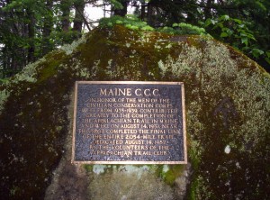
The day ends just short of six in the evening at my target for yesterday: Spaulding Mountain Lean-to. I note in the trail register that The Honeymooners did stay last night here, and I make a note in my entry warning hikers not to buy groceries on an empty stomach.
The lean-to is a full house tonight: a couple on a three-day trip, it being the weekend and all, and a bevy of northbounders (five, the most I’ve seen yet in the same place). The northbounders are Crazy Legs, Water Bear, Marathon, Strides, and one last person whose name I’ve sadly forgotten. Dinner tonight is another modern miracle: beef Knorr with dried beef slices (again from a pouch). The slices are, of course, heavily salted; the instructions on the label suggest running the slices under warm water for fifteen seconds to wash off excess sodium, which I don’t do, much to my chagrin: this stuff’s wicked salty, nearly to the point of not being readily edible. The northbounders remark on the quantity of food I have (with good reason!) and say the bear canister I’ve been using on the trail is superfluous, with bear lines or boxes at every shelter (and perhaps tent site as well? I don’t remember the exact wording) where you’d actually need them. Given my pack weight now, I’m inclined to agree with just about any suggestion that reduces its weight.
Some fun facts about some of the northbounders from late-night flab-chewing:
One of them is from the upper peninsula of Michigan near Marquette (I believe the exact town mentioned was Big Bay, but I’m not 100% sure). He worked for the National Park Service on Isle Royale several years ago doing wildlife surveys, among other things, and once while hiking with a partner saw three gray wolves approaching him. He called to his partner hiking fifty or so feet ahead of him, and when the partner turned they’d all scattered. Since this was a bit unnerving, they quickly continued on for another mile or so before stopping to regroup. Then, on a whim, they checked whether any of the wolves had been radio-tagged: turns out one of them had been, and furthermore, it was only thirty or so yards away and had followed them the entire time. According to him, this was at the time the closest incident to a wolf attack in NPS history (!).
Another of the northbounders (perhaps the same one, perhaps a different one, perhaps the one who would then quite aptly have been named Marathon) has so far logged three forty-mile days on the trail during his thru-hike. I doubt I’ve broken fifteen more than a handful of times, ever, so this is an almost-incomprehensible feat. We shall see what flatter trails do to what I consider achievable.
June 29
(10.4; 211.7 total, 1962.3 to go; -4.6 from pace, -103.3 overall)
I get a nice quick start this morning in 75 minutes from in sleeping bag to hiking down the trail; I’m pretty sure it’s my fastest start yet out of a shelter (out of a tent is naturally slower), but I haven’t been paying much attention so far.
The first few miles are across reasonably flat ground, and I make nice time — for a moment I become optimistic that I can do well for the day. The first real stop is Poplar Ridge Lean-to at eight miles out, occupied by a couple guys drying out tents and other gear. I talk for a second to them (one has the same Eureka Solitaire tent I have), and they mention an under-construction tent site (not listed in books yet, of course) a little further down the trail between mountains — they inadvertently stayed there the previous night to be awoken by a trail crew coming in to work on the second of three days installing a privy. I then continue down the trail a touch and stop to use the shelter privy before heading along further; it’s too early and too short to stop here for the night. I pass over Saddleback Junior and stop at what I think is the nascent tent site, although it’s not marked by the orange tape that had been mentioned as denoting it. There’s a large number of boot prints from the south which stop right at the place where I turn off, so I think I’m there, even if I can’t find the aforementioned half-built privy.
The site itself is pretty nice; it’s not too buggy, although I pull out my rain coat to reduce the need to ward them off, set up my tent in a nice cushioned spot, and start making dinner. While making dinner, I hear some loud grunting noises from the east by the trail — turns out it’s a porcupine about ten or fifteen yards away! I don’t know for sure it was one since it was dusky, but it looked a lot like one; since I’m in the middle of dinner preparation the last thing on my mind is taking a picture — I’d rather he leave me (and my smellable goodies) alone now.
June 30
(10.4; 222.1 total, 1951.9 to go; -4.6 from pace, -107.9 overall)
Often trail magic, as it’s called, comes in edible form, a fact which should not be surprising given just how much energy hikers require to move from place to place (particularly through places like Maine which are particularly hilly). Today, trail magic was not edible but rather white and stored on a roll. More on that in a bit…
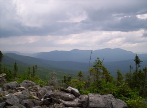
It turns out I’d stopped short of the nascent campsite, which I pass a bit down the trail this morning. Nobody’s there, and the privy looks complete, so sadly I can’t celebrate its existence; it looks pretty awesome. The morning continues with a nice hike up The Horn, yet another mountain in Maine. Saddleback Mountain itself follows next, and it has good views all around.
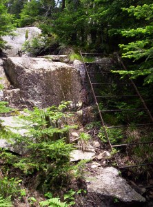
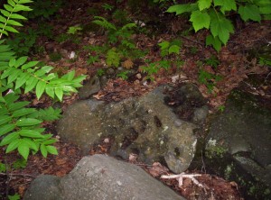
The most interesting part of the early day, however, isn’t what’s listed in the Companion. Strangely, it’s also not on any of the Maine maps I’ve seen. It’s definitely mentioned in a lot of books, but my available guide resources have both inexplicably missed it. It is a feature, located between The Horns and Saddleback Mountain, known as Saddle Point:
I fully expect the ALDHA and the Maine ATC to rectify this serious omission from their literature at the earliest time possible.
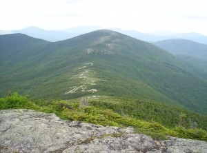
Finally, I take the customary 360-degree video from the top of Saddleback Mountain:
I continue down the trail toward the next lean-to, Piazza Rock Lean-to. Along the way I pass a guy wearing bug netting trimming along the trail; turns out he’s the lean-to’s caretaker out for a bit of maintenance. Since I’m hoping to make it six miles further that day to Little Swift River Pond Campsite, I continue on.
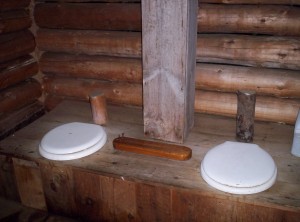
When I reach the lean-to, I decide to stop in to check when the Honeymooners passed through. Before doing so, I stop to use the privy. This privy has all the amenities:
Incredibly, while using the privy, I run out of toilet paper. I’d resupplied with a small partial roll in Stratton, but somehow, due to a ridiculously (but not perilously, as I note in the shelter register) active bladder, my supply (intended to reach Gorham) is already depleted! The options aren’t good. I’m right near a road into Rangeley, so I could hitch in in the morning just to get toilet paper, which would eat up a good hour, and that’s if I get lucky. I could experiment and see just how well leaves work, but I’d rather not find that out until I’m forced to do so. I also have one last option: see if the caretaker has a phone I could borrow to call for some to be delivered by friendly people in the area (there’s a nearby place with five people willing to put up and party with hikers that would probably work). I head back to the trail to think about how to find the caretaker without walking back too far, but amazingly he comes around the corner at exactly that moment! I make my request, and he goes one further and outright gives me a roll! It’s an absolutely monster roll that’s at least three inches in radius before flattening, but I don’t care: it’s saved me a lot of trouble.
Reinvigorated from this unexpected bit of magic, I complete the remaining 1.8 miles to the road in 48 minutes, at the strong pace of 2.25 miles an hour. If I keep that up for the next 4.8 miles I can make my intended destination with a little time to spare. Naturally, the uphills start again and I fail to do so, but I do make it two miles further down and set up camp just off the trail and next to South Pond, so water’s readily available. Bugs are out but not too bad as I make dinner and go to sleep.
July 1
(11.8; 233.9 total, 1940.1 to go; -3.2 from pace, -111.1 overall)
I’d planned to wake up around 6:30, thinking to pack up and be out before anyone else can pass by. Since I’m two miles from a road (and shuttles from town wouldn’t arrive until far later) and four miles from the nearest shelter, I don’t really expect anyone until at least eight. It’s really strange, then, when someone walks by at 6:35 as I’m slowly thinking about getting up and says hi. You meet all kinds on the trail, I guess.
After breakfast and packing up I head further south. I don’t go far before I pass a treasure: a Maine map for the section of trail I’m hiking! The Maine topos are pretty awesome: profiles, notes on trail features passed along the way, and so on. I haven’t bought them because they’re expensive, and many thru-hikers have done fine with trail signs combined with the white blazes on trees and rocks along the way. This map is only good another few miles, but I’ll take what I can get. It’s probably the early hiker’s map, but if it isn’t, I’ve got a nice shiny map (and if it is, he’ll be happy to get it).
A few hundred yards later I stumble on an even better treasure: the map for the next section of trail. Again, it’s probably the early hiker’s map, but whatever: I have far-seeing guidance for a little while.
Later down the trail I meet another hiker heading north named Saxifrage (a thoroughly awesome name). After inquiring where he’s heading to make sure he’s not doubling back for maps (he’s not), he mentions that a guy up the trail, a Seth of the American Hiking Society, had asked him to look for the maps. I tell him I picked up the maps and will pass them along when I see Seth.
I eventually catch up to Seth at Sabbath Day Pond Lean-to, where I eat lunch and pass on the maps. He’s delighted and passes along contact info in case I need any trail magic in the D.C. area; we’ll see how I feel when I get there.
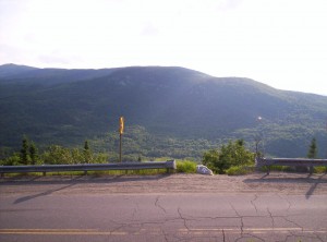
I’m hoping to head on to the next lean-to, Bemis Mountain Lean-to, so I hurry on, past an awfully large number of hikers — I think I pass around twenty total today (twelve or so from a camp group). Before getting to the lean-to I have a road crossing and a ford, not to mention the mountain itself. The road crossing is a definite candidate for best road-crossing view; I’ll post the picture when I have more time later here’s a picture out across the road showing how good it is:
The descent from crossing to ford is steep and takes a lot of time, so I decide to stop just after the ford and pitch the tent. This isn’t actually a good idea: the bugs are the worst they’ve been since the one site in the 100-Mile Wilderness, and I pull out the raincoat and forego a cooked dinner in favor of energy bars and call it a night.
July 2
(12.5; 246.4 total, 1927.6 to go; -2.5 from pace, -113.6 overall)
I get a late start in the morning; bugs are out again for breakfast, so I pack up quickly and don’t heat water for oatmeal. First stop is the lean-to I’d intended to hit the previous day, after a long hike over Bemis Mountain. I see I’m still behind the Honeymooners, and I discover that the two hikers with whom I’d hiked Katahdin oh-so-long-ago are now known as Asgask and Slowpoke. I sign the shelter register and include the birthday song in my entry, because it’s my birthday today! Happy birthday to me! (22, a pretty unremarkable number, but still a new age.)
Travel is fine until just before Old Blue Mountain at about ten miles in. I hope to go seven miles further to a shelter, but just then it starts to rain pretty hard, and even with a rain coat I’m completely soaked when I reach the top of the mountain. Since I’m just short of a road to Andover, I decide to stop there and hitch in to a hostel for the night — a birthday present, or something. The only problem is that the Companion says of the two roads into Andover that, “Neither road has much traffic.” I hurry as fast as I can and hope for the best.
I reach the road at 20:15, at which point it’s not yet dark but is starting to get there. One vehicle passes heading in the opposite direction as I descend the last few feet to the road; I then wait fifteen more minutes, during which time exactly two vehicles pass heading in the direction I want to go. Miraculously (and I mean that in the literal sense) the second vehicle offers me a ride, next to their two dogs in the back seat of their pickup truck. They take me nine miles into town, and I arrive at the Andover Guest House at 20:52. I say hi to the hostel owners, who tell me I probably want to head over to the store across the street to get something to eat — just before it closes in eight minutes. (See what I meant about miraculous? You can’t cut it any closer than that!) I get food and eat it while talking to family back home on the phone; when the conversation ends I check email and deal with a post here while laundry cycles, then I head to sleep.
The main theme of southern Maine is that it’s a lot of up and down. Northbounders are blowing past us, fresh from 2000 miles of hiking and the White Mountains as conditioning for the ups and downs (south of the Whites is actually considered pretty easy — the “hiker superhighway”, actually, where twenty-mile days are neither uncommon nor generally difficult if you get up early and keep a nice, long stride going), so their pace can be a bit depressing if you don’t take it in context. Right now I’m just anticipating Glencliff in New Hampshire, where, as I’ve been told by the two hikers at the lean-to just before Saddleback, the mountain climbing ends and the hiking starts.

You’re just now discovering the joy of pouched/canned chicken? That plus some couscous is delicious, simple, and fast.
I hope you’re also aware of of ready-to-eat bacon! OMG, bacon!!!
Comment by Justin Dolske — 19.07.08 @ 04:56
I totally know this effect of buying way too much food when shopping hungry. Happens all the time to me. I’m following your hiking writeup with great interest (and I’m totally jealous), keep it up!
Comment by Carl Fredrich Bolz — 19.07.08 @ 12:47
oops.. sorry for the early birthday wishes. happy birthday!! (again) 😛
you know, every time i saw trail mix, i thought of you. and now, i’ll think of you when i see pouch tuna. 🙂 (not TP.. don’t worry)
Comment by spark — 19.07.08 @ 20:44