September 13
(13; 0 side; 43 total, 168 to go)
Deep in Lyell Canyon sunrise starts at its usual time, but direct sunlight doesn’t reach the floor until hours later. I eat my breakfast near the campfire with the other nearby backpackers, and we have some reasonable conversation as I eat my oatmeal. The fire provides a nice bit of warmth in the not-quite-sunlight. Once food’s finished it’s time to head back down the trail to wherever I end up today.

My stumbling continues, but when the ascent out of the canyon starts it necessarily slows as the trail begins crawling up and over rocks. I pass by a couple also doing a thru-hike of the JMT at one point; they’ve been out since a little before me, and they plan to leisurely hike the trail into early October. We leapfrog a few times until I pass them for a final time after lunch today.
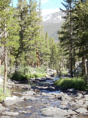
The ascent continues past several tarns, mountain lakes fed by glacial runoff. The lakes are connected by the Lyell Fork, which is much smaller at this elevation than it was from even the earlier bridge (let alone the canyon itself). It’s also much smaller now than it was a couple months ago; this late in the season I can cross it on rocks without getting my feet wet.
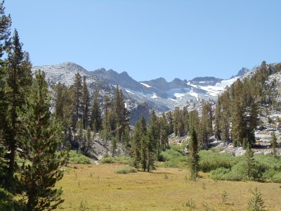


Just above the lip of rocks in the near foreground is a flat area with another tarn whose outlet the trail crosses. Now seems like a good time for a lunch break, and I stop and cool off my feet and swollen ankles in the water for a brief moment (this being snowmelt water after all) before I eat lunch. There’s another group of other hikers here already doing the same things I’m doing; they head off before I finish.
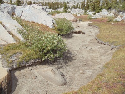
After lunch the ascent resumes. It’s pretty gradual as ascents go, which also means it’s rather long. Donohue Pass may be a pass, but it’s not nearly the sight to see that later passes are, clearly occupying a narrow ridge between peaks. It’s more accurate to call it Donohue Plain or Donohue Plateau, I think.
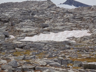
Donohue Pass marks the end of the first recreational area the JMT passes through, as I leave Yosemite National Park and enter Ansel Adams Wilderness, not surprisingly named for Ansel Adams, a noted black-and-white photographer of nature, most particularly Yosemite — try a web search to see his work.
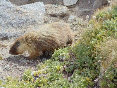
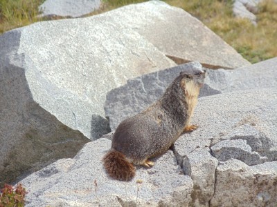
From here south through the end of the day is mostly a blur. The scenery is impressive as always along the JMT, but it is not particularly more memorable than other sections, perhaps because the lakes being passed by are a bit smaller, peaks are further in the distance, and there aren’t many people out and about. My biggest recollection from this descent, and from some others, is of a marmot or two living at high elevation.
The initial descent from Donohue Pass presents some nice views, and the gradual winding around lakes, over small streams, and through some trees makes for a comfortable, leisurely section. I have no particular goal for the day, but as I approach it Thousand Island Lake seems like a good stopping point: reasonable mileage for the day, going by my map, great views, plenty of space nearby for camping.

I descend near Thousand Island Lake around 17:00, although the lake has been visible for awhile (Banner Peak behind it even moreso). I haven’t filled up on water in awhile, so I’m going to need to do that when I get to the lake, and by the time I reach wherever I end up staying near it the iodine I’ll add to it should have purified it.

A handful of lakes in this section of the trail don’t permit camping within a quarter mile of their outlets. I pass by most of those lakes without stopping for the night, but Thousand Island Lake is the one exception. I attempt with partial success to follow the path around the lake past the edge of the no-camping zone, and I reach a flat, rocky area a short distance from the lake itself around 18:00. Daylight disappears as I cook dinner, made slightly more interesting by the constant wind blowing along the lake. Constant wind is the harbinger of a cold night, so I put on some long underwear. I can see more stars in the sky than I’ve seen in a long time, including all of the generally-too-faint-to-be-seen Little Dipper, as I head to sleep.
I took enough pictures this day and the next that each warrants its own post. These days are probably the most gorgeous of the whole trail, but the passes in the latter half of the trail are more breathtaking. (Literally.) This isn’t to say that either is more beautiful than the other but rather to say that they’re beautiful in different ways — about what I’d say if asked to compare the Appalachian Trail to the John Muir Trail. It’s apples to oranges as far as I’m concerned. (What if I really had to choose A.T. versus JMT, with no further distinction? 139 days versus 15 days is a no-brainer. But taken day by day, the JMT easily wins.)

