02.09.13

37 days and one year later: part 9: health

This is part nine of a series of posts discussing various aspects of a bike trip I did across the United States in 2012. Part one discussed the start of the trip and choosing a route. Part two discussed my daily routine and nightly shelter. Part three discussed general mileage, elevation encountered, and state-by-state scenery. Part four discussed mileage extremes and water. Part five discussed food. Part six discussed elevation extremes, particularly crossing the Continental Divide at Monarch Pass. Part seven discussed how I used down time and how I kept electronics charged. Part eight discussed mechanical problems and other surprises. This post discusses health issues I had along the way.

A marathon

It’s one thing to bike a hundred miles in a day, once. It’s another to do it several days in a row, as I’ve done several times on the DALMAC ride in Michigan (80-100mi/day for four or five days, on the routes I’ve taken). In a certain sense, it really isn’t that different to bike a hundred miles a day (average) for over a month. It is a bit different, however, when that month includes no true, complete rest days. Without rest days, you give your body almost no time to heal before it’s back on again for another day of beating. 🙂

I could feel, as I traveled, that I was always slightly on the edge of exhaustion. I didn’t get a cold, but I could tell I was always on the very edge of one: slightly out of breath all the time, with a slight cough that never really went away, slightly weary every morning as I woke up to prepare for yet another long day of riding. I’m actually somewhat surprised I didn’t get one, from the constant strain I was putting on my immune system.

Beyond simple exhaustion, my pace and timing forced certain health sacrifices on me, that being able to truly rest might have healed quicker.

Pulled muscles

At some point on the first day, I pedaled slightly too aggressively, quickly, or eagerly with my right leg, and I slightly pulled a back lower-leg (ankle?) muscle. This didn’t prevent me from cycling, but it did make it slightly painful to push hard while pedaling with that leg: I cycled for about a week with my right toes pointed downward further than I might ordinarily do, so that I wouldn’t stress it. Interestingly, as soon as it healed, I experienced the same slight injury to my left leg, and it too was slightly out of sorts for a week. Neither injury materially interfered with cycling, and both were only barely noticeable while walking. But a day off might have healed these injuries, rather than having to live with them for a week each of cycling, if I’d been able to take one. (Or it might have taken several days regardless, for all I know.)

Left knee pain

The other pain I experienced, that I’m still at somewhat of a loss to explain, was in the muscle just above my knee, on the front inside. It first arose on the third day as I climbed from Folsom Lake into the Sierras, subsided overnight, then returned again the next day up and over Carson Pass. The pain was much of the reason my third day was comparatively short and slow. The other side of the Sierras, I stopped at a bike shop to ask if they had any ideas what might be causing the pain. (I, er, carefully didn’t mention the bike was only four days old, figuring if there was a problem, it should be visible and observable regardless. Not that I was afraid of looking stupid or anything, of course.) Their only thought was my left cleat was misaligned, but I hadn’t touched that cleat in over a year, so it seemed pretty unlikely. But the pain appeared to correlate with ascending, and Nevada promised to be flatter, so they suggested continuing on and seeing what happened. And indeed, the pain disappeared — all the way til Virginia. Then I felt it almost returning, at lesser intensity, by the latter phases of each day.

My initial thought was that the pain was some early-trip lack of strength which subsided after some toughening up. But that wouldn’t explain its reappearance at the end of the trip. (I dealt with it at end by trying to bike slightly easier and by wearing my slightly-compressing leg warmers. A doctor would of course have recommended rest, but that Wasn’t Going To Happen, so I did the best I could in its absence.) Even now I’m still not sure what might have caused it. Perhaps, even given a year at that position, the cleat still needed adjustment when subjected to particularly harsh climbing? *shrug*

Next time, the logistics of getting home.
29.08.13

37 days and one year later: part 6: elevation extremes and Monarch Pass

This is part six of a series of posts discussing various aspects of a bike trip I did across the United States in 2012. Part one discussed the start of the trip and choosing a route. Part two discussed my daily routine and nightly shelter. Part three discussed general mileage, elevation encountered, and state-by-state scenery. Part four discussed mileage extremes and water. Part five discussed food. This post discusses the elevation and ascents I encountered, particularly how I traversed Monarch Pass.

Elevation extremes

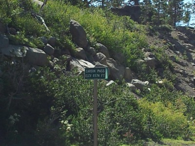
The first elevation extreme, Carson Pass, was perhaps the hardest: not for its height, which is only mid-8000s feet, but for its earliness and the length of the ascent. A gradual ascent, but still a long, energy-sapping ascent. Approaching it later in the trip, I’d probably have found it easier.

The Carson Pass elevation sign: 8574ft
Only 8500ft? Weaksauce

Kentucky and Virginia had the steepest ascents: never ascending particularly far, but lasting long enough that reaching the top was a relief. If someone wanted to do hill training, setting aside high-altitude benefits, he’d likely be better off training in the Appalachians than in the western states, surprisingly.

Colorado reached the highest elevation of any state. Passing over the highest point at the Continental Divide was possibly the best, and stupidest, part of the entire trip.

Monarch Pass

As usual, I started biking late that morning, and by early afternoon I’d only covered about 40mi. But then I turned it on, reaching the base of the climb to Monarch Pass at 18:15 at ~90mi. From here it was only 10.5mi/2800ft to a tourist store with snacks at the top, then a few miles’ descent to a turnoff to Monarch Campground where I planned to stop. The store closed at 20:00, but if I kept moving I could reach the top before then.

Everything went well with this plan until around 19:00, when it began to rain. Rain is an excellent way to cool down. But in cloudy weather at 10000ft in chill temperatures, it was the last thing I wanted. I didn’t have warm clothes, only the arm warmers I wore constantly (mostly for sun protection), cycling jersey and shorts, and leg warmers if I’d taken the time to put them on (can’t remember if I did — I think I decided that stopping and putting them on, when the rain started, would leave me worse off than continuing to bike would). What to do? It really wasn’t a choice: I had to keep shivering my way to the store before it closed.

I reached the top around 19:52, comfortably just in time, and immediately went inside to snack and warm up. I was doubtless now hypothermic. But between warmth and food, I’d be fine. I got a hot chocolate, a quarter pound of fudge (okay, four ounces, but they sold it as a quarter pound!), and — this was the worst idea in the world, but I’m a sucker for the flavor, so I had to have some — a small cone of peppermint ice cream. After consuming those while slowly warming up, I headed back outside — it was now completely dark and still raining — and began the bike ride down to the campground.

A fully-transparent image, i.e. I was too cold/tired/etc. to take any picture at all
One of the many pictures I took time to take at Monarch Pass

The trip down was dangerous, putting it mildly. The descent was steep and thoroughly wet from the rain. And while I had lights, I also didn’t have very good motor control through my cycling gloves in the cold. I knew I would quickly return to hypothermia, and my hands would only get worse. If I fell or something happened, I was going to be in very deep trouble. So I took it very slow, braking every second or so to not gain speed. I could not afford to crash.

After some period of time between five and twenty minutes, I saw signs for the turnoff to the campground and took it. I proceeded down the road maybe a couple thousand feet without seeing signs for the campground, so I started to worry. Was I on the right road? I was, but I wasn’t sure enough to go too far down it without being certain, so I returned to US-50 and continued to descend. (I knew I had options further down US-50 if that turnoff was the one I wanted.) By this point I was definitely back into hypothermia, and I knew that I was unquestionably staying at the very first place I saw. A short time later I reached Monarch Lodge, where I rolled my bike up, leaned it against an outside wall, and went in and asked mumbled to ask if they had rooms. They did and pointed me to the hot tub and sauna as I obviously needed to warm up. (I was sufficiently cold that the typically-cool pool at the motel actually felt warm when I jumped in it before jumping into the hot tub.) I quickly made use of them and returned to normal body temperature.

Good idea, bad idea

Monarch Pass, done that way, was the second-stupidest thing I’ve ever done in my life. (The only thing stupider was walking 51 miles in a day for the Four State Challenge, because I had no good reason at all to do it. It was a totally arbitrary challenge done for no reason except its existence.) It was somewhat pointlessly dangerous, and it might have been nice to experience the full downhill from Monarch Pass at full speed, without missing five or so miles of it in rainy hypothermic darkness. (The first forty miles of the next day were downhill at an average 24mph, so I still got plenty of downhill. 😉 )

But hypothermia and unanticipated rain aside, I knew what I was doing. I knew the condition I was in, and that I had to get warm as soon as possible after reaching the campground or stopping elsewhere. I knew the margins for error in reaching the Monarch Pass store and in descending. And I made the utmost efforts to respect them by pushing hard to reach the pass on time and then to descend as quickly as safely practicable. It was unquestionably dangerous, but it was entirely manageable danger, that I managed with no real issue. If I had to do it over again, I’d do it the exact same way without regrets. (Although I’d definitely give more thought to the possibility of cold rain at elevation, and after-dark riding through it. Not considering that did make for a bit of discomfort, but it didn’t add that much risk, so long as I was careful.)

Next time, down time and keeping electronics charged.

24.08.13

37 days and one year later: part 1: the start and choosing a route

One year ago, after 37 days of biking around ~3875mi total starting in San Francisco, I reached Yorktown, VA to finish biking across the country. An exact day-to-day accounting would likely bog down in uninteresting logistics (particularly given the way I traveled — other approaches would likely yield more interesting day-by-day commentary). Instead, I’m going to cover a variety of topics of interest from the trip, in somewhat random order, in series. If you want a very cursory, sometimes out-of-order account of the trip, reading approximately July 18 to August 25 of my Twitter stream covers it.

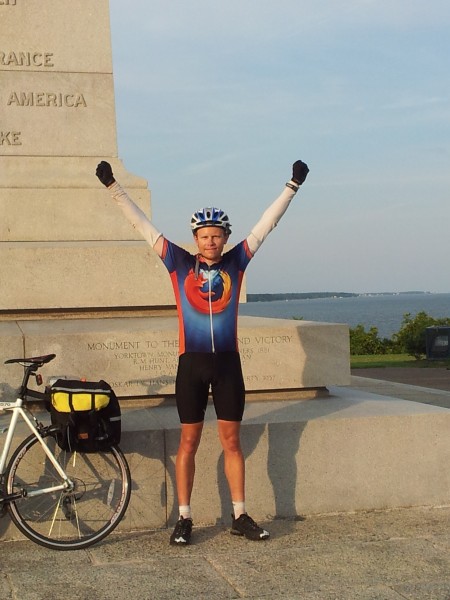
Me in the traditional arms-upraised pose, next to my bike and (appropriately) the Victory Monument at Yorktown, with the Chesapeake Bay (and the Atlantic Ocean) in the background
The secret to my speed: obviously the cycling jersey

An inauspicious start

The trip got off to a bumpy start the Tuesday night before I planned to leave. I planned to ride my spiffy, super-light carbon-fiber racing bike. I use it for regular transport, so I waited to get a final tune-up til the last minute, picking it up the evening before I departed. I began loading it with panniers and gear. Racing bikes don’t have mounts for carrying gear, so I’d use a seatpost rack (with correspondingly light ~16-pound load). When I began attaching the rack, I noticed the clamp matched a much smaller-diameter seatpost. Looking at how the clamp would make contact with the seatpost, it suddenly occurred to me that attaching a seatpost rack to a carbon fiber seatpost might not be a good idea. Carbon fiber is strong along its length, not laterally: the clamp could easily crush the seatpost.

A red carbon-fiber racing bike
Shiny! But really not the thing to use for touring

Wednesday morning, I asked the bike shop if they had an aluminum seatpost of the right size. They wouldn’t have one til Friday. Other local shops didn’t have any, either. Replacing the seatpost was out.

Seeing no other options…I went to the first bike shop, bought a non-carbon road bike that fit me, walked home with it, transferred gear and pedals to it, and biked to Caltrain to head to San Francisco to start the trip.

Thus I crossed the country on a bike I bought the day I left.

Me standing underneath a "Welcome to Illinois" sign, with my bike leaning against the sign just next to me; a sign with directions to a mental health center is just visible
Too bad that mental health center wasn’t closer to the start of the trip, there might have been hope for me then

This is crazy. But not quite as crazy as it sounds. I’d purchased a 2012 Scattante R-570; I’d previously owned the 2010 version, so I knew I’d be comfortable. And months before, I’d considered getting a touring-oriented bike for extra carrying capacity. But I’ve never spent money very easily. I had the money, but I didn’t want to spend it if I didn’t have to.

Now I was in a “have to” situation. Riding a totally untested bike would rightly scare most people to death. Most people would probably cancel the trip or substantially change plans. But my philosophy is that what must be done, can be done. So I did it.

Other than lost biking time (day 1 was 23.76mi route miles rather than the ~100mi I’d intended — no small loss, but not huge, either), all I lost was the ability to buy the bike on sale for ~$160 less. It could have been worse.

Choosing a route

I traveled pretty much entirely with the aid of the Adventure Cycling Association‘s route maps. I considered finding my own route, but I discarded the idea for lack of time and being unsure I’d enjoy route-planning. In hindsight this was clearly the right choice. Unless you enjoy route-planning for its own sake, buy existing cycling maps. You’ll get better routes, and more cycling-useful information, than you can create on the fly. (Plus GPS units cost hundreds of dollars and must be charged every night.)

Route profile for the section of road from Grover to Lake Powell in Utah
A profile from an ACA map, that’s likely harder to find outside of prepared maps

The 4200-mile TransAmerica Trail goes from Oregon into Montana, southeast to Pueblo in Colorado, then east to Virginia and the coast. It’s the most well-known and commonly-used cross-country route. The 1580-mile Western Express goes from San Francisco to Pueblo. Most people do the TransAmerica because it avoids much waterless desert and elevation change. For me, convenience and available time made the Western Express and eastern TransAmerica a no-brainer.

A definite perk to using an existing route is that the roads will be good for cycling. Often I was on relatively empty back roads, or on state roads with light traffic. The worst roads were in the Rockies in Colorado, likely because of the terrain. The worst regularly-bad road occurred between Cimarron and Sapinero along US-50: a narrow, winding stretch of road with little shoulder and a bunch of RV traffic, where I should have occasionally taken the entire lane rather than let anyone unsafely pass me. Colorado also had the worst irregularly-bad stretches of road, along CO-145 due to road construction. There were two two-mile stretches of riding through gravel where roads were being re-oiled, which I rode through (what choice did I have?) past Motorcycles use extreme caution signs on 700×23 tires (less than an inch wide). Good times. And the stretch from Telluride to Placerville had so much construction dust I sometimes couldn’t see ten feet; I had to stop and turn on head and tail lights to be visible. But generally, ignoring these rare exceptions, the roads were great.

Next time, the daily grind and shelter.

17.07.12

37 awesome days

I tend to take very long vacations. Coding gives me the flexibility to work from anywhere, so when I travel, I keep working by default and take days off when something special arises. Thus I usually take vacation in very short increments, but very occasionally I’ll be gone awhile. And when I’m gone awhile, I’m gone: no hacking, no work, just focused on the instant.

My last serious-length vacation was August-September last year. And since then, I’ve taken only a day and a half of vacation (although I’ve shifted a few more days or fractions thereof to evenings or weekends). It’s time for a truly long vacation.

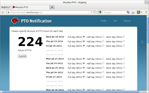
Screenshot of a browser showing Mozilla's PTO app, indicating 224 hours of PTO starting July 18
Yeah, I’m pretty much using it all up.

For several years I’ve had a list of long trips I’ve decided I will take: the Appalachian Trail, the John Muir Trail, the Coast to Coast Walk in England, and the Pacific Crest Trail. I’ve done the first two in 2008 and 2010 and the third last year. The fourth requires more than just a vacation, so I haven’t gotten to it yet. This leaves one last big trip: biking across the United States.

Tomorrow I take a much-needed break to recharge and recuperate (in a manner of speaking) by biking from the Pacific to the Atlantic. (Ironically, the first leg out of San Francisco is a ferry to Vallejo.) I have a commitment at the back end August 25 in San Francisco, and a less-critical one (more biking, believe it or not!) August 26. The 24th must be a day to fly back, so I have 37 days to bike the ~3784 miles of the Western Express Route (San Francisco, CA to Pueblo, CO) and part of the TransAmerica Trail (Pueblo to Yorktown, VA). This is an aggressive pace, to put it mildly; but I’ve biked enough hundred-mile days before, singly and seriatim, that I believe it’s doable with effort and focus.

Unlike in past trips, I won’t be incommunicado this time. I’ll pass through towns regularly, so I’ll have consistent ability to access the Internet. And I died a little, but I bought two months of cell/data service to cover the trip. So it goes. I won’t be regularly checking email (or bugmail, or doing reviews). But I’ll try to make a quick post from time to time with a picture and a few words.

I could say a little about gear — my twenty-five pound carrying capacity in panniers on a seatpost-mounted rack, the Kindle I purchased for reading end-of-day (which I’ve enjoyed considerably for the last week…as has my credit card), the 25-ounce sleeping bag I’ll carry, the tent I’ll use. I could also say a little about the hazards — the western isolation (you Europeans have no idea what that means), the western desert (one Utah day will be 50 miles without water, then 74 miles without water), the high summer climate, the other traffic, and simple exhaustion. But none of that’s important compared to the fact that 1) this is finally happening, and 2) it starts tomorrow.

“And now I think I am quite ready to go on another journey.” Let’s do this.