07.05.17

Back in a bit

Tags: , , , , — Jeff @ 05:00
Woman with an anxious look on her face, sitting in a seat on an airplane -- from that great classic, Airplane!
I’ve gotta get out of here

I tend to take either relatively brief vacations (a day or two at a time) or very long ones. Brief vacations serve specific purposes, so they only mentally recharge me a little. Only long vacations let me set my head straight. Recent long vacations have been:

I haven’t taken any long trips to unwind since 2014. Injuries (a persistent high ankle sprain ultimately requiring arthroscopic surgery, a stress fracture to the same foot) are partly to blame. Regardless, I haven’t fully decompressed in a very long time.


During the last weeks of the A.T. thru-hike, I stayed at a hostel with a Pacific Crest Trail thru-hiker guidebook. When I finished reading it, I knew I would hike the PCT. I wasn’t sure when, but I knew it would happen.

This year’s the year.

Conventional wisdom holds that if you can hike the ~2175mi A.T. in N months, the ~2650mi PCT will take N – 1 months. (The A.T. is a rugged trail of rocks and roots; the PCT is a well-graded horse trail.) Obviously this breaks down eventually, and I suspect a relatively-fast 137-day A.T. pace passes that point. I’m guessing I’ll need four months: 240 hours of PTO (Nᴇᴡ Hɪɢʜ Sᴄᴏʀᴇ!), then three months’ unpaid leave, including a cushion. I’m guessing I’ll be done by mid-September.


The A.T. is generally non-technical. No special equipment is required (except during snow extremes at the north end). Civilization is almost always nearby. The PCT is more technical, with a trail unmarked by omnipresent white blazes or signs regularly identifying the PCT. Lingering snow may completely obscure the trail. Swollen, icy creek crossings present dangers I only approached a single day on the A.T. Resupply locations are less frequent and comprehensive. It’s necessary to mail food to oneself at certain points, to resupply at all at them.
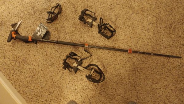
New equipment I've had to pick up for the PCT: crampons; wraparound, UV-blocking, polarized sunglasses; crampons
With trekking pole/ice pick in hand, I’m ready for my next political assassination

The learning curve for the PCT is steeper than for the A.T. Some people might worry about this, but I won’t be one of them. Worrying isn’t helpful: why allow it take root?


Caution and preparedness are different matters. For example, I know ~zero about safely hiking through alpine snow. And this year was a roughly every-six-year snow year, maybe worse in localized areas. But I can address that with training. There should be room to learn other PCT peculiarities in the first few hundred miles.
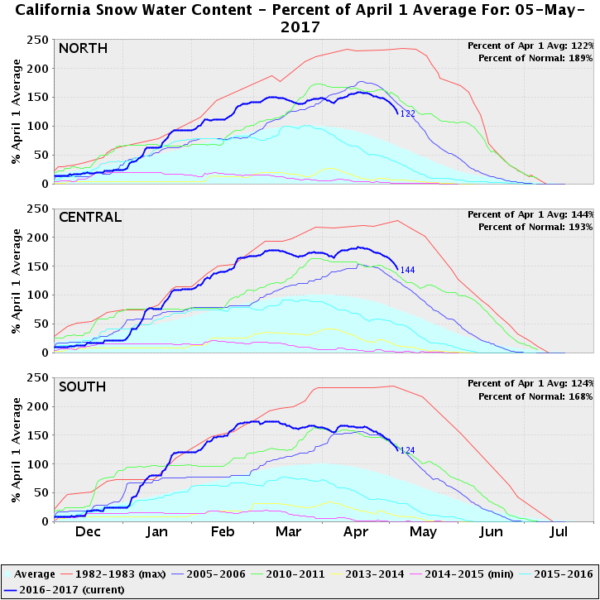
A graph of California north/central/south snowpack over each season, for various winter seasons; 1982-1983 establishes a high mark, 2016-2017/2010-2011/2005-2006 are high but not historically so, and 2013-2014 and 2014-2015 are around the recorded minimums

My only uncontrollable concern is that foot stress fracture. It happened two and a half years ago; the fracture has healed; and I’ve walked, run, and hiked on it for a year. A sports medicine doctor cleared me to walk to Canada on it.  (I was very specific about doing exactly that.) But my right big toe still isn’t 100% flexible, its ligaments semi-regularly ache during or after exercise, and it sometimes bruises. I’ll do what I can about this through cushioned socks, ongoing flexibility exercises, and moderating pace if needed. But I can’t eliminate the risk that it might significantly slow me down or even stop me.


If all goes well, I’ll return in September, mentally refreshed, with a peculiarly developed endurance for walking and very few fast-twitch muscle fibers. 🙂 I’ve turned off Bugzilla request capabilities, so don’t try asking me to review patches. If you must contact me, email might work. I’ll rely heavily on server-side filters to keep the firehoses hidden, but that doesn’t mean I’ll necessarily see an email. If possible send reviews and questions to the usual suspects. Moreover, the PCT is much more remote than the A.T., so I’ll likely go longer between email access than I did on the A.T. In places, a two-week delay in responding would not be unusual. (But I’ll try to keep people updated on where I am whenever possible, specifically to reduce the risks and dangers in a moronically-avoidable 127 Hours-style rescue snafu. I put the best odds on Twitter updates because they’re quickest. But I’ll post some pictures here as well to one-up roc. “My country’s scenery beat up your country’s scenery”)

I’m currently on my way to San Diego. Some helpful souls who love the trail (“trail angels”, in the vernacular) offer aspiring thru-hikers a place to stay just before, and a ride to the start the day of, their thru-hikes. I’ll stay tonight with them. Tomorrow the rubber hits the trail. It should be good.

18.01.11

Property rights without legal enforcement

Tags: , , , , , — Jeff @ 07:51

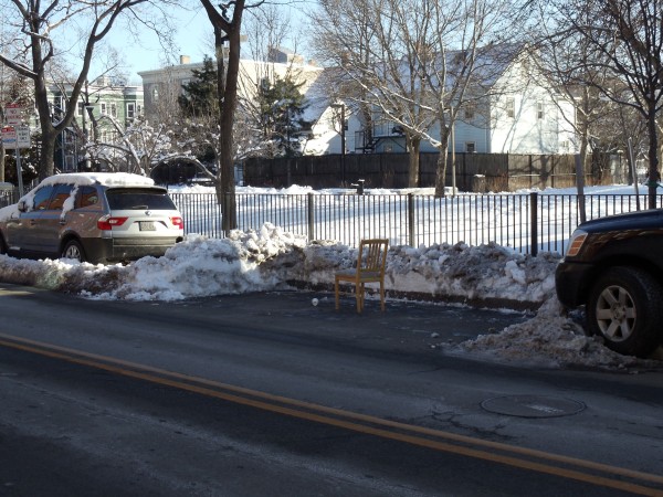
Can you own something without a government enforcing that ownership right? Sometimes, yes:

A parking space cleared of snow lies empty but for a wooden chair placed in the center of it, laying claim to that space for the person who cleared it
Property takes many forms

Some time ago I read about Boston’s system for allocating parking spaces in snowy weather: you clear it, you claim it. (See also more recent articles, too.) I happened to see this system in action yesterday for the first time. People not living in areas with proper winter climes might not have heard of this before, and I think it’s a nifty little system worth highlighting. It calibrates investments and incentives, thus “pricing” a scarcity to produce a more efficient allocation. It saves money, because there’s no need to pay city workers to clear spaces. And it does so with little administrative overhead: individuals overwhelmingly maintain the system. It’s a thing of beauty all around.

For more on the economics of this property system, see the article Snow Jobs at the Library of Economics and Liberty.

07.11.10

John Muir Trail: Lyell Canyon to Thousand Island Lake

September 13

(13; 0 side; 43 total, 168 to go)

Deep in Lyell Canyon sunrise starts at its usual time, but direct sunlight doesn’t reach the floor until hours later. I eat my breakfast near the campfire with the other nearby backpackers, and we have some reasonable conversation as I eat my oatmeal. The fire provides a nice bit of warmth in the not-quite-sunlight. Once food’s finished it’s time to head back down the trail to wherever I end up today.

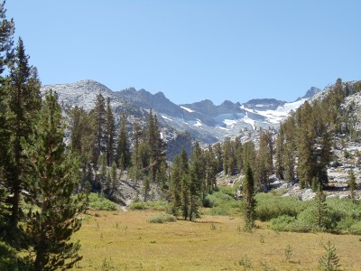
A grassy meadow near the southern end of Lyell Canyon, just before the ascent to Donahue Pass starts
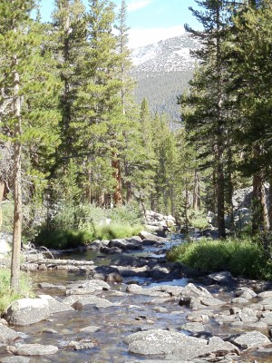
The trail continues to wind through Lyell Canyon a little longer
Lyell Canyon and Lyell Fork running down it, with Kuna Crest in the background
Lyell Canyon, through which the serpentine Lyell Fork passes, seen shortly up the ascent toward Donahue Pass

My stumbling continues, but when the ascent out of the canyon starts it necessarily slows as the trail begins crawling up and over rocks. I pass by a couple also doing a thru-hike of the JMT at one point; they’ve been out since a little before me, and they plan to leisurely hike the trail into early October. We leapfrog a few times until I pass them for a final time after lunch today.

Lyell Fork, from a bridge partway up the ascent out of the canyon
The majestic Lyell Canyon and the surrounding mountains
The majestic Lyell Canyon

The ascent continues past several tarns, mountain lakes fed by glacial runoff. The lakes are connected by the Lyell Fork, which is much smaller at this elevation than it was from even the earlier bridge (let alone the canyon itself). It’s also much smaller now than it was a couple months ago; this late in the season I can cross it on rocks without getting my feet wet.

Along the upper Lyell Fork toward Mount Lyell and Mount MacClure
Along the upper Lyell Fork toward Mount Lyell and Mount MacClure; I believe Lyell is the furthest-right peak in this picture
Panorama view just past a river crossing
Panorama view just past a river crossing, 1 of 3; note the camera's image-splicing glitch near center
Panorama view just past the river crossing
Panorama view just past a river crossing, part 2 of 3
Panorama view just past a river crossing
Panorama view just past a river crossing, part 3 of 3
Looking further up near one of the fords of the Lyell Fork
Looking further up near one of the "fords" of the Lyell Fork, which would be far more menacing earlier in the season

Just above the lip of rocks in the near foreground is a flat area with another tarn whose outlet the trail crosses. Now seems like a good time for a lunch break, and I stop and cool off my feet and swollen ankles in the water for a brief moment (this being snowmelt water after all) before I eat lunch. There’s another group of other hikers here already doing the same things I’m doing; they head off before I finish.

A hundred feet of shallow pond lie in front of me, flowing rightward to narrow and flow down; in front is an outcropping of rock, and somewhat to the left and back lie mountains with snow-covered flanks
Lunchtime scenery; yes, the whole John Muir Trail really is like this

After lunch the ascent resumes. It’s pretty gradual as ascents go, which also means it’s rather long. Donohue Pass may be a pass, but it’s not nearly the sight to see that later passes are, clearly occupying a narrow ridge between peaks. It’s more accurate to call it Donohue Plain or Donohue Plateau, I think.

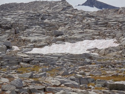
A patch of watermelon-colored snow in Donohue Pass
Algae produce this snow's watermelon coloring and even smell; anecdotally, eating such snow is a good way to get sick, so it's unclear whether the snow tastes like watermelon
A desolate, late-summer alpine pool surrounded by granite rocks
A late-summer alpine pool
Atop Donohue Pass, covered in small granite rocks, looking south down the trail, as I recall
Atop Donohue Plain, er, I mean Pass

Donohue Pass marks the end of the first recreational area the JMT passes through, as I leave Yosemite National Park and enter Ansel Adams Wilderness, not surprisingly named for Ansel Adams, a noted black-and-white photographer of nature, most particularly Yosemite — try a web search to see his work.

A wooden sign marking the entry to Ansel Adams Wilderness and Inyo National Forest
Welcome to Ansel Adams Wilderness

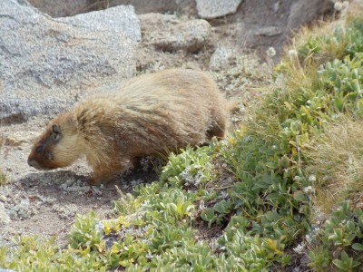
From here south through the end of the day is mostly a blur. The scenery is impressive as always along the JMT, but it is not particularly more memorable than other sections, perhaps because the lakes being passed by are a bit smaller, peaks are further in the distance, and there aren’t many people out and about. My biggest recollection from this descent, and from some others, is of a marmot or two living at high elevation.

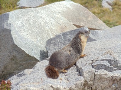
A marmot forages for food near ground-hugging alpine vegetation
A marmot forages for food just south of Donohue Pass
A marmot sniffs at a rock
I wonder if this rock is edible...
A marmot sits on a rock with its head perked up
Aroo?

The initial descent from Donohue Pass presents some nice views, and the gradual winding around lakes, over small streams, and through some trees makes for a comfortable, leisurely section. I have no particular goal for the day, but as I approach it Thousand Island Lake seems like a good stopping point: reasonable mileage for the day, going by my map, great views, plenty of space nearby for camping.

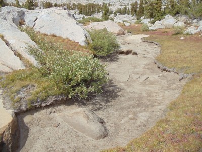
A large depression of dry soil, which would have been filled with water a few months ago
It is definitely late summer/early fall in the Sierra Nevadas
A signpost on the JMT and PCT; Island Pass where I'm heading is to the left, Donohue Pass from which I just came is to the right
A signpost on the JMT and PCT; the JMT and PCT follow the same path for around 175 miles, minus a stretch just south of here
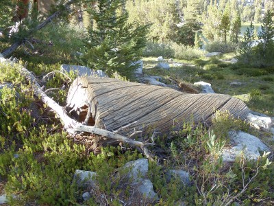
An unusual-looking section of tree, clearly cut; the bark is gone, revealing slowly spiralling pencil-thin ridges of wood
An unusual-looking section of tree

I descend near Thousand Island Lake around 17:00, although the lake has been visible for awhile (Banner Peak behind it even moreso). I haven’t filled up on water in awhile, so I’m going to need to do that when I get to the lake, and by the time I reach wherever I end up staying near it the iodine I’ll add to it should have purified it.

Banner Peak towers over Thousand Island Lake
Trail sign at Thousand Island Lake for the PCT/JMT split: the PCT heads straight toward the ridge, while the JMT continues to the right around half a dozen lakes
The PCT and JMT split at Thousand Island Lake for fifteen to twenty miles, the PCT taking a ridge and the JMT winding around lakes and up, over, and through smaller mountains

A handful of lakes in this section of the trail don’t permit camping within a quarter mile of their outlets. I pass by most of those lakes without stopping for the night, but Thousand Island Lake is the one exception. I attempt with partial success to follow the path around the lake past the edge of the no-camping zone, and I reach a flat, rocky area a short distance from the lake itself around 18:00. Daylight disappears as I cook dinner, made slightly more interesting by the constant wind blowing along the lake. Constant wind is the harbinger of a cold night, so I put on some long underwear. I can see more stars in the sky than I’ve seen in a long time, including all of the generally-too-faint-to-be-seen Little Dipper, as I head to sleep.

I took enough pictures this day and the next that each warrants its own post. These days are probably the most gorgeous of the whole trail, but the passes in the latter half of the trail are more breathtaking. (Literally.) This isn’t to say that either is more beautiful than the other but rather to say that they’re beautiful in different ways — about what I’d say if asked to compare the Appalachian Trail to the John Muir Trail. It’s apples to oranges as far as I’m concerned. (What if I really had to choose A.T. versus JMT, with no further distinction? 139 days versus 15 days is a no-brainer. But taken day by day, the JMT easily wins.)