14.10.08

Glencliff, NH to Norwich, VT: Beware of Tourists!

Tags: , , , — Jeff @ 15:38

A few things I forgot from the last post (delay from event to post strikes, as does a failure to keep notes of remarkable things):

  • I had the most awesome conversation ever with a northbounder yesterday while descending Moosilauke:

    […as I see him approaching from down the trail…]
    Me: Northbounder?
    Him: Yep.
    Me: Good stuff.
    […as we’re passing…]
    Him: Southbounder?
    Me: Yep.
    Him: Good stuff.

    What’s not to love? You can’t possibly get any more concise without losing something doing so.

  • A half gallon of Hershey’s ice cream (from Hershey Creamery Company, which astoundingly isn’t affiliated with the chocolate company, although I’d be surprised if most people eating the ice cream knew it) contains 16 servings, each with 140 calories, for 2240 calories total. I think it would be awesome if they collaborated with Mars and made a Milky Way ice cream, just for the sheer cognitive dissonance of it.

Now on to the usual updates…

July 19

(14.7; 413.2 total, 1760.8 to go; -0.3 from pace, -201.8 overall)

I wake up fairly late and pack up my things. On my way out the hostel owner mentions two things. First, make sure to check out the “penta-style” (the Companion’s description, contrasted with the more normal “mouldering”- or “composting”-style privies) privy at Hexacuba Shelter (my intended target for the day). The second is that there’s a hiker festival in Bennington, VT on August 1 with free food, and when I say free I mean “free as in beer”, and if you think that phrase might have more than one meaning, it indeed does, and both apparently apply! Bennington’s at 577.9 miles from Katahdin, so that’s perhaps 180 or so miles from where I am now. If I attend it’ll mean punting on recouping pace until August; for now I choose to punt a different decision — whether to attend — and see how the hiking goes between now and then. I’m supposedly on the hiker highway now and should be able to hike further and faster, but the delta is still a big unknown.

After packing and heading out, I drop by the post office that’s just across the street and send off more gear I don’t want to carry any more: a hat I’ve only worn because I remember I’m carrying and haven’t worn it recently, pants (rain suit and/or fleece, can’t remember which), and one or two other things. I stop by the nearby pay phone and call home for a bit, then it’s back on the trail at 12:28 for a day of hiking.

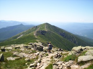
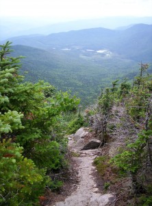
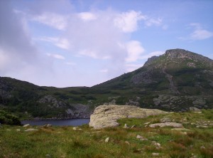
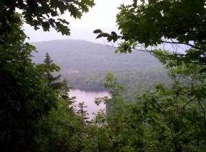
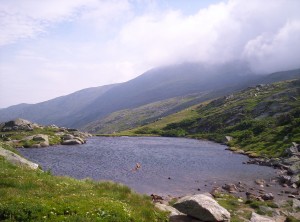
The view from my lunchtime outlook onto a lake below

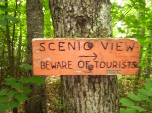
First stop is an early one for lunch by a small overlook that’s nothing compared to anything in the Whites or before, really. That doesn’t stop the trail maintainers, the Dartmouth Outing Club, from putting up the most incredibly awesome sign saying, “Beware of tourists” by it anyway! (I have a picture of it I’ll post eventually.) Here’s said picture:

A sign saying "SCENIC VIEW, BEWARE OF TOURISTS"; someone has scrawled "Stupid college kids" on it as well
Epic win in signage

I love these guys; the AMC (Appalachian Money Club, natch) felt moneygrubbing and impersonal, and MATC felt somewhat perfunctory in its duties (if reasonably well-performed, modulo the ability to construct switchbacks or bridges over large streams or boardwalks through swamps), but these guys feel like they enjoy what they’re doing. I’m not entirely surprised; one sign atop Moosilauke gave a mileage figure to the post office in Glencliff, a move clearly catering to the needs of thru-hikers, and trail junctions often point out A.T. north and south (a problem in the maze of twisty trails that was the Whites).

While I’m at the overlook I meet another southbounder named Sweet Sweet, hiking from somewhere north of Glencliff that day. I head on while he stays longer at the overlook.

I’m running pretty low on water when I get to the first shelter south of Glencliff, Ore Hill Shelter (the area’s actually a bit contaminated from the operations there in the past, with signs saying where not to stray to avoid problems), and I stop to fill at the puddle there. It really basically is a puddle, although it seems to be fed somehow. A frog jumps out of the pool when I fill up, and due to dehydration I wait the necessary twenty minutes at the shelter to have a liter to chug and promptly refill before heading out again.

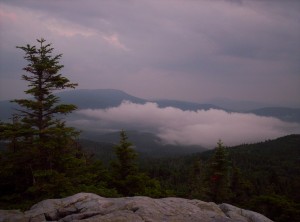
Going south, it’s awesome how easy the hiking is. Terrain’s mostly flat, no huge winds or tricky rocks to navigate — worst is a stretch of trail that I have to run through to avoid mosquitoes, really. I reach Mount Cube just as it’s getting dark and take a few shots of the sunset; if they’re anything like the pictures I’ve tried to take since, they’re not that great. This camera is about as bare-bones a digital camera as you can get: no zoom, no ability to deal with light and dark in the same picture (kiss super skyline shots goodbye), really inadequate all around.
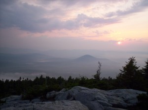
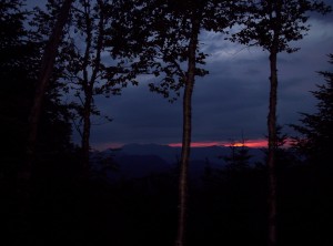
A pale pink and purple sunset from atop Mount Cube
A pale pink and purple sunset from atop Mount Cube which, incidentally, turned out significantly better than I expected from the on-camera preview
Clouds among the valleys as seen from Mount Cube

The camera’s original intended purpose was for purely indoor, close-range photography without a need for true detail (photographing completed Scrabble games at tournaments to avoid needing to exactly record moves, to be precise), so I shouldn’t be surprised it underperforms here.

360 degrees atop Mount Cube

Just after the summit, on super-slick rocks where my poles are useless if they’re slanted any amount at all, Sweet Sweet catches up to me, and we walk the remaining couple miles to Hexacuba Shelter mostly in the dark with only my meager flashlight for assistance. I’d considered making dinner when I got in, but there are other people in the shelter and I’m tired anyway, so I go to sleep.

July 20

(12.0; 425.2 total, 1748.8 to go; -3.0 from pace, -204.8 overall)

I wake up fairly late by hiker standards and am able to take a first look at the shelter where I slept the past night. Every other shelter I’ve seen so far has been a variation on the three-sided theme with perhaps a second floor or a skylight for variety and some manner of support for cooking and eating. This shelter is just bizarre. Its base is a regular hexagon; four adjacent sides are walled, with the remaining two open for entry and exit. The roof is a hexagonal pyramid, with a central beam going to the top. The shelter floor is a few feet above the ground, so you can sit and let your feet dangle as you cook or do whatever. Of the shelters I’ve seen so far (future-me speaking, over 80% down the trail), it’s by far the most unusual. The privy (“penta-style”, if you recall) is standard fare but has a pentagonal base. As a reminder, this is all right next to Mount Cube. Have I said how much I enjoy the DOC’s trail maintenance yet?

Today’s start is rather slow, and by the time I’ve eaten breakfast it’s raining; I take a look for the register and find a section of the seventh Harry Potter book in the shelter, and of course I’m sucked into it as I don’t really want to hike in the rain. The section is from Malfoy Manor to the first page inside Hogsmeade, some fun reading. About 10:30 or so I finish and reluctantly head out into the water.

I’d originally hoped to get to Moose Mountain Shelter today, around 18 miles south, but the late start and the rain slowly nix that idea. I stop for lunch at the Firewarden’s Cabin about five south, eating on a porch out of the rain. I also fill up water bottles; there’s a trail to a source, but it’s so rainy and wet that I only get perhaps halfway there when I have to walk over several large puddles. Rather than do that, I just scoop the water out of the puddles with my bottles — with my water purification system (iodine crystals which diffuse into a glass bottle of water, then add the resulting solution to impure water and wait twenty minutes), I don’t need to worry about filtering or wasting my time in the rain. I’d highly recommend Polar-PUR iodine for anyone considering water purification systems; one bottle’s something under $20 and will last for years (I doubt I’ve used half the crystals in mine over four months of hiking). There is the matter of the taste, but if you can get over that the stuff’s awesome.

It continues raining as I head further south, but I now have a goal in mind. It turns out there’s a guy slightly off the trail south of here who gives ice cream bars to hikers when he’s home! You can also fill up water bottles from a hose, so much nicer than drinking water with iodine in it. It’s stopped raining by the time I reach the hundred-foot side trail to his house; I don’t see anyone home, but as I fill up my water bottles the man walks up from a short hike up the mountain to the south. He gets me an ice cream bar and asks a series of questions: trail name, home town, age, what sort of hike (thru, section, day, etc.) I’m doing. He says he’s been recording this information for several years now; for several years now, the median age of hikers who stop by is 26. He also mentions that it rained around three inches today — yikes! It’s getting to be late afternoon now, so I continue south just another mile to Trapper John Shelter.

I end up spending the night at Trapper John Shelter with four companions. Milkshake and Monty are a Dartmouth graduate and her dog, out for a backpacking trip during the summer when classes aren’t in session (she’s a teacher). The other two are Pickle and Ragdy Andy, two northbound brothers who, as I discover further south on the trail, hail from Israel. The shelter’s nice and comfy for the night, and I head to sleep planning to reach Hanover and Dartmouth or thereabouts tomorrow.

July 21

(15.2; 440.4 total, 1733.6 to go; +0.2 from pace, -204.6 overall)

Typically I compile these entries by looking over the list of trail features in the Companion to jog my memory, then add anything I remember from those features. As I look back at the schedule today, I really don’t remember much of anything. I stopped at the first shelter south, Moose Mountain Shelter, and spent some time reading some printouts of A.T. history, while eating lunch.
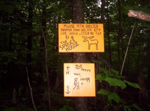
Welcome signs for Moose Mountain Shelter, clearly crafted by hand with a router, with a few rough illustrations of the lay of the site

I also believe I noticed an entry in the register from Frog, a northbounder I met in the spring (at the same time I met Chef) during my little loop over spring break; it seems I’ve missed seeing him, alas.

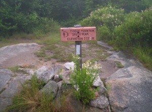
A sign recognizing Moose Mountain's south peak, with the elevation 2222 feet in four different colors
The four-colored sign recognizing Moose Mountain is yet another example of DOC awesomeness

It’s getting close to six or so by the time I reach Velvet Rocks Shelter, just 0.8 miles north of Hanover. Most people don’t stop here; Hanover’s close, and I hear several fraternities offer space for thru-hikers to stay. It’s late enough, however, that I don’t feel like taking my chances on finding a cheap spot in town, and in any case, this shelter’s awesome! It has a clear plastic roof, and the register is full of entries from people talking about sitting in sleeping bags overnight watching bats fly overhead. I get water after a considerable walk to the source north of the shelter (off the A.T.), eat and head to sleep.

July 22

(7.3; 447.7 total, 1726.3 to go; -7.7 from pace, -212.3 overall)

I take it nice and easy this morning, as I intend to take a slow day through Hanover. After breakfast and signing the register (populated primarily with Dartmouth student entries — I make a pitch to them to not start work immediately after graduating to take advantage of college loan deferments and the largest block of free time and physical fitness they might ever have again), I head into town.

First stop is the local grocery store for resupply. It has everything I could want, but it’s not especially cheap. I pick up a few yogurts, which ostensibly fight the bad side effects of continuing use of iodine for water purification, 2.5 pounds of cherries, a bunch of Granny Smiths, and a loaf of raisin bread as things to eat before I leave town. Unfortunately, I didn’t look too closely at the price of the cherries — they constituted $15 of the full $60 bill. :-\

Next stop is the library, where I work some on updates here and start to record mileages each day in drafts so I can see how far off pace I am. Conveniently the computers aren’t in demand, or else I’d have had much less time to use one than I did. I linger inside for awhile before returning to the heat outside to finish off the cherries and bread.

The pack cover I’ve been using so far, which I’ve had since my first backpack as I recall, is pretty horrid. I’m not really sure it even works at all, and its form was designed for an external-frame pack (a very rare sight on the trail these days; strange how much that’s changed in the last ten years or so). The first outfitter in town has none, so they direct me to another. This one has pack covers, but strangely enough the smallest one they have is too big for my pack, which is itself far bigger than it need be for hiking the A.T. (once I removed the superfluous gear, that is). I depart pack-cover-less and head for an unplanned stop at Ramunto’s, a pizza place down the street. Word on the street is that they give a free slice of za to thru-hikers! I arrive, partake (along with a draft Guinness, partly because it Is Good and partly because it’ll help offset the cost of their generosity), and sign their register.

The last stop in town is for a much-needed haircut, the first since Christmastime. Ideally I’d have gotten the haircut in Boston, but I couldn’t find time while there. I suspect that that saves me at least a pound of weight to haul over trails when my hair is wet. Finally, I head out of town, briefly stopping at the DOC offices to see who’s there (nobody) on the way out.

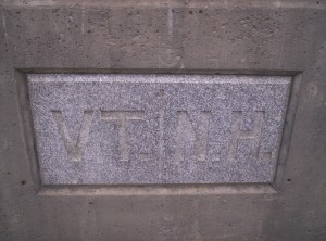
Now follows one of the less enjoyable parts of the trail: a road walk. I stroll a couple miles or so down sidewalks and across the bridge over the river defining the New Hampshire-Vermont border into Norwich.

The granite stone in the middle of the bridge across the river delineating the Vermont-New Hampshire state line, with VT | NH engraved in it
State three!
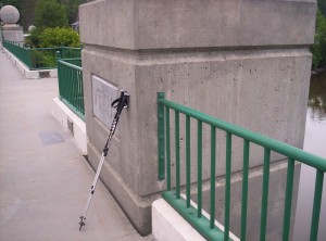
The state line marker with my hiking poles leaning against it

From there it’s a run down a side street, past a house with a table out front with a handwritten sign reading “trail magic” (and a dog who seemed curiously incapable of dragging himself to me to be petted, until I realized the high-pitched whine I was hearing from his collar was a radio restraint device; once I moved toward him so he could retreat a bit he was markedly more mobile), and up a hill to a return to wooded trails.

The trail’s slow going at first; packs weighted with resupply are too heavy. To tell the truth, tho, I bring some of this upon myself by carrying a couple pounds of Granny Smiths. (Carrying apples with me out of resupply, sometimes for multiple days, is a foible I have not managed to curb. I’ve been told by some I’m the least weight-conscious southbounder they’ve met; if that’s not actually the truth, it’s certainly not far off.) Eating a couple for energy and “weight loss” (off my back, even if not from what I’m hauling) helps, and I walk into Happy Hill Shelter at dusk, cook dinner, and sleep.

The future-me speaking now is a mere 270 or so miles from the end of the trail, as of yesterday at -1.7 from pace at 1903.3 down the trail in Hot Springs, NC. The last week or so I’ve passed through North Carolinessee, as the trail practically follows the TNNC border for awhile. I have roughly 40 miles to the Smokies, 70 miles through them, 80 miles through North Carolina not along the border, and then another 80 miles through Georgia to Springer Mountain. I’m still not sure what day I’ll be done — I’d kind of like to be home by next Saturday, but that’s probably overly ambitious. In any case I can smell the end, and I’m starting to drag a bit as I fight the urge to stop just a little bit earlier each day, wake up a little bit later (daylight’s disappearing, alas) and not leave a warm sleeping bag for the creeping cold, stay an extra night in towns, and on very very rare occasions flat-out skip trail by hitching from the trail ahead to a town where I might have planned to stay (exacerbated by late-day hiking caused by the late wakeup, of course; night hiking is curiously both tedious and fun at once). I have not yet succumbed to these temptations — I’ve been working at not zeroing since my last one in Damascus, just north into Virginia — and I’m into the last push to finish. I’m definitely looking forward to being done hiking soon. I’ve got a fever, and the only prescription is more cowbellSpringer!
02.09.08

The Four State Challenge

I am currently in Harpers Ferry, WV with 5.8 miles remaining in this thoroughly idiotic accomplishment. I do not have the energy to find a good resource that describes what this is, beyond what you can probably guess it is. (I might continue an extra three miles to the first shelter in VA, which would also net fifty miles for the day, but that decision will definitely wait until after the state line.) If someone can find such a resource, I’ll update this post with it when I can. Four State Challenge will work about as well as anything for describing what the challenge is. After grabbing some food (wrapped deli sandwich or similar) to eat for dinner when I stop for the night, I’m heading back out to finish the day; hopefully I’ll be able to eat the food and get a bear bag or something going before collapsing into sleep from sheer exhaustion.

Tomorrow’s hike will be a shorter-than-average day.

Update:

  • There’s apparently some funky trail-winding near the border such that it’s only 1.9 miles to one crossing of the Virginia border, so in reality that was all the distance I actually needed to cover. The Thru-Hiker’s Companion book doesn’t really make this clear, and 5.8 is to the last of the “Virginia sections”.
  • I ended up completing the full 5.8 plus the remaining 3 to that first shelter, for 51 total for the day.
  • Even if you’re a thru-hiker, you can never let your ego grow too huge, or else it’ll be deflated when you read the register at that first shelter and discover another crazy southbounder started from even further into Pennsylvania and thus hiked a 60-mile day. I never had any illusions of extreme hiking prowess, but if I had, the southbounder Rock Layer would have trashed them completely.

29.08.08

Crawford Notch to Glencliff or, the steep side of Moosilauke is tomorrow morning, right?

Tags: , , , — Jeff @ 00:04

July 14

(11.9; 356.9 total, 1817.1 to go; -3.1 from pace, -183.1 overall)

It’s an early start today to be ready for a shuttle back to the trail; I eat breakfast and pack up and am on the trail again by about 8:30. It’s a nice walk up to Ethan Pond Campsite, where I duck in to sign the register. I’ve been ducking in most places and huts along the way hoping to find Dan and Leah, since I’m carrying their Companion, but no sign of them anywhere; it’s starting to worry me. This campsite apparently has big bear problems, and there’s a specially designated cooking area about a hundred feet from the shelter; I’m glad I’m not staying there, because that looks like it’d be really frustrating to have to use.

The next stop is Zealand Falls Hut, next to Zealand Falls, and the trail is an extremely pleasant surprise. It’s incredibly flat and easy terrain, and I cover the 4.8 miles between the two places in just under two hours; I rave about the easiness of the terrain in the register at the hut so northbounders will be aware of it. After lunch I continue onward.

A view back along the mountains north of Zealand Hut

The next terrain isn’t nearly so easy, and I make fairly slow time. I’d hoped to make Garfield Ridge, nearly ten miles away, by the end of the day, but instead I find it’s getting late and I’m only near Guyot, 5.5 miles away.

360 degrees atop Guyot, as best as I can recall
The view from Mount Guyot toward Franconia Ridge

It’s a 0.7 mile trip off-trail to get there, but I’m not really in the mood to bushwhack to find my own site the requisite distance from trail, so I stop there early. My only thru-hiker companion is a guy named “R.B.” as I recall. Dinner is some rice and dried vegetables I picked up from the leftover hiker goods at White Birches; I don’t have directions, so things don’t turn out perfectly rehydrated, but it’s still very much edible. After dinner it’s straight to sleep.

July 15

(5.5; 362.4 total, 1811.6 to go; -9.5 from pace, -192.6 overall)

I wake up a little late this morning, but it’s not wakeup time that makes the day go slow; to be honest, I’m not really sure what did make it go slow. All I remember is that it gets to be midafternoon and I’m still not even to Garfield Ridge Campsite, which is more than a bit frustrating. The last stretch of trail up toward the site is incredibly, ridiculously steep. I stand at the bottom marveling at it when I hear voices from up the trail: “That’s way too steep to be the trail, no way that’s it.” I yell up, “Yes it is!” for massive hilarity from my point of view. Day hikers.

A view of...something I don't remember at all; perhaps backwards to Zealand Hut?

It’s still kind of early, but there’s no real place to stay unless I go to Greenleaf Hut, and the register at Ethan Pond said to avoid it, so I stop super-early for the day. I’m eventually joined by a bunch of other hikers: Old Dawg and the Foot Machine are northbounding, and Medicine Man, Privy, and Hungarian are southbounding, among others I don’t remember. The caretaker, Claire, comes around to collect payment in blood from people staying the night; her job during the winter is “Solid Waste Supervisor” (not human waste, note) or somesuch at McMurdo in Antarctica. I try to get to sleep early so I can get an early start the next day and hopefully make more reasonable mileage than I’ve made the last two days.

July 16

(15.1; 377.5 total, 1796.5 to go; +0.1 from pace, -192.5 overall)

I wake up around 5 and get the early start I’d intended. Before I head out, I sign the shelter register. The register has an amusing, unsigned (of course) rant yesterday from someone complaining about going into the wilderness to get away from capitalism yet still being followed by it and the AMC monopoly. In my entry I take the time to differentiate capitalism from monopolies (capitalist societies do often act to curb them, after all) and note that it’s really the government-sponsored monopolies, as here, that are most dangerous.

The first stop is the top of Mount Garfield for a sunrise; the valleys around are still covered in fog, making for a beautiful view.

An early-morning view of Franconia Ridge, as seen from Mount Garfield
Cloud-covered valleys outside of the White Mountains, seen from Mount Garfield
A valley inside the White Mountains, seen from Mount Garfield

Next up after a bit more hiking is the famous Franconia Ridge, consisting of Mount Lafayette and Mount Lincoln (and I suppose Little Haystack Mountain). The views from both peaks and along the ridge are fantastic; here’s what it looked like from Lafayette:

360 degrees atop Mount Lafayette
From Lafayette looking toward Lincoln along the ridge
From Lafayette looking toward Lincoln along the ridge; the hiker ahead of me is Hungarian

The walk along the ridge, despite going up and down a bit, is actually easy walking. The descent down is the usual sheer-cliff drop, but once I get past most of it it’s easy walking to Liberty Springs Tentsite. However, I’m making good time and it’s early, so I continue on.

Around 17:30 I reach Lonesome Lake Hut, the southernmost of the huts. Its main attraction is Lonesome Lake, and the swimming looks too good to pass up. I stop, swim and dry for an hour, pick up six Snickers bars to tide me over for trail snacking out of the Whites, and continue on another two hours to Kinsman Pond Campsite. It’s the last fee site in the Whites (yay!), and I’m even offered a work-for-stay while I’m there, but I want to make good time the next morning, so I pass it up and fork over my payment in blood of $8. The shelter’s super-duper new, and it’s really spiffy.

July 17

(13.1; 390.6 total, 1783.4 to go; -1.9 from pace, -194.4 overall)

Unlike yesterday, I don’t get an early start; in fact, it’s really rather sluggish, and I’m passed by a couple thru-hikers who opted to stop for the day yesterday at Lonesome Lake Hut.

A view of Harvard Brook, if I've picked it out right in Google
More Harvard Brook
More Harvard Brook

On the trail things proceed at a mellow pace. I pass a trail crew doing maintenance, with a radio playing Steve Miller’s Jet Airliner in the background. There are a couple people at Eliza Brook Shelter when I pass by, but I continue on. There are an awful lot of people heading north toward the shelter that I pass as I head toward Kinsman Notch, and I suspect some people were forced simply due to lack of space to tent.

Around 19:00 or so I reach Kinsman Notch, at which point only 1.6 miles remain to Beaver Brook Shelter on the slopes of Mount Moosilauke, the last above-treeline travel on the A.T. heading south. One slope is so steep there are wooden blocks and rebar in places for hand- and footholds; my understanding was this was the southern slope, so I’d be hitting it tomorrow morning. My understanding was wrong. Oops. It’s now twilight and I’m busy scrambling up a ridiculously steep ascent with a weak flashlight as the sun goes away; it’s about 20:30 by the time I finally reach the shelter, safe and sound, in full nighttime darkness. The shelter’s full, so I pull out my tent and use it bivy-style for the night after a quick dinner.

July 18

(7.9; 398.5 total, 1775.5 to go; -7.1 from pace, -201.5 overall)

I wake up around five when another camper is taking pictures of the sunrise; it’s a nice sunrise, but my camera can’t capture its colors very well.

Sunrise from Beaver Brook Shelter

I slowly meander into making breakfast, in no rush since I’m planning on a short day into Glencliff and the hostel there. I’m hiking by about 7:45 and reach the cloud-covered top of Moosilauke by about 9:30, at which point I start my descent into the hiker superhighway south of the Whites.

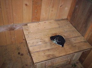
A heart-shaped toilet

Today’s terrain is nice and easy, no steep ascents or descents, and I’m into Glencliff shortly after noon. I grab a bike (rock on!) and head over to nearby Warren for resupply, including a half gallon of mint chocolate chip ice cream (eaten in Warren before the return trip), and return with supplies to get to Hanover and the NH-VT border. Several northbounders (among them Doctor Zayus, Start, and Chef, whom I met in a backpacking trip over spring break down in the first two hundred miles of the A.T. in North Carolina) are holding a small barbecue, so I chip in some money and get awesome food for really cheap; alas, they go for cheap Budweiser, so I have to buy my own Guinness bottle to have anything tasty to drink with the meal. After eating and doing some more trail update writing, I head to sleep.

Now that all the hard stuff is done, it’s time to start cruising; it shall be awesome. Also, as a note from the future, I’m currently at -173.9 after stringing together a week or so of averaging around twenty miles a day, including one gangbusters thirty-mile day. Things are looking great for an on-time finish, although I’m now starting to eye a possible one-week off-trail hiatus to do trail maintenance for the fun of it during my thru-hike, which might just fit in my schedule if I can keep up a good pace. We shall see…

18.08.08

Gorham to Crawford Notch: Welcome to the Land of the Fee

Tags: , , , , , — Jeff @ 04:46

July 8

(0.0; 297.9 total, 1876.1 to go; -15.0 from pace, -152.1 overall)

I set my alarm for fairly early the next morning as I plan to walk into town to Welsh’s for breakfast. As it turns out, I wake up just as Dan and Leah are leaving to hit the trail again. After they leave I notice a 2008 thru-hiker’s companion left where they were staying; it’s probably theirs, so I put it with my stuff to deliver it to them further down the trail.

I walk about a mile in to town before getting picked up by the same guy as yesterday, who drives me the remaining half mile in. Breakfast is a big omelet; at Welsh’s I meet Sunday again (staying at a different hostel), as well as a different couple, Silver Potato and Cracker, who are eating breakfast and getting a mail drop before hitting the trail again. They ask what kind of stove I have, and when I note I have a canister stove Silver Potato asks if I need any fuel — their mail drops anticipated a greater burn rate than has actually happened. I’m still working on my second 15.9 ounce canister but was planning on getting more while in town, so we discuss a meeting location when I finish breakfast.

After breakfast I head to an outfitter nearly across the street to pick up those trekking poles I could have used so long ago. A random passerby from the Randolph Mountain Club explains the basics of trekking pole features; the available choices range from $80 to $140. I eventually decide to keep it simple and just get the most expensive ones, because I’m generally pretty thrifty and can’t think of a better way to spend it than here — I’ll be using these for at least another couple thousand-ish miles. I also grab a second stuff sack to help with carrying food; I don’t remember what I used before I got this new stuff sack.

Next stop is Colonial Comfort Inn where Silver Potato and Cracker had stayed the previous night. Silver Potato gives me two eight-ounce fuel canisters, which should at least be enough to get me through New Hampshire. Yay for free fuel! I’m also present as Cracker conclusively chooses her trail name (for managing to break one each of two pairs of hiking poles so far; they’re sending them home now to deal with possible warranties and such when the thru-hike finishes).
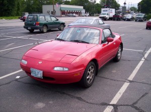
A red convertible with a license plate numbered MIDL1F
A car I spotted in a parking lot as I walked through town

After making a phone call home, I head to the library for Internet access. The library in Gorham, as with every place I’ve visited, has a copy of Firefox running on it. What’s particularly interesting, however, is the bookmarks — the bookmarks in the bookmarks toolbar are:

So this install dates back at least to Firefox 0.8 or 0.9, can’t remember the last release with those bookmarks — pretty unusual for a library with restricted use policies.

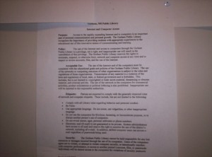
The Gorham library's usage policies for their computers, which arguably unconstitutionally forbid a number of uses

Speaking of restricted use policies, this library’s Internet is practically useless. I cannot access my blog (Reason for restriction: Forbidden Category “Games” — what the heck? It’s a single personal domain! The blacklist must be ridiculously comprehensive.), so I’m forced to write some of the immediate past trail updates in an email to myself via webmail. I also can’t access xkcd (Reason for restriction: Forbidden Category “Humor/Jokes” — at least this one makes sense). I cannot access Facebook (Reason for restriction: Administrative Custom List settings — so a prejudicial block), which isn’t really a huge deal. Internet security gurus will not be surprised to find that 0x000000 is blocked, as I suspected after images from an entry displayed by Google Reader didn’t load (Reason for restriction: Forbidden Category “Hacking/Proxy Avoidance Systems” — I am amused). Note how the last item demonstrates the considerable flaw in the apparent blacklisting setup they’ve got running here — there doesn’t seem to be any attempt to block content, so if you can get it another way you win. Lastly, while I don’t have any intention of doing any here, it seems this publicly funded library also forbids speech over the Internet in the form of political lobbying as well. (Aside: small-government enthusiasts will note that there would be no First Amendment concern here if this library weren’t publicly funded: a private library could set any access restrictions it wanted without raising any freedom-of-speech concerns. The First Amendment applies to state and federal governments, not to independently-operating private entities.) I don’t ask the librarians if there’s a way to disable the blocking, but when I mention the blocking being a pain they say they can’t do anything to override it. To top it all off, the connection is slow and flaky, and I can’t get images off my camera’s memory card and into permanent storage elsewhere because of it.

I spend rather more time at the library than I should making less progress than I’d like before heading out and back to the campground. On the way out I pass a northbounder, Bird, who’s in town from further south on the trail (possibly Pinkham Notch, I think); we talk for a little bit about various things before heading our separate ways.

Back at the campground I regroup for a trip to get supplies for the next section of hike. Tomorrow begins the anticipated White Mountains, consisting of roughly 100 miles of trail. Various roads cut through these national forests, so I don’t have to carry food for the entire trek, and furthermore, thru-hikers have the option to do a work-for-stay at a series of luxury shelters (in price, not amenities) in the mountains along the way. I decide to carry food for a roughly fifty-mile section to Crawford Notch, about five days of hiking. I get a ride in to Shaw’s, which is at the far end of town, to pick up food.

After the limited options in Monson and the relative smallness of the Stratton store, Shaw’s is paradise: rows and rows and rows of choices, much closer to what I expect after having grown up in suburbs of Detroit and having spent the last four years in Cambridge in Massachusetts. The choices are most obvious in the pouch tuna section: several choices, with seasoning and without, and a variety of other pouch meats as well, including salmon and crab! I cannot pass up the chance at crab, so I grab a pouch for one of my meals. Along with the usual Knorr fare I also try out Idahoan potatoes, as noted in another hiker’s meals earlier on the trail. Once groceries are completed I head a little further up the road, intending to hit a Wal-Mart (yet another verdant oasis on the trail) to get a new memory card for my camera. The current card was the original that came with the camera, and it’s painfully small: a pitiful 16MB for pictures and minimal video. I end up hitting a Radio Shack before getting there, and the new card I pick up means I’ll never have to worry about capacity again: 1GB of roomy goodness for pictures!

It’s now about dinnertime, so I head south back into Gorham to find a place to eat. I’m in the mood for Mexican, but Dan and Leah discouraged me from going to the Mexican restaurant (it apparently doesn’t serve free chips and salsa!), so I end up stopping at Mr. Pizza, this time for a sit-down meal. I attempt to satisfy some of my Mexican longings with a margarita, and I eat another Hawaiian pizza for the actual meal.

What’s truly memorable about the dinner, however, isn’t what I eat but rather what I watch: baseball! The Red Sox are hosting the Twins at Fenway, and when I come in it’s the top of the seventh and the Sox are down 4-1. The top ends and the bottom begins; the Sox score a run to take it to 4-2, but the Twins strike back in the top of the eighth to make it 5-2. The top ends and things start to get interesting: the Sox get a man on base, and a double puts him in to make it 5-3. Up to the plate comes Manny Ramirez (who I have since found out has been traded, alas — hope the results of the trade pan out), with a man on second. Manny takes the very first pitch and smashes a monster over the Monster and into the stands, and suddenly it’s a tie game! There’s still more inning to go, and the Sox get another run in to edge up to 6-5; the Twins can’t overcome in the top of the ninth, and we have a game. Awesome!

By now it’s nearly ten; I should sit in the parking lot and wait for someone heading south to leave so I can get a ride, but instead I start walking back to the campground, arriving some forty minutes later, just in time for a good night’s sleep. I’ve probably walked seven or so miles today around town (albeit without a pack) and I fall asleep pretty quickly.

July 9

(8.0; 305.9 total, 1868.1 to go; -7.0 from pace, -159.1 overall)

Back on the trail again today! First, however, I go into town (this time hitching the entire way — I’m saving my energy for hiking today, no unnecessary walking around town; I ask the campground owner about getting cheap bikes for use by hikers, and she says they had them until the insurance company complained — phooey) and eat another breakfast at Welsh’s; I then head to the post office to ship home more supplies I don’t need. This time the big item is a bear canister which everyone’s said I don’t need (the sites which have problems have adequate facilities to handle smellables) as the container, and inside I stuff a water bottle (I was carrying four, of which I only ever used two or three assuming on-the-go water refilling), trekking pole packaging, soap (licking clean plus boiling water is plenty for sanitation), a compass (the trail provides enough directional assistance, and besides, I don’t have a map with which to use it), and other assorted items I’ve since forgotten and rarely if ever used. That done, I grab a ride back to the campground, pack up my stuff, and hit the trail around noon with a northbounder named Ishmael (yes, he carries Moby Dick with him, as I recall) who’d arrived the previous day.

Today’s hike is going to be short since I’ve started so late; the question is how short. The first shelter is 1.9 miles in, and I cover it in 35 minutes. Is it the zero, my poles, breakfast, or something else? As I write in the shelter register, “Who cares!” (In retrospect that section was fairly flat, so it was probably that plus excess energy from breakfast; I’m also a little skeptical of that distance being accurate.) Jukebox catches up and passes me at the shelter from his stay in Gorham, and I continue on after a snack.

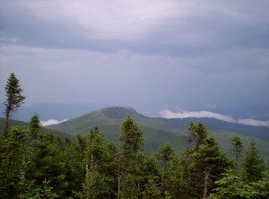
A view of a mountain in the distance
More distant views with a cloudy sky
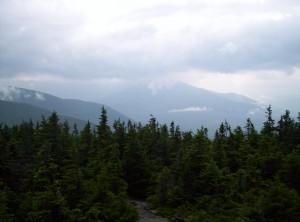
Yet more mountain views

Much of the hiking today is fairly uneventful; the weather turns a bit inclement, but there’s nothing particularly memorable about the views. Still, since I have the pictures, I might as well post them. Here’s one last bit of video footage from a trailside overlook area:

Some trailside overlook scenery

Continuing on and up, it starts to rain. I pull out a rain coat and my pack cover and keep going to Imp Campsite, my first pay site in the Whites. I pull in around 19:30, pay the caretaker the fee, and head in to the shelter itself to make dinner and head to sleep. Compared to every other shelter I’ve used, this one is dead — I doubt I hear more than fifty words from the time I reach the shelter to when I go to sleep (including anything I said) because so many people are asleep or close to it, even though hushed voices really wouldn’t pose any problems.

July 10

(10.6; 316.5 total, 1857.5 to go; -4.4 from pace, -163.5 overall)

I get up in the morning and return to my traditional breakfast fare: oatmeal packets. These oatmeal packets are Shaws-brand, just as my first batch in the 100-Mile Wilderness was, and they have trivia questions on them. Strangely, today’s trivia has an error in it, giving “Irvin” Berlin as the author of my aunt’s favorite Christmas song, White Christmas. (I also hit an error on the last day in the 100-Mile Wilderness with a packet crediting Hank Aaron with the all-time home run record but forgot to mention it here; it passed to Barry Bonds fairly recently.) Another oddity: a fellow backpacker remarks upon my eating oatmeal from the packet after pouring in the requisite boiling water; I’d thought that trick was well-known backpacker folklore, but perhaps it isn’t in very rare cases.

The view from an overlook just below Imp Campsite, possibly overlooking Gorham in the distance; it's even more spectacular at night with the lights below
A view from near one of the peaks of Carter Mountain

The day commences with travels over three peaks named North, Middle, and South Carter Mountain. Early on I pass two girls in a tent off the trail at a stealth site (although to be honest it’s pretty un-stealthy; I’m surprised ridge runners haven’t managed to cite them, since they’re right next to the 0.25-mile radius around Imp where you can’t otherwise camp and aren’t the required 200 feet or so off the trail. Jukebox passes me on one of the peaks when I stop for a snack.

Another view from near one of the peaks of Carter Mountain

As usual, I also snag a few 360-degree videos:

360 degrees most likely from one of the Carter Mountain Peaks
360 degrees most likely from another one of the Carter Mountain Peaks

Lunch is near Carter Dome, a rocky mountaintop with excellent views. I meet Limeonade and Emily doing a southbound thru-hike; Limeonade got her trail name from a botched blue hair-dyeing session, learning as so many MIT students learn that getting the color hair you want is easy to get wrong. There’s also a backpacker out enjoying the Whites who did a thru-hike in the past and a couple northbounders who talk about shelters south; apparently there’s one which is known as being capable of receiving pizza deliveries. 🙂

A view from near Carter Dome, where I eat lunch today

I continue on, doubling back to grab a water bottle that fell from my pack in an errant stumble (wasting probably half an hour doing so), and reach the trail to my first “hut” before 16:00.

Carter Notch Hut, as seen from above on the mountain just north of it on the A.T.
Carter Notch Hut, as seen from north on the A.T.

In the Whites, huts are buildings administered by the AMC where you can stay overnight in bunks with provided sheets and blankets, get meals in the morning and at night, use bathroom facilities, stock up on drinkable water (a scarce resource, especially if as a day hiker you don’t carry water-purification options), and get minimal supplies (energy bars and the like). They’re also wicked expensive — upwards of $90 a night, targeted at day hikers and families. Frankly, I don’t understand why anyone would visit them at that price. Thru-hikers, however, do have an option which makes them useful beyond just temporary resupply and indoor snack-eating: work-for-stay. Under this system, some number of thru-hikers (the Companion says two or four, but experience says these numbers are lies) are allowed to stay overnight in the hut, on the floor in the common area, and get to eat dinner and breakfast leftovers, in exchange for an hour or so of work around the hut. It’s about the time when I could do a work-for-stay at Carter Notch Hut, but I decide to continue on and leave that open for Limeonade and Emily, who are nursing a sprained ankle and need it more. (Had I known of the two-is-a-lie rub I might have stopped, but it would have been a pretty short day, so I probably would have pushed on.)

Next up are the Wildcat Mountain peaks, of which I pass over peaks A and D (I don’t know where the others lie, except off-trail). I’m hoping to reach Pinkham Notch and camp off-trail to walk in for an all-you-can-eat breakfast the next morning, but the terrain stymies me, and I make it but half a mile or so past peak D and have to call it quits for the night. I move off-trail a ways to be regulation-legal (200 feet, but as I find in the morning it’s really only about half that, oops), set up, eat some Idahoan potatoes (amazing, competitive with Knorr in simplicity, weight, and calories), and sleep.

July 11

(10.3; 326.8 total, 1847.2 to go; -4.7 from pace, -168.2 overall)

I get a really late start today, far too late to eat that breakfast at Pinkham Notch, and descend the remaining miles to the visitor’s center.

A view from Wildcat Ridge down to Pinkham Notch Visitor's Center, with Mount Washington in the background

As it turns out, I’ve been here before — this was the entry point for a weekend trip in the Whites toward Glen Boulder (not on the A.T.) during MITOC‘s winter school in 2007. I eat lunch, offload my accumulated trash, and head on.

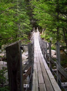
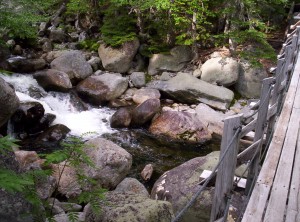
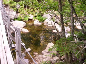
I reach Osgood Tentsite around five or so in the evening, at the base of Mount Madison, after passing over a stream on a bridge which seems excessive after the sparseness of bridges over rivers in Maine (picture coming when I have time to insert it — and there they are).

A large wooden footbridge across a stream just north of Mount Madison
I think this is the first real walking bridge I've seen on the A.T.
To the left are large rocks and some water, but nothing someone couldn't hop over (or through, for a short bit)
To the left...not much water
Water on the right side forms a larger pool, but one could still easily walk through it
To the right...water, but definitely not enough to hinder someone

There’s possibly still time to reach Madison Hut or a tentsite on a side trail near it, so I head on and up for an above-treeline summit. It’s up but not too steep until I reach treeline, and I make what I think is good time.

A view toward cloud-obscured Mount Washington from just near treeline on Mount Madison
Facing up toward Mount Madison

Once I hit treeline, however, the going slows. A lot. It’s not the exposure or incline but rather the stupid rocks there, and I have to pick my way carefully to avoid twisting an ankle. Fog starts rolling in as I head up, and there’s not a whole lot of view from the top. More impressively, however, is that I get within about 500 feet of the hut and treeline without even noticing it — a break in the fog as I happen to lift my head from staring at my feet reveals it to me at an impressively close distance.

I reach Madison Hut around 20:00. It’s late and I don’t really expect a work-for-stay, but I need their bathroom and figure I’d be kicking myself if it actually were available and I hadn’t asked, so I ask. Turns out they’re awesome and say, “Yeah, we won’t make you walk further tonight.” Whee! It’s past dinnertime, but they find some leftover pasta and pass me an approximately 9″x12″ cafeteria pan full of bowtie pasta with chunks of ham, along with a bowl and spoon. I fill the bowl and eat, idly chatting with people staying in the hut overnight. As it turns out, there’s another Waldo on the trail hiking north! (I seem to have passed him without knowing it, which isn’t especially hard to do.) Good thing I didn’t stick with that name, because it would have been mildly confusing, to say the least. I refill the bowl again, and again, and again, and eventually I manage to empty the entire pan — I really was hungry, I guess. There are a few other work-for-stayers, but I can only remember that one was named Applecore; all total there were about six or so of us when the limit is supposedly two.

Lights go out at 21:30 to conserve energy (the huts all have these goofy “going green at the huts” posters that make it out to be a save-the-planet notion, but I don’t doubt it’s also economically efficient — this is one place where wind power is a very viable source of energy), and people filter to bed shortly thereafter. I pull out my pad and bag and do a little reading of the Federalist Papers (I believe around No. 20 or so), quite appropriately as I’ve just passed over a mountain named for one of its authors, and go to sleep after topping it off with the usual Bible reading.

July 12

(7.0; 333.8 total, 1840.2 to go; -8.0 from pace, -176.2 overall)

I wake up early, around 5:30, to get out of the way of the crew at the hut (“croo” as they call it, for reasons which escape me) as they prepare for the overnighters’ breakfast. Now it’s time to sit tight and wait, because we thru-hikers eat after the paying visitors and croo do — living it on the cheap means you don’t necessarily get a high-quality experience. I do some more reading of the Federalist Papers while I wait. Breakfast consists of some oatmeal and a pancake or two; after that, I sweep out the dining area and both bunkrooms as my work and head out on the trail.

Heading south on the A.T. from Madison Hut I encounter yellow blazes instead of white, because white is invisible against snow
Heading south on the A.T. from Madison Hut, I begin to do a different kind of yellow-blazing, necessary because white paint doesn't show up well against snow
Madison Hut from the north

Today’s trail is more of the end of yesterday. I’m now in the Presidentials, a twenty-five mile stretch that’s all above treeline, with all the same frustrating rocks. Progress is slow as I approach the most well-known peak in the Whites, Mount Washington.

Progressing toward Mount Washington

Mount Washington is the site of the world record for greatest wind speed (upwards of 230 miles per hour) and, as with Pike’s Peak in Colorado, can be reached either by cog rail or by driving up it on a road. The summit has a visitor’s center, gift shop, and all the usual tourist trap things, so I’m hardly going to be in wilderness on it (not to mention the throngs of day-hikers the huts enable, carrying packs that are way fuller than they should be to carry food and water for a day, warm clothing, and basically nothing else — my fellow thru-hikers wonder what they could possibly be carrying).

Mount Washington's cog rail

On the hike up I pass by the cog railway, best known to thru-hikers for a tradition known as mooning the cog; you can guess what it entails (I choose not to participate). The cog rail is belching an incredible amount of exhaust fumes, making a complete mockery of the “going green” poster at Madison Hut. Some would say the cog shouldn’t exist, but then you require that everyone agree with your assessment of the relative merits of the different ways to pollute, and it’s clear that’s never going to happen, for any assessment that could be made. Once again we see a situation where a fully equitable Pigovian tax which forced people to consider the full costs of their actions, including those which would otherwise be negative externalities not shouldered by the offenders, would result in a natural (and totally voluntary) decrease in an undesirable activity (polluting by riding the cog). Never heard of Pigovian taxes before? It’s too bad, because they’re a good policy idea that politicians are wary to touch for fear of not getting elected; instead we see inequitable and less efficient systems like cap-and-trade proposed simply because it’s easier to say “make someone else pay” than “everybody pay your fair share based wholly on your voluntary choices”.

On a mostly unrelated note, some of my Federalist Papers reading lately touches on the federal power of taxation, a contentious power in the days when the constitution was submitted for ratification by the states. No mention has yet been made of why the power to levy income taxes was not included in the constitution (no, really, we amended the constitution to make the income tax possible — go us!); exactly what the reasons were for this prohibition would be extremely interesting to read.

Inching closer to the summit and into the clouds

Further up near the summit I’m passed by the two hikers I started with, Slowpoke and Asgask. At the summit I stumble through the crowds to find a gift shop, from which I purchase a candy bar and several postcards, which I hastily fill out and leave at the post office (yes, the summit has a post office, with a “distinguished” postmark, or so I’m told) to be sent when the weekend end. After signing the hiker register I continue down to Lakes of the Clouds Hut, the highest and largest of the huts.

One of the namesakes for Lakes of the Clouds Hut - a pond with ripples from constant wind
One of the namesakes for Lakes of the Clouds Hut

I arrive to the sounds of dinner starting; the impression I get is that the croo functions similar to that of a summer camp, so you get the usual skits and rah-rah-rah stuff as mild entertainment (which invariably here instructs you on how to fold the blanket they provide you as well as how to “tip the croo”, of course). Asgask and Slowpoke are there, as well as another southbounder, Cripple, as are two northbounders (Dee Jay and Gray Ghost, I believe), and I duck inside to inquire about work-for-stay, which is indeed available. I settle back to do more Federalist Papers reading until paying dinner ends. Once everything’s cleared away, dinner is served — turkey, cranberry sauce, some salad, and lentil soup. I get several bowls of lentil soup and, once everyone’s cleared out for the night, head to sleep sated.

July 13

(11.2; 345.0 total, 1829.0 to go; -3.8 from pace, -180.0 overall)

The other lake by Lakes of the Clouds Hut

We’re up and out of the way of the croo at breakfast by 6, to sit back and wait for our scraps. Breakfast is more oatmeal, and after that we do our work (sweeping out the bunkrooms and changing pillowcases) and head out on the trail.

A view from the Presidentials
More Presidential views
Some small trees above treeline with mountains in the background
A shot notable because the cog rail is just visible in the distance

Today’s hiking gets me below treeline again, which is nice because it means camping options are more plentiful; I don’t know what non-thru-hikers do if they’re not getting scalped by the Appalachian Money Club at the huts, because the pickings are spare through here. The first stop below the trees today is Mizpah Spring Hut, where I stop for a snack. There are tent sites as well there, but it’s way too early to stop, and I continue on and over a couple more peaks, seeing what remains of The Old Man of the Mountain in the distance (a picture is, as always, forthcoming), and heading down the mountainside to Crawford Notch, reaching the road there by about 19:30.

Looking down from Mount Webster on the AMC's Highland Center
The AMC's Highland Center against the backdrop of Mount Field

I’ve planned this bit of hiking to have me resupply at Crawford Notch General Store just three miles up the road, so I sit down and put out the thumb. I wait nearly forty minutes before getting a ride, the longest wait yet, until I get a ride there just before it closes, in time for quick resupply for the rest of the Whites down to south of Mount Moosilauke. I’m staying at the attached campground for the night; there’s a new bunkhouse there for hikers, but I’m too late to get a spot in it for the night and it’s already full, so I pitch the tent adjacent to a northbounder named Thud in a hammock, cook and eat a dinner as it starts to rain, shower (although I’m not sure how much good a shower without doing laundry actually is), and head to sleep.

I’m finding I have less and less time when I stop off the trail to make these posts, and I’m stopping off less than I did early on now that I’ve adjusted to living on-trail all the time, so I’m most likely going to try to churn out a few days at a time rather than the longer sections I’ve been trying to do. For example, this bit was going to go to Glencliff just south of the Whites, but I ran out of time to do so and would rather get something out instead of punting getting anything out for another long period of time; I’ve punted getting anything out for too long.

Just so everyone’s aware of my current progress, I’m about 25 miles into the New Jersey section of the trail, but the trail dips back into New York for a little bit (it’s hugging the border mostly), so I’m in Unionville, NY at the moment. By my numbers I’m at 843.3 total, 1330.7 to go, -206.7 overall, an offset from pace which is worse than the latest numbers you see in this post but better than a nadir of -234.1 overall, hit partially due to an opportunity along the trail that I couldn’t bring myself to miss that required that I slow down slightly (or rather, not speed up too much) through August 1. More importantly, in the last two weeks of hiking I’ve only had three days below pace (one due to a thunderstorm as I was heading up a mountain and by only 0.6 at that, the other two which I intentionally made into an effective zero), and if you cut those out I made up about 40 miles on pace over that time, and some of those days felt (and were) easy due to restrictions on available campsites (the last several states only allow camping in designated sites, which curtails freedom in how far I can hike). I wish I had no deficit, but what I do have seems to be peeling away nicely, and 20+ days are easily and commonly in reach now.

Oh, if you were in MA/CT/NY and a little bit on either side of that between July 30 and August 17 and smelled something funny, it was probably me and my stench from not having taken a shower during that time.

12.08.08

I have a confession to make

Tags: , , , — Jeff @ 11:55

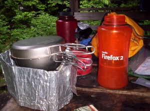
I still have not upgraded:

My cooking setup for dinner one night, with a Firefox 2-labeled water bottle full of hot chocolate

Super-special brownie points if you can guess where and when I got it. (Hint: I wanted to make this post about two weeks ago, if I’d taken the picture and found Internet access between then and now.)

Posts have been slow in coming of late partly because they take so long to write and partly because I haven’t hit towns at the right times to use their libraries (today’s access actually is the result of an overnight stay after a short day because this library isn’t open on Mondays). Also, my progress in the last few days has been hampered by a giant, man-eating rattlesnake! (Or at least that’s what it’ll grow into by the time I fully elaborate on the encounter; you know how it goes.) Thinking of you, dear readers, I of course managed to get a few pictures (although they’re rather severely impaired by my camera’s lack of zoom capabilities) and even a little footage of it slithering along! Take a gander at my best picture of it, and make sure to click through for the video footage as well:

A rattlesnake slithering along among the rocks
« NewerOlder »